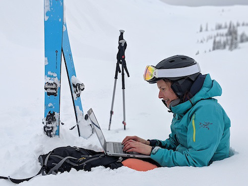
Backcountry Skiing Map & Planning App
Download The App
Trailforks is dedicated to giving you the best interactive trail maps, custom designed for your selected activity.
Trailforks might have started out as a mountain biking platform, but has since expanded to an array of sports that utilize trails.
Backcountry skiing or ski touring is one of them. Enjoy all the Trailforks website and app features along with the features below, which are particularly useful for backcountry ski adventures.
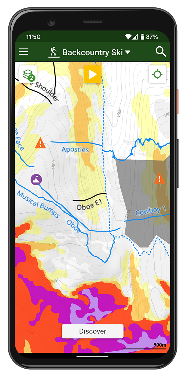
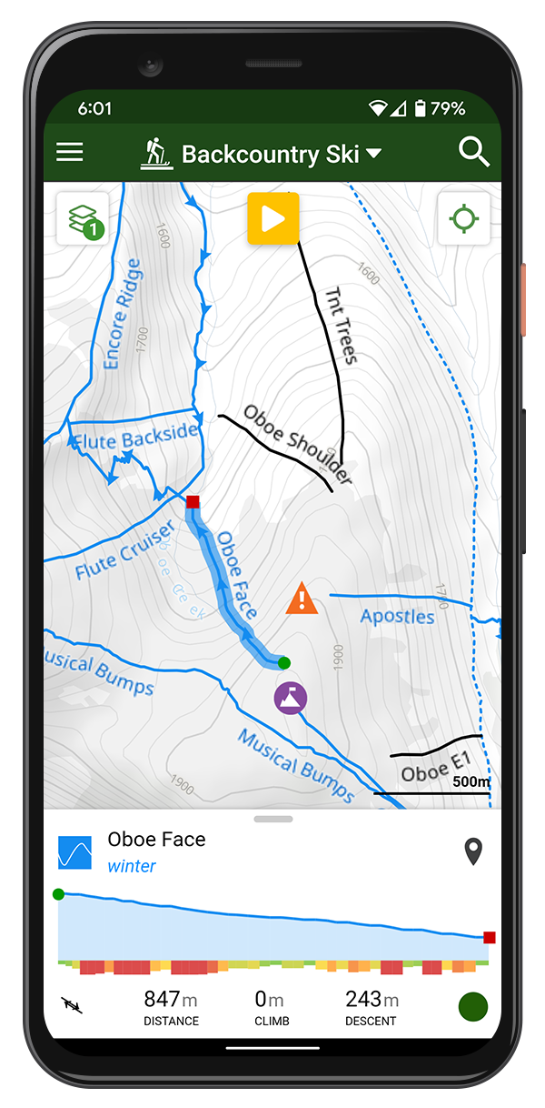
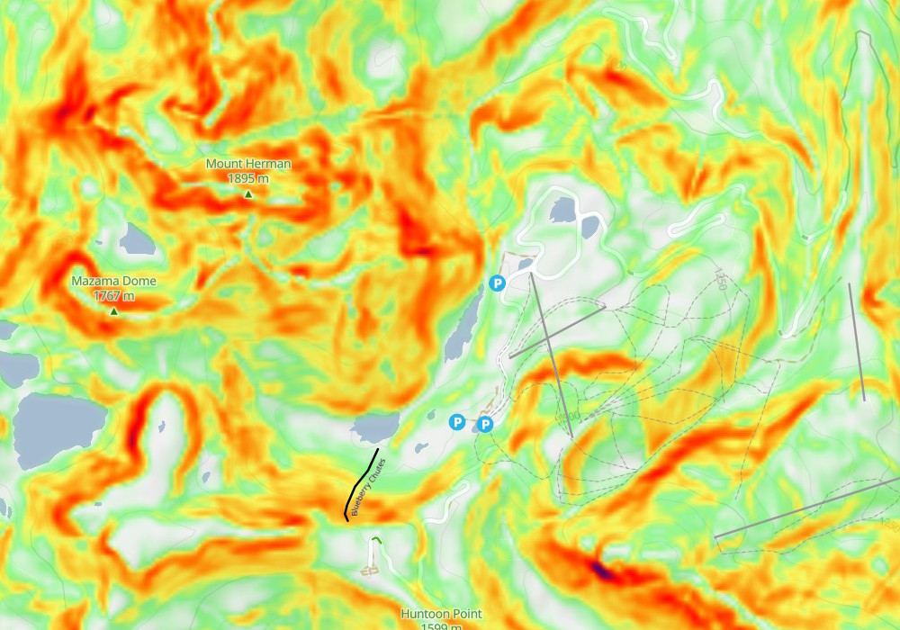
Avalanche Risk Layer
Toggle this layer on the website or app. Polygons are color based upon known avalanche danger slope angles, with red being the most dangerous areas. Many factors are involved in an avalanche (e.g. slab, a weak layer, a trigger, and a slope angle steep enough to slide). This layer only highlights angles that avalanches typically form.
Closure & Danger Zone Polygons
Polygons are contributed to the map showing areas that might be closed, or closed to motor-vehicle use. Which can help in avoiding user-conflict with snow mobiles.
High avalanche or no-go zones might also be mapped, or just a polygon showing an entire area you can ski, like an open bowl.
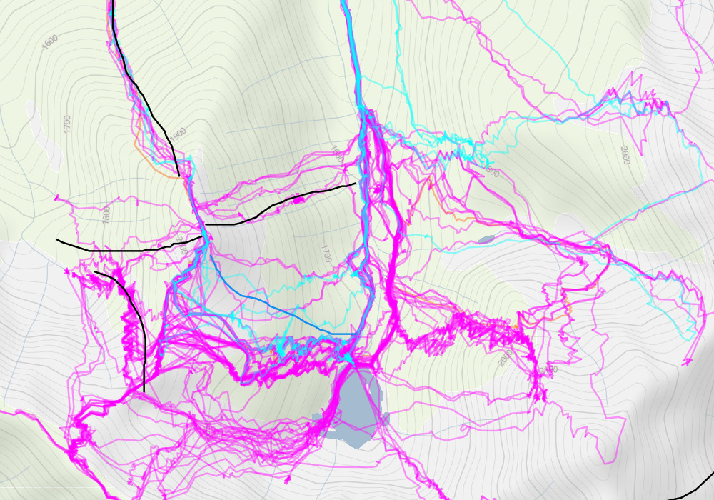
Winter Activity Recordings
View public tracks recorded by others, colored coded by activity in our new winter activity recordings layer. Help plan your trip route in popular zones, or seek out new terrain which is not popular.
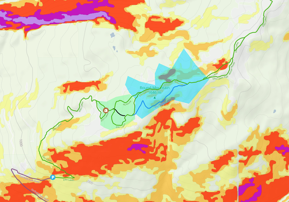
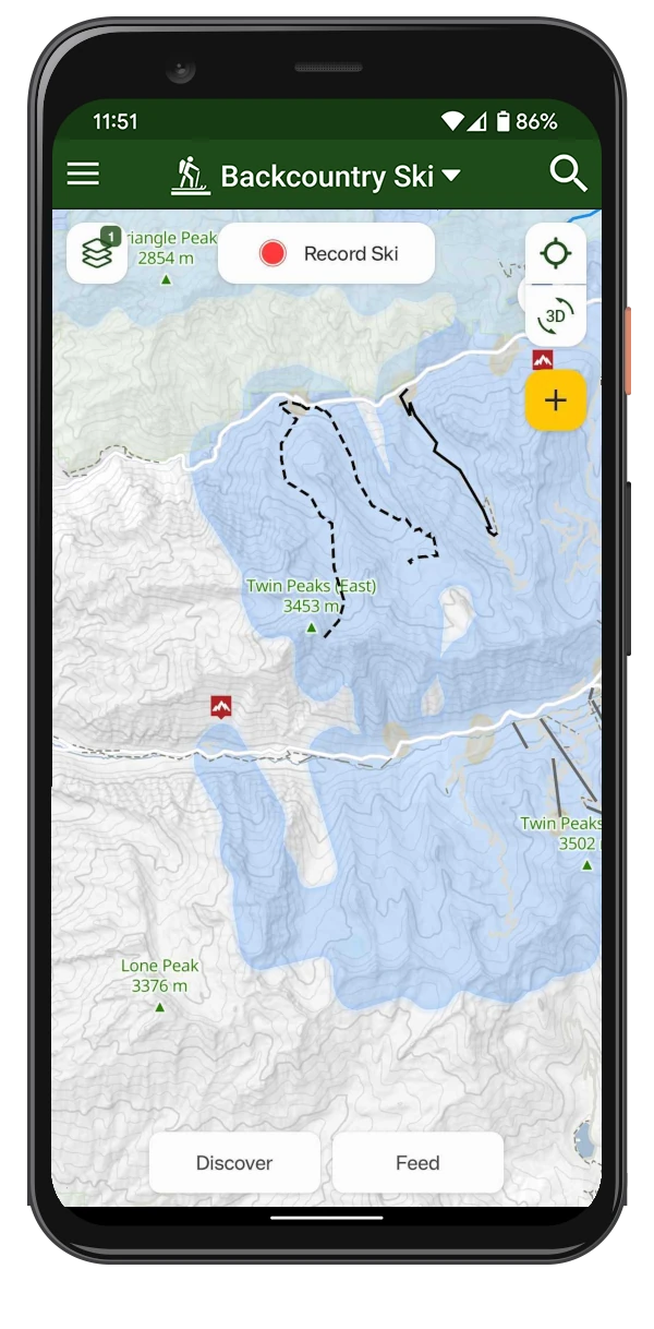
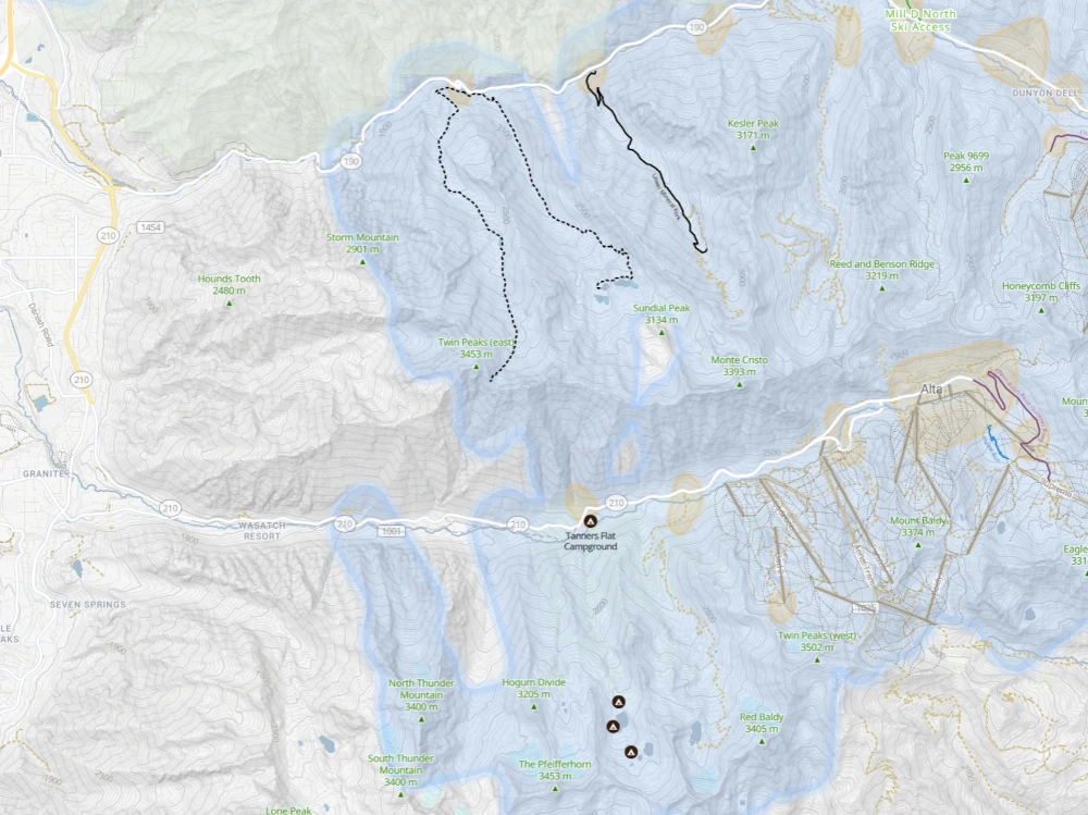
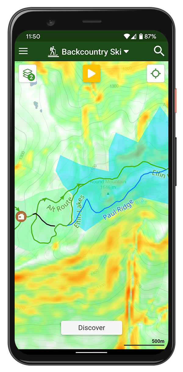
Backcountry Ski Zones
Analyzing our public ski data we've created polygons of popular ski zones. This light-blue colored overlay is shown on the winter map.
We are also showing the common starting zones using the light orange polygons within the Backcountry Ski Zones.
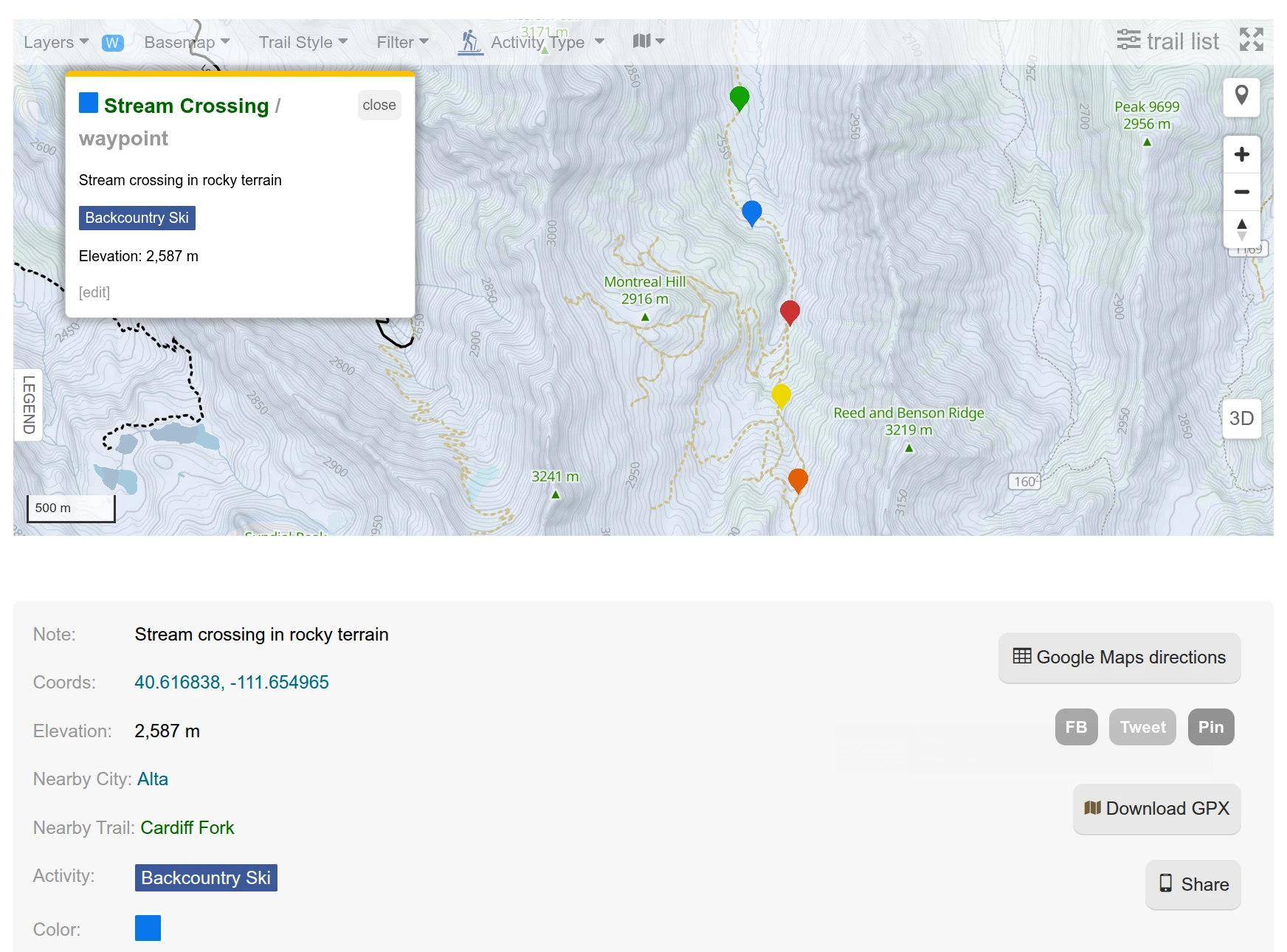
Waypoints
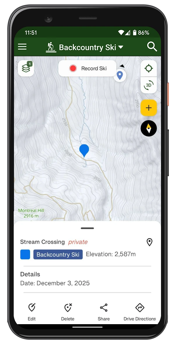
Create your personal waypoints in the app or on the website to mark important locations such as trailheads, huts, or any other points of interest for your backcountry ski trips.
Waypoints are synced between all your devices, ensuring you have access to them whether you're planning your trip at home or navigating in the backcountry.
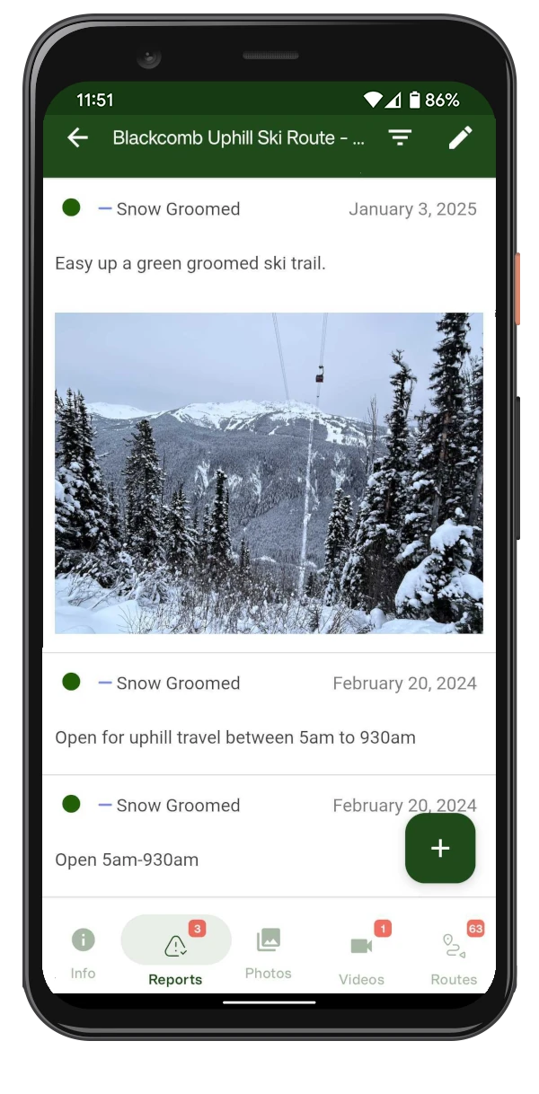
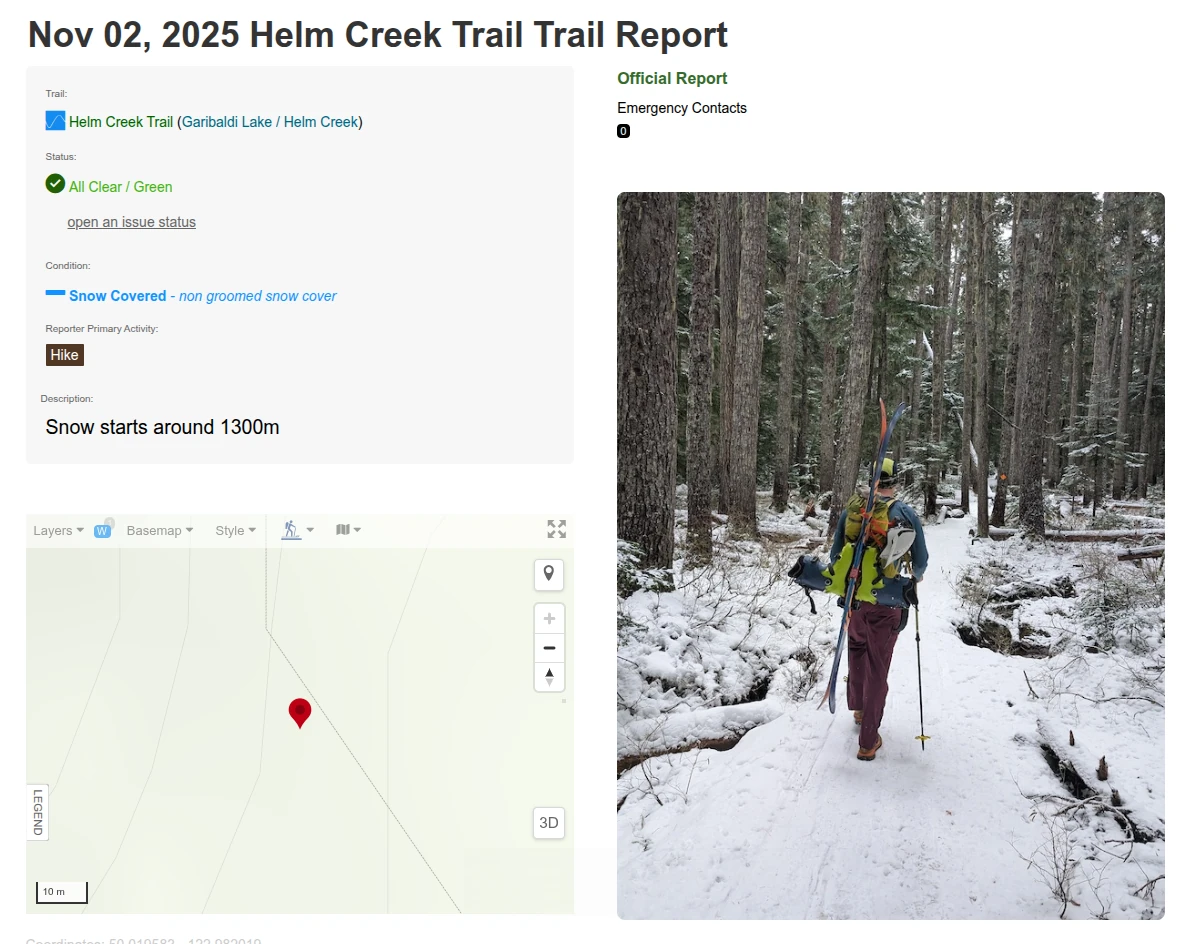
Ski Reports & Conditions
Check the latest community reports for snowpack updates, avalanche observations, access status, and photos specific to ski touring terrain.
The "Last Used" trail style shows when a route was most recently traveled, helping assess popularity in winter conditions.
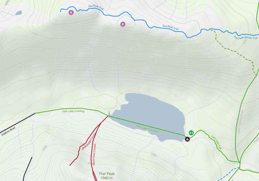
Mapped Trails & POIs
Our database of mapped trails and routes is continually growing. Discover routes commonly used for ski touring access, and explore ski touring POIs - including huts, trailheads and parking, hazard zones, and more.
Total BC skiing trails: 29,527
Total community activities: 418,027*
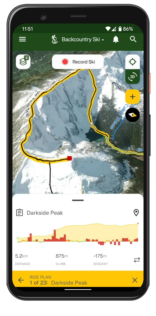
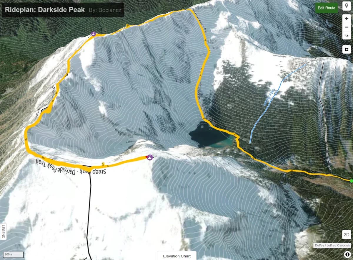
Plan Your Next Ski Tour
Adventure
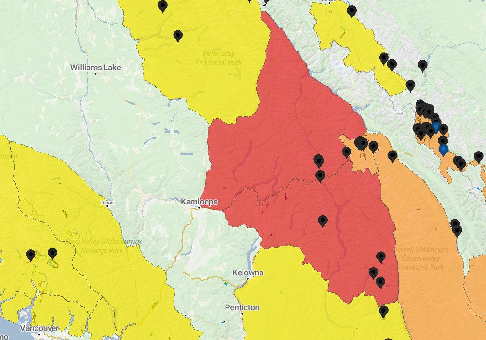
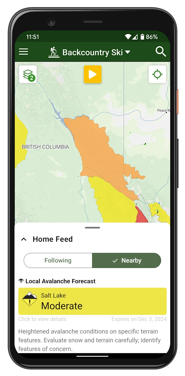
Avalanche Forecast
View avy report zones for BC and the western USA. Click to view the full avalanche forecast. You will also receive your local avalanche forecast in your feed.
View observations by local skiers from avalanche.ca and mountainconditions.ca
Slope Layer
Provides a shaded gradient of how steep and often rugged the terrain is. Great for finding viewpoints and finding ridge traverses.
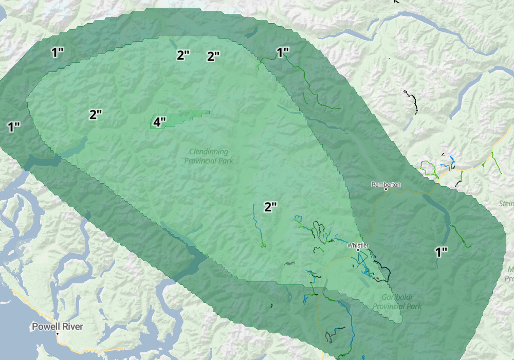
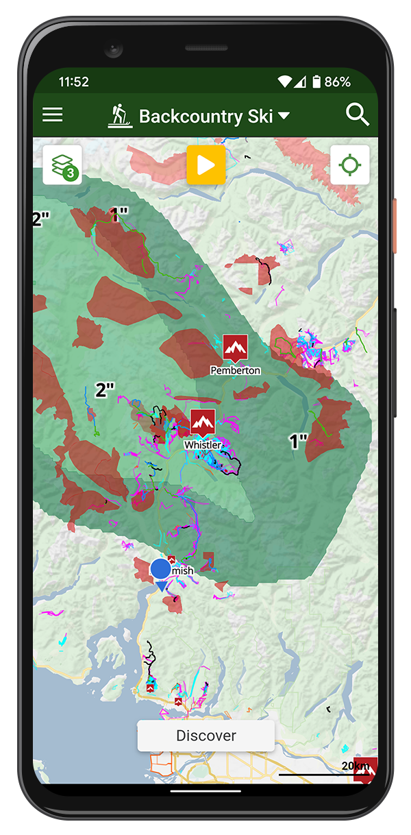
Snow Forecast
A 24-hour snowfall forecast overlay derived from NOAA weather data, which is refreshed every 12 hours. These maps are color coded to indicate the expected depth of new snow in inches.
View our weather map to find the best area to ride given the forecast.
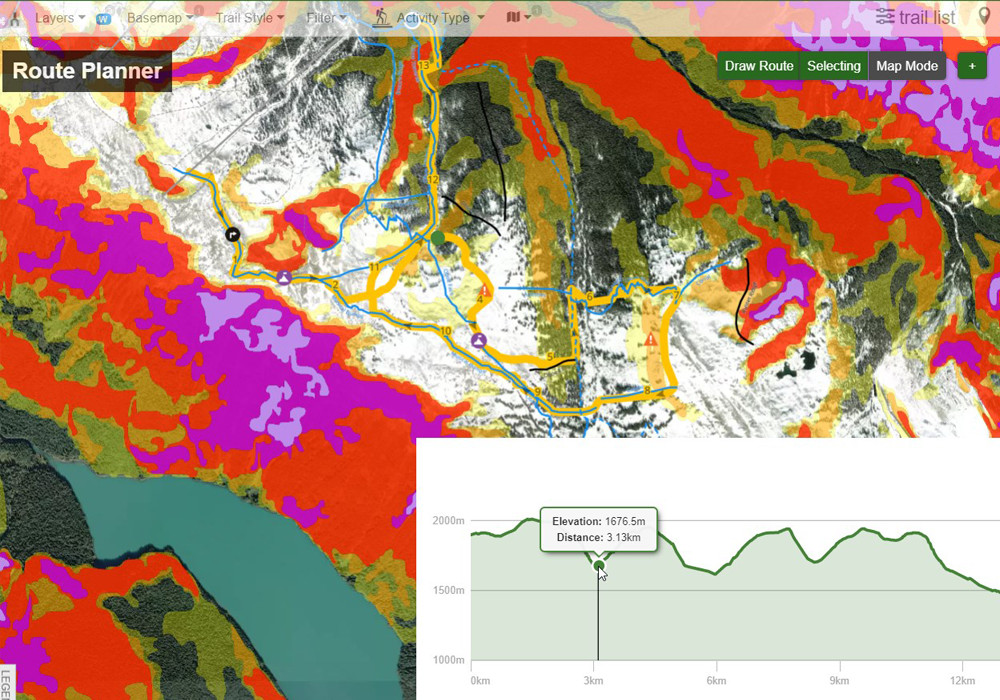
Route Planner
Use our custom route planner on the website to draw your route tracing over any of the toggable layers. Add custom lines, pois & polygons to fully plan your trip. Sync your route plan to the app and navigate out in the mountains.
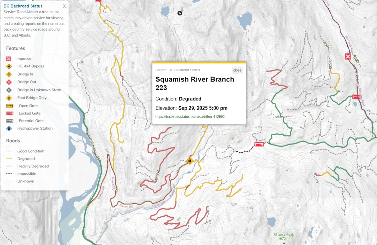
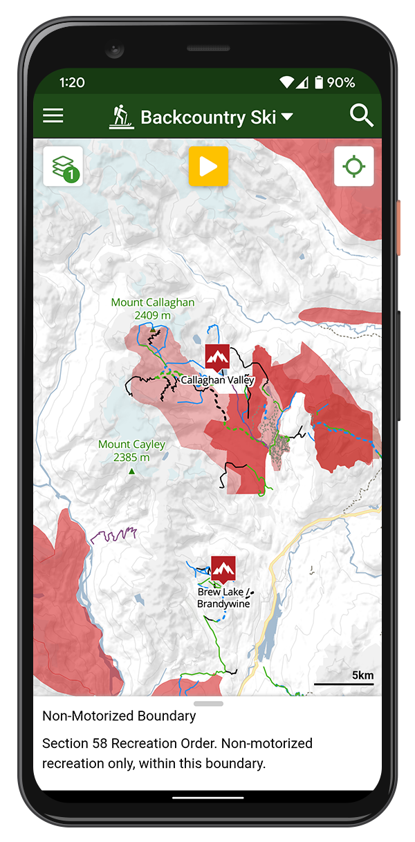
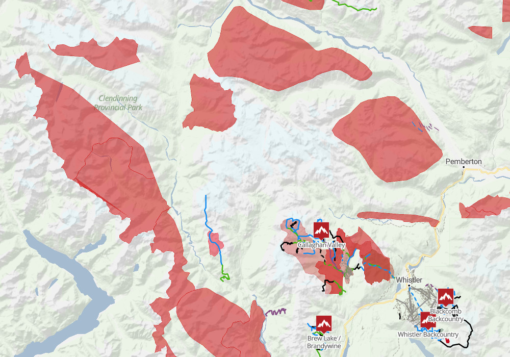
BC Backroad Status
Layer from Service Road Atlas, showing status and reports on the numerous back-country service roads around British Columbia and Alberta.
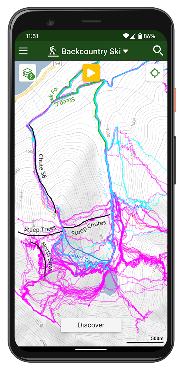
3D Map
Our website and mobile apps include a powerful 3D map mode, perfect for visualizing ski terrain and planning your route. If you're looking for a FATMAP replacement, Trailforks delivers the same terrain detail with an easy-to-use interface.
Plan on The Website
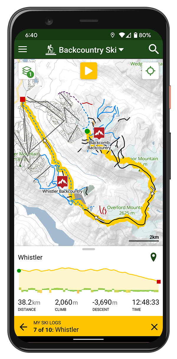
Use the App in the Backcountry!
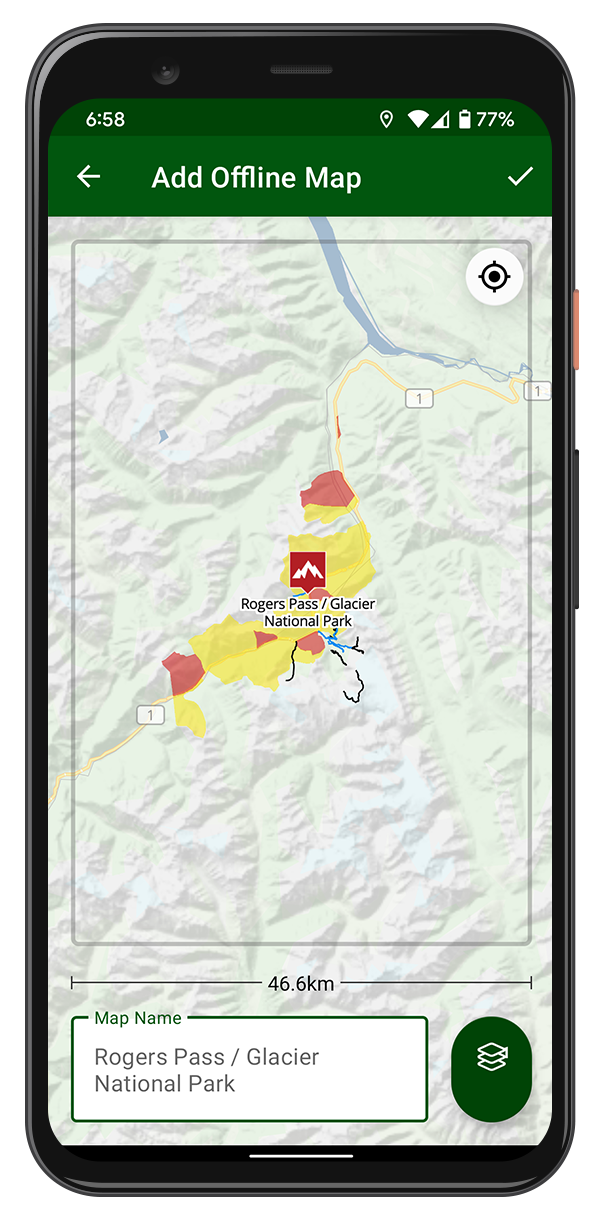
Offline Maps
All the trails, POIs, polygons and your routes are stored offline. The GPS on your phone works offline, even with no network connection.
Offline Basemaps & Layers
Download the basemap tiles and some layers offline in the app.
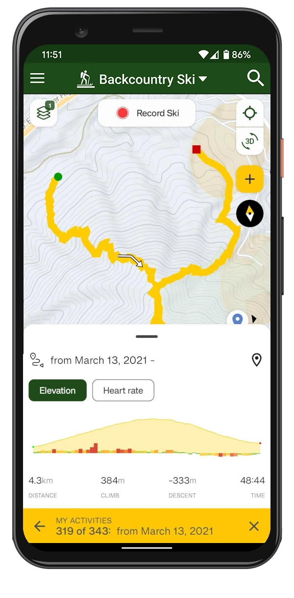
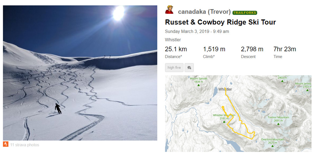
Share Your Adventures
Record your ski using the Trailforks app or connect your Garmin account. Populate a log of your backcountry ski trips and view a feed of your friends adventures.
T-Mobile T-Satellite support
Trailforks mobile apps are optimized to function with more constrained satellite data connections and fully support T-Mobile's T-Satellite service in the United States. This means you can remain online and use advanced Trailforks features even in remote backcountry areas where traditional cellular coverage is unavailable.
Live Location Sharing
When using the Trailforks app, you can share your location with friends and family. They will be able to see your real-time location on the map, including all previous locations, which is especially useful for safety during backcountry skiing adventures.


More Features
- View trail reports with status and conditions
- Discover popular routes
- List Routes for a specific trail
- Share a pin of your current location
- Compass Direction
- Motor Vehicle Use Map for sled access
- US Land Owner Overlay
- Trail photos and videos
Get More With Outside+
- All the Trailforks Pro functionality
- Gaia GPS Premium
- Access to Snow-Forecast.com Premium
- Award-Winning Content from Ski Magazine and annual gear guides
- Movies & TV shows including Warren Miller
- Event Services, Skireg & FinisherPix
- Track your fitness goals with MapMyFitness MVP
- Read stories, gear reviews and more from 10+ publications