Tayside Trail Association

![]()
![]()
![]()
| Type | Trail Association |
|---|---|
| Primary Activity | Mountain Bike |
| Other |
|
| Website |
| Geo | |
|---|---|
| Address |
Perth
United Kingdom

|
| Associated Group |
TTA Tayside Trail Association
|
9
The Tayside Trail Association (TTA) was formed in 2020 by a collection of local riders searching for a way to formalise communication with land managers, the local riding community, and trail builders for the betterment of the Tayside trail network.
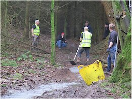
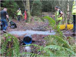
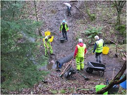
Due to the geography and size of the area, the TTA was subdivided into individual 'Trail Crews' covering Dunkeld, Perth (Kinnoull Hill and Deuchny Bike Park), Pitmedden, and Ballo. This allows pre-existing groups to continue the work that has put the area on the map, with improved guidance, education, and support from the TTA.
The standardisation of best practice throughout our region makes for a better rider experience, but also makes the communication easier when working with multiple landowners in the area, all of whom have different approaches to trail management.
Parent Organization
Riding Areas
| name | trails | total descent | highest trail | total distance |
|---|---|---|---|---|
| Atholl Hill | 51 | -7,987 ft | 1,406 ft | 34 miles |
| Ballo Wood | 38 | -5,795 ft | 1,074 ft | 11 miles |
| Birnam Hill | 24 | -4,456 ft | 1,292 ft | 18 miles |
| Craigvinean | 52 | -7,020 ft | 1,351 ft | 23 miles |
| Dalmarnock | 64 | -9,550 ft | 1,599 ft | 31 miles |
| Deuchary Hill | 22 | -4,162 ft | 1,637 ft | 27 miles |
| Deuchny Woods | 60 | -3,160 ft | 785 ft | 15 miles |
| Hallyburton & Lundie Craigs | 43 | -3,784 ft | 1,132 ft | 18 miles |
| Kinnoull Hill | 61 | -3,654 ft | 728 ft | 13 miles |
| Newtyle Hill | 10 | -1,248 ft | 916 ft | 5 miles |
| Pitmedden | 113 | -7,753 ft | 926 ft | 39 miles |
| Strathtay & Grandtully Wood | 19 | -3,501 ft | 1,493 ft | 21 miles |
| Weem Wood | 22 | -5,189 ft | 1,570 ft | 20 miles |
Earn Trail Karma by Donating to the Local Trail Association
Help fund trail maintenance and development
Donate