-
DateSaturday December 3, 2016 at 8:00am MST
past event -
TypeGroup RideFatbike
-
ActivitiesMountain Bike
-
LocationCorner Canyon United States
-
Route
-
Trail
-
Email
-
Facebook
-
RegistrationOpen Free
-
Organizer
8am - 10am Group Ride
10am - Noon Free Fat Bike Demo
Meet at Little Valley Trailhead
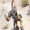
Come celebrate Global Fat Bike Day with Utah Mountain Biking this Saturday in Corner Canyon. We will have a group ride from 8-10am. If you need a bike, please call to reserve a rental bike. Cost is $20.
From 10am-Noon, we will have our Rocky Mountain Blizzard demo bikes available to try out for free. If you have ever wanted to try out a fat bike in the snow, here is your chance.
See you Saturday
Comments
-
+ 1
 UtahBikeMike
Dec 1, 2016 at 18:13
UtahBikeMike
Dec 1, 2016 at 18:13

-
- Download
- Subscribe
-
21interested
-
19going
Route
-
Killer Loop
close-
Layers w
- Weather Layers
- Pro
- Pro
- Pro
- Pro
- Pro
- Pro
- More Layers
- Pro
- Pro
- Pro
- Pro
-
Upgrade to

3DTrail Conditions- Unknown
- Snow Groomed
- Snow Packed
- Snow Covered
- Snow Cover Partial
- Freeze/thaw Cycle
- Icy
- Prevalent Mud
- Wet
- Variable
- Ideal
- Dry
- Very Dry
Trail Flow (Ridden Direction)Trailforks scans users ridelogs to determine the most popular direction each trail is ridden. A good flowing trail network will have most trails flowing in a single direction according to their intension.
The colour categories are based on what percentage of riders are riding a trail in its intended direction.- > 96%
- > 90%
- > 80%
- > 70%
- > 50%
- < 50%
- bi-directional trail
- no data
Trail Last RiddenTrailforks scans ridelogs to determine the last time a trail was ridden.- < 2 days
- < 1 week
- < 2 weeks
- < 1 month
- < 6 months
- > 6 months
Trail Ridden DirectionThe intended direction a trail should be ridden.- Downhill Only
- Downhill Primary
- Both Directions
- Uphill Primary
- Uphill Only
- One Direction
Contribute DetailsColors indicate trail is missing specified detail.- Description
- Photos
- Description & Photos
- Videos
Trail Popularity ?Trailforks scans ridelogs to determine which trails are ridden the most in the last 9 months. Trails are compared with nearby trails in the same city region with a possible 25 colour shades. Think of this as a heatmap, more rides = more kinetic energy = warmer colors.- most popular
- popular
- less popular
- not popular
ATV/ORV/OHV FilterMax Vehicle WidthinchesUS Cell CoverageLegend
Radar TimeActivity RecordingsTrailforks uses anonymized public activity data. ?Activity RecordingsTrailforks uses anonymized public activity data. ?Personal Heatmap▶ Activity Typesall / none▶ Options2Date range month–Winter TrailsWarning A routing network for winter maps does not exist. Selecting trails using the winter trails layer has been disabled.Missing TrailsMost PopularLeast PopularTrails are colored based on popularity. The more popular a trail is, the more red. Less popular trails trend towards green.Jump Magnitude HeatmapHeatmap of where riders jump on trails. Zoom in to see individual jumps, click circles to view jump details.BC Backroad Status
Service Road Atlas is a free to use, community-driven service for viewing and creating reports on the numerous back-country service roads around B.C. and Alberta.
![map legend]() Slope AspectDirection the slope facesTrails DeemphasizedTrails are shown in grey.Only show trails with no bike usage.Suggested LayersBased on selected activity type
Slope AspectDirection the slope facesTrails DeemphasizedTrails are shown in grey.Only show trails with no bike usage.Suggested LayersBased on selected activity typeSave the current map location and zoom level as your default home location whenever this page is loaded.
SaveTrail transparencymore stats11.6 milesDistance1,756 ftClimb-1,866 ftDescent1 mileHigh Point-110 ftAltitude change4,985 ftAltitude min5,185 ftAltitude start5,075 ftAltitude end-0.2%Grade-49.2%Grade max66%Grade min6 milesDistance climb5 milesDistance down3,891 ftDistance flat -
