close
-
Layers w
- Weather Layers
- Pro
- Pro
- Pro
- Pro
- Pro
- Pro
- More Layers
- Pro
- Pro
- Pro
- Pro
-
Upgrade to

3D
Trail Conditions
- Unknown
- Snow Groomed
- Snow Packed
- Snow Covered
- Snow Cover Partial
- Freeze/thaw Cycle
- Icy
- Prevalent Mud
- Wet
- Variable
- Ideal
- Dry
- Very Dry
Trail Flow (Ridden Direction)
Trailforks scans users ridelogs to determine the most popular direction each trail is ridden. A good flowing trail network will have most trails flowing in a single direction according to their intension.
The colour categories are based on what percentage of riders are riding a trail in its intended direction.
The colour categories are based on what percentage of riders are riding a trail in its intended direction.
- > 96%
- > 90%
- > 80%
- > 70%
- > 50%
- < 50%
- bi-directional trail
- no data
Trail Last Ridden
Trailforks scans ridelogs to determine the last time a trail was ridden.
- < 2 days
- < 1 week
- < 2 weeks
- < 1 month
- < 6 months
- > 6 months
Trail Ridden Direction
The intended direction a trail should be ridden.
- Downhill Only
- Downhill Primary
- Both Directions
- Uphill Primary
- Uphill Only
- One Direction
Contribute Details
Colors indicate trail is missing specified detail.
- Description
- Photos
- Description & Photos
- Videos
Trail Popularity ?
Trailforks scans ridelogs to determine which trails are ridden the most in the last 9 months.
Trails are compared with nearby trails in the same city region with a possible 25 colour shades.
Think of this as a heatmap, more rides = more kinetic energy = warmer colors.
- most popular
- popular
- less popular
- not popular
ATV/ORV/OHV Filter
Max Vehicle Width
inches
US Cell Coverage
Legend

Radar Time
Activity Recordings
Trailforks uses anonymized public activity data.
?
Activity Recordings
Trailforks uses anonymized public activity data.
?
Personal Heatmap
▶
Activity Types
all
/
none
▶
Options
2
Date range
month
–
Winter Trails
Warning
A routing network for winter maps does not exist. Selecting trails using the winter trails layer has been disabled.
Missing Trails
Most Popular
Least Popular
Trails are colored based on popularity. The more popular a trail is, the more red. Less popular trails trend towards green.
Jump Magnitude Heatmap
Heatmap of where riders jump on trails. Zoom in to see individual jumps, click circles to view jump details.
BC Backroad Status
![map legend]()
Service Road Atlas is a free to use, community-driven service for viewing and creating reports on the numerous back-country service roads around B.C. and Alberta.

Slope Aspect
Direction the slope faces
Trails Deemphasized
Trails are shown in grey.
Only show trails with no bike usage.
Suggested Layers
Based on selected activity type
Save the current map location and zoom level as your default home location whenever this page is loaded.
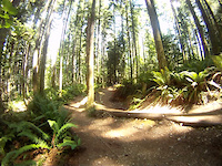
SaveThe Teanaway is a beautiful, quiet, rural valley in central Washington State, 15 miles east from the town of Cle Elum and a two hour drive east from Seattle. Small farms, ranches and homesteads are scattered along the river on the valley floor and surrounded by the newly established Teanaway Community Forest.
A paved, two-lane, dead-end county road winds for about 15 miles up the valley, following the Teanaway River and providing spectacular views of Mount Stuart. Local residents treasure the quiet solitude, dramatic scenery and abundant wildlife of the valley as well as the many opportunities for outdoor recreation. Mountain bikers and other outdoor enthusiasts from all over the Northwest have cherished this valley for generations. The valley is considered to be one of the most pristine and ecologically valuable and diverse river drainages of the Cascade Range.
Note: For the lack of a name, some of the trails north and outside of the Teanaway Community Forest land have been included in this record.
Primary Trail Type: Cross-Country
eBikes Allowed:
No
Land Status: Community Forest
 google parking directions
 Access Info:
Directions: Start at I-90 exit 85 (Cle Elum). Go east on SR-970 for 6.9 miles. Turn left on Teanaway Road. Go 7.3 miles. Turn left on West Fork Teanaway Road for .6 miles and turn left into Teanaway Campground.
Links
Activities Click to view
- Mountain Bike
165 trails
- E-Bike
31 trails
- Horse
30 trails
- Hike
175 trails
- Trail Running
171 trails
- Dirtbike/Moto
23 trails
- ATV/ORV/OHV
9 trails
- Snowmobile
25 trails
- Snowshoe
7 trails
Region Details
- 57
- 26
- 61
- 20
- 1
Region Status
Caution as of Jun 21, 2026Stats
- Avg Trail Rating
- Trails (view details)
- 197
- Trails Mountain Bike
- 165
- Trails E-Bike
- 31
- Trails Gravel Bike
- 43
- Trails Adaptive Bike
- 25
- Trails Winter Fat Bike
- 6
- Trails Horse
- 30
- Trails Hike
- 175
- Trails Trail Running
- 171
- Trails Dirtbike/Moto
- 23
- Trails Observed Trials
- 1
- Trails ATV/ORV/OHV
- 9
- Trails Snowmobile
- 25
- Trails Snowshoe
- 7
- Total Distance
- 295 miles
- Total Descent
- 60,152 ft
- Total Vertical
- 4,960 ft
- Highest Trailhead
- 7,197 ft
- Reports
- 1,535
- Photos
- 318
- Ridden Counter
- 8,088
Popular Teanaway Community Forest Trails
• 100 ★ 0.0 • 2,575 ft • 34 ft • 555 •
Popular blue difficulty singletrack. This multi-use trail can be used both directions and has a moderate overall physical rating with a 34 ft blue climb. Trail visibility is always easy to follow. On average it takes 4 minutes to complete this trail.
• 100 ★ 4.0 • 2 miles • 456 ft • 380 •
A fun trail with ups and downs and a great little hoodoo called Split near the top. Can be sandy and loose in places when dry. Spring 2026: The trail has been re-routed in several places to reduce the grade for climbing and to move the...
• 100 ★ 4.5 • 2 miles • 132 ft • 301 •
Slabs and , some sandy parts that are loose most of the time. A couple of hard climbs but can be a rocking hill ride if you take care on the sandy bits.
• 75 ★ 4.0 • 4,183 ft • 129 ft • 237 •
connects the seven-way intersection with and Lower Big Sandy with the . This is a nice trail through the trees and is fun to ride in both directions.
• 95 ★ 4.5 • 2 miles • 99 ft • 237 •
May 2026: The is now connected to Upper BST on new . The new section of trail is still settling/bumpy and needs your tires. It's a fun and very scenic ride. Below the new trail (after the tight switchbacks coming steeply to a road...
• 100 ★ 4.0 • 1,339 ft • 50 ft • 212 •
This trail was recently rebuilt with a more gentle grade and erosion prevention measures. Switchbacks are still steep with log drainage bars, so it is best to descend if on a bike, but would be easy to push up if you want the shortest...
• 100 ★ 3.0 • 1,650 ft • 119 ft • 187 •
The trail to . Kid friendly but keep them away from the cliffs that begin on the large slab of rock. Mostly rideable except for the last steep sandy push to the rock.
• 95 ★ 4.7 • 1,673 ft • 0 ft • 185 •
A short climb from the brings you to & a large granite slab with numerous options. NOTE: Take caution, there are numerous fall hazards here! On the minor level are breaks in the rock slab with 5-20 foot drops. On a more major level...
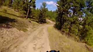
Mountain Bike Routes
Effff'n A, Teanaway Featured
★ 2.4 • 20 miles • 2,503 ft • 0 •
A mix of double track and single. Can be dusty and loose in mid-summer. There are areas of deep sand and...
12 miles • 1,484 ft • 4 •
A loop to access using bridge crossings of the
5 miles • 1,394 ft • 2 • Out & Back •
From the West Fork up to the Cle Elum Ridge via Road to Roddich.
★ 3.0 • 16 miles • 2,323 ft • 5 • Loop •
Great XC Loop with lots of sandstone--Best early May-late July, then early Sept-late Oct
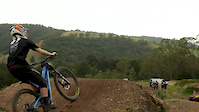
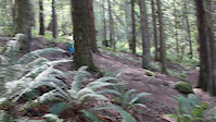
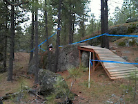
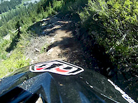
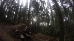
Photos of Teanaway Community Forest Mountain Bike
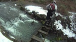
Videos of Teanaway Community Forest Mountain Bike
trail: TCF trail - Locals Only
0:00 |
1323 |
Oct 30, 2016
trail: Down
0:04 |
553 |
Aug 22, 2016
trail: Down
0:13 |
347 |
Dec 28, 2013
trail: Down
2:02 |
157 |
Jul 2, 2013
trail: Down
0:14 |
129 |
Jul 29, 2011
trail: West Fork TCF trail 1
15:46 |
251 |
Mar 2, 2023 , Cle Elum
trail: Down
0:04 |
280 |
Jan 20, 2010
trail: Down
2:32 |
215 |
Jan 19, 2010
Current Trail Warnings
| status | trail | date | condition | user | info |
|---|---|---|---|---|---|
| Paris Creek | Jun 21, 2026 @ 4:39pm (America/Los_Angeles) Jun 21, 2026 | Dry | ckoont | All of the blowdowns referenced in the... | |
| Frog Slab Trail | Jun 21, 2026 @ 10:46am (America/Vancouver) Jun 21, 2026 | Dry | fastford337 | Super sandy on DH portion…must have... |
Recent Trail Reports
| status | trail | date | condition | info | user |
|---|---|---|---|---|---|
| Upper Frog Pond | Jun 21, 2026 @ 10:46am (America/Vancouver) Jun 21, 2026 | Dry | fastford337 | ||
| Lower Frog Pond | Jun 21, 2026 @ 10:46am (America/Vancouver) Jun 21, 2026 | Dry | fastford337 | ||
| First Trail | Jun 20, 2026 @ 6:19pm (America/Los_Angeles) Jun 20, 2026 | Unknown | JoshV987 | ||
| Wildcat | Jun 20, 2026 @ 6:17pm (America/Los_Angeles) Jun 20, 2026 | Unknown | JoshV987 | ||
| Windy Ridge | Jun 8, 2026 @ 11:54am (America/Los_Angeles) Jun 8, 2026 | Very Dry | Freyasf | ||
| Adenauer Forst | Jun 8, 2026 @ 11:54am (America/Los_Angeles) Jun 8, 2026 | Very Dry | Freyasf | ||
| Corral Creek Trail | May 17, 2026 @ 1:20pm (America/Vancouver) May 17, 2026 | Unknown | TrailFerry Silver | ||
| Pine Needles | May 17, 2026 @ 1:20pm (America/Vancouver) May 17, 2026 | Unknown | TrailFerry Silver | ||
| Carlson Tie | May 3, 2026 @ 7:50pm (America/Los_Angeles) May 3, 2026 | Dry | i-g-o-r | ||
| River Ridge Trail | May 3, 2026 @ 7:49pm (America/Los_Angeles) May 3, 2026 | Dry | i-g-o-r |
Activity Feed
| username | action | type | title | date |
|---|---|---|---|---|
| singletrackck | wishlist | trail | activity #98284162 | Jul 2, 2026 @ 11:40am 9 hours |
| Livelyprairie | wishlist | trail | activity #98198975 and 2 more | Jul 1, 2026 @ 7:32am 2 days |
| woodway | update | trail | activity #98167353 | Jun 30, 2026 @ 5:36pm 2 days |
| hollybikespnw | wishlist | route | activity #98106211 | Jun 29, 2026 @ 8:35pm 3 days |
| woodway | update | trail | activity #98033780 and 4 more | Jun 28, 2026 @ 4:42pm Jun 28, 2026 |
Recent Comments
| username | type | title | comment | date |
|---|---|---|---|---|
| trail | The Sasse Mountain Trail #1340 begins at... | Jun 25, 2026 @ 9:39am Jun 25, 2026 | ||
| trail | do not attempt the western portion of thisnl... | Jun 19, 2026 @ 8:35am Jun 19, 2026 | ||
| trail | Lots of trees down 5/29/2026 | May 29, 2026 @ 11:36am May 29, 2026 | ||
| report | oh, almost forgot to mention it’s very... | Aug 18, 2025 @ 11:30pm Aug 18, 2025 | ||
| trail | I would ride this trail from west to east.... | Jul 20, 2025 @ 6:16am Jul 20, 2025 |
Nearby Areas
| name | distance | ||||
|---|---|---|---|---|---|
| Roslyn Area Trails | 3 | 16 | 4 | 3.9 km | |
| Roslyn Urban Forest | 2 | 12 | 1 | 4.3 km | |
| Skyline Ridge | 4.9 km | ||||
| Coal Trax Mountain Bike Park | 2 | 10 | 4 | 1 | 5.7 km |
| Suncadia Resort | 22 | 1 | 6.1 km |
Local Badges
-

Completionist0 awarded
Activity Type Stats
| activitytype | trails | distance | descent | descent distance | total vertical | rating | global rank | state rank | photos | reports | routes | ridelogs |
|---|---|---|---|---|---|---|---|---|---|---|---|---|
| Mountain Bike | 165 | 261 miles | 50,663 ft | 128 miles | 4,173 ft | #437 | #170 | 264 | 1,530 | 10 | 1,662 | |
| E-Bike | 31 | 109 miles | 19,350 ft | 51 miles | 4,137 ft | #1,360 | #671 | 1,352 | 96 | |||
| Gravel Bike | 43 | 101 miles | 8,143 ft | 46 miles | 2,028 ft | #3,612 | #1,650 | 1 | 363 | 1 | 13 | |
| Adaptive Bike | 25 | 60 miles | 5,279 ft | 27 miles | 2,848 ft | #3,620 | #1,653 | 175 | ||||
| Winter Fat Bike | 6 | 2 miles | 535 ft | 4,757 ft | 446 ft | #3,612 | #1,650 | 57 | ||||
| Horse | 30 | 62 miles | 9,806 ft | 26 miles | 3,970 ft | #673 | #359 | 1,143 | 2 | |||
| Hike | 175 | 271 miles | 51,614 ft | 129 miles | 4,961 ft | #136 | #102 | 21 | 1,529 | 1 | 270 | |
| Trail Running | 171 | 267 miles | 48,802 ft | 126 miles | 4,961 ft | #130 | 1 | 1,529 | 1 | 98 | ||
| Dirtbike/Moto | 23 | 79 miles | 17,415 ft | 38 miles | 4,124 ft | #100 | #53 | 25 | 1,151 | 52 | ||
| Observed Trials | 1 | 5,240 ft | 108 ft | 4,514 ft | 92 ft | 398 | 2 | |||||
| ATV/ORV/OHV | 9 | 19 miles | 1,844 ft | 9 miles | 1,526 ft | #388 | #107 | 602 | 4 | |||
| Snowmobile | 25 | 24 miles | 8,143 ft | 15 miles | 1,473 ft | #11 | #3 | 6 | 891 | 29 | ||
| Snowshoe | 7 | 7 miles | 1,818 ft | 5 miles | 1,296 ft | #749 | #332 | 925 | 3 |
Frequently Asked Questions About Teanaway Community Forest
▼
What are the highest rated mountain biking trails in Teanaway Community Forest?
The highest rated mountain biking trails in Teanaway Community Forest are:
- Sandstone Slab (4.4/5)
- River Ridge Trail (4.3/5)
- Bible Rock Descent (4.2/5)
- Hex Mountain Trail (4.1/5)
- Hangover (4.1/5)
▼
What is the best time of the year to ride in Teanaway Community Forest?
Based on ride log data, the most popular months to ride in Teanaway Community Forest are:
- June (73 activities)
- July (63 activities)
- May (57 activities)
▼
Where can I park to ride in Teanaway Community Forest?
There are 9 parking locations listed in Teanaway Community Forest. The most popular parking spots are: View all parking and trailhead locations on the map to plan your visit.
▼
What is the longest trail in Teanaway Community Forest?
The longest trail in Teanaway Community Forest is Yellow Hill Trail #1222 at 10.1 miles. View all trails sorted by distance.
Activities
- Teanaway Community Forest Mountain Biking Trails
- Teanaway Community Forest E-Biking Trails
- Teanaway Community Forest Horseback Trails
- Teanaway Community Forest Hiking Trails
- Teanaway Community Forest Trail Running Trails
- Teanaway Community Forest Dirtbiking Trails
- Teanaway Community Forest ATVing/Offroading Trails
- Teanaway Community Forest Snowmobiling Trails
- Teanaway Community Forest Snowshoeing Trails
Trails
- Hard trails in Teanaway Community Forest
- Easy trails in Teanaway Community Forest
- Favorite trails in Teanaway Community Forest
- Most ridden trails in Teanaway Community Forest
- Singletrack in Teanaway Community Forest
- Viewpoint trails in Teanaway Community Forest
- Trails with technical features in Teanaway Community Forest
- Race routes in Teanaway Community Forest
- By boxxerace
 TRAILFORKS EMBA-BOD & contributors
 - Admins: EMBA-KC, WTA, EMBA-KC
- #10000 - 29,568 views
- teanaway community forest activity log | embed map of Teanaway Community Forest mountain bike trails | teanaway community forest mountain biking points of interest
Downloading of trail gps tracks in kml & gpx formats is enabled for Teanaway Community Forest.
You must login to download files.