close
-
Layers w
- Weather Layers
- Pro
- Pro
- Pro
- Pro
- Pro
- Pro
- More Layers
- Pro
- Pro
- Pro
- Pro
-
Upgrade to

3D
Trail Conditions
- Unknown
- Snow Groomed
- Snow Packed
- Snow Covered
- Snow Cover Partial
- Freeze/thaw Cycle
- Icy
- Prevalent Mud
- Wet
- Variable
- Ideal
- Dry
- Very Dry
Trail Flow (Ridden Direction)
Trailforks scans users ridelogs to determine the most popular direction each trail is ridden. A good flowing trail network will have most trails flowing in a single direction according to their intension.
The colour categories are based on what percentage of riders are riding a trail in its intended direction.
The colour categories are based on what percentage of riders are riding a trail in its intended direction.
- > 96%
- > 90%
- > 80%
- > 70%
- > 50%
- < 50%
- bi-directional trail
- no data
Trail Last Ridden
Trailforks scans ridelogs to determine the last time a trail was ridden.
- < 2 days
- < 1 week
- < 2 weeks
- < 1 month
- < 6 months
- > 6 months
Trail Ridden Direction
The intended direction a trail should be ridden.
- Downhill Only
- Downhill Primary
- Both Directions
- Uphill Primary
- Uphill Only
- One Direction
Contribute Details
Colors indicate trail is missing specified detail.
- Description
- Photos
- Description & Photos
- Videos
Trail Popularity ?
Trailforks scans ridelogs to determine which trails are ridden the most in the last 9 months.
Trails are compared with nearby trails in the same city region with a possible 25 colour shades.
Think of this as a heatmap, more rides = more kinetic energy = warmer colors.
- most popular
- popular
- less popular
- not popular
ATV/ORV/OHV Filter
Max Vehicle Width
inches
US Cell Coverage
Legend

Radar Time
Activity Recordings
Trailforks uses anonymized public activity data.
?
Activity Recordings
Trailforks uses anonymized public activity data.
?
Personal Heatmap
▶
Activity Types
all
/
none
▶
Options
2
Date range
month
–
Winter Trails
Warning
A routing network for winter maps does not exist. Selecting trails using the winter trails layer has been disabled.
Missing Trails
Most Popular
Least Popular
Trails are colored based on popularity. The more popular a trail is, the more red. Less popular trails trend towards green.
Jump Magnitude Heatmap
Heatmap of where riders jump on trails. Zoom in to see individual jumps, click circles to view jump details.
BC Backroad Status
![map legend]()
Service Road Atlas is a free to use, community-driven service for viewing and creating reports on the numerous back-country service roads around B.C. and Alberta.

Slope Aspect
Direction the slope faces
Trails Deemphasized
Trails are shown in grey.
Only show trails with no bike usage.
Suggested Layers
Based on selected activity type
Save the current map location and zoom level as your default home location whenever this page is loaded.
Save
No description for Middle Fork Snoqualmie has been added yet!
Login or register to submit one.
 google parking directions
Primary Trail Type: All-Mountain & Downhill
eBikes Allowed:
No
google parking directions Activities Click to view
- Mountain Bike
6 trails
- Hike
12 trails
- Trail Running
12 trails
Region Details
- 1
- 1
- 3
- 1
Region Status
Caution as of Jun 14, 2026Local Trail Association
Stats
- Avg Trail Rating
- Trails (view details)
- 12
- Trails Mountain Bike
- 6
- Trails E-Bike
- 1
- Trails Horse
- 3
- Trails Hike
- 12
- Trails Trail Running
- 12
- Trails Snowshoe
- 1
- Total Distance
- 49 miles
- Total Descent Distance
- 11 miles
- Total Descent
- 2,649 ft
- Total Vertical
- 2,998 ft
- Highest Trailhead
- 3,971 ft
- Reports
- 127
- Photos
- 158
- Ridden Counter
- 2,903
Popular Middle Fork Snoqualmie Mountain Biking Trails
• 40 ★ 3.9 • 14 miles • 3,025 ft • 105 •
Rugged and beautiful trail. Technically difficult. This trail follows the Snoqualmie River, rolling along on the opposite side of the river from the MF Road (FR56). The first 1/3 of the trail is nice and in good shape; the upper 2/3rds...
• 40 ★ 3.7 • 10 miles • 2,803 ft • 94 •
So what happens if you get all the way to the and realize it's an EVEN numbered day? Or maybe you are too early or too late(before June or after Oct). Or maybe you have done the extension trail and need some more miles. What DO you do?...
• 40 ★ 0.0 • 1,181 ft • 0 ft • 56 •
Trail access from Dingford Creek Trailhead
• 35 ★ 0.0 • 2,766 ft • 45 ft • 29 •
Less popular green difficulty singletrack. This multi-use trail can be used both directions. On average it takes 9 minutes to complete this trail.
Middle Fork Snoqualmie Mountain Bike Routes
16 miles • 2,136 ft • 1 •
FS road up to Goldmyer, on the way back. Odd days only for MTBs.
• 8 miles • 1,023 ft • 2 •
• 11 miles • 2,809 ft • 1 •
• 30 miles • 1,700 ft • 0 •
• 7 miles • 1,639 ft • 1 •
• 5 miles • 189 ft • 0 •
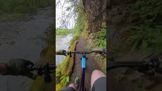
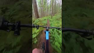
Photos of Middle Fork Snoqualmie Mountain Bike
Videos of Middle Fork Snoqualmie Mountain Bike
trail: Middle Fork
0:00 |
62 |
Sep 7, 2025 , North Bend
trail: Middle Fork
0:39 |
68 |
Sep 7, 2025 , North Bend
Recent Trail Reports
| status | trail | date | condition | info | user |
|---|---|---|---|---|---|
| CCC Trail | Jun 14, 2026 @ 7:55pm (America/Los_Angeles) Jun 14, 2026 | Ideal | eplanajr | ||
| Snoqualmie Lake Trail | Apr 10, 2026 @ 5:18pm (America/Los_Angeles) Apr 10, 2026 | Variable | ckoont | ||
| Middle Fork | Jul 12, 2025 @ 3:15pm Jul 12, 2025 | Ideal | maukiman | ||
| Middle Fork Access Trail | Apr 17, 2025 @ 10:04am Apr 17, 2025 | Ideal | kawabunghole | ||
| NF 56 Road | Nov 29, 2024 @ 5:41am Nov 29, 2024 | Variable | loamchompsghee | ||
| Taylor River Connector | Oct 13, 2023 @ 2:42pm Oct 13, 2023 | Ideal | amckech |
Activity Feed
| username | action | type | title | date |
|---|---|---|---|---|
| 15268clare | wishlist | trail | activity #97491405 | Jun 21, 2026 @ 9:09am 4 hours |
| Bfurch | ridden | trail | activity #97366497 | Jun 19, 2026 @ 10:06pm 2 days |
| eplanajr | add | report | activity #97020145 | Jun 14, 2026 @ 7:55pm Jun 14, 2026 |
| gapp30 | wishlist | trail | activity #96401657 | Jun 6, 2026 @ 1:21pm Jun 6, 2026 |
| AndrewLu9la | wishlist | trail | activity #96061567 | Jun 1, 2026 @ 9:20pm Jun 1, 2026 |
Recent Comments
| username | type | title | comment | date |
|---|---|---|---|---|
| trail | If you enjoy old school, punchy and sometimes... | Aug 17, 2025 @ 3:27pm Aug 17, 2025 | ||
| trail | Somebody's butt hurt about mountain bikers | May 3, 2025 @ 8:57am May 3, 2025 | ||
| report | Since this report, the WTA report 10 days... | Jan 17, 2025 @ 9:14am Jan 17, 2025 | ||
| trail | I'd suggest splitting this into three... | Nov 29, 2024 @ 5:59am Nov 29, 2024 | ||
| trail | Yes, map needs to be updated. I got to where... | Sep 15, 2024 @ 7:39pm Sep 15, 2024 |
Nearby Areas
| name | distance | ||||
|---|---|---|---|---|---|
| Middle Fork Snoqualmie River | 3 | 2 | 2.9 km | ||
| Middle Fork Snoqualmie NRCA | 7.2 km | ||||
| The Summit at Snoqualmie | 10.5 km | ||||
| Boxley Creek | 10 | 10 | 2 | 10.8 km | |
| Olallie State Park | 2 | 3 | 10.8 km |
Local Products
Activity Type Stats
| activitytype | trails | distance | descent | descent distance | total vertical | rating | global rank | state rank | photos | reports | routes | ridelogs |
|---|---|---|---|---|---|---|---|---|---|---|---|---|
| Mountain Bike | 6 | 40 miles | 2,448 ft | 10 miles | 2,848 ft | #4,939 | #1,779 | 140 | 126 | 1 | 2,576 | |
| E-Bike | 1 | 13 miles | 623 ft | 2 miles | 1,749 ft | 7 | 52 | 88 | ||||
| Horse | 3 | 27 miles | 2,008 ft | 7 miles | 1,804 ft | 68 | ||||||
| Hike | 12 | 49 miles | 2,648 ft | 11 miles | 2,999 ft | #2,323 | #877 | 11 | 127 | 862 | ||
| Trail Running | 12 | 49 miles | 2,648 ft | 11 miles | 2,999 ft | #4,358 | #1,251 | 127 | 1 | 195 | ||
| Snowshoe | 1 | 1 mile | 10 ft | 364 ft | 1,250 ft | 3 |
Frequently Asked Questions About Middle Fork Snoqualmie
▼
What are the highest rated mountain biking trails in Middle Fork Snoqualmie?
The highest rated mountain biking trails in Middle Fork Snoqualmie are:
- CCC Trail (4/5)
- Middle Fork (3.9/5)
- Snoqualmie Lake Trail (3.8/5)
- Taylor River Connector (0/5)
- Middle Fork Access Trail (0/5)
▼
What is the best time of the year to ride in Middle Fork Snoqualmie?
Based on ride log data, the most popular months to ride in Middle Fork Snoqualmie are:
- September (51 activities)
- October (51 activities)
- August (49 activities)
▼
Where can I park to ride in Middle Fork Snoqualmie?
There are 8 parking locations listed in Middle Fork Snoqualmie. The most popular parking spots are: View all parking and trailhead locations on the map to plan your visit.
▼
What is the longest trail in Middle Fork Snoqualmie?
The longest trail in Middle Fork Snoqualmie is Middle Fork at 13.7 miles. View all trails sorted by distance.
Activities
Trails
- Hard trails in Middle Fork Snoqualmie
- Easy trails in Middle Fork Snoqualmie
- Favorite trails in Middle Fork Snoqualmie
- Most ridden trails in Middle Fork Snoqualmie
- Singletrack in Middle Fork Snoqualmie
- Viewpoint trails in Middle Fork Snoqualmie
- Trails with technical features in Middle Fork Snoqualmie
- By jebike
 & contributors
 - Admins: EMBA-C2S
- #5477 - 12,220 views
- middle fork snoqualmie activity log | embed map of Middle Fork Snoqualmie mountain bike trails | middle fork snoqualmie mountain biking points of interest
Downloading of trail gps tracks in kml & gpx formats is enabled for Middle Fork Snoqualmie.
You must login to download files.