close
-
Layers w
- Weather Layers
- Pro
- Pro
- Pro
- Pro
- Pro
- Pro
- More Layers
- Pro
- Pro
- Pro
- Pro
-
Upgrade to

3D
Trail Conditions
- Unknown
- Snow Groomed
- Snow Packed
- Snow Covered
- Snow Cover Partial
- Freeze/thaw Cycle
- Icy
- Prevalent Mud
- Wet
- Variable
- Ideal
- Dry
- Very Dry
Trail Flow (Ridden Direction)
Trailforks scans users ridelogs to determine the most popular direction each trail is ridden. A good flowing trail network will have most trails flowing in a single direction according to their intension.
The colour categories are based on what percentage of riders are riding a trail in its intended direction.
The colour categories are based on what percentage of riders are riding a trail in its intended direction.
- > 96%
- > 90%
- > 80%
- > 70%
- > 50%
- < 50%
- bi-directional trail
- no data
Trail Last Ridden
Trailforks scans ridelogs to determine the last time a trail was ridden.
- < 2 days
- < 1 week
- < 2 weeks
- < 1 month
- < 6 months
- > 6 months
Trail Ridden Direction
The intended direction a trail should be ridden.
- Downhill Only
- Downhill Primary
- Both Directions
- Uphill Primary
- Uphill Only
- One Direction
Contribute Details
Colors indicate trail is missing specified detail.
- Description
- Photos
- Description & Photos
- Videos
Trail Popularity ?
Trailforks scans ridelogs to determine which trails are ridden the most in the last 9 months.
Trails are compared with nearby trails in the same city region with a possible 25 colour shades.
Think of this as a heatmap, more rides = more kinetic energy = warmer colors.
- most popular
- popular
- less popular
- not popular
ATV/ORV/OHV Filter
Max Vehicle Width
inches
US Cell Coverage
Legend

Radar Time
Activity Recordings
Trailforks uses anonymized public activity data.
?
Activity Recordings
Trailforks uses anonymized public activity data.
?
Personal Heatmap
▶
Activity Types
all
/
none
▶
Options
2
Date range
month
–
Winter Trails
Warning
A routing network for winter maps does not exist. Selecting trails using the winter trails layer has been disabled.
Missing Trails
Most Popular
Least Popular
Trails are colored based on popularity. The more popular a trail is, the more red. Less popular trails trend towards green.
Jump Magnitude Heatmap
Heatmap of where riders jump on trails. Zoom in to see individual jumps, click circles to view jump details.
BC Backroad Status
![map legend]()
Service Road Atlas is a free to use, community-driven service for viewing and creating reports on the numerous back-country service roads around B.C. and Alberta.

Slope Aspect
Direction the slope faces
Trails Deemphasized
Trails are shown in grey.
Only show trails with no bike usage.
Suggested Layers
Based on selected activity type
Save the current map location and zoom level as your default home location whenever this page is loaded.
SaveThis park is stuffed full of fun rolling trails for hiking, biking, and equestrian. Expect dense forest and undergrowth as you navigate the loamy trails. This area can often be muddy, so check trail conditions and the weather before visiting.
Primary Trail Type: Cross-Country
eBikes Allowed:
No
Land Status: County Park
Land Manager: Kitsap County Parks
 google parking directions
 Access Info:
Most of the parking is located on the east side of the park, but there's a smaller parking area and access point on the south end.
Activities Click to view
- Mountain Bike
65 trails
- E-Bike
2 trails
- Horse
2 trails
- Hike
65 trails
- Trail Running
65 trails
Region Details
- 6
- 37
- 22
Region Status
Open as of Jun 5, 2026Local Trail Association
Stats
- Avg Trail Rating
- Trails (view details)
- 65
- Trails Mountain Bike
- 65
- Trails E-Bike
- 2
- Trails Horse
- 2
- Trails Hike
- 65
- Trails Trail Running
- 65
- Total Distance
- 25 miles
- Total Descent
- 2,219 ft
- Total Vertical
- 127 ft
- Highest Trailhead
- 445 ft
- Reports
- 1,112
- Photos
- 128
- Ridden Counter
- 5,640
Popular Banner Forest Heritage Park Trails
• 95 ★ 4.5 • 1 mile • 8 ft • 476 •
Highly rated popular blue difficulty singletrack. This multi-use trail can be used both directions and has a easy overall physical rating with a 8 ft green climb. On average it takes 12 minutes to complete this trail.
• 100 ★ 3.5 • 820 ft • 11 ft • 374 •
Popular green difficulty singletrack. This multi-use trail can be used both directions and has a easy overall physical rating with a 11 ft green climb. On average it takes 2 minutes to complete this trail.
• 100 ★ 4.1 • 4,802 ft • 82 ft • 296 •
Highly rated popular blue difficulty singletrack. This multi-use trail can be used both directions and has a moderate overall physical rating with a 82 ft green climb. On average it takes 9 minutes to complete this trail.
• 100 ★ 4.0 • 755 ft • 36 ft • 294 •
Popular blue difficulty singletrack. This multi-use trail can be used both directions and has a easy overall physical rating with a 36 ft green climb. On average it takes 1 minutes to complete this trail.
• 95 ★ 4.0 • 1 mile • 77 ft • 278 •
Highly rated popular blue difficulty singletrack. This multi-use trail can be used both directions and has a moderate overall physical rating with a 77 ft blue climb. On average it takes 19 minutes to complete this trail.
• 85 ★ 3.7 • 3,581 ft • 80 ft • 267 •
Popular blue difficulty singletrack. This multi-use trail can be used both directions and has a easy overall physical rating with a 80 ft green climb. On average it takes 8 minutes to complete this trail.
• 95 ★ 4.0 • 3,549 ft • 40 ft • 266 •
Popular blue difficulty singletrack. This multi-use trail can be used both directions and has a easy overall physical rating with a 40 ft green climb. On average it takes 8 minutes to complete this trail.
• 100 ★ 3.8 • 2,859 ft • 37 ft • 263 •
Popular green difficulty singletrack. This multi-use trail can be used both directions and has a easy overall physical rating with a 37 ft green climb. On average it takes 4 minutes to complete this trail.
Photos of Banner Forest Heritage Park Mountain Bike
Videos of Banner Forest Heritage Park Mountain Bike
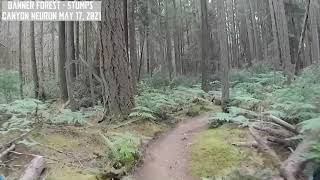
trail: Stumps
5:25 |
40 |
Feb 28, 2024
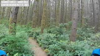
trail: Worm Hole
8:26 |
67 |
Feb 28, 2024

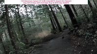
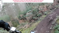
trail: San Francisco
4:37 |
9024 |
Nov 16, 2010

trail: Worm Hole
7:05 |
398 |
Jun 29, 2022 , Port Orchard

trail: Stumps
6:49 |
325 |
Jun 29, 2022 , Port Orchard
trail: Stumps
7:08 |
468 |
May 18, 2021 , Port Orchard
trail: Worm Hole
7:42 |
597 |
May 18, 2021 , Port Orchard
Recent Trail Reports
| status | trail | date | condition | info | user |
|---|---|---|---|---|---|
| Gnome St | May 30, 2026 @ 11:42am (America/Vancouver) May 30, 2026 | Ideal | emery85 | ||
| Dr. John | May 30, 2026 @ 11:42am (America/Vancouver) May 30, 2026 | Ideal | emery85 | ||
| Lariat Loop | May 30, 2026 @ 11:42am (America/Vancouver) May 30, 2026 | Ideal | emery85 | ||
| Banner Forest Road | May 30, 2026 @ 11:42am (America/Vancouver) May 30, 2026 | Ideal | emery85 | ||
| Puffball | May 30, 2026 @ 11:42am (America/Vancouver) May 30, 2026 | Ideal | emery85 | ||
| Sun Belt | May 30, 2026 @ 11:42am (America/Vancouver) May 30, 2026 | Ideal | emery85 | ||
| Bloviate | May 30, 2026 @ 11:42am (America/Vancouver) May 30, 2026 | Ideal | emery85 | ||
| Wally World | May 30, 2026 @ 11:42am (America/Vancouver) May 30, 2026 | Ideal | emery85 | ||
| Mismash | May 30, 2026 @ 11:42am (America/Vancouver) May 30, 2026 | Ideal | emery85 | ||
| PR2 | May 30, 2026 @ 11:42am (America/Vancouver) May 30, 2026 | Ideal | emery85 |
Activity Feed
| username | action | type | title | date |
|---|---|---|---|---|
| V5sQFd | wishlist | region | activity #97693439 | Jun 24, 2026 @ 6:42am Jun 24, 2026 |
| MarcusNetherton | ridden | trail | activity #96982116 | Jun 14, 2026 @ 10:09am Jun 14, 2026 |
| emery85 | add | report | activity #95897079 and 9 more | May 30, 2026 @ 4:45pm May 30, 2026 |
| crashXred | wishlist | region | activity #95547587 | May 26, 2026 @ 12:39am May 26, 2026 |
| emery85 | add | report | activity #94772969 and 10 more | May 15, 2026 @ 3:31pm May 15, 2026 |
Recent Comments
| username | type | title | comment | date |
|---|---|---|---|---|
| report | trees removed | Jan 16, 2026 @ 1:00pm Jan 16, 2026 | ||
| report | Trees removed | Jan 16, 2026 @ 1:00pm Jan 16, 2026 | ||
| trail | Very turny and tight ! | Sep 23, 2025 @ 5:53pm Sep 23, 2025 | ||
| trail | Also overgrown in spots ! | Aug 21, 2025 @ 1:22pm Aug 21, 2025 | ||
| trail | Quite overgrown in spots | Aug 21, 2025 @ 1:21pm Aug 21, 2025 |
Nearby Areas
| name | distance | ||||
|---|---|---|---|---|---|
| Island Center Forest | 22 | 9 | 4.6 km | ||
| Judd Creek Preserve | 11 | 6.1 km | |||
| Wax Orchard Park | 6.1 km | ||||
| McCormick Woods Trail System | 1 | 6.8 km | |||
| Fort Ward Park | 3 | 2 | 7.4 km |
Local Badges
-

Completionist2 awarded
Local Products
Activity Type Stats
| activitytype | trails | distance | descent | descent distance | total vertical | rating | global rank | state rank | photos | reports | routes | ridelogs |
|---|---|---|---|---|---|---|---|---|---|---|---|---|
| Mountain Bike | 65 | 25 miles | 2,218 ft | 10 miles | 128 ft | #2,079 | #706 | 131 | 1,112 | 4,786 | ||
| E-Bike | 2 | 1,201 ft | 20 ft | #1,598 | #688 | 1 | 951 | 419 | ||||
| Horse | 2 | 1,831 ft | 33 ft | 912 ft | 75 ft | #3,330 | #1,976 | 194 | 1 | |||
| Hike | 65 | 25 miles | 2,218 ft | 10 miles | 128 ft | #6,174 | #2,237 | 1,092 | 132 | |||
| Trail Running | 65 | 25 miles | 2,218 ft | 10 miles | 128 ft | #5,239 | #1,592 | 1,092 | 160 |
Frequently Asked Questions About Banner Forest Heritage Park
▼
What are the highest rated mountain biking trails in Banner Forest Heritage Park?
The highest rated mountain biking trails in Banner Forest Heritage Park are:
- Capitulate (4.2/5)
- Roller Coaster (4.2/5)
- Flying Squirrel (4.1/5)
- Pulverizer (4.1/5)
- Omega (4.1/5)
▼
What is the best time of the year to ride in Banner Forest Heritage Park?
Based on ride log data, the most popular months to ride in Banner Forest Heritage Park are:
- August (211 activities)
- September (177 activities)
- October (146 activities)
▼
Where can I park to ride in Banner Forest Heritage Park?
There are 2 parking locations listed in Banner Forest Heritage Park. The most popular parking spots are:
▼
What is the longest trail in Banner Forest Heritage Park?
The longest trail in Banner Forest Heritage Park is Mismash at 1.3 miles. View all trails sorted by distance.
Activities
Trails
- Hard trails in Banner Forest Heritage Park
- Easy trails in Banner Forest Heritage Park
- Favorite trails in Banner Forest Heritage Park
- Most ridden trails in Banner Forest Heritage Park
- Singletrack in Banner Forest Heritage Park
- Viewpoint trails in Banner Forest Heritage Park
- Trails with technical features in Banner Forest Heritage Park
- By jebike
 & contributors
 - Admins: apply
- #5482 - 19,771 views
- banner forest heritage park activity log | embed map of Banner Forest Heritage Park mountain bike trails | banner forest heritage park mountain biking points of interest
Downloading of trail gps tracks in kml & gpx formats is enabled for Banner Forest Heritage Park.
You must login to download files.