

Open in App
Get this route on your phone instantly.
Alcuni sentieri sono ad uso promiscuo con gli escursionisti a piedi, prestare attenzione.
Dislivello in salita complessivo con gli impianti di risalita: 2.415 m.
Some trails are shared with hikers, so please be careful.
Total ascent elevation with ski lifts: 2,415 meters.
ENG
This itinerary allows you to cross from east to west the areas where the Man of Mondeval once lived and hunted, also passing through the entire System Number 1 Pelmo - Croda da Lago of the UNESCO Dolomites World Heritage. It's a journey that will take you back to ancient times when these places were visited only by animals and a few nomadic hunters.
From Selva di Cadore, head towards the summit of Monte Fertazza via the two chairlifts Pescul - Fertazza and Fertazza. The view of the most important Dolomite groups from up here is unique.
Then, we head towards Passo Staulanza through scenic forest roads, eventually reaching a large parking lot right at the foot of Monte Pelmo. From here, a slightly uphill gravel road, easily rideable, leads to Rifugio Città di Fiume (1918m). After passing the refuge, continue on trail n.467 under the slopes of Col de la Puina. From Forcella de la Puina, descend for a short stretch, then ascend towards Forcella Roan, Casera Prendera, and finally Forcella Ambrizzola. The single track from Casera Prendera to Forcella Ambrizzola is not rideable in some parts and requires carrying the bike by hand.
Mondeval de Sora stands before us, with the towering mountains above it, the Lastoi de Formin, and La Croda da Lago. In the distance to the left, we can see the boulder where the burial of the Man of Mondeval, who lived approximately 7000 years ago, was found. The burial is preserved in the Vittorino Cazzetta Museum in Selva di Cadore.
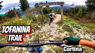
From Forcella Prendera, continue downhill on an enjoyable trail to Rifugio Palmieri and its panoramic lake (2046 m). Proceed through the forest on trail n.431, which is narrower and more technical, requiring some sections to be walked, until reaching the village of Mortisa. From there, reach the center of Cortina d'Ampezzo via road and the Freccia nel Cielo cable car. From there, ascend to Rifugio Duca D'Aosta, then ride the Tofanina trail (Part of the Cortina Bike Park) and reach the Skyline cable car and subsequently the 5 Torri chairlift. From there, the final uphill stretch begins to Rifugio Averau (2413 m).
After passing Rifugio Averau, immediately take a scenic single track on the right that leads to the entrance of the fantastic single track for the Piani di Melei. A long and fun descent through the pastures of Monte Pore with the Marmolada accompanying us leads to the characteristic village of Larzonei. From there, the trail slightly ascends to Forzela and descends to Colle Santa Lucia. Once on the main road, it's a short return to Selva di Cadore, admiring the panorama of Val Fiorentina, and finally reaching the village of Pescul.
*************
ITA
Questo itinerario permette di attraversare da est a ovest le zone dove un tempo viveva e cacciava L’uomo di Mondeval inoltre il tour attraversa l’intero Sistema Numero 1 Pelmo - Croda da Lago delle Dolomiti UNESCO. Un escursione che vi riporterà ai tempi antichi quando questi luoghi erano visitati solo da animali e da alcuni nomadi cacciatori.
Da Selva di Cadore ci si dirige in direzione cima Monte Fertazza attraverso le due seggiovie Pescul - Fertazza e Fertazza. Da quassù il panorama sui più importanti gruppi dolomitici è unico.
Ci avviamo quindi verso Passo Staulanza attraverso panoramiche strade forestali, per raggiungere in seguito un ampio parcheggio proprio ai piedi del Monte Pelmo. Da qui parte una stradina bianca leggermente in salita facilmente pedalabile che porta al Rifugio Città di Fiume (1918m). Superato il Rifugio si prosegue per il sentiero n.467 sotto le pendici del Col de la Puina.
Da forcella de la Puina si scende per un breve tratto e si sale in direzione forcella Roan, Casera Prendera e infine Forcella Ambrizzola. Il single track da Casera Prendera fino a Forcella Ambrizzola in alcuni punti non è pedalabile e la bici va portata a mano.
Mondeval de Sora si staglia dinanzi a noi, con le montagne che lo sovrastano, i Lastoi de Formin e La Croda da Lago. Sulla sinistra in lontananza possiamo vedere il masso dove è stata ritrovata la sepoltura dell’Uomo di Mondeval vissuto circa 7000 anni fa. La sepoltura è conservata nel Museo Vittorino Cazzetta a Selva di Cadore.
Dalla Forcella continuiamo in discesa per un divertente trail fino al Rifugio Palmieri e al suo panoramico Lago (m 2046).
Proseguiamo attraverso il bosco per il sentiero n. 431 più stretto e tecnico, dove in un breve tratto la bici va portata a mano, fino a raggiungere l'abitato di Mortisa. Da qui si raggiunge via strada il centro di Cortina d'Ampezzo e la cabinovia Freccia nel Cielo. Da qui si risale fino al rifugio Duca D'Aosta, per percorrere il trail Tofanina (Parte del Cortina Bike Park) e raggiungere la cabinovia Skyline e successivamente la seggiovia 5 Torri. Da qui inizia l’ultimo tratto in salita fino al Rifugio Averau (m 2413).
Superato il rifugio Averau subito sulla destra prendiamo un panoramico single track che ci porta all’imbocco del fantastico single track per i piani di Melei. Una lunga e divertente discesa attraversando i pascoli del Monte Pore con la Marmolada a farci compagnia ci porta al caratteristico paesino di Larzonei. Da lì il sentiero risale leggermente fino a Forzela e scende a Colle Santa Lucia. Arrivati sulla strada statale in breve tempo si rientra a Selva di Cadore ammirando il panorama della Val Fiorentina, raggiungendo infine l'abitato di Pescul.

We hope you've been enjoying Trailforks!
Create a FREE account to view route comments and much more.
| 2,703 ft | |||||
| 1 mile | |||||
| 1,355 ft | |||||
| 1,119 ft | |||||
| 2,415 ft | |||||
| 4,488 ft | |||||
| 2 miles | |||||
| 338 ft | |||||
| 1,480 ft | |||||
| 2 miles | |||||
| 1,847 ft | |||||
| 1 mile | |||||
| 3 miles | |||||
| 1 mile | |||||
| 3,724 ft | |||||
| 2,602 ft |


Service Road Atlas is a free to use, community-driven service for viewing and creating reports on the numerous back-country service roads around B.C. and Alberta.
Save the current map location and zoom level as your default home location whenever this page is loaded.
Save & contributors