18.2 miles
Distance
1,919 ft
Climb
-1,920 ft
Descent
1,353 ft
High Point
0 ft
Altitude change
1,065 ft
Altitude min
1,327 ft
Altitude start
1,329 ft
Altitude end
-37.6%
Grade max
30.4%
Grade min
7 miles
Distance climb
8 miles
Distance down
3 miles
Distance flat

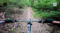
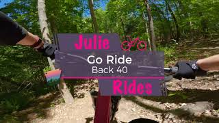
Hit the best downhills in the Back 40 with this loop. It covers Go Ride, Taylor's Homestead, and Rago. But there's also still a lot of pedaling, as would be expected for the Back 40 Smile

Detailed Description
Back 40 Fun & Flow is a 18 mile popular intermediate route located near Bella Vista Arkansas. This mountain bike only route. This route includes 3 trails. This route climbs 1,919 ft with a max elevation of 1,353 ft then descends -1,920 ft.

Trail Issues on Route

  • Minor Issue / Yellow: 1 trail (newest: Jun 17, 2026)
Local Trail Association
Local trail association
Friends of Arkansas Single Track (FAST) (fasttrails.org)
Please consider joining or donating to the local riding association to support trail development & maintenance.
Donate to earn trail karma!

Stats

  • Distance
    18 miles
  • Altitude change
    0 ft
  • Altitude min
    1,065 ft
  • Altitude start
    1,327 ft
  • Altitude end
    1,329 ft
  • Climb
    1,919 ft
  • Descent
    -1,920 ft
  • Grade max
    -37.6%
  • Grade min
    30.4%
  • Distance climb
    7 miles
  • Distance down
    8 miles
  • Distance flat
    3 miles

25 Reviews & Comments


We hope you've been enjoying Trailforks!

Create a FREE account to view route comments and much more.

Trails in Route

Details

  • Riding area
  • Primary Activity
    Mountain Bike
  • Difficulty rating
    Blue
  • Ridelogs
    2
Avg: 3.65 (3 votes)
close
3D
Trail Conditions
  • Unknown
  • Snow Groomed
  • Snow Packed
  • Snow Covered
  • Snow Cover Partial
  • Freeze/thaw Cycle
  • Icy
  • Prevalent Mud
  • Wet
  • Variable
  • Ideal
  • Dry
  • Very Dry
Trail Flow (Ridden Direction)
Trailforks scans users ridelogs to determine the most popular direction each trail is ridden. A good flowing trail network will have most trails flowing in a single direction according to their intension.
The colour categories are based on what percentage of riders are riding a trail in its intended direction.
  • > 96%
  • > 90%
  • > 80%
  • > 70%
  • > 50%
  • < 50%
  • bi-directional trail
  • no data
Trail Last Ridden
Trailforks scans ridelogs to determine the last time a trail was ridden.
  • < 2 days
  • < 1 week
  • < 2 weeks
  • < 1 month
  • < 6 months
  • > 6 months
Trail Ridden Direction
The intended direction a trail should be ridden.
  • Downhill Only
  • Downhill Primary
  • Both Directions
  • Uphill Primary
  • Uphill Only
  • One Direction
Contribute Details
Colors indicate trail is missing specified detail.
  • Description
  • Photos
  • Description & Photos
  • Videos
Trail Popularity ?
Trailforks scans ridelogs to determine which trails are ridden the most in the last 9 months. Trails are compared with nearby trails in the same city region with a possible 25 colour shades. Think of this as a heatmap, more rides = more kinetic energy = warmer colors.
  • most popular
  • popular
  • less popular
  • not popular
ATV/ORV/OHV Filter
Max Vehicle Width
inches
US Cell Coverage
Legend
cell carrier legend

Radar Time
Activity Recordings
Trailforks uses anonymized public activity data. ?
Activity Recordings
Trailforks uses anonymized public activity data. ?
Personal Heatmap
Activity Types
all / none
Options
2
Date range month
Winter Trails
Warning A routing network for winter maps does not exist. Selecting trails using the winter trails layer has been disabled.
Missing Trails
Most Popular
Least Popular
Trails are colored based on popularity. The more popular a trail is, the more red. Less popular trails trend towards green.
Jump Magnitude Heatmap
Heatmap of where riders jump on trails. Zoom in to see individual jumps, click circles to view jump details.
BC Backroad Status

Service Road Atlas is a free to use, community-driven service for viewing and creating reports on the numerous back-country service roads around B.C. and Alberta.

map legend
Slope Aspect
Direction the slope faces
Flat N NE E SE S SW W NW
Trails Deemphasized
Trails are shown in grey.
disable
Only show trails with no bike usage.
Enable
Suggested Layers
Based on selected activity type

    Save the current map location and zoom level as your default home location whenever this page is loaded.

    Save
    Trail transparency
    • Singletrack
    49
    34
    34
    36
    Trail: Go Ride - System: The Back 40
    Trail: Go Ride - System: The Back 40
    trail: Go Ride
    2:59 | 46 | comments: 0 | favs:
    Aug 19, 2025
    #bellavista #oztrails #theback40 #goride
    Julie Rides Go Ride on the Back 40
    Julie Rides Go Ride on the Back 40
    trail: Go Ride
    4:59 | 245 | comments: 0 | favs:
    May 28, 2023

    Recent Trail Reports Along Route

    statustraildateconditiondescription
    Taylor Homestead
    Jun 17, 2026 @ 4:54pm (America/Chicago)
    Jun 17, 2026
    Tree down between SBAT & road crossing
    Summit School
    Jun 16, 2026 @ 1:53pm (America/Chicago)
    Jun 16, 2026
    New grade reversal at the top is working. We still had some rutting in the middle of the trail. I would like to get out there after the next rain to see if we can help the water line out.
    more reports »
    • By twowheeledwandererTF Pro & contributors
    • #55765 - 1,646 views

    Hit the Trail

    Open in App

    Get this route on your phone instantly.

    Download Route

    Save to wishlist, Garmin & download.