8.8 miles
Distance
1,035 ft
Climb
-1,046 ft
Descent
1,252 ft
High Point
-11 ft
Altitude change
1,021 ft
Altitude min
1,040 ft
Altitude start
1,030 ft
Altitude end
-27.8%
Grade max
42.6%
Grade min
4 miles
Distance climb
4 miles
Distance down
1 mile
Distance flat

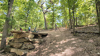
This is a fun ride that links together the Blowing Springs and Alice in Wonderland Trails. There are lots of ways to make it longer or shorter, harder or easier

Detailed Description
Alice in Wonderland Blowing Springs Ride is a 9 mile popular intermediate route located near Bella Vista Arkansas. This mountain bike primary route. This route includes 21 trails. This route climbs 1,035 ft with a max elevation of 1,252 ft then descends -1,046 ft.
Local Trail Association
Local trail association
Friends of Arkansas Single Track (FAST) (fasttrails.org)
Please consider joining or donating to the local riding association to support trail development & maintenance.
Donate to earn trail karma!

Stats

  • Distance
    9 miles
  • Altitude change
    -11 ft
  • Altitude min
    1,021 ft
  • Altitude start
    1,040 ft
  • Altitude end
    1,030 ft
  • Climb
    1,035 ft
  • Descent
    -1,046 ft
  • Grade max
    -27.8%
  • Grade min
    42.6%
  • Distance climb
    4 miles
  • Distance down
    4 miles
  • Distance flat
    1 mile

21 Reviews & Comments


We hope you've been enjoying Trailforks!

Create a FREE account to view route comments and much more.

Details

  • Riding area
  • Primary Activity
    Mountain Bike
  • Other Activities
    • E-Bike
  • Difficulty rating
    Blue
  • eBike Allowed
Avg: 5 (1 votes)
close
3D
Trail Conditions
  • Unknown
  • Snow Groomed
  • Snow Packed
  • Snow Covered
  • Snow Cover Partial
  • Freeze/thaw Cycle
  • Icy
  • Prevalent Mud
  • Wet
  • Variable
  • Ideal
  • Dry
  • Very Dry
Trail Flow (Ridden Direction)
Trailforks scans users ridelogs to determine the most popular direction each trail is ridden. A good flowing trail network will have most trails flowing in a single direction according to their intension.
The colour categories are based on what percentage of riders are riding a trail in its intended direction.
  • > 96%
  • > 90%
  • > 80%
  • > 70%
  • > 50%
  • < 50%
  • bi-directional trail
  • no data
Trail Last Ridden
Trailforks scans ridelogs to determine the last time a trail was ridden.
  • < 2 days
  • < 1 week
  • < 2 weeks
  • < 1 month
  • < 6 months
  • > 6 months
Trail Ridden Direction
The intended direction a trail should be ridden.
  • Downhill Only
  • Downhill Primary
  • Both Directions
  • Uphill Primary
  • Uphill Only
  • One Direction
Contribute Details
Colors indicate trail is missing specified detail.
  • Description
  • Photos
  • Description & Photos
  • Videos
Trail Popularity ?
Trailforks scans ridelogs to determine which trails are ridden the most in the last 9 months. Trails are compared with nearby trails in the same city region with a possible 25 colour shades. Think of this as a heatmap, more rides = more kinetic energy = warmer colors.
  • most popular
  • popular
  • less popular
  • not popular
ATV/ORV/OHV Filter
Max Vehicle Width
inches
US Cell Coverage
Legend
cell carrier legend

Radar Time
Activity Recordings
Trailforks uses anonymized public activity data. ?
Activity Recordings
Trailforks uses anonymized public activity data. ?
Personal Heatmap
Activity Types
all / none
Options
2
Date range month
Winter Trails
Warning A routing network for winter maps does not exist. Selecting trails using the winter trails layer has been disabled.
Missing Trails
Most Popular
Least Popular
Trails are colored based on popularity. The more popular a trail is, the more red. Less popular trails trend towards green.
Jump Magnitude Heatmap
Heatmap of where riders jump on trails. Zoom in to see individual jumps, click circles to view jump details.
BC Backroad Status

Service Road Atlas is a free to use, community-driven service for viewing and creating reports on the numerous back-country service roads around B.C. and Alberta.

map legend
Slope Aspect
Direction the slope faces
Flat N NE E SE S SW W NW
Trails Deemphasized
Trails are shown in grey.
disable
Only show trails with no bike usage.
Enable
Suggested Layers
Based on selected activity type

    Save the current map location and zoom level as your default home location whenever this page is loaded.

    Save
    Trail transparency
    • Singletrack
    • Unpaved
    35
    23
    70
    47
    Big Crash on Area 51
    Big Crash on Area 51
    trail: Area 51
    0:06 | 432 | comments: 4 | favs:
    Aug 6, 2024
    This is my daughter, Alannah, doing the Area 51 drop at Wonderland in Bella Vista, AR. Scary moment as a dad. Knocked her out cold for over a...

    Recent Trail Reports Along Route

    statustraildateconditiondescription
    Blowing Spring Loop (South)
    Jun 20, 2026 @ 10:39am (America/Indiana/Vincennes)
    Jun 20, 2026
    Mad Hatter (Lower)
    Jun 13, 2026 @ 2:54pm (America/Indiana/Vincennes)
    Jun 13, 2026
    Cooper Elementary Mtb Spur
    Jun 13, 2026 @ 2:54pm (America/Indiana/Vincennes)
    Jun 13, 2026
    Ace of Spades
    Jun 13, 2026 @ 2:54pm (America/Indiana/Vincennes)
    Jun 13, 2026
    Through the Looking Glass
    Jun 13, 2026 @ 2:54pm (America/Indiana/Vincennes)
    Jun 13, 2026
    more reports »
    • By twowheeledwandererTF Pro & contributors
    • #56271 - 1,780 views

    Hit the Trail

    Open in App

    Get this route on your phone instantly.

    Download Route

    Save to wishlist, Garmin & download.