Track your percentage towards completion easier.
- Mountain Bike
Login to see your progress towards riding all the trails and routes in this list.
Trails
| title | riding area | rating | distance | completed | |||
|---|---|---|---|---|---|---|---|
| 1 | Bunny Run | 3,173 ft | |||||
| 2 | Burke Brook Ravine Trail | 1,673 ft | |||||
| 3 | Corduroy Road | 1,252 ft | |||||
| 4 | Creek Run North | 1,821 ft | |||||
| 5 | Creek Run South | 1,309 ft | |||||
| 6 | Cudmore Creek | 1,079 ft | |||||
| 7 | Dave Money Hill | 955 ft | |||||
| 8 | Deepwoods | 1,519 ft | |||||
| 9 | Elephant Ridge | 1,617 ft | |||||
| 10 | Elephant Valley | 659 ft | |||||
| 11 | Escott Promenade | 1,352 ft | |||||
| 12 | Everything But | 1,339 ft | |||||
| 13 | Fiveplay | 2,293 ft | |||||
| 14 | Hot Laps Shortcut | 679 ft | |||||
| 15 | Kitchen Sink | 1 mile | |||||
| 16 | Lookout | 587 ft | |||||
| 17 | Loopy Gundy | 2,073 ft | |||||
| 18 | Moccasin Pond Loop | 1,614 ft | |||||
| 19 | Old Beechwood Dr | 761 ft | |||||
| 20 | Party Atmosphere | 2,651 ft | |||||
| 21 | Party Down | 1,102 ft | |||||
| 22 | Pine Grove Trek | 472 ft | |||||
| 23 | Razor's Edge | 1,535 ft | |||||
| 24 | River's Edge | 2,618 ft | |||||
| 25 | RollerFlowster | 1 mile | |||||
| 26 | Secret Hidden Trail | 2,310 ft | |||||
| 27 | Sixplay | 4,039 ft | |||||
| 28 | Swamp | 2,093 ft | |||||
| 29 | Taylor Creek Hydro Corridor (East Section) | 3,445 ft | |||||
| 30 | Taylor Creek Park North Shore | 3,639 ft | |||||
| 31 | The Elephants | 2,106 ft | |||||
| 32 | The Flats | 2 miles | |||||
| 33 | The Ridge | 1 mile | |||||
| 34 | Topo | 994 ft | |||||
| 35 | Training Loop | 3,048 ft | |||||
| 36 | Vanderhoof Hill | 817 ft | |||||
| 37 | Wilket DH | 666 ft | |||||
| 38 | Woods Gundy | 1,775 ft |
Displaying 38
Videos
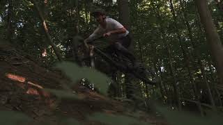
0:48 |
98 |
Aug 11, 2025 , Toronto
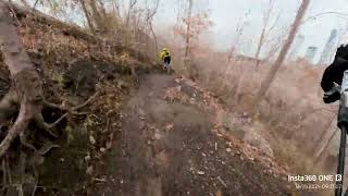
2:08 |
127 |
Dec 8, 2024 , Toronto

9:30 |
160 |
Nov 1, 2024 , Toronto
Recent Trail Reports
| status | trail | date | condition | |
|---|---|---|---|---|
| The Flats | Jun 22, 2026 @ 4:21pm (America/Toronto) 1 day | view | ||
| Swamp | Jun 22, 2026 @ 4:21pm (America/Toronto) 1 day | view | ||
| River's Edge | Jun 22, 2026 @ 4:21pm (America/Toronto) 1 day | view | ||
| Dave Money Hill | Jun 22, 2026 @ 4:21pm (America/Toronto) 1 day | view | ||
| The Ridge | Jun 20, 2026 @ 2:46pm (America/Toronto) Jun 20, 2026 | view |
Total Trails
38
Total Distance
17 miles
Total Descent
-1,381 ft
Total Climb
1,418 ft
close
-
Layers w
- Weather Layers
- Pro
- Pro
- Pro
- Pro
- Pro
- Pro
- More Layers
- Pro
- Pro
- Pro
- Pro
-
Upgrade to

3D
Trail Conditions
- Unknown
- Snow Groomed
- Snow Packed
- Snow Covered
- Snow Cover Partial
- Freeze/thaw Cycle
- Icy
- Prevalent Mud
- Wet
- Variable
- Ideal
- Dry
- Very Dry
Trail Flow (Ridden Direction)
Trailforks scans users ridelogs to determine the most popular direction each trail is ridden. A good flowing trail network will have most trails flowing in a single direction according to their intension.
The colour categories are based on what percentage of riders are riding a trail in its intended direction.
The colour categories are based on what percentage of riders are riding a trail in its intended direction.
- > 96%
- > 90%
- > 80%
- > 70%
- > 50%
- < 50%
- bi-directional trail
- no data
Trail Last Ridden
Trailforks scans ridelogs to determine the last time a trail was ridden.
- < 2 days
- < 1 week
- < 2 weeks
- < 1 month
- < 6 months
- > 6 months
Trail Ridden Direction
The intended direction a trail should be ridden.
- Downhill Only
- Downhill Primary
- Both Directions
- Uphill Primary
- Uphill Only
- One Direction
Contribute Details
Colors indicate trail is missing specified detail.
- Description
- Photos
- Description & Photos
- Videos
Trail Popularity ?
Trailforks scans ridelogs to determine which trails are ridden the most in the last 9 months.
Trails are compared with nearby trails in the same city region with a possible 25 colour shades.
Think of this as a heatmap, more rides = more kinetic energy = warmer colors.
- most popular
- popular
- less popular
- not popular
ATV/ORV/OHV Filter
Max Vehicle Width
inches
US Cell Coverage
Legend

Radar Time
Activity Recordings
Trailforks uses anonymized public activity data.
?
Activity Recordings
Trailforks uses anonymized public activity data.
?
Personal Heatmap
▶
Activity Types
all
/
none
▶
Options
2
Date range
month
–
Winter Trails
Warning
A routing network for winter maps does not exist. Selecting trails using the winter trails layer has been disabled.
Missing Trails
Most Popular
Least Popular
Trails are colored based on popularity. The more popular a trail is, the more red. Less popular trails trend towards green.
Jump Magnitude Heatmap
Heatmap of where riders jump on trails. Zoom in to see individual jumps, click circles to view jump details.
BC Backroad Status
![map legend]()
Service Road Atlas is a free to use, community-driven service for viewing and creating reports on the numerous back-country service roads around B.C. and Alberta.

Slope Aspect
Direction the slope faces
Trails Deemphasized
Trails are shown in grey.
Only show trails with no bike usage.
Suggested Layers
Based on selected activity type
Save the current map location and zoom level as your default home location whenever this page is loaded.
Save
Trail transparency
Average difficulty
Trails and Routes in List - Distance by Difficulty
Trails and Routes in List - Difficulty Totals
- By natedagreat

- #619 - 719 views