close
-
Layers w
- Weather Layers
- Pro
- Pro
- Pro
- Pro
- Pro
- Pro
- More Layers
- Pro
- Pro
- Pro
- Pro
-
Upgrade to

3D
Trail Conditions
- Unknown
- Snow Groomed
- Snow Packed
- Snow Covered
- Snow Cover Partial
- Freeze/thaw Cycle
- Icy
- Prevalent Mud
- Wet
- Variable
- Ideal
- Dry
- Very Dry
Trail Flow (Ridden Direction)
Trailforks scans users ridelogs to determine the most popular direction each trail is ridden. A good flowing trail network will have most trails flowing in a single direction according to their intension.
The colour categories are based on what percentage of riders are riding a trail in its intended direction.
The colour categories are based on what percentage of riders are riding a trail in its intended direction.
- > 96%
- > 90%
- > 80%
- > 70%
- > 50%
- < 50%
- bi-directional trail
- no data
Trail Last Ridden
Trailforks scans ridelogs to determine the last time a trail was ridden.
- < 2 days
- < 1 week
- < 2 weeks
- < 1 month
- < 6 months
- > 6 months
Trail Ridden Direction
The intended direction a trail should be ridden.
- Downhill Only
- Downhill Primary
- Both Directions
- Uphill Primary
- Uphill Only
- One Direction
Contribute Details
Colors indicate trail is missing specified detail.
- Description
- Photos
- Description & Photos
- Videos
Trail Popularity ?
Trailforks scans ridelogs to determine which trails are ridden the most in the last 9 months.
Trails are compared with nearby trails in the same city region with a possible 25 colour shades.
Think of this as a heatmap, more rides = more kinetic energy = warmer colors.
- most popular
- popular
- less popular
- not popular
ATV/ORV/OHV Filter
Max Vehicle Width
inches
US Cell Coverage
Legend

Radar Time
Activity Recordings
Trailforks uses anonymized public activity data.
?
Activity Recordings
Trailforks uses anonymized public activity data.
?
Personal Heatmap
▶
Activity Types
all
/
none
▶
Options
2
Date range
month
–
Winter Trails
Warning
A routing network for winter maps does not exist. Selecting trails using the winter trails layer has been disabled.
Missing Trails
Most Popular
Least Popular
Trails are colored based on popularity. The more popular a trail is, the more red. Less popular trails trend towards green.
Jump Magnitude Heatmap
Heatmap of where riders jump on trails. Zoom in to see individual jumps, click circles to view jump details.
BC Backroad Status
![map legend]()
Service Road Atlas is a free to use, community-driven service for viewing and creating reports on the numerous back-country service roads around B.C. and Alberta.

Slope Aspect
Direction the slope faces
Trails Deemphasized
Trails are shown in grey.
Only show trails with no bike usage.
Suggested Layers
Based on selected activity type
Save the current map location and zoom level as your default home location whenever this page is loaded.
Save** ALL trails in the Number Two Canyon area are closed from December 1st to April 15th. **
The Wenatchee River Ranger District of the Okanogan-Wenatchee National Forest will implement its seasonal road and area closure for the Number Two Canyon area. The goal of this closure is to manage deer winter range to sustain healthy populations of mule deer and elk.
The seasonal closure within the Number Two Canyon Project Area is for all recreational use from December 1 to April 15 annually, including cross-country skiing, snowshoeing, hiking, and mountain biking to avoid distress to animals during this critical period.
There are two exceptions to this closure: Forest Service Road 7101 will remain open to snowmobiles and non-motorized recreational use on the road prism from Number Two Canyon over to Mission Creek during the closure period, and FS Road 7101-500 (the road to the top of Twin Peaks) will be open to non-motorized recreational use from December 1 to January 31 annually as this is the period of deepest snow depth and deer migrate to lower elevations during this period.
This closure period may be extended prior to December 1 or later than April 15 annually in consultation with the Washington Department of Fish and Wildlife, if wintering deer are still present, or if roads are still wet and could be damaged by vehicle use.
Primary Trail Type: Cross-Country
eBikes Allowed:
No
Land Status: National Forest
 google parking directions
 Access Info:
To access Number Two Canyon, drive south out of town on Number Two Canyon Rd. for 4.5 miles until the pavement ends. There is parking here for a handful of vehicles, if you want some extra mileage. Otherwise, drive up the gravel road about 3/4 mile to the open gate. There is more parking here if you want to start riding up Stairway to Heaven. Please avoid parking on the corner so emergency vehicles can get up to the properties above.
Go through the gate another 1/4 to the new parking lot with two bathrooms, picnic tables, and a kiosk. This is the central hub for many trails like Wag More, Community Property, Easy Monday, and the bottom of Prepare to Die and My Name is Inigo Montoya. There is room for about 40 cars here and because of recent road improvements, cars of all sizes can make it here.
Currently, no permits are required to park in any of these areas until all of the trail and infrastructure work is completed.
Activities Click to view
- Mountain Bike
23 trails
- Hike
22 trails
- Trail Running
23 trails
Region Details
- 2
- 7
- 11
- 3
Region Status
Open as of May 31, 2026Stats
- Avg Trail Rating
- Trails (view details)
- 23
- Trails Mountain Bike
- 24
- Trails Horse
- 2
- Trails Hike
- 22
- Trails Trail Running
- 23
- Total Distance
- 28 miles
- Total Descent
- 6,854 ft
- Total Vertical
- 2,521 ft
- Highest Trailhead
- 4,625 ft
- Reports
- 946
- Photos
- 227
- Ridden Counter
- 14,069
Popular #2 Canyon Mountain Biking Trails
• 100 ★ 4.7 • 4 miles • 1,133 ft • 1,252 •
This trail is flowy and non-technical. Most people climb this trail but it can be ridden both ways. Besides riding up the road, this is the easiest to the upper trail system, including Prepare to Die, My Name is Inigo Montoya, , and .
• 95 ★ 4.3 • 2 miles • 202 ft • 1,054 •
Nice downhill run with an optional small drop, berms and a few small bumps you can catch air on.
• 100 ★ 3.3 • 2,513 ft • 10 ft • 966 •
This trail goes from the bottom of to the foundation where the new parking lot will eventually be. It's designed to be an alternative to riding down the road.
• 100 ★ 3.3 • 3,491 ft • 6 ft • 780 •
Popular blue difficulty singletrack. This mountain bike primary trail can be used both directions. On average it takes 4 minutes to complete this trail.
• 70 ★ 4.0 • 2 miles • 211 ft • 726 •
is currently being modified to become the first adaptive trail in Number Two Canyon. It is being widened and the steeper switchbacks are being removed to create a trail that matches the requirements for adaptive cyclists. This is the...
• 100 ★ 3.2 • 4,678 ft • 255 ft • 661 •
was built by the Central Washington chapter of the Evergreen Mountain Bike Association in the spring of 2020. It connects the bottom of to the , which connects to above . The new trail follows the traverse to and replaces Upper .
• 95 ★ 4.0 • 190 ft • 0 ft • 583 •
Popular green difficulty singletrack. This mountain bike primary trail can be used both directions. On average it takes minutes to complete this trail.
• 100 ★ 1.0 • 994 ft • 41 ft • 579 •
Popular green difficulty singletrack. This mountain bike primary trail. On average it takes 3 minutes to complete this trail.
#2 Canyon Mountain Bike Routes
★ 4.0 • 8 miles • 1,342 ft • 6 •
Nice loop @ #2 canyon taking you up stair way and then down and .
★ 4.5 • 70 miles • 12,578 ft • 25 • Loop •
Potential Wenatchee endurance mountain biking race route. Start and end in town at Rotary Park. See most...
37 miles • 7,930 ft • 4 • Loop •
A bigger day route with several ascents of lesser mountains. This is intended as a fall route,...
16 miles • 2,639 ft • 12 •
Stairway, Dragontail, Twin Peaks, EVH, New Sundance, Double D, Bootleg, loop, and back
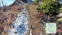
Photos of #2 Canyon Mountain Bike
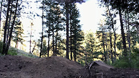
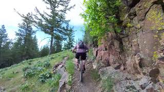
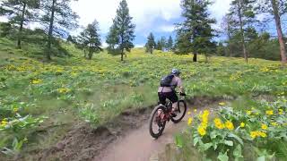
Videos of #2 Canyon Mountain Bike
trail: Eye Candy
3:39 |
98 |
Nov 7, 2025
trail: PTD
0:19 |
475 |
Jun 21, 2021
trail: Stairway to Heaven
0:51 |
26 |
May 11, 2026 , Wenatchee
trail: Stairway to Heaven
0:25 |
25 |
May 11, 2026 , Wenatchee
trail: Sundance
2:33 |
20 |
May 11, 2026 , Wenatchee
trail: Wet Burrito
3:05 |
68 |
May 11, 2026 , Wenatchee

trail: PTD
209 |
Jun 22, 2025 , Wenatchee
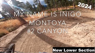
trail: MNIIM
21:56 |
312 |
Nov 25, 2024 , Wenatchee
Current Trail Warnings
| status | trail | date | condition | user | info |
|---|---|---|---|---|---|
| Community Property | May 26, 2026 @ 7:15pm (America/Los_Angeles) May 26, 2026 | Unknown | rbwen EMBA-CC | The north side of the trail (climber's... |
Recent Trail Reports
Activity Feed
| username | action | type | title | date |
|---|---|---|---|---|
| Shockley | wishlist | route | activity #97292797 | Jun 18, 2026 @ 7:54pm 4 hours |
| PeterMarkdrQSMH | wishlist | trail | activity #97219269 | Jun 17, 2026 @ 5:14pm 1 day |
| ultramegabadass | comment | trail | activity #97023375 | Jun 14, 2026 @ 10:16pm Jun 14, 2026 |
| Codycarter | difficultyvote | trail | activity #96968442 | Jun 14, 2026 @ 7:51am Jun 14, 2026 |
| Shawnnason | ridden | route | activity #96796446 | Jun 12, 2026 @ 5:26am Jun 12, 2026 |
Recent Comments
| username | type | title | comment | date |
|---|---|---|---|---|
| trail | Not that bad of climb, 2 short unrideable... | Jun 14, 2026 @ 10:16pm Jun 14, 2026 | ||
| trail | More like spicy green, very flat, almost no... | Jun 11, 2026 @ 3:12pm Jun 11, 2026 | ||
| trail | A pleasure to climb | Jun 1, 2026 @ 5:55pm Jun 1, 2026 | ||
| trail | I appreciate that they built a jump line with... | May 27, 2026 @ 9:26pm May 27, 2026 | ||
| trail | This is one of the most fun, well designed and... | May 14, 2026 @ 12:14pm May 14, 2026 |
Nearby Areas
| name | distance | ||||
|---|---|---|---|---|---|
| Sage Hills | 7 | 12 | 2 | 3.5 km | |
| Devils - Mission | 3 | 11 | 3 | 4.1 km | |
| Saddle Rock Natural Area | 1 | 9 | 1 | 4.4 km | |
| Dry Gulch Preserve | 1 | 5 km | |||
| Squilchuck State Park | 5 | 2 | 7.3 km |
Local Badges
-

Completionist0 awarded
Local Products
Activity Type Stats
| activitytype | trails | distance | descent | descent distance | total vertical | rating | global rank | state rank | photos | reports | routes | ridelogs |
|---|---|---|---|---|---|---|---|---|---|---|---|---|
| Mountain Bike | 23 | 28 miles | 6,854 ft | 14 miles | 2,520 ft | #2,166 | #734 | 227 | 946 | 11 | 9,033 | |
| Horse | 2 | 4,678 ft | 43 ft | 768 ft | 220 ft | 179 | ||||||
| Hike | 22 | 25 miles | 5,692 ft | 12 miles | 2,520 ft | #6,814 | #2,479 | 913 | 1 | 212 | ||
| Trail Running | 23 | 27 miles | 6,152 ft | 13 miles | 2,520 ft | #5,673 | #1,756 | 936 | 1 | 209 |
Frequently Asked Questions About #2 Canyon
▼
What are the highest rated mountain biking trails in #2 Canyon?
The highest rated mountain biking trails in #2 Canyon are:
- Stairway to Heaven (4.6/5)
- PTD (4.5/5)
- Wet Burrito (4.2/5)
- Easy Monday (4.2/5)
- The Meadow Trail (4.1/5)
▼
What is the best time of the year to ride in #2 Canyon?
Based on ride log data, the most popular months to ride in #2 Canyon are:
- July (239 activities)
- June (209 activities)
- May (188 activities)
▼
Where can I park to ride in #2 Canyon?
There are 3 parking locations listed in #2 Canyon. The most popular parking spots are: View all parking and trailhead locations on the map to plan your visit.
▼
What is the longest trail in #2 Canyon?
The longest trail in #2 Canyon is Stairway to Heaven at 3.9 miles. View all trails sorted by distance.
Trails
- By mapdork & contributors
- Admins: CDLT, EMBA-CC, EMBA-CC, CDLT, EMBA-CC
- #5441 - 31,728 views
- #2 canyon activity log | embed map of #2 Canyon mountain bike trails | #2 canyon mountain biking points of interest
Downloading of trail gps tracks in kml & gpx formats is enabled for #2 Canyon.
You must login to download files.