close
-
Layers w
- Weather Layers
- Pro
- Pro
- Pro
- Pro
- Pro
- Pro
- More Layers
- Pro
- Pro
- Pro
- Pro
-
Upgrade to

3D
Trail Conditions
- Unknown
- Snow Groomed
- Snow Packed
- Snow Covered
- Snow Cover Partial
- Freeze/thaw Cycle
- Icy
- Prevalent Mud
- Wet
- Variable
- Ideal
- Dry
- Very Dry
Trail Flow (Ridden Direction)
Trailforks scans users ridelogs to determine the most popular direction each trail is ridden. A good flowing trail network will have most trails flowing in a single direction according to their intension.
The colour categories are based on what percentage of riders are riding a trail in its intended direction.
The colour categories are based on what percentage of riders are riding a trail in its intended direction.
- > 96%
- > 90%
- > 80%
- > 70%
- > 50%
- < 50%
- bi-directional trail
- no data
Trail Last Ridden
Trailforks scans ridelogs to determine the last time a trail was ridden.
- < 2 days
- < 1 week
- < 2 weeks
- < 1 month
- < 6 months
- > 6 months
Trail Ridden Direction
The intended direction a trail should be ridden.
- Downhill Only
- Downhill Primary
- Both Directions
- Uphill Primary
- Uphill Only
- One Direction
Contribute Details
Colors indicate trail is missing specified detail.
- Description
- Photos
- Description & Photos
- Videos
Trail Popularity ?
Trailforks scans ridelogs to determine which trails are ridden the most in the last 9 months.
Trails are compared with nearby trails in the same city region with a possible 25 colour shades.
Think of this as a heatmap, more rides = more kinetic energy = warmer colors.
- most popular
- popular
- less popular
- not popular
ATV/ORV/OHV Filter
Max Vehicle Width
inches
US Cell Coverage
Legend

Radar Time
Activity Recordings
Trailforks uses anonymized public activity data.
?
Activity Recordings
Trailforks uses anonymized public activity data.
?
Personal Heatmap
▶
Activity Types
all
/
none
▶
Options
2
Date range
month
–
Winter Trails
Warning
A routing network for winter maps does not exist. Selecting trails using the winter trails layer has been disabled.
Missing Trails
Most Popular
Least Popular
Trails are colored based on popularity. The more popular a trail is, the more red. Less popular trails trend towards green.
Jump Magnitude Heatmap
Heatmap of where riders jump on trails. Zoom in to see individual jumps, click circles to view jump details.
BC Backroad Status
![map legend]()
Service Road Atlas is a free to use, community-driven service for viewing and creating reports on the numerous back-country service roads around B.C. and Alberta.

Slope Aspect
Direction the slope faces
Trails Deemphasized
Trails are shown in grey.
Only show trails with no bike usage.
Suggested Layers
Based on selected activity type
Save the current map location and zoom level as your default home location whenever this page is loaded.
Save
No description for 3 Rifugi has been added yet!
Login or register to submit one.
This region uses the Uk/Euro style trail grading system.
Activities Click to view
- Mountain Bike
13 trails
- E-Bike
8 trails
- Hike
13 trails
- Trail Running
13 trails
Region Details
- 4
- 7
Region Status
Open as of Sep 8, 2025Stats
- Avg Trail Rating
- Trails (view details)
- 11
- Trails Mountain Bike
- 13
- Trails E-Bike
- 8
- Trails Hike
- 13
- Trails Trail Running
- 13
- Total Distance
- 23 miles
- Total Descent
- 8,437 ft
- Total Vertical
- 5,421 ft
- Highest Trailhead
- 7,281 ft
- Reports
- 30
- Photos
- 15
- Ridden Counter
- 255
Popular 3 Rifugi Mountain Biking Trails
• 65 ★ 4.5 • 4 miles • 81 ft • 25 •
Moderately popular blue difficulty singletrack. This mountain bike primary trail can be used downhill primary and has a moderate overall physical rating. Trail visibility is sometimes hard to follow. On average it takes 16 minutes to complete this trail.
• 95 ★ 4.0 • 1 mile • 813 ft • 24 •
Best Way reach Peak of Monte Crostis, push & carry bike uphill on this track (CAI 151) for ca 45 minutes. Access to beautiful Downhill.
• 80 ★ 4.0 • 4,091 ft • 0 ft • 21 •
Popular blue difficulty alpine singletrack. This mountain bike primary trail can be used downhill primary. On average it takes 9 minutes to complete this trail.
• 60 ★ 0.0 • 1 mile • 0 ft • 21 •
Moderately popular blue difficulty alpine singletrack. This mountain bike primary trail can be used downhill primary. On average it takes 16 minutes to complete this trail.
• 55 ★ 0.0 • 2 miles • 230 ft • 18 •
One of the most beautiful mulatterias of Carnia - ride it or it will disappear! Starting with great views on the peak of Monte Crostis, this wonderful WW1 mulatteria aka CAI Sent 151 is one of the most beautiful rides in the region. But...
• 50 ★ 3.0 • 1 mile • 27 ft • 5 •
Sentiero divertente e mai difficile. Fondo prevalentemente su terra compatta.
• 20 ★ 2.0 • 3,264 ft • 129 ft • 2 •
Sentiero single track con qualche saliscendi. Fondo su terra compatta.
Photos of 3 Rifugi Mountain Bike
Videos of 3 Rifugi Mountain Bike
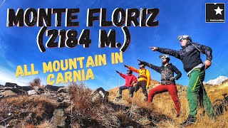
trail: Floriz
20:53 |
402 |
Mar 24, 2023 , Forni Avoltri
Recent Trail Reports
| status | trail | date | condition | info | user |
|---|---|---|---|---|---|
| Gracco Mieli | Sep 8, 2025 @ 4:41am Sep 8, 2025 | Dry | LjOc5z | ||
| Vuezzis Gracco | Sep 8, 2025 @ 4:39am Sep 8, 2025 | Ideal | LjOc5z | ||
| Givigliana Vuezzis | Sep 8, 2025 @ 4:31am Sep 8, 2025 | Ideal | LjOc5z | ||
| Crostis DH 2 | Sep 8, 2025 @ 4:26am Sep 8, 2025 | Variable | LjOc5z | ||
| CrostisSent151 | Sep 8, 2025 @ 4:01am Sep 8, 2025 | Ideal | LjOc5z | ||
| MonteCrostis Uphill 2 | Sep 8, 2025 @ 3:59am Sep 8, 2025 | Ideal | LjOc5z | ||
| Crostis DH 3 | Aug 17, 2025 @ 10:09am Aug 17, 2025 | Ideal | Articolo18 | ||
| MonteCrostis Uphill 1 | Aug 17, 2025 @ 10:09am Aug 17, 2025 | Ideal | Articolo18 | ||
| Floriz | Aug 15, 2025 @ 12:13pm Aug 15, 2025 | Variable | LH3 | ||
| Floriz climb (portage) | Aug 9, 2025 @ 8:26am Aug 9, 2025 | Ideal | Articolo18 |
Activity Feed
| username | action | type | title | date |
|---|---|---|---|---|
| Dutchess1970 | wishlist | trail | activity #96314612 | Jun 5, 2026 @ 12:29pm Jun 5, 2026 |
| LjOc5z | ridden | trail | activity #95614812 and 1 more | May 26, 2026 @ 10:45pm May 26, 2026 |
| incognitobi | wishlist | trail | activity #93760304 | May 1, 2026 @ 12:42am May 1, 2026 |
| Igorvisko | wishlist | trail | activity #93216499 | Apr 23, 2026 @ 8:44am Apr 23, 2026 |
| ProfessorTrail | ridden | trail | activity #89837851 and 1 more | Mar 2, 2026 @ 7:03am Mar 2, 2026 |
Recent Comments
| username | type | title | comment | date |
|---|---|---|---|---|
| trail | A beauty of a trail in a stunning landscape,... | Aug 16, 2024 @ 3:05pm Aug 16, 2024 | ||
| trail | One of the most beautiful mulatterias of... | Jun 27, 2022 @ 10:39pm Jun 27, 2022 |
Nearby Areas
| name | distance | ||||
|---|---|---|---|---|---|
| Val Pesarina | 3 | 1 | 4.7 km | ||
| Zoncolan | 3 | 2 | 2 | 6.2 km | |
| Tenchia | 7 | 6.4 km | |||
| Pierabech | 2 | 6.6 km | |||
| Dimon | 2 | 10.5 km |
Activity Type Stats
| activitytype | trails | distance | descent | descent distance | total vertical | rating | global rank | state rank | photos | reports | routes | ridelogs |
|---|---|---|---|---|---|---|---|---|---|---|---|---|
| Mountain Bike | 13 | 23 miles | 8,438 ft | 8 miles | 5,420 ft | #7,142 | #367 | 15 | 30 | 163 | ||
| E-Bike | 8 | 17 miles | 3,333 ft | 4 miles | 5,220 ft | #4,869 | #328 | 23 | 18 | |||
| Hike | 13 | 23 miles | 8,438 ft | 8 miles | 5,420 ft | #6,972 | #263 | 31 | 96 | |||
| Trail Running | 13 | 23 miles | 8,438 ft | 8 miles | 5,420 ft | #6,206 | #255 | 31 | 6 |
Frequently Asked Questions About 3 Rifugi
▼
What are the highest rated mountain biking trails in 3 Rifugi?
The highest rated mountain biking trails in 3 Rifugi are:
- Floriz (4.1/5)
- MonteCrostis Uphill 2 (4/5)
- Crostis DH 3 (4/5)
- Givigliana Vuezzis (3.8/5)
- Vuezzis Gracco (3.7/5)
▼
What is the best time of the year to ride in 3 Rifugi?
Based on ride log data, the most popular months to ride in 3 Rifugi are:
- August (2 activities)
- October (1 activities)
- November (1 activities)
▼
Where can I park to ride in 3 Rifugi?
Check the 3 Rifugi trail map for trailhead and parking information. Community members regularly update access and parking details for trails in the area.
▼
What is the longest trail in 3 Rifugi?
The longest trail in 3 Rifugi is Floriz at 5.7 km. View all trails sorted by distance.
- By maxmisdaris
 MGNR & contributors
 - Admins: apply
- #42161 - 1,605 views
- 3 rifugi activity log | embed map of 3 Rifugi mountain bike trails |
Downloading of trail gps tracks in kml & gpx formats is enabled for 3 Rifugi.
You must login to download files.