close
-
Layers w
- Weather Layers
- Pro
- Pro
- Pro
- Pro
- Pro
- Pro
- More Layers
- Pro
- Pro
- Pro
- Pro
-
Upgrade to

3D
Trail Conditions
- Unknown
- Snow Groomed
- Snow Packed
- Snow Covered
- Snow Cover Partial
- Freeze/thaw Cycle
- Icy
- Prevalent Mud
- Wet
- Variable
- Ideal
- Dry
- Very Dry
Trail Flow (Ridden Direction)
Trailforks scans users ridelogs to determine the most popular direction each trail is ridden. A good flowing trail network will have most trails flowing in a single direction according to their intension.
The colour categories are based on what percentage of riders are riding a trail in its intended direction.
The colour categories are based on what percentage of riders are riding a trail in its intended direction.
- > 96%
- > 90%
- > 80%
- > 70%
- > 50%
- < 50%
- bi-directional trail
- no data
Trail Last Ridden
Trailforks scans ridelogs to determine the last time a trail was ridden.
- < 2 days
- < 1 week
- < 2 weeks
- < 1 month
- < 6 months
- > 6 months
Trail Ridden Direction
The intended direction a trail should be ridden.
- Downhill Only
- Downhill Primary
- Both Directions
- Uphill Primary
- Uphill Only
- One Direction
Contribute Details
Colors indicate trail is missing specified detail.
- Description
- Photos
- Description & Photos
- Videos
Trail Popularity ?
Trailforks scans ridelogs to determine which trails are ridden the most in the last 9 months.
Trails are compared with nearby trails in the same city region with a possible 25 colour shades.
Think of this as a heatmap, more rides = more kinetic energy = warmer colors.
- most popular
- popular
- less popular
- not popular
ATV/ORV/OHV Filter
Max Vehicle Width
inches
US Cell Coverage
Legend

Radar Time
Activity Recordings
Trailforks uses anonymized public activity data.
?
Activity Recordings
Trailforks uses anonymized public activity data.
?
Personal Heatmap
▶
Activity Types
all
/
none
▶
Options
2
Date range
month
–
Winter Trails
Warning
A routing network for winter maps does not exist. Selecting trails using the winter trails layer has been disabled.
Missing Trails
Most Popular
Least Popular
Trails are colored based on popularity. The more popular a trail is, the more red. Less popular trails trend towards green.
Jump Magnitude Heatmap
Heatmap of where riders jump on trails. Zoom in to see individual jumps, click circles to view jump details.
BC Backroad Status
![map legend]()
Service Road Atlas is a free to use, community-driven service for viewing and creating reports on the numerous back-country service roads around B.C. and Alberta.

Slope Aspect
Direction the slope faces
Trails Deemphasized
Trails are shown in grey.
Only show trails with no bike usage.
Suggested Layers
Based on selected activity type
Save the current map location and zoom level as your default home location whenever this page is loaded.
SavePopular Trail Networks
view all areas »
No description for China has been added yet!
Login or register to submit one.
Region Details
- 26
- 2
- 32
- 87
- 43
- 11
- 3
Stats
- Avg Trail Rating
- Trails (view details)
- 211
- Trails Mountain Bike
- 213
- Trails E-Bike
- 107
- Trails Horse
- 32
- Trails Hike
- 211
- Trails Trail Running
- 173
- Trails Dirtbike/Moto
- 36
- Trails Observed Trials
- 5
- Trails ATV/ORV/OHV
- 7
- Trails Snowshoe
- 6
- Trails Downhill Ski
- 5
- Trails Backcountry Ski
- 5
- Trails Nordic Ski
- 5
- Total Distance
- 586 miles
- Total Descent
- 151,449 ft
- Total Vertical
- 14,766 ft
- Highest Trailhead
- 14,805 ft
- Reports
- 681
- Photos
- 565
- Ridden Counter
- 2,111
Articles
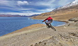
Reader Story: Incredible Freeride Adventures in India’s Rugged North
Jan 18, 2026 from pinkbike.com
Vinay Menon and friends ride remote Ladakh trails, exploring terrain at the edge of India, Pakistan, and China.

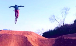
Interview: Meet the Chinese Rider Going Viral for His Massive Freeride Sends
Sep 5, 2025 from pinkbike.com
Wang Hanxiang (aka @dirt.jump.w) is going huge and putting China’s budding freeride (stair hucking) scene on the map.
Video: Building a Bike Park in China
Jan 15, 2020 from pinkbike.com
Keith & Ding, the foreigner and the local, come together to create a bike park in China.

Downhill Racing in China's Gui De Geological Park
Sep 4, 2019 from pinkbike.com
A unique landscape and a big prize purse made this China's largest downhill event.
Sub Regions
- East (16)
- North (34)
- Beijing (7)
- Beijing (7)
- North (15)
- Northeast (1)
- Northwest (19)
- South Central (74)
- Southwest (7)
- Shijiazhuang (4)
- Tianjin (28)
Popular China Mountain Biking Trails
• 100 ★ 5.0 • 3,691 ft • 84 ft • 99 •
A loop, very techy and rocky climb at first, but after that is the sweet downhill section, flowy, and fast, Make sure to watch out for sharp rocks.
• 75 ★ 3.0 • 2 miles • 311 ft • 97 •
Popular blue difficulty singletrack. This mountain bike primary trail can be used one direction and has a hard overall physical rating with a 311 ft double black diamond climb. It features rock face and wallride. On average it takes 35 minutes to complete this trail.
• 95 ★ 4.6 • 2 miles • 223 ft • 96 •
Highly rated popular blue difficulty singletrack. This mountain bike primary trail can be used downhill only and has a moderate overall physical rating. It features berm and drop. On average it takes 17 minutes to complete this trail.
• 100 ★ 3.7 • 1 mile • 687 ft • 92 •
Up trail to the small bike park, new entrance is right before the Helipad in Mui Wo make your way up to coastal trail and take your second trial off to the right. Climbs about 600ft all the way up to the small jump line and pump track....
• 90 ★ 4.4 • 4,979 ft • 40 ft • 87 •
Popular black diamond difficulty singletrack. This mountain bike primary trail can be used downhill only and has a hard overall physical rating. It features berm, drop and jump. On average it takes 6 minutes to complete this trail.
• 60 ★ 4.0 • 1 mile • 390 ft • 87 •
A technical single track with rockgarden and stream crossings. This segment finishes at the stairs which leads to the awesome Tin Fu Tsai North Trails (a.k.a. Tinman) via a steep road. However, you can choose to continue on the full...
• 65 ★ 4.4 • 5 miles • 1,191 ft • 76 •
Moderately popular green difficulty mixed. This mountain bike primary trail can be used both directions and has a easy overall physical rating with a 1,191 ft green climb. On average it takes 55 minutes to complete this trail.
China Mountain Bike Routes
★ 5.0 • 5 miles • 1,843 ft • 4 • Loop •
One full enduro loop: Start by the beginners loop, then take the full enduro connector (the last 150m are...
6 miles • 1,521 ft • 4 • Loop •
One full enduro loop: Start by the new dirt road, an easy climb, to join trail 12 at the crest, then pedal...
19 miles • 4,830 ft • 6 • Point to Point •
Our longest offroad route: 31km long, 1500m D+, 90% off-road. Start by the beginners loop, then take the...
★ 5.0 • 52 miles • 6,311 ft • 0 • Out & Back •
china yunnan honghe gejiu city ,gejiu-laochang-yangbadi-saonu-baihuacao-kafan-gejiu.
Photos of China Mountain Bike
Videos of China Mountain Bike
featured
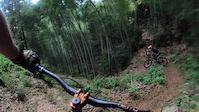
![MTB Freeride in Shexian (China, Anhui)]()

trail: JiaXingSeng trail 假行僧路线
5:59 |
672 |
Aug 1, 2013

trail: Italy
2:55 |
6 |
May 29, 2026

trail: JiaXingSeng trail 假行僧路线
2:05 |
18 |
Jun 8, 2024
trail: Xiaoguyun trail (a) 小谷运A路线
3:57 |
19 |
Oct 17, 2023

trail: Pingtanyuan trail 平坦源路线
4:33 |
26 |
Apr 8, 2023
trail: Xining Beishan Downhill
3:20 |
9 |
Dec 4, 2022
trail: Ho Poi DH
4:48 |
105 |
Jan 31, 2021
trail: 刺马
5:44 |
28 |
Nov 11, 2020
Recent Comments
| username | type | title | comment | date |
|---|---|---|---|---|
| trail | 20 ft road gap | Jun 17, 2026 @ 6:14pm Jun 17, 2026 | ||
| trail | Very technical | Jun 12, 2026 @ 3:58pm Jun 12, 2026 | ||
| report | Thanks, saved me a lot of time! | May 10, 2026 @ 5:34am May 10, 2026 | ||
| trail | This looks more like a route. | Sep 9, 2025 @ 1:06am Sep 9, 2025 | ||
| trail | it is quite nicely build | Sep 2, 2025 @ 8:21am Sep 2, 2025 |
Bike & Skill Parks
| name | type | city | rating |
|---|---|---|---|
| Songkeng 竦坑 | bike park | Huangshan | |
| Quan-Lin Daray Mountain Bike Park | bike park | ZhongShan | |
| Pinghu Ecological Garden MTB Skills Park | skill park | Shenzhen | |
| 冠阳单车公园Guanyang Pump Track | skill park | Tianjin | |
| Donghu BMX/Skate Skillpark | skill park | Shenzhen |
Activity Type Stats
| activitytype | trails | distance | descent | descent distance | total vertical | rating | global rank | state rank | photos | reports | routes | ridelogs |
|---|---|---|---|---|---|---|---|---|---|---|---|---|
| Mountain Bike | 213 | 581 miles | 149,806 ft | 287 miles | 14,767 ft | #48 | 534 | 681 | 15 | 34,240 | ||
| E-Bike | 107 | 364 miles | 63,734 ft | 161 miles | 13,225 ft | #50 | 619 | 9 | 978 | |||
| Horse | 32 | 393 miles | 78,743 ft | 172 miles | 11,135 ft | #30 | 36 | 2 | 1 | |||
| Hike | 209 | 561 miles | 138,110 ft | 272 miles | 14,767 ft | #46 | 33 | 654 | 10 | 4,944 | ||
| Trail Running | 173 | 528 miles | 123,520 ft | 253 miles | 14,767 ft | #46 | 652 | 10 | 661 | |||
| Dirtbike/Moto | 36 | 251 miles | 30,879 ft | 99 miles | 11,414 ft | #28 | 36 | 3 | ||||
| Observed Trials | 5 | 17 miles | 456 ft | 2 miles | 3,799 ft | #40 | 3 | |||||
| ATV/ORV/OHV | 7 | 198 miles | 15,725 ft | 68 miles | 7,887 ft | #27 | 36 | 6 | ||||
| Snowshoe | 6 | 13 miles | 3,205 ft | 8 miles | 2,779 ft | #35 | 3 | |||||
| Downhill Ski | 5 | 13 miles | 3,205 ft | 8 miles | 2,779 ft | #34 | 136 | |||||
| Backcountry Ski | 5 | 13 miles | 3,205 ft | 8 miles | 2,779 ft | #36 | 20 | |||||
| Nordic Ski | 5 | 13 miles | 3,205 ft | 8 miles | 2,779 ft | #34 | 124 |
Activities
- China Mountain Biking Trails
- China E-Biking Trails
- China Horseback Trails
- China Hiking Trails
- China Trail Running Trails
- China Dirtbiking Trails
- China Observed Trials Trails
- China ATVing/Offroading Trails
- China Snowshoeing Trails
- China Skiing Trails
- China Backcountry Skiing Trails
- China Nordic Skiing Trails
Trails
Points of Interest
- Jump TTF
- White Rock Mountain Viewpoint
- Apple barn Viewpoint
- Lunch possible at farmers place Lodge
- Shangyangjian 上阳尖 (1350m) Summit
- Camping spot
- Guest house (possible to dinner & sleep) Lodge
- Lunch possible at farmers place Lodge
- Lunch possible at farmers place Lodge
- Lunch possible at farmers place Lodge
- Xueling 雪岭 (13,924 ft)
- Beimufang (13,743 ft)
- 轿顶 (13,645 ft)
- By canadaka
 Trailforks & contributors
 - Admins: grippygravel
- #3231 - 34,602 views
- china activity log | embed map of China mountain bike trails | china mountain biking points of interest
Downloading of trail gps tracks in kml & gpx formats is enabled for China.
You must login to download files.