close
-
Layers w
- Weather Layers
- Pro
- Pro
- Pro
- Pro
- Pro
- Pro
- More Layers
- Pro
- Pro
- Pro
- Pro
-
Upgrade to

3D
Trail Conditions
- Unknown
- Snow Groomed
- Snow Packed
- Snow Covered
- Snow Cover Partial
- Freeze/thaw Cycle
- Icy
- Prevalent Mud
- Wet
- Variable
- Ideal
- Dry
- Very Dry
Trail Flow (Ridden Direction)
Trailforks scans users ridelogs to determine the most popular direction each trail is ridden. A good flowing trail network will have most trails flowing in a single direction according to their intension.
The colour categories are based on what percentage of riders are riding a trail in its intended direction.
The colour categories are based on what percentage of riders are riding a trail in its intended direction.
- > 96%
- > 90%
- > 80%
- > 70%
- > 50%
- < 50%
- bi-directional trail
- no data
Trail Last Ridden
Trailforks scans ridelogs to determine the last time a trail was ridden.
- < 2 days
- < 1 week
- < 2 weeks
- < 1 month
- < 6 months
- > 6 months
Trail Ridden Direction
The intended direction a trail should be ridden.
- Downhill Only
- Downhill Primary
- Both Directions
- Uphill Primary
- Uphill Only
- One Direction
Contribute Details
Colors indicate trail is missing specified detail.
- Description
- Photos
- Description & Photos
- Videos
Trail Popularity ?
Trailforks scans ridelogs to determine which trails are ridden the most in the last 9 months.
Trails are compared with nearby trails in the same city region with a possible 25 colour shades.
Think of this as a heatmap, more rides = more kinetic energy = warmer colors.
- most popular
- popular
- less popular
- not popular
ATV/ORV/OHV Filter
Max Vehicle Width
inches
US Cell Coverage
Legend

Radar Time
Activity Recordings
Trailforks uses anonymized public activity data.
?
Activity Recordings
Trailforks uses anonymized public activity data.
?
Personal Heatmap
▶
Activity Types
all
/
none
▶
Options
2
Date range
month
–
Winter Trails
Warning
A routing network for winter maps does not exist. Selecting trails using the winter trails layer has been disabled.
Missing Trails
Most Popular
Least Popular
Trails are colored based on popularity. The more popular a trail is, the more red. Less popular trails trend towards green.
Jump Magnitude Heatmap
Heatmap of where riders jump on trails. Zoom in to see individual jumps, click circles to view jump details.
BC Backroad Status
![map legend]()
Service Road Atlas is a free to use, community-driven service for viewing and creating reports on the numerous back-country service roads around B.C. and Alberta.

Slope Aspect
Direction the slope faces
Trails Deemphasized
Trails are shown in grey.
Only show trails with no bike usage.
Suggested Layers
Based on selected activity type
Save the current map location and zoom level as your default home location whenever this page is loaded.
Save
No description for Aachen has been added yet!
Login or register to submit one.
This region uses the Uk/Euro style trail grading system.
Activities Click to view
- Mountain Bike
63 trails
- E-Bike
63 trails
- Adaptive Bike
0 trails
- Winter Fat Bike
0 trails
- Hike
45 trails
- Trail Running
45 trails
Region Details
- 1
- 20
- 29
- 9
- 1
Region Status
Open as of Jun 6, 2026Stats
- Avg Trail Rating
- Trails (view details)
- 60
- Trails Mountain Bike
- 63
- Trails E-Bike
- 63
- Trails Hike
- 45
- Trails Trail Running
- 45
- Total Distance
- 22 miles
- Total Descent
- 6,678 ft
- Total Vertical
- 780 ft
- Highest Trailhead
- 1,246 ft
- Reports
- 545
- Photos
- 120
- Ridden Counter
- 10,232
Articles

From The Top: Bike-Components.de CEO Philipp Simon on the Future of MTB Retail
Aug 24, 2020 from pinkbike.com
And why the "COVID bike boom" is a huge challenge.
Sub Regions
-
Aachener Wald
- 1
- 12
- 1
-
Bikepark Geländefahrrad Aachen e.V.
- 3
- 2
Popular Aachen Mountain Biking Trails
• 90 ★ 4.3 • 1,991 ft • 0 ft • 400 •
Trail along the Lütticher Straße. Be careful, horses might be on the trail
• 80 ★ 3.7 • 2,159 ft • 0 ft • 376 •
Three really fun segments with a lot curves. Last part has a lot of roots and two small jumps.
• 50 ★ 1.7 • 2,116 ft • 0 ft • 328 •
Very easy trail, but it gets a bit steep and rougher on the end. You can use this trail in both directions. Great to combine with the Römertrail to get back to Three Border Point.
• 85 ★ 4.0 • 1,781 ft • 0 ft • 317 •
Highly rated popular red difficulty singletrack. This mountain bike primary trail can be used downhill only with a 0 ft black diamond climb. It features drop and jump. Trail visibility is always easy to follow. On average it takes 5 minutes to complete this trail.
• 90 ★ 4.0 • 755 ft • 0 ft • 316 •
Steep trail with a lot of serpentines. Great to combine with the trail "Enduro 2.0/Flowtrail"
• 60 ★ 4.0 • 3,136 ft • 41 ft • 315 •
Moderately popular blue difficulty singletrack. This mountain bike primary trail can be used both directions. On average it takes 7 minutes to complete this trail.
• 95 ★ 4.8 • 876 ft • 0 ft • 303 •
A steep trail with a lot of loose fire stones and roots. Be careful when it's wet. Ride with respect to other people and to the nature.
Aachen Mountain Bike Routes
★ 5.0 • 9 miles • 1,578 ft • 6 • Point to Point •
Schöne Runde mit schönen Anstiegen und flowigen Trails, teils etwas Enduro Abfahrten, nichts für...
★ 5.0 • 23 miles • 3,114 ft • 21 • Loop •
Good technical parts, nice flow and some jumps :)
16 miles • 1,870 ft • 0 •
Mountainbike ritje in grensgebied 3 landenpunt.
• 16 miles • 2,188 ft • 0 •
• 13 miles • 1,796 ft • 17 •
Photos of Aachen Mountain Bike
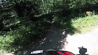
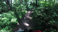
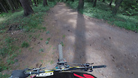
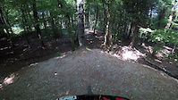
Videos of Aachen Mountain Bike
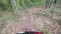
trail: Funkturm 3
0:38 |
98 |
May 6, 2023
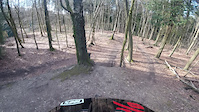
trail: Funkturm 2
0:54 |
89 |
Apr 9, 2023
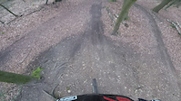
trail: Funkturm Trail
0:53 |
241 |
Apr 9, 2023
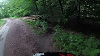
trail: Schlitzer
0:57 |
112 |
Jul 6, 2022
trail: Jazztrail
0:41 |
75 |
Jul 3, 2022
trail: Pelzerwurm Upper
0:26 |
194 |
Jul 3, 2022
trail: Kurventrail
0:00 |
147 |
May 18, 2022
trail: Funkturm Trail
0:04 |
174 |
May 18, 2022
Current Trail Warnings
| status | trail | date | condition | user | info |
|---|---|---|---|---|---|
| Schmidthofers | Jun 6, 2026 @ 2:51pm (Europe/Berlin) Jun 6, 2026 | Prevalent Mud | HyeGj0 |
Recent Trail Reports
| status | trail | date | condition | info | user |
|---|---|---|---|---|---|
| Little Whistler | May 1, 2026 @ 7:04pm (Europe/Brussels) May 1, 2026 | Ideal | AJshred | ||
| Bob Bahn | May 1, 2026 @ 7:04pm (Europe/Brussels) May 1, 2026 | Ideal | AJshred | ||
| Triple Fun | May 1, 2026 @ 7:04pm (Europe/Brussels) May 1, 2026 | Ideal | AJshred | ||
| Funkturm 2 | May 1, 2026 @ 7:04pm (Europe/Brussels) May 1, 2026 | Ideal | AJshred | ||
| Funkturm Trail | May 1, 2026 @ 7:04pm (Europe/Brussels) May 1, 2026 | Ideal | AJshred | ||
| Grilli | May 1, 2026 @ 7:04pm (Europe/Brussels) May 1, 2026 | Ideal | AJshred | ||
| Kurventrail | May 1, 2026 @ 7:04pm (Europe/Brussels) May 1, 2026 | Ideal | AJshred | ||
| Lower Bob-Bahn | May 1, 2026 @ 7:04pm (Europe/Brussels) May 1, 2026 | Ideal | AJshred | ||
| Enduro 2.0 | May 1, 2026 @ 7:04pm (Europe/Brussels) May 1, 2026 | Ideal | AJshred | ||
| Wurzeltrail Bahnlinie | Apr 3, 2026 @ 12:18pm (Europe/Brussels) Apr 3, 2026 | Ideal | RidewithRens |
Activity Feed
| username | action | type | title | date |
|---|---|---|---|---|
| HyeGj0 | add | report | activity #96360928 | Jun 6, 2026 @ 5:51am Jun 6, 2026 |
| HyeGj0 | comment | trail | activity #96360538 | Jun 6, 2026 @ 5:46am Jun 6, 2026 |
| HyeGj0 | ridden | trail | activity #96360506 | Jun 6, 2026 @ 5:45am Jun 6, 2026 |
| RedDevilNL | wishlist | route | activity #95767909 and 2 more | May 29, 2026 @ 4:47am May 29, 2026 |
| 3barJonas | wishlist | trail | activity #95719547 and 1 more | May 28, 2026 @ 10:58am May 28, 2026 |
Recent Comments
| username | type | title | comment | date |
|---|---|---|---|---|
| trail | Waldarbeiter haben den Weg komplett zerstört 😂 | Jun 6, 2026 @ 5:46am Jun 6, 2026 | ||
| report | Wrong report - trail is quite muddy | Oct 31, 2025 @ 4:15am Oct 31, 2025 | ||
| trail | Very fun ride. easy to acces and easy upride. | Apr 5, 2025 @ 2:11pm Apr 5, 2025 | ||
| trail | Very nice Trail. I rode it for the first time... | Apr 5, 2025 @ 1:59pm Apr 5, 2025 | ||
| report | *Trail head | Apr 4, 2025 @ 12:21am Apr 4, 2025 |
Local Badges
-

10 Blue Trails224 awarded -

Epic Ride Climb 2k98 awarded -

Climbing 10k Badge73 awarded -

Climbing 100k Badge10 awarded -

Epic Ride Descent 2k96 awarded -

Descent 10k Badge73 awarded
Bike & Skill Parks
| name | type | city | rating |
|---|---|---|---|
| Pumptrack Kijuze | skill park | Aachen |
Activity Type Stats
| activitytype | trails | distance | descent | descent distance | total vertical | rating | global rank | state rank | photos | reports | routes | ridelogs |
|---|---|---|---|---|---|---|---|---|---|---|---|---|
| Mountain Bike | 63 | 22 miles | 6,677 ft | 15 miles | 781 ft | #1,283 | #9 | 118 | 545 | 4 | 14,724 | |
| E-Bike | 63 | 22 miles | 6,677 ft | 15 miles | 781 ft | #1,322 | #30 | 483 | 1 | 1,883 | ||
| Hike | 45 | 16 miles | 4,518 ft | 11 miles | 781 ft | #3,208 | #24 | 2 | 517 | 184 | ||
| Trail Running | 45 | 16 miles | 4,518 ft | 11 miles | 781 ft | #2,688 | #23 | 517 | 202 |
Frequently Asked Questions About Aachen
▼
What are the best places to ride in Aachen?
Aachen has 2 areas to explore for mountain biking. The top rated areas are:
▼
What are the highest rated mountain biking trails in Aachen?
The highest rated mountain biking trails in Aachen are:
- Funkturm Trail (4.5/5)
- Lower Bob-Bahn (4.3/5)
- Schlitzer (4.2/5)
- Pelzerwurm Upper (4.2/5)
- Enduro 2.0 (4.2/5)
▼
What is the best time of the year to ride in Aachen?
Based on ride log data, the most popular months to ride in Aachen are:
- July (77 activities)
- September (72 activities)
- August (63 activities)
▼
Where can I park to ride in Aachen?
There are 1 parking locations listed in Aachen. The most popular parking spots are:
- By BastiEnduro & contributors
- Admins: apply
- #4713 - 21,955 views
- aachen activity log | embed map of Aachen mountain bike trails | aachen mountain biking points of interest
Downloading of trail gps tracks in kml & gpx formats is enabled for Aachen.
You must login to download files.