close
-
Layers w
- Weather Layers
- Pro
- Pro
- Pro
- Pro
- Pro
- Pro
- More Layers
- Pro
- Pro
- Pro
- Pro
-
Upgrade to

3D
Trail Conditions
- Unknown
- Snow Groomed
- Snow Packed
- Snow Covered
- Snow Cover Partial
- Freeze/thaw Cycle
- Icy
- Prevalent Mud
- Wet
- Variable
- Ideal
- Dry
- Very Dry
Trail Flow (Ridden Direction)
Trailforks scans users ridelogs to determine the most popular direction each trail is ridden. A good flowing trail network will have most trails flowing in a single direction according to their intension.
The colour categories are based on what percentage of riders are riding a trail in its intended direction.
The colour categories are based on what percentage of riders are riding a trail in its intended direction.
- > 96%
- > 90%
- > 80%
- > 70%
- > 50%
- < 50%
- bi-directional trail
- no data
Trail Last Ridden
Trailforks scans ridelogs to determine the last time a trail was ridden.
- < 2 days
- < 1 week
- < 2 weeks
- < 1 month
- < 6 months
- > 6 months
Trail Ridden Direction
The intended direction a trail should be ridden.
- Downhill Only
- Downhill Primary
- Both Directions
- Uphill Primary
- Uphill Only
- One Direction
Contribute Details
Colors indicate trail is missing specified detail.
- Description
- Photos
- Description & Photos
- Videos
Trail Popularity ?
Trailforks scans ridelogs to determine which trails are ridden the most in the last 9 months.
Trails are compared with nearby trails in the same city region with a possible 25 colour shades.
Think of this as a heatmap, more rides = more kinetic energy = warmer colors.
- most popular
- popular
- less popular
- not popular
ATV/ORV/OHV Filter
Max Vehicle Width
inches
US Cell Coverage
Legend

Radar Time
Activity Recordings
Trailforks uses anonymized public activity data.
?
Activity Recordings
Trailforks uses anonymized public activity data.
?
Personal Heatmap
▶
Activity Types
all
/
none
▶
Options
2
Date range
month
–
Winter Trails
Warning
A routing network for winter maps does not exist. Selecting trails using the winter trails layer has been disabled.
Missing Trails
Most Popular
Least Popular
Trails are colored based on popularity. The more popular a trail is, the more red. Less popular trails trend towards green.
Jump Magnitude Heatmap
Heatmap of where riders jump on trails. Zoom in to see individual jumps, click circles to view jump details.
BC Backroad Status
![map legend]()
Service Road Atlas is a free to use, community-driven service for viewing and creating reports on the numerous back-country service roads around B.C. and Alberta.

Slope Aspect
Direction the slope faces
Trails Deemphasized
Trails are shown in grey.
Only show trails with no bike usage.
Suggested Layers
Based on selected activity type
Save the current map location and zoom level as your default home location whenever this page is loaded.
Save
No description for Aarhus has been added yet!
Login or register to submit one.
This region uses the Uk/Euro style trail grading system.
Activities Click to view
- Mountain Bike
58 trails
- E-Bike
41 trails
- Adaptive Bike
0 trails
- Winter Fat Bike
0 trails
- Hike
27 trails
- Trail Running
41 trails
Region Details
- 4
- 42
- 9
- 1
Region Status
Caution as of Mar 27, 2026Local Trail Association
Stats
- Avg Trail Rating
- Trails (view details)
- 56
- Trails Mountain Bike
- 58
- Trails E-Bike
- 41
- Trails Hike
- 27
- Trails Trail Running
- 41
- Total Distance
- 21 miles
- Total Descent
- 2,591 ft
- Total Vertical
- 278 ft
- Highest Trailhead
- 324 ft
- Reports
- 1,255
- Photos
- 71
- Ridden Counter
- 7,720
Sub Regions
-
Marselisborg
- 40
- 9
- 1
-
Skølhøjkilen
- 1
Popular Aarhus Mountain Biking Trails
• 65 ★ 3.0 • 1,545 ft • 23 ft • 254 •
Moderately popular blue difficulty singletrack. This mountain bike primary trail can be used one direction and has a moderate overall physical rating with a 23 ft blue climb. On average it takes 1 minutes to complete this trail.
• 100 ★ 3.0 • 476 ft • 33 ft • 207 •
Popular blue difficulty singletrack. This mountain bike primary trail can be used uphill primary with a 33 ft green climb. On average it takes minutes to complete this trail.
• 95 ★ 3.0 • 1 mile • 11 ft • 205 •
Singletracker is the longest downhill segment on the Marselisborg Trail. The section can be ridden by anybody, but only your fitness and courage set the limits of how fast you can go.
• 70 ★ 3.0 • 2,566 ft • 61 ft • 194 •
Popular blue difficulty singletrack. This mountain bike primary trail can be used one direction. On average it takes 2 minutes to complete this trail.
• 95 ★ 3.0 • 1,266 ft • 73 ft • 190 •
Combination challenge with two steep climbs, a switchback, and yet another strenuous climb
• 100 ★ 2.0 • 3,822 ft • 44 ft • 187 •
Vikingesporet connects the mid and southern parts of the trail. Beware, this trail is ridden in both directions (southbound on the way out, northbound on the way home).
• 95 ★ 3.0 • 1,427 ft • 10 ft • 180 •
Popular blue difficulty singletrack. This mountain bike primary trail can be used one direction and has a easy overall physical rating with a 10 ft green climb. It features berm, drop and jump. Trail visibility is always easy to follow. On average it takes 1 minutes to complete this trail.
• 80 ★ 3.0 • 1,890 ft • 23 ft • 179 •
Popular blue difficulty singletrack. This mountain bike primary trail can be used uphill only and has a easy overall physical rating with a 23 ft green climb. It features berm, drop and rock garden. Trail visibility is always easy to follow. On average it takes 2 minutes to complete this trail.
Aarhus Mountain Bike Routes
★ 4.7 • 15 miles • 1,408 ft • 19 • Out & Back •
This is the full Marselisborg route featuring all blue trails. The length of the Marselisborg Blue trail...
★ 4.0 • 16 miles • 1,715 ft • 34 •
This is the full Marselisborg route featuring all blue trails combined with all red segments ( , ,...
8 miles • 955 ft • 15 •
A shorter version of the blue Marselisborg route. This one cuts back right after the downhill trail.
★ 1.0 • 3 miles • 225 ft • 0 • Loop •
Intermediate MTB trail, ca 5km, western part of Aarhus.
• 20 miles • 2,305 ft • 45 •
• 10 miles • 1,061 ft • 21 •
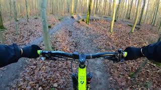
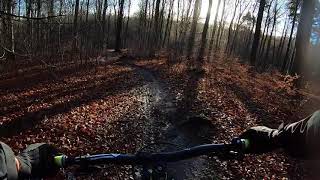
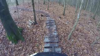
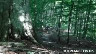
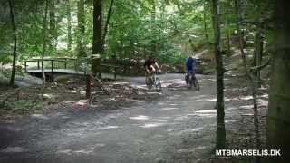
Photos of Aarhus Mountain Bike
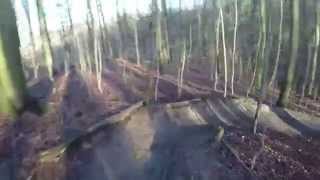
Videos of Aarhus Mountain Bike
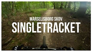
trail: Singletracket
3:42 |
214 |
Aug 9, 2023 , Aarhus
trail: Rævehulen
0:01 |
518 |
Jan 5, 2019 , Aarhus
trail: DM bakken
0:55 |
540 |
Jan 5, 2019 , Aarhus
trail: Ymers Mave
819 |
Dec 3, 2016 , Aarhus
trail: Måtten
711 |
Jan 14, 2016 , Aarhus
trail: Karussellen
845 |
Jan 10, 2016 , Aarhus
trail: Dobbeltbakken aka. Kamelen
789 |
Jan 10, 2016 , Aarhus
Recent Trail Reports
| status | trail | date | condition | info | user |
|---|---|---|---|---|---|
| Ymers Mave | Nov 17, 2024 @ 7:48am Nov 17, 2024 | Unknown | miksen ATBA | ||
| Willi's Corner | Nov 17, 2024 @ 7:48am Nov 17, 2024 | Unknown | miksen ATBA | ||
| Vikingesporet | Nov 17, 2024 @ 7:48am Nov 17, 2024 | Unknown | miksen ATBA | ||
| Trippelbakken | Nov 17, 2024 @ 7:48am Nov 17, 2024 | Unknown | miksen ATBA | ||
| Trappen | Nov 17, 2024 @ 7:48am Nov 17, 2024 | Unknown | miksen ATBA | ||
| Tilbage til vikingesporet | Nov 17, 2024 @ 7:48am Nov 17, 2024 | Unknown | miksen ATBA | ||
| The Last Jack Sparrow | Nov 17, 2024 @ 7:48am Nov 17, 2024 | Unknown | miksen ATBA | ||
| Talentsporet Rød | Nov 17, 2024 @ 7:48am Nov 17, 2024 | Unknown | miksen ATBA | ||
| Talentsporet Blå | Nov 17, 2024 @ 7:48am Nov 17, 2024 | Unknown | miksen ATBA | ||
| Strandvejen | Nov 17, 2024 @ 7:48am Nov 17, 2024 | Unknown | miksen ATBA |
Activity Feed
| username | action | type | title | date |
|---|---|---|---|---|
| DanielV | wishlist | trail | activity #96655746 | Jun 9, 2026 @ 11:35pm Jun 9, 2026 |
| PerChristoffersen | wishlist | region | activity #95826454 | May 30, 2026 @ 12:03am May 30, 2026 |
| LukahasxFX | wishlist | region | activity #95388744 | May 24, 2026 @ 2:49am May 24, 2026 |
| REN77 | ridden | route | activity #95087096 | May 19, 2026 @ 9:26pm May 19, 2026 |
| REN77 | wishlist | route | activity #94704925 | May 14, 2026 @ 12:06pm May 14, 2026 |
Local Badges
-

Epic Ride Climb 2k12 awarded -

Climbing 10k Badge31 awarded -

Climbing 100k Badge6 awarded -

Epic Ride Descent 2k12 awarded -

Descent 10k Badge31 awarded -

Descent 100k Badge6 awarded
Bike & Skill Parks
| name | type | city | rating |
|---|---|---|---|
| Aarhus MX | skill park | Aarhus | |
| Grimhøj MX | skill park | Aarhus | |
| Hornslet MX | skill park | Aarhus | |
| Vormstrup MX | skill park | Aarhus |
Activity Type Stats
| activitytype | trails | distance | descent | descent distance | total vertical | rating | global rank | state rank | photos | reports | routes | ridelogs |
|---|---|---|---|---|---|---|---|---|---|---|---|---|
| Mountain Bike | 58 | 21 miles | 2,592 ft | 8 miles | 279 ft | #1,100 | #2 | 71 | 1,255 | 4 | 11,912 | |
| E-Bike | 41 | 3,606 ft | 39 ft | 889 ft | 79 ft | #1,115 | #14 | 1,155 | 1,146 | |||
| Hike | 27 | 9 miles | 1,089 ft | 3 miles | 279 ft | #1,958 | #10 | 1,202 | 686 | |||
| Trail Running | 41 | 14 miles | 1,650 ft | 5 miles | 279 ft | #1,395 | #10 | 1,203 | 162 |
Frequently Asked Questions About Aarhus
▼
What are the best places to ride in Aarhus?
Aarhus has 2 areas to explore for mountain biking. The top rated areas are:
▼
What are the highest rated mountain biking trails in Aarhus?
The highest rated mountain biking trails in Aarhus are:
- The Last Jack Sparrow (4.1/5)
- Talentsporet Rød (4.1/5)
- Rød Ulv (4.1/5)
- Hinnerup MTB Spor (4.1/5)
- Ymers Mave (4/5)
▼
What is the best time of the year to ride in Aarhus?
Based on ride log data, the most popular months to ride in Aarhus are:
- September (59 activities)
- November (42 activities)
- August (41 activities)
▼
Where can I park to ride in Aarhus?
There are 3 parking locations listed in Aarhus. The most popular parking spots are: View all parking and trailhead locations on the map to plan your visit.
Activities
- By anders-valeur & contributors
- Admins: ATBA
- #7570 - 10,237 views
- aarhus activity log | embed map of Aarhus mountain bike trails | aarhus mountain biking points of interest
Downloading of trail gps tracks in kml & gpx formats is enabled for Aarhus.
You must login to download files.