close
-
Layers w
- Weather Layers
- Pro
- Pro
- Pro
- Pro
- Pro
- Pro
- More Layers
- Pro
- Pro
- Pro
- Pro
-
Upgrade to

3D
Trail Conditions
- Unknown
- Snow Groomed
- Snow Packed
- Snow Covered
- Snow Cover Partial
- Freeze/thaw Cycle
- Icy
- Prevalent Mud
- Wet
- Variable
- Ideal
- Dry
- Very Dry
Trail Flow (Ridden Direction)
Trailforks scans users ridelogs to determine the most popular direction each trail is ridden. A good flowing trail network will have most trails flowing in a single direction according to their intension.
The colour categories are based on what percentage of riders are riding a trail in its intended direction.
The colour categories are based on what percentage of riders are riding a trail in its intended direction.
- > 96%
- > 90%
- > 80%
- > 70%
- > 50%
- < 50%
- bi-directional trail
- no data
Trail Last Ridden
Trailforks scans ridelogs to determine the last time a trail was ridden.
- < 2 days
- < 1 week
- < 2 weeks
- < 1 month
- < 6 months
- > 6 months
Trail Ridden Direction
The intended direction a trail should be ridden.
- Downhill Only
- Downhill Primary
- Both Directions
- Uphill Primary
- Uphill Only
- One Direction
Contribute Details
Colors indicate trail is missing specified detail.
- Description
- Photos
- Description & Photos
- Videos
Trail Popularity ?
Trailforks scans ridelogs to determine which trails are ridden the most in the last 9 months.
Trails are compared with nearby trails in the same city region with a possible 25 colour shades.
Think of this as a heatmap, more rides = more kinetic energy = warmer colors.
- most popular
- popular
- less popular
- not popular
ATV/ORV/OHV Filter
Max Vehicle Width
inches
US Cell Coverage
Legend

Radar Time
Activity Recordings
Trailforks uses anonymized public activity data.
?
Activity Recordings
Trailforks uses anonymized public activity data.
?
Personal Heatmap
▶
Activity Types
all
/
none
▶
Options
2
Date range
month
–
Winter Trails
Warning
A routing network for winter maps does not exist. Selecting trails using the winter trails layer has been disabled.
Missing Trails
Most Popular
Least Popular
Trails are colored based on popularity. The more popular a trail is, the more red. Less popular trails trend towards green.
Jump Magnitude Heatmap
Heatmap of where riders jump on trails. Zoom in to see individual jumps, click circles to view jump details.
BC Backroad Status
![map legend]()
Service Road Atlas is a free to use, community-driven service for viewing and creating reports on the numerous back-country service roads around B.C. and Alberta.

Slope Aspect
Direction the slope faces
Trails Deemphasized
Trails are shown in grey.
Only show trails with no bike usage.
Suggested Layers
Based on selected activity type
Save the current map location and zoom level as your default home location whenever this page is loaded.
Save
No description for Abergavenny has been added yet!
Login or register to submit one.
This region uses the Uk/Euro style trail grading system.
Activities Click to view
- Mountain Bike
15 trails
- E-Bike
13 trails
- Hike
5 trails
- Trail Running
5 trails
Region Details
- 1
- 1
- 5
- 2
- 2
- 1
Region Status
Open as of Aug 4, 2024Stats
- Avg Trail Rating
- Trails (view details)
- 15
- Trails Mountain Bike
- 15
- Trails E-Bike
- 13
- Trails Hike
- 5
- Trails Trail Running
- 5
- Total Distance
- 8 miles
- Total Descent
- 3,733 ft
- Total Vertical
- 1,828 ft
- Highest Trailhead
- 2,264 ft
- Reports
- 42
- Photos
- 43
- Ridden Counter
- 5,810
Articles

Video: Tyler McCaul, Joey Foresta, Tom Isted, & Joey Gough on the New GT Force 29 in ‘Speed Metal’
Aug 2, 2019 from pinkbike.com
Tyler McCaul, Joey Foresta, Tom Isted and Joey Gough unleash the new Force 29 on their home turf.
Sub Regions
-
Dirt Farm (BMCC)
- 1
- 5
- 2
- 2
- 1
Popular Abergavenny Mountain Biking Trails
• 95 ★ 4.7 • 2,769 ft • 3 ft • 655 •
Popular blue difficulty machine groomed. This mountain bike primary trail can be used downhill only and has a moderate overall physical rating. It features berm and jump. On average it takes 2 minutes to complete this trail.
• 80 ★ 4.7 • 1,283 ft • 0 ft • 610 •
is our biggest jump line. It begins with a step down double over a berm leading into another step down followed by two forty foot tables. The trail then narrows into a step down and step ending with two big jumps.
• 65 ★ 4.0 • 1,227 ft • 21 ft • 602 •
Moderately popular red difficulty machine groomed. This mountain bike primary trail can be used downhill only and has a hard overall physical rating. It features berm, jump and rock garden. On average it takes 2 minutes to complete this trail.
• 55 ★ 4.0 • 2,048 ft • 12 ft • 574 •
Moderately popular blue difficulty machine groomed. This mountain bike primary trail can be used downhill only and has a moderate overall physical rating. It features berm and jump. On average it takes 1 minutes to complete this trail.
• 85 ★ 4.4 • 2,356 ft • 0 ft • 556 •
is a dirt rollercoaster which can be used as a warm up trail packed full of fun, twisty, pumps and jumps. It is designed as an intermediate trail but if ridden fast enough it opens up for all abilities.
• 70 ★ 4.4 • 725 ft • 0 ft • 448 •
Brown Pow is an advanced trail which has more of a natural feel to it. This trail is fast and flowing with lots of roots and rocks. It features three steep back to back berms which leads down to the 'Bridge'.
• 40 ★ 3.0 • 331 ft • 0 ft • 334 •
Moderately popular red difficulty mixed. This mountain bike primary trail can be used downhill only and has a moderate overall physical rating. It features berm, jump and rock garden. On average it takes minutes to complete this trail.
• 50 ★ 4.4 • 1,060 ft • 3 ft • 314 •
Moderately popular black difficulty singletrack. This mountain bike primary trail can be used downhill only and has a moderate overall physical rating with a 3 ft green climb. It features berm, bridge, drop, jump and gap jump. Trail visibility is always easy to follow. On average it takes 3 minutes to complete this trail.
Abergavenny Mountain Bike Routes
★ 3.7 • 23 miles • 3,071 ft • 0 • Loop •
Take some sandwhiches, as you'll be out for quite a while! Pretty remote and exposed at times
★ 4.0 • 13 miles • 1,365 ft • 0 • Loop •
Ridge line ride with some quite tricky rock drops/gaps, or just walk over them. Don't fall off the ridge!...
28 miles • 4,194 ft • 0 • Loop •
From Talgarth, the route follows country lanes to the lower slopes of the Black Mountains before a...
19 miles • 2,965 ft • 0 • Loop •
The route ascends from Talgarth on tarmac before joining the ‘Three Rivers Ride’ bridleway towards...
• 17 miles • 4,285 ft • 56 •
Photos of Abergavenny Mountain Bike
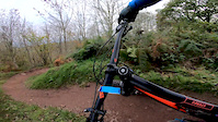
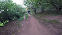
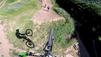
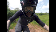
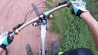
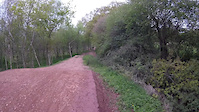
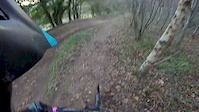
Videos of Abergavenny Mountain Bike
trail: Full Moto
0:00 |
133 |
Oct 15, 2019
trail: Full Moto
0:17 |
319 |
Oct 7, 2017
trail: Full Moto
0:54 |
296 |
Oct 7, 2017
trail: Full Moto
2:50 |
51 |
May 24, 2017
trail: Full Moto
0:09 |
129 |
May 14, 2017
trail: Full Moto
0:04 |
65 |
Apr 29, 2017
trail: Full Moto
0:34 |
57 |
Dec 4, 2016

trail: Outback
2:19 |
37 |
Sep 19, 2016
Recent Trail Reports
| status | trail | date | condition | info | user |
|---|---|---|---|---|---|
| Brown Pow | Aug 4, 2024 @ 2:50am Aug 4, 2024 | Very Dry | Vimto-North | ||
| Rabbit Run (Lower) | Aug 4, 2024 @ 2:50am Aug 4, 2024 | Very Dry | Vimto-North | ||
| Full Moto | Aug 4, 2024 @ 2:50am Aug 4, 2024 | Very Dry | Vimto-North | ||
| Well Oiled Weasel | Aug 4, 2024 @ 2:50am Aug 4, 2024 | Very Dry | Vimto-North | ||
| Rabbit Run (Upper) | Aug 4, 2024 @ 2:50am Aug 4, 2024 | Very Dry | Vimto-North | ||
| Uplift Road | Aug 4, 2024 @ 2:50am Aug 4, 2024 | Very Dry | Vimto-North | ||
| Tidy Darts/G-Force | Jun 12, 2023 @ 4:19am Jun 12, 2023 | Very Dry | goulldy | ||
| Red Dragon | May 28, 2023 @ 4:39am May 28, 2023 | Dry | Paulmaxey73 |
Activity Feed
| username | action | type | title | date |
|---|---|---|---|---|
| ronson987 | wishlist | trail | activity #95544036 | May 25, 2026 @ 10:28pm May 25, 2026 |
| Robertocottino | wishlist | route | activity #94695935 | May 14, 2026 @ 9:36am May 14, 2026 |
| pgn666 | wishlist | trail | activity #87626157 | Jan 22, 2026 @ 7:44am Jan 22, 2026 |
| StefanioKg2kBM | ridden | route | activity #87591019 | Jan 21, 2026 @ 1:00pm Jan 21, 2026 |
| 2IuMe | ridden | trail | activity #87254599 | Jan 15, 2026 @ 3:29pm Jan 15, 2026 |
Recent Comments
| username | type | title | comment | date |
|---|---|---|---|---|
| trail | The UK's best jump line | Jun 12, 2023 @ 4:19am Jun 12, 2023 | ||
| trail | It is basically a footpath through the woods.... | Jan 7, 2021 @ 4:50am Jan 7, 2021 | ||
| trail | Has anyone got any info on this trail please?... | Dec 28, 2020 @ 12:04am Dec 28, 2020 |
Local Badges
-

Epic Mountain Bike Climb 2k104 awarded -

Climbing 10k Badge18 awarded -

Mountain Biking 100k Badge0 awarded -

Epic Ride Descent 2k104 awarded -

Descent 10k Badge22 awarded -

Descent 100k Badge0 awarded
Bike & Skill Parks
| name | type | city | rating |
|---|---|---|---|
| Dirt Farm (BMCC) | bike park | Abergavenny |
Activity Type Stats
| activitytype | trails | distance | descent | descent distance | total vertical | rating | global rank | state rank | photos | reports | routes | ridelogs |
|---|---|---|---|---|---|---|---|---|---|---|---|---|
| Mountain Bike | 15 | 8 miles | 3,734 ft | 6 miles | 1,827 ft | #2,866 | #92 | 43 | 42 | 5 | 4,117 | |
| E-Bike | 13 | 7 miles | 2,648 ft | 5 miles | 1,827 ft | #3,813 | #142 | 40 | 464 | |||
| Hike | 5 | 5 miles | 1,926 ft | 3 miles | 1,680 ft | #7,692 | #222 | 42 | 592 | |||
| Trail Running | 5 | 5 miles | 1,926 ft | 3 miles | 1,680 ft | #7,265 | #212 | 40 | 37 |
Frequently Asked Questions About Abergavenny
▼
What are the best places to ride in Abergavenny?
Abergavenny has 1 areas to explore for mountain biking. The top rated areas are:
▼
What are the highest rated mountain biking trails in Abergavenny?
The highest rated mountain biking trails in Abergavenny are:
- Rabbit Run (Lower) (4.2/5)
- Full Moto (4.2/5)
- Rabbit Run (Upper) (4.1/5)
- Brown Pow (4.1/5)
- Tidy Darts/G-Force (4.1/5)
▼
What is the best time of the year to ride in Abergavenny?
Based on ride log data, the most popular months to ride in Abergavenny are:
- July (14 activities)
- September (10 activities)
- May (8 activities)
▼
Where can I park to ride in Abergavenny?
Check the Abergavenny trail map for trailhead and parking information. Community members regularly update access and parking details for trails in the area.
Activities
Trails
Points of Interest
- By brenthillier
 NSMBA TRAILFORKS & contributors
 - Admins: apply
- #10337 - 7,642 views
- abergavenny activity log | embed map of Abergavenny mountain bike trails | abergavenny mountain biking points of interest
Downloading of trail gps tracks in kml & gpx formats is enabled for Abergavenny.
You must login to download files.