close
-
Layers w
- Weather Layers
- Pro
- Pro
- Pro
- Pro
- Pro
- Pro
- More Layers
- Pro
- Pro
- Pro
- Pro
-
Upgrade to

3D
Trail Conditions
- Unknown
- Snow Groomed
- Snow Packed
- Snow Covered
- Snow Cover Partial
- Freeze/thaw Cycle
- Icy
- Prevalent Mud
- Wet
- Variable
- Ideal
- Dry
- Very Dry
Trail Flow (Ridden Direction)
Trailforks scans users ridelogs to determine the most popular direction each trail is ridden. A good flowing trail network will have most trails flowing in a single direction according to their intension.
The colour categories are based on what percentage of riders are riding a trail in its intended direction.
The colour categories are based on what percentage of riders are riding a trail in its intended direction.
- > 96%
- > 90%
- > 80%
- > 70%
- > 50%
- < 50%
- bi-directional trail
- no data
Trail Last Ridden
Trailforks scans ridelogs to determine the last time a trail was ridden.
- < 2 days
- < 1 week
- < 2 weeks
- < 1 month
- < 6 months
- > 6 months
Trail Ridden Direction
The intended direction a trail should be ridden.
- Downhill Only
- Downhill Primary
- Both Directions
- Uphill Primary
- Uphill Only
- One Direction
Contribute Details
Colors indicate trail is missing specified detail.
- Description
- Photos
- Description & Photos
- Videos
Trail Popularity ?
Trailforks scans ridelogs to determine which trails are ridden the most in the last 9 months.
Trails are compared with nearby trails in the same city region with a possible 25 colour shades.
Think of this as a heatmap, more rides = more kinetic energy = warmer colors.
- most popular
- popular
- less popular
- not popular
ATV/ORV/OHV Filter
Max Vehicle Width
inches
US Cell Coverage
Legend

Radar Time
Activity Recordings
Trailforks uses anonymized public activity data.
?
Activity Recordings
Trailforks uses anonymized public activity data.
?
Personal Heatmap
▶
Activity Types
all
/
none
▶
Options
2
Date range
month
–
Winter Trails
Warning
A routing network for winter maps does not exist. Selecting trails using the winter trails layer has been disabled.
Missing Trails
Most Popular
Least Popular
Trails are colored based on popularity. The more popular a trail is, the more red. Less popular trails trend towards green.
Jump Magnitude Heatmap
Heatmap of where riders jump on trails. Zoom in to see individual jumps, click circles to view jump details.
BC Backroad Status
![map legend]()
Service Road Atlas is a free to use, community-driven service for viewing and creating reports on the numerous back-country service roads around B.C. and Alberta.

Slope Aspect
Direction the slope faces
Trails Deemphasized
Trails are shown in grey.
Only show trails with no bike usage.
Suggested Layers
Based on selected activity type
Save the current map location and zoom level as your default home location whenever this page is loaded.
Save
No description for Aberystwyth has been added yet!
Login or register to submit one.
This region uses the Uk/Euro style trail grading system.
Activities Click to view
- Mountain Bike
46 trails
- E-Bike
24 trails
- Gravel Bike
0 trails
- Adaptive Bike
0 trails
- Winter Fat Bike
0 trails
- Hike
28 trails
- Trail Running
28 trails
Region Details
- 16
- 1
- 3
- 13
- 4
Region Status
Open as of Jun 12, 2026Stats
- Avg Trail Rating
- Trails (view details)
- 38
- Trails Mountain Bike
- 47
- Trails E-Bike
- 24
- Trails Horse
- 3
- Trails Hike
- 28
- Trails Trail Running
- 28
- Trails Dirtbike/Moto
- 1
- Trails ATV/ORV/OHV
- 1
- Total Distance
- 29 miles
- Total Descent
- 5,932 ft
- Total Vertical
- 1,076 ft
- Highest Trailhead
- 1,530 ft
- Reports
- 397
- Photos
- 56
- Ridden Counter
- 9,961
Sub Regions
-
Bwlch Nant Yr Arian
- 1
-
Bwlch Nant yr Arian
- 2
- 9
- 2
-
Myherin
- 1
Popular Aberystwyth Mountain Biking Trails
• 100 ★ 4.4 • 3,517 ft • 22 ft • 668 •
Highly rated popular red difficulty singletrack. This mountain bike primary trail can be used downhill only. It features berm, drop and jump. Trail visibility is always easy to follow. On average it takes 3 minutes to complete this trail.
• 95 ★ 4.0 • 791 ft • 33 ft • 629 •
Short section of singletrack with a stone surface, slightly uphill.
• 95 ★ 4.0 • 984 ft • 18 ft • 624 •
Popular red difficulty singletrack. This mountain bike primary trail can be used downhill only. On average it takes minutes to complete this trail.
• 90 ★ 4.3 • 1,522 ft • 5 ft • 619 •
Highly rated popular red difficulty singletrack. This mountain bike primary trail can be used downhill only. It features berm and drop. Trail visibility is always easy to follow. On average it takes 2 minutes to complete this trail.
• 95 ★ 4.4 • 1,352 ft • 6 ft • 615 •
Popular red difficulty singletrack. This mountain bike primary trail can be used downhill only. On average it takes 1 minutes to complete this trail.
• 85 ★ 4.7 • 4,566 ft • 119 ft • 609 •
Highly rated popular red difficulty singletrack. This mountain bike primary trail can be used downhill only. It features berm, bridge, drop and jump. Trail visibility is always easy to follow. On average it takes 7 minutes to complete this trail.
• 90 ★ 4.0 • 1,922 ft • 8 ft • 568 •
Highly rated popular red difficulty singletrack. This mountain bike primary trail can be used downhill only. It features berm, drop and jump. Trail visibility is always easy to follow. On average it takes 2 minutes to complete this trail.
• 100 ★ 4.7 • 3,123 ft • 11 ft • 520 •
The Melindwr trail is in two loops. The first loop is under 2km with one forest road climb, a fine view with a bench and one super fun flowy descent with lots of berms back to the visitor centre. Riding both loops is 5km. This takes you...
Aberystwyth Mountain Bike Routes
★ 5.0 • 6 miles • 951 ft • 16 • Loop •
“Got there late or want a final quick blast before you go home? Pendam is the definitive “Now That’s...
★ 4.5 • 11 miles • 1,590 ft • 20 • Loop •
This is the red-graded summit trail at Nant yr Arian.
17 miles • 2,037 ft • 22 • Out & Back •
Great route which combines the best of the backcountry riding on offer at Bwlch Nant yr Arian with the...
22 miles • 2,719 ft • 27 • Out & Back •
The complete 35km Syfydrin trail which combines excellent techincal singletrack and lung-busting climbs...
• 16 miles • 3,718 ft • 16 •
• 15 miles • 3,117 ft • 9 •
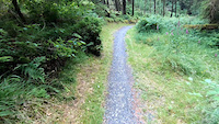
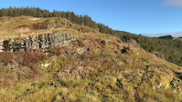
Photos of Aberystwyth Mountain Bike
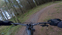
Videos of Aberystwyth Mountain Bike
trail: Drunken Druid
0:31 |
3 |
Jul 8, 2023
trail: Cliffy McCliff Face
0:19 |
93 |
Jun 21, 2022
trail: Mark of Zorro
6:46 |
280 |
Nov 23, 2019

trail: Summit Trail
7:48 |
53 |
Jan 3, 2016

trail: Mark of Zorro
9:38 |
47 |
Jan 3, 2016

trail: Summit Trail
4:53 |
32 |
Dec 31, 2015

trail: Hippity Hop
0:30 |
133 |
Dec 30, 2015

trail: The Italian Job
4:48 |
100 |
Dec 30, 2015
Current Trail Warnings
| status | trail | date | condition | user | info |
|---|---|---|---|---|---|
| Mark of Zorro | Jun 12, 2026 @ 5:11pm (Europe/London) Jun 12, 2026 | Ideal | PercyPongo | Top third of Mark Of Zorro is unpassable... | |
| Stumpy DH To Farm | May 27, 2026 @ 2:28pm (Europe/London) May 27, 2026 | Unknown | fez-uk |
Recent Trail Reports
| status | trail | date | condition | info | user |
|---|---|---|---|---|---|
| Melindwr Loop 2 | May 2, 2026 @ 9:45pm (Europe/London) May 2, 2026 | Unknown | Tony223Hre | ||
| To The Mark of Zorro | Apr 20, 2026 @ 6:42pm (Europe/London) Apr 20, 2026 | Variable | NoahAdsaVH | ||
| Hippity Hop | Apr 20, 2026 @ 4:27pm (Europe/London) Apr 20, 2026 | Variable | NoahAdsaVH | ||
| Digger's End | Apr 20, 2026 @ 4:27pm (Europe/London) Apr 20, 2026 | Variable | NoahAdsaVH | ||
| The Spine | Apr 20, 2026 @ 4:27pm (Europe/London) Apr 20, 2026 | Dry | NoahAdsaVH | ||
| Melindwr Loop | Apr 10, 2026 @ 2:11pm (Europe/London) Apr 10, 2026 | Wet | sjm13 | ||
| Drunken Druid | Apr 10, 2026 @ 2:09pm (Europe/London) Apr 10, 2026 | Wet | sjm13 | ||
| The Italian Job | Apr 10, 2026 @ 2:09pm (Europe/London) Apr 10, 2026 | Wet | sjm13 | ||
| The Reaper | Aug 1, 2025 @ 4:51am Aug 1, 2025 | Variable | petecog | ||
| High As A Kite | Jul 10, 2025 @ 10:37am Jul 10, 2025 | Very Dry | Pushingpedals |
Activity Feed
| username | action | type | title | date |
|---|---|---|---|---|
| PercyPongo | add | report | activity #96809427 | Jun 12, 2026 @ 9:17am Jun 12, 2026 |
| fez-uk | add | report | activity #95629865 | May 27, 2026 @ 6:28am May 27, 2026 |
| yeoman89 | wishlist | route | activity #94050934 and 1 more | May 4, 2026 @ 3:03pm May 4, 2026 |
| Tony223Hre | add | report | activity #93891643 | May 2, 2026 @ 1:45pm May 2, 2026 |
| Tony223Hre | wishlist | route | activity #93526798 | Apr 27, 2026 @ 10:31am Apr 27, 2026 |
Recent Comments
| username | type | title | comment | date |
|---|---|---|---|---|
| trail | A bit terrifying in places. Good challenging... | Aug 1, 2025 @ 4:48am Aug 1, 2025 | ||
| trail | Trail closed, trees have been felled across... | Jun 16, 2025 @ 12:19am Jun 16, 2025 | ||
| trail | This "progressive" trail has the biggest... | Jul 31, 2024 @ 1:57pm Jul 31, 2024 | ||
| trail | Fun bit of trail but not worth the 6 or 7... | Jul 31, 2024 @ 1:45pm Jul 31, 2024 | ||
| report | Think its open now. Barriers removed. Some... | May 23, 2024 @ 3:17pm May 23, 2024 |
Local Badges
-

Epic Ride Climb 2k35 awarded -

Climbing 10k Badge30 awarded -

Climbing 100k Badge1 awarded -

Epic Ride Descent 2k35 awarded -

Descent 10k Badge30 awarded -

Descent 100k Badge2 awarded
Activity Type Stats
| activitytype | trails | distance | descent | descent distance | total vertical | rating | global rank | state rank | photos | reports | routes | ridelogs |
|---|---|---|---|---|---|---|---|---|---|---|---|---|
| Mountain Bike | 46 | 29 miles | 5,932 ft | 15 miles | 1,076 ft | #2,397 | #78 | 56 | 397 | 4 | 4,826 | |
| E-Bike | 24 | 6 miles | 2,057 ft | 4 miles | 912 ft | #4,204 | #164 | 373 | 950 | |||
| Horse | 3 | 140 | ||||||||||
| Hike | 28 | 23 miles | 2,979 ft | 10 miles | 1,076 ft | #6,311 | #161 | 372 | 123 | |||
| Trail Running | 28 | 23 miles | 2,979 ft | 10 miles | 1,076 ft | #5,772 | #147 | 372 | 20 | |||
| Dirtbike/Moto | 1 | 140 | ||||||||||
| ATV/ORV/OHV | 1 | 140 |
Frequently Asked Questions About Aberystwyth
▼
What are the best places to ride in Aberystwyth?
Aberystwyth has 3 areas to explore for mountain biking. The top rated areas are:
▼
What are the highest rated mountain biking trails in Aberystwyth?
The highest rated mountain biking trails in Aberystwyth are:
- Mark of Zorro (4.5/5)
- The Italian Job (4.3/5)
- The Reaper (4.3/5)
- High As A Kite (4.3/5)
- Melindwr Loop 2 (4.2/5)
▼
What is the best time of the year to ride in Aberystwyth?
Based on ride log data, the most popular months to ride in Aberystwyth are:
- April (38 activities)
- May (28 activities)
- March (22 activities)
▼
Where can I park to ride in Aberystwyth?
There are 3 parking locations listed in Aberystwyth. The most popular parking spots are: View all parking and trailhead locations on the map to plan your visit.
Activities
Trails
- By jonathono & contributors
- Admins: apply
- #6232 - 6,461 views
- aberystwyth activity log | embed map of Aberystwyth mountain bike trails | aberystwyth mountain biking points of interest
Downloading of trail gps tracks in kml & gpx formats is enabled for Aberystwyth.
You must login to download files.