close
-
Layers w
- Weather Layers
- Pro
- Pro
- Pro
- Pro
- Pro
- Pro
- More Layers
- Pro
- Pro
- Pro
- Pro
-
Upgrade to

3D
Trail Conditions
- Unknown
- Snow Groomed
- Snow Packed
- Snow Covered
- Snow Cover Partial
- Freeze/thaw Cycle
- Icy
- Prevalent Mud
- Wet
- Variable
- Ideal
- Dry
- Very Dry
Trail Flow (Ridden Direction)
Trailforks scans users ridelogs to determine the most popular direction each trail is ridden. A good flowing trail network will have most trails flowing in a single direction according to their intension.
The colour categories are based on what percentage of riders are riding a trail in its intended direction.
The colour categories are based on what percentage of riders are riding a trail in its intended direction.
- > 96%
- > 90%
- > 80%
- > 70%
- > 50%
- < 50%
- bi-directional trail
- no data
Trail Last Ridden
Trailforks scans ridelogs to determine the last time a trail was ridden.
- < 2 days
- < 1 week
- < 2 weeks
- < 1 month
- < 6 months
- > 6 months
Trail Ridden Direction
The intended direction a trail should be ridden.
- Downhill Only
- Downhill Primary
- Both Directions
- Uphill Primary
- Uphill Only
- One Direction
Contribute Details
Colors indicate trail is missing specified detail.
- Description
- Photos
- Description & Photos
- Videos
Trail Popularity ?
Trailforks scans ridelogs to determine which trails are ridden the most in the last 9 months.
Trails are compared with nearby trails in the same city region with a possible 25 colour shades.
Think of this as a heatmap, more rides = more kinetic energy = warmer colors.
- most popular
- popular
- less popular
- not popular
ATV/ORV/OHV Filter
Max Vehicle Width
inches
US Cell Coverage
Legend

Radar Time
Activity Recordings
Trailforks uses anonymized public activity data.
?
Activity Recordings
Trailforks uses anonymized public activity data.
?
Personal Heatmap
▶
Activity Types
all
/
none
▶
Options
2
Date range
month
–
Winter Trails
Warning
A routing network for winter maps does not exist. Selecting trails using the winter trails layer has been disabled.
Missing Trails
Most Popular
Least Popular
Trails are colored based on popularity. The more popular a trail is, the more red. Less popular trails trend towards green.
Jump Magnitude Heatmap
Heatmap of where riders jump on trails. Zoom in to see individual jumps, click circles to view jump details.
BC Backroad Status
![map legend]()
Service Road Atlas is a free to use, community-driven service for viewing and creating reports on the numerous back-country service roads around B.C. and Alberta.

Slope Aspect
Direction the slope faces
Trails Deemphasized
Trails are shown in grey.
Only show trails with no bike usage.
Suggested Layers
Based on selected activity type
Save the current map location and zoom level as your default home location whenever this page is loaded.
SaveAbidar mountain is one of the most beatiful mountains in kurdestan of iran. there are many trails in this mountain.
Primary Trail Type: All-Mountain & Downhill
Shuttleable: YES
Land Status: National Park
Access Info:
sanandaj, kurdestan, iran
Activities Click to view
- Mountain Bike
8 trails
- Hike
8 trails
- Trail Running
8 trails
Region Details
- 4
- 3
- 1
Region Status
Open as of Jul 31, 2021Stats
- Trails (view details)
- 8
- Trails Mountain Bike
- 8
- Trails Hike
- 8
- Trails Trail Running
- 8
- Total Distance
- 8 miles
- Total Descent
- 5,146 ft
- Total Vertical
- 2,309 ft
- Highest Trailhead
- 7,650 ft
- Photos
- 13
- Ridden Counter
- 10
Popular Abidar Mountain Mountain Biking Trails
• 5 ★ 0.0 • 2 miles • 25 ft • 2 •
Less popular blue difficulty singletrack. This mountain bike primary trail can be used both directions and has a moderate overall physical rating with a 25 ft blue climb. It features jump, rock face and skinny.
• 5 ★ 0.0 • 1,775 ft • 231 ft • 2 •
Less popular green difficulty singletrack. This mountain bike primary trail can be used both directions and has a moderate overall physical rating with a 231 ft blue climb.
• 5 ★ 0.0 • 4,099 ft • 7 ft • 1 •
Less popular green difficulty singletrack. This mountain bike primary trail can be used downhill primary and has a moderate overall physical rating with a 7 ft black diamond climb. It features jump and skinny.
• 5 ★ 0.0 • 2,642 ft • 5 ft • 1 •
Less popular green difficulty singletrack. This mountain bike primary trail can be used downhill primary and has a moderate overall physical rating with a 5 ft blue climb. It features jump.
• 5 ★ 0.0 • 1 mile • 451 ft • 1 •
Less popular blue difficulty singletrack. This mountain bike primary trail can be used both directions and has a easy overall physical rating with a 451 ft green climb. It features skinny.
• 5 ★ 0.0 • 4,288 ft • 291 ft • 1 •
Less popular blue difficulty singletrack. This mountain bike primary trail can be used both directions and has a moderate overall physical rating with a 291 ft black diamond climb. It features rock face and skinny.
• 5 ★ 0.0 • 4,408 ft • 38 ft • 1 •
Less popular green difficulty singletrack. This mountain bike primary trail can be used downhill primary with a 38 ft blue climb. It features rock face and skinny.
• 5 ★ 0.0 • 1 mile • 19 ft • 1 •
Less popular double black diamond difficulty singletrack. This mountain bike primary trail can be used downhill only and has a hard overall physical rating with a 19 ft black diamond climb. It features jump, rock face and skinny.
Photos of Abidar Mountain Mountain Bike
Videos of Abidar Mountain Mountain Bike
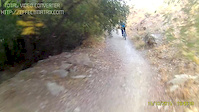
trail: Haft Asiaw
0:00 |
125 |
Oct 15, 2015
Activity Feed
| username | action | type | title | date |
|---|---|---|---|---|
| Ebimaky | ridden | trail | activity #22505819 | Aug 25, 2021 @ 11:17pm Aug 25, 2021 |
| alpha-line | wishlist | trail | activity #7851423 and 7 more | Jan 12, 2020 @ 8:43pm Jan 12, 2020 |
| markholloway | update | trail | activity #3501917 | Dec 20, 2018 @ 7:29pm Dec 20, 2018 |
| sasan-MTB | add | photo | activity #651593 and 2 more | Apr 19, 2017 @ 7:47am Apr 19, 2017 |
| Hitting | add | video | activity #146382 | Oct 15, 2015 @ 8:59am Oct 15, 2015 |
Activity Type Stats
| activitytype | trails | distance | descent | descent distance | total vertical | rating | global rank | state rank | photos | reports | routes | ridelogs |
|---|---|---|---|---|---|---|---|---|---|---|---|---|
| Mountain Bike | 8 | 8 miles | 5,144 ft | 6 miles | 2,310 ft | #10,259 | #4 | 13 | 9 | |||
| Hike | 8 | 8 miles | 5,144 ft | 6 miles | 2,310 ft | #1,986 | #4 | |||||
| Trail Running | 8 | 8 miles | 5,144 ft | 6 miles | 2,310 ft | #1,318 | #4 |
Frequently Asked Questions About Abidar Mountain
▼
What are the highest rated mountain biking trails in Abidar Mountain?
The highest rated mountain biking trails in Abidar Mountain are:
- Haft Asiaw (0/5)
- Chia (0/5)
- Cinema Trail (0/5)
- Ban Shlana - Kani Shafa (0/5)
- Fox Road (0/5)
▼
What is the best time of the year to ride in Abidar Mountain?
Based on ride log data, the most popular months to ride in Abidar Mountain are:
- January (1 activities)
- February (1 activities)
▼
Where can I park to ride in Abidar Mountain?
Check the Abidar Mountain trail map for trailhead and parking information. Community members regularly update access and parking details for trails in the area.
▼
What is the longest trail in Abidar Mountain?
The longest trail in Abidar Mountain is Haft Asiaw at 3.2 km. View all trails sorted by distance.
- By Hitting & contributors
- Admins: apply
- #10002 - 4,053 views
- abidar mountain activity log | embed map of Abidar Mountain mountain bike trails |
Downloading of trail gps tracks in kml & gpx formats is enabled for Abidar Mountain.
You must login to download files.