close
-
Layers w
- Weather Layers
- Pro
- Pro
- Pro
- Pro
- Pro
- Pro
- More Layers
- Pro
- Pro
- Pro
- Pro
-
Upgrade to

3D
Trail Conditions
- Unknown
- Snow Groomed
- Snow Packed
- Snow Covered
- Snow Cover Partial
- Freeze/thaw Cycle
- Icy
- Prevalent Mud
- Wet
- Variable
- Ideal
- Dry
- Very Dry
Trail Flow (Ridden Direction)
Trailforks scans users ridelogs to determine the most popular direction each trail is ridden. A good flowing trail network will have most trails flowing in a single direction according to their intension.
The colour categories are based on what percentage of riders are riding a trail in its intended direction.
The colour categories are based on what percentage of riders are riding a trail in its intended direction.
- > 96%
- > 90%
- > 80%
- > 70%
- > 50%
- < 50%
- bi-directional trail
- no data
Trail Last Ridden
Trailforks scans ridelogs to determine the last time a trail was ridden.
- < 2 days
- < 1 week
- < 2 weeks
- < 1 month
- < 6 months
- > 6 months
Trail Ridden Direction
The intended direction a trail should be ridden.
- Downhill Only
- Downhill Primary
- Both Directions
- Uphill Primary
- Uphill Only
- One Direction
Contribute Details
Colors indicate trail is missing specified detail.
- Description
- Photos
- Description & Photos
- Videos
Trail Popularity ?
Trailforks scans ridelogs to determine which trails are ridden the most in the last 9 months.
Trails are compared with nearby trails in the same city region with a possible 25 colour shades.
Think of this as a heatmap, more rides = more kinetic energy = warmer colors.
- most popular
- popular
- less popular
- not popular
ATV/ORV/OHV Filter
Max Vehicle Width
inches
US Cell Coverage
Legend

Radar Time
Activity Recordings
Trailforks uses anonymized public activity data.
?
Activity Recordings
Trailforks uses anonymized public activity data.
?
Personal Heatmap
▶
Activity Types
all
/
none
▶
Options
2
Date range
month
–
Winter Trails
Warning
A routing network for winter maps does not exist. Selecting trails using the winter trails layer has been disabled.
Missing Trails
Most Popular
Least Popular
Trails are colored based on popularity. The more popular a trail is, the more red. Less popular trails trend towards green.
Jump Magnitude Heatmap
Heatmap of where riders jump on trails. Zoom in to see individual jumps, click circles to view jump details.
BC Backroad Status
![map legend]()
Service Road Atlas is a free to use, community-driven service for viewing and creating reports on the numerous back-country service roads around B.C. and Alberta.

Slope Aspect
Direction the slope faces
Trails Deemphasized
Trails are shown in grey.
Only show trails with no bike usage.
Suggested Layers
Based on selected activity type
Save the current map location and zoom level as your default home location whenever this page is loaded.
SaveActivities Click to view
- Mountain Bike
202 trails
- E-Bike
202 trails
- Horse
27 trails
- Hike
205 trails
- Trail Running
205 trails
Region Details
- 129
- 14
- 38
- 18
- 3
Region Status
Open as of May 10, 2026Stats
- Avg Trail Rating
- Trails (view details)
- 204
- Trails Mountain Bike
- 202
- Trails E-Bike
- 202
- Trails Horse
- 27
- Trails Hike
- 205
- Trails Trail Running
- 205
- Total Distance
- 248 miles
- Total Descent Distance
- 161 miles
- Total Descent
- 77,257 ft
- Total Vertical
- 7,921 ft
- Highest Trailhead
- 7,922 ft
- Reports
- 619
- Photos
- 67
- Ridden Counter
- 2,923
Popular Abona Mountain Biking Trails
• 100 ★ 5.0 • 1 mile • 50 ft • 83 •
Popular red difficulty singletrack. This multi-use trail can be used downhill only. Trail visibility is always easy to follow. On average it takes 21 minutes to complete this trail.
• 100 ★ 5.0 • 3 miles • 0 ft • 76 •
Popular blue difficulty singletrack. This multi-use trail can be used downhill primary. Trail visibility is always easy to follow. On average it takes 41 minutes to complete this trail.
• 100 ★ 4.5 • 2 miles • 24 ft • 74 •
Popular red difficulty singletrack. This multi-use trail can be used downhill only. Trail visibility is always easy to follow. On average it takes 15 minutes to complete this trail.
• 100 ★ 5.0 • 2,930 ft • 0 ft • 54 •
Popular green difficulty singletrack. This multi-use trail can be used both directions. On average it takes 2 minutes to complete this trail.
• 95 ★ 5.0 • 2,349 ft • 9 ft • 49 •
Perfectly beginner friendly - if you simply go around the optional features. But for a rider with a little more experience, this might be between blue and almost red (skinny).
• 100 ★ 5.0 • 5,151 ft • 0 ft • 43 •
Top Barranco del Hermano Pedro to bottom of Barranco los Balos, with the option to use the tunnel to access the beach of El Médano. Some loose gravel, some polished volcanic rock in all colors you can imagine.
• 95 ★ 5.0 • 1 mile • 8 ft • 42 •
Nice trail that has a few wooden and a few stone-built features dotted along. Most of them are optional, so if you're adventurous, then even with a XC hard tail you can enjoy this one. Best combined with the Saltadero and trails, for a...
• 95 ★ 0.0 • 2,028 ft • 200 ft • 33 •
Popular blue difficulty singletrack. This multi-use trail can be used both directions. Trail visibility is always easy to follow. On average it takes 22 minutes to complete this trail.
Abona Mountain Bike Routes
17 miles • 1,539 ft • 1 • Loop •
Simple yet varied and entertaining cross-country loop near Urbanización El Guincho, but you could use the...
Oleoteide Arico MTB Featured
★ 5.0 • 14 miles • 1,685 ft • 14 • Loop • Race •
OLEOTEIDE ARICO MTB es una prueba deportiva en bicicleta de montaña cuyo recorrido transcurre por zonas...
Desafio Tenerife Teide 360 UCI Featured
81 miles • 12,032 ft • 9 • Loop • Race •
El Desafío TENERIFE TEIDE 360º es una Prueba Deportiva no competitiva de Gran Fondo y con categoría...
16 miles • 1,400 ft • 0 • Loop • Race •
La Amarilla Extrem Irichen es una prueba en bicicleta de montaña, con un recorrido por la zona de costa...
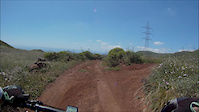
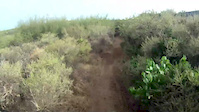
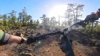
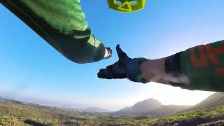
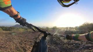
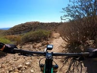
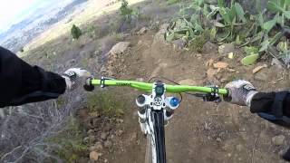
Photos of Abona Mountain Bike
Videos of Abona Mountain Bike
trail: Piconera
2:56 |
54 |
Apr 28, 2016
trail: Jama
10:56 |
145 |
Aug 12, 2013
trail: Chimoche
15:40 |
334 |
Feb 7, 2024 , Granadilla
trail: Imoque
5:14 |
192 |
Feb 7, 2024 , Granadilla
trail: Las Águilas
8:49 |
229 |
Feb 7, 2024 , Granadilla

trail: Jama
0:47 |
118 |
Apr 17, 2011
11:09 |
914 |
Jul 10, 2022
trail: Jama
11:42 |
438 |
Apr 23, 2022 , Granadilla
Recent Trail Reports
| status | trail | date | condition | info | user |
|---|---|---|---|---|---|
| Autopista - Derriscaderos | May 10, 2026 @ 11:23am (Atlantic/Canary) May 10, 2026 | Dry | FranNegrin | ||
| Barranco los Balos | May 10, 2026 @ 11:23am (Atlantic/Canary) May 10, 2026 | Dry | FranNegrin | ||
| Saltadero | May 10, 2026 @ 11:23am (Atlantic/Canary) May 10, 2026 | Dry | FranNegrin | ||
| Las Eritas | May 10, 2026 @ 11:23am (Atlantic/Canary) May 10, 2026 | Dry | FranNegrin | ||
| Saltadero | May 10, 2026 @ 11:23am (Atlantic/Canary) May 10, 2026 | Dry | FranNegrin | ||
| Las Rosas | Mar 16, 2026 @ 12:17pm (Atlantic/Canary) Mar 16, 2026 | Very Dry | FranNegrin | ||
| Arujo | Mar 1, 2026 @ 12:54pm (Atlantic/Canary) Mar 1, 2026 | Unknown | Paddy77 | ||
| Las Lajas | Mar 1, 2026 @ 12:48pm (Atlantic/Canary) Mar 1, 2026 | Unknown | Paddy77 | ||
| Cho Pancho | Mar 1, 2026 @ 12:46pm (Atlantic/Canary) Mar 1, 2026 | Unknown | Paddy77 | ||
| Los Cardones | Feb 25, 2026 @ 10:48am (Atlantic/Canary) Feb 25, 2026 | Dry | FranNegrin |
National Scenic Trails & Official Routes
-
GR-131 Tramo 3 - Camino Natural de Anaga - Chasna
- Mountain Bike
- E-Bike
- Hike
- Trail Running

Activity Feed
| username | action | type | title | date |
|---|---|---|---|---|
| FranNegrin | add | report | activity #94423341 and 4 more | May 10, 2026 @ 7:07am May 10, 2026 |
| MediKit | comment | trail | activity #94419399 | May 10, 2026 @ 6:08am May 10, 2026 |
| FranNegrin | add | report | activity #92409157 and 2 more | Apr 11, 2026 @ 10:46am Apr 11, 2026 |
| MiaSanMia | ridden | trail | activity #91066025 | Mar 22, 2026 @ 6:08am Mar 22, 2026 |
| FranNegrin | add | report | activity #90698857 and 3 more | Mar 16, 2026 @ 10:56am Mar 16, 2026 |
Recent Comments
| username | type | title | comment | date |
|---|---|---|---|---|
| trail | Nice trail, not steep. | May 10, 2026 @ 6:08am May 10, 2026 | ||
| trail | Can’t find the start of the trail. Maybe gone | Mar 1, 2026 @ 5:22am Mar 1, 2026 | ||
| trail | Very boring trail. Just millions of loose... | Mar 1, 2026 @ 5:21am Mar 1, 2026 | ||
| trail | Trail is closed | Mar 1, 2026 @ 5:20am Mar 1, 2026 | ||
| trail | Much closer to a red trail both up and down | Dec 26, 2025 @ 1:48pm Dec 26, 2025 |
Nearby Areas
| name | distance | ||||
|---|---|---|---|---|---|
| Parque Nacional del Teide | 4 | 10 km | |||
| Valle De La Orotava | 10 | 23 | 15.3 km | ||
| Valle de Güímar | 3 | 4 | 15.6 km | ||
| Valle de Icod | 6 | 16.4 km | |||
| Monte De La Esperanza | 28 | 89 | 21.4 km |
Local Badges
-

Completionist0 awarded
Activity Type Stats
| activitytype | trails | distance | descent | descent distance | total vertical | rating | global rank | state rank | photos | reports | routes | ridelogs |
|---|---|---|---|---|---|---|---|---|---|---|---|---|
| Mountain Bike | 202 | 247 miles | 77,238 ft | 160 miles | 7,920 ft | #452 | #26 | 59 | 619 | 4 | 3,406 | |
| E-Bike | 202 | 247 miles | 77,238 ft | 160 miles | 7,920 ft | #42 | #30 | 8 | 618 | 4 | 544 | |
| Horse | 27 | 40 miles | 6,788 ft | 20 miles | 6,365 ft | #807 | #49 | 9 | ||||
| Hike | 205 | 248 miles | 77,257 ft | 161 miles | 7,920 ft | #234 | #51 | 619 | 235 | |||
| Trail Running | 205 | 248 miles | 77,257 ft | 161 miles | 7,920 ft | #119 | #39 | 619 | 176 |
Frequently Asked Questions About Abona
▼
What are the highest rated mountain biking trails in Abona?
The highest rated mountain biking trails in Abona are:
- Barranco de Tajo (4.3/5)
- Los Cristianos - Montaña de Guaza (4.2/5)
- Cactus (4.2/5)
- Mohino (4.2/5)
- Hermano Pedro (4.2/5)
▼
What is the best time of the year to ride in Abona?
Based on ride log data, the most popular months to ride in Abona are:
- November (3 activities)
- February (2 activities)
- October (2 activities)
▼
Where can I park to ride in Abona?
Check the Abona trail map for trailhead and parking information. Community members regularly update access and parking details for trails in the area.
▼
What is the longest trail in Abona?
The longest trail in Abona is Paisaje Lunar at 7.2 km. View all trails sorted by distance.
Activities
Trails
Points of Interest
- By not-really
 TFSPAIN & contributors
 - Admins: apply
- #50480 - 2,193 views
- abona activity log | embed map of Abona mountain bike trails | abona mountain biking points of interest polygons
Downloading of trail gps tracks in kml & gpx formats is enabled for Abona.
You must login to download files.