close
-
Layers w
- Weather Layers
- Pro
- Pro
- Pro
- Pro
- Pro
- Pro
- More Layers
- Pro
- Pro
- Pro
- Pro
-
Upgrade to

3D
Trail Conditions
- Unknown
- Snow Groomed
- Snow Packed
- Snow Covered
- Snow Cover Partial
- Freeze/thaw Cycle
- Icy
- Prevalent Mud
- Wet
- Variable
- Ideal
- Dry
- Very Dry
Trail Flow (Ridden Direction)
Trailforks scans users ridelogs to determine the most popular direction each trail is ridden. A good flowing trail network will have most trails flowing in a single direction according to their intension.
The colour categories are based on what percentage of riders are riding a trail in its intended direction.
The colour categories are based on what percentage of riders are riding a trail in its intended direction.
- > 96%
- > 90%
- > 80%
- > 70%
- > 50%
- < 50%
- bi-directional trail
- no data
Trail Last Ridden
Trailforks scans ridelogs to determine the last time a trail was ridden.
- < 2 days
- < 1 week
- < 2 weeks
- < 1 month
- < 6 months
- > 6 months
Trail Ridden Direction
The intended direction a trail should be ridden.
- Downhill Only
- Downhill Primary
- Both Directions
- Uphill Primary
- Uphill Only
- One Direction
Contribute Details
Colors indicate trail is missing specified detail.
- Description
- Photos
- Description & Photos
- Videos
Trail Popularity ?
Trailforks scans ridelogs to determine which trails are ridden the most in the last 9 months.
Trails are compared with nearby trails in the same city region with a possible 25 colour shades.
Think of this as a heatmap, more rides = more kinetic energy = warmer colors.
- most popular
- popular
- less popular
- not popular
ATV/ORV/OHV Filter
Max Vehicle Width
inches
US Cell Coverage
Legend

Radar Time
Activity Recordings
Trailforks uses anonymized public activity data.
?
Activity Recordings
Trailforks uses anonymized public activity data.
?
Personal Heatmap
▶
Activity Types
all
/
none
▶
Options
2
Date range
month
–
Winter Trails
Warning
A routing network for winter maps does not exist. Selecting trails using the winter trails layer has been disabled.
Missing Trails
Most Popular
Least Popular
Trails are colored based on popularity. The more popular a trail is, the more red. Less popular trails trend towards green.
Jump Magnitude Heatmap
Heatmap of where riders jump on trails. Zoom in to see individual jumps, click circles to view jump details.
BC Backroad Status
![map legend]()
Service Road Atlas is a free to use, community-driven service for viewing and creating reports on the numerous back-country service roads around B.C. and Alberta.

Slope Aspect
Direction the slope faces
Trails Deemphasized
Trails are shown in grey.
Only show trails with no bike usage.
Suggested Layers
Based on selected activity type
Save the current map location and zoom level as your default home location whenever this page is loaded.
Save
No description for Acquerino has been added yet!
Login or register to submit one.
Primary Trail Type: All-Mountain & Downhill
Land Status: Conservation Reserve
This region uses the Uk/Euro style trail grading system.
Activities Click to view
- Mountain Bike
18 trails
- E-Bike
7 trails
- Hike
17 trails
- Trail Running
18 trails
Region Details
- 2
- 1
- 6
Region Status
Caution as of Jun 14, 2026Stats
- Avg Trail Rating
- Trails (view details)
- 12
- Trails Mountain Bike
- 18
- Trails E-Bike
- 7
- Trails Adaptive Bike
- 2
- Trails Winter Fat Bike
- 1
- Trails Hike
- 17
- Trails Trail Running
- 18
- Total Distance
- 21 miles
- Total Descent
- 10,064 ft
- Total Vertical
- 3,336 ft
- Highest Trailhead
- 3,720 ft
- Reports
- 212
- Photos
- 17
- Ridden Counter
- 892
Popular Acquerino Mountain Biking Trails
• 75 ★ 4.0 • 3 miles • 396 ft • 99 •
Popular green difficulty singletrack. This mountain bike primary trail and has a easy overall physical rating with a 396 ft green climb. Trail visibility is always easy to follow. On average it takes 21 minutes to complete this trail.
• 35 ★ 5.0 • 1 mile • 52 ft • 43 •
Less popular blue difficulty singletrack. This mountain bike primary trail can be used downhill primary. On average it takes 18 minutes to complete this trail.
• 20 ★ 5.0 • 1 mile • 1,063 ft • 28 •
Trail molto tecnico e fisico per risalire dopo aver sceso il sentiero delle 3 Sorgenti.
• 25 ★ 4.0 • 1 mile • 24 ft • 19 •
Less popular blue difficulty singletrack. This mountain bike primary trail can be used downhill primary with a 24 ft black diamond climb. On average it takes 10 minutes to complete this trail.
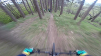
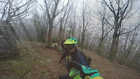
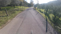
Photos of Acquerino Mountain Bike
Videos of Acquerino Mountain Bike
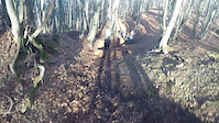
trail: Cannicciaie
3:32 |
174 |
Apr 24, 2017
trail: Monachino
5:14 |
194 |
Mar 21, 2017
trail: Monachino
7:32 |
91 |
Jan 16, 2017
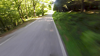
trail: Vancouver
4:33 |
46 |
Jan 16, 2017

trail: Cannicciaie
5:14 |
155 |
Dec 13, 2016
trail: Monachino
6:00 |
72 |
Dec 9, 2016
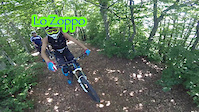
trail: Lo Zoppo
6:52 |
183 |
Jul 9, 2016
trail: Monachino
7:46 |
151 |
Jul 9, 2016
Recent Trail Reports
| status | trail | date | condition | info | user |
|---|---|---|---|---|---|
| Lo Zoppo | Jun 14, 2026 @ 9:05am (Europe/Rome) Jun 14, 2026 | Ideal | bluca | ||
| Monachino | Jun 14, 2026 @ 9:05am (Europe/Rome) Jun 14, 2026 | Ideal | bluca | ||
| Ho Chi Minh | May 30, 2026 @ 8:26am (Europe/Rome) May 29, 2026 | Variable | bluca | ||
| Access to Acquerino | May 24, 2026 @ 9:21am (Europe/Rome) May 24, 2026 | Ideal | SP0304 | ||
| Zigghe Zaghe | Mar 15, 2026 @ 8:23pm (Europe/Rome) Mar 15, 2026 | Ideal | JN13 | ||
| Le Sorgenti | Mar 15, 2026 @ 8:22pm (Europe/Rome) Mar 15, 2026 | Ideal | JN13 | ||
| Budello | Feb 22, 2026 @ 8:49am (Europe/San_Marino) Feb 21, 2026 | Ideal | marcogiordani | ||
| Cannicciaie | Feb 22, 2026 @ 8:49am (Europe/San_Marino) Feb 21, 2026 | Ideal | marcogiordani | ||
| Vancouver | Feb 22, 2026 @ 8:49am (Europe/San_Marino) Feb 21, 2026 | Ideal | marcogiordani | ||
| Access to Vancouver | Feb 22, 2026 @ 8:49am (Europe/San_Marino) Feb 21, 2026 | Variable | marcogiordani |
Activity Feed
| username | action | type | title | date |
|---|---|---|---|---|
| bluca | add | report | activity #96957401 and 1 more | Jun 14, 2026 @ 5:18am Jun 14, 2026 |
| bluca | add | report | activity #95972375 | May 31, 2026 @ 1:16pm May 31, 2026 |
| SP0304 | add | report | activity #95428319 | May 24, 2026 @ 11:10am May 24, 2026 |
| Cipper73 | ridden | trail | activity #92450459 | Apr 12, 2026 @ 1:04am Apr 12, 2026 |
| matteokNYWXO | ridden | trail | activity #91051878 | Mar 22, 2026 @ 1:57am Mar 22, 2026 |
Recent Comments
| username | type | title | comment | date |
|---|---|---|---|---|
| report | Grazie | Jul 18, 2025 @ 12:00am Jul 18, 2025 | ||
| report | Non ci sono mai stato vale la pena ? | Jul 18, 2025 @ 12:00am Jul 18, 2025 | ||
| trail | Sentiero libero e ripulito come le sorgenti.... | Jun 10, 2024 @ 4:56am Jun 10, 2024 | ||
| trail | Dovrebbe essere riportato come “trail... | May 12, 2024 @ 7:16am May 12, 2024 | ||
| trail | interrotto. ho guadare il fiume 2 volte e... | May 12, 2024 @ 2:01am May 12, 2024 |
Nearby Areas
| name | distance | ||||
|---|---|---|---|---|---|
| Monte Javello | 15 | 15 | 2 | 1 | 3.6 km |
| A.V.D.O. trail area | 10 | 10 | 3 | 6.5 km | |
| Vainella | 3 | 2 | 2 | 1 | 7.3 km |
| Brasimone Trail Area | 6 | 8 | 7.9 km | ||
| Calvana | 7 | 14 | 6 | 8.8 km |
Activity Type Stats
| activitytype | trails | distance | descent | descent distance | total vertical | rating | global rank | state rank | photos | reports | routes | ridelogs |
|---|---|---|---|---|---|---|---|---|---|---|---|---|
| Mountain Bike | 18 | 21 miles | 10,066 ft | 11 miles | 3,337 ft | #4,532 | #213 | 17 | 212 | 810 | ||
| E-Bike | 7 | 1 mile | 233 ft | 2,103 ft | 833 ft | #7,708 | #523 | 157 | 210 | |||
| Adaptive Bike | 2 | #4,988 | #210 | |||||||||
| Winter Fat Bike | 1 | #4,977 | #209 | 1 | ||||||||
| Hike | 17 | 20 miles | 9,829 ft | 10 miles | 3,337 ft | #7,393 | #284 | 207 | 56 | |||
| Trail Running | 18 | 21 miles | 10,066 ft | 11 miles | 3,337 ft | #6,340 | #267 | 212 | 7 |
Frequently Asked Questions About Acquerino
▼
What are the highest rated mountain biking trails in Acquerino?
The highest rated mountain biking trails in Acquerino are:
- Cannicciaie (4.4/5)
- Monachino (4.2/5)
- Le Sorgenti (4.1/5)
- Zigghe Zaghe (4.1/5)
- Vancouver (4.1/5)
▼
What is the best time of the year to ride in Acquerino?
Based on ride log data, the most popular months to ride in Acquerino are:
- April (6 activities)
- November (3 activities)
- September (2 activities)
▼
Where can I park to ride in Acquerino?
Check the Acquerino trail map for trailhead and parking information. Community members regularly update access and parking details for trails in the area.
▼
What is the longest trail in Acquerino?
The longest trail in Acquerino is Ho Chi Minh at 2.7 miles. View all trails sorted by distance.
- By 0silvano & contributors
- Admins: DanielePracchia
- #26085 - 2,488 views
- acquerino activity log | embed map of Acquerino mountain bike trails |
Downloading of trail gps tracks in kml & gpx formats is enabled for Acquerino.
You must login to download files.