close
-
Layers w
- Weather Layers
- Pro
- Pro
- Pro
- Pro
- Pro
- Pro
- More Layers
- Pro
- Pro
- Pro
- Pro
-
Upgrade to

3D
Trail Conditions
- Unknown
- Snow Groomed
- Snow Packed
- Snow Covered
- Snow Cover Partial
- Freeze/thaw Cycle
- Icy
- Prevalent Mud
- Wet
- Variable
- Ideal
- Dry
- Very Dry
Trail Flow (Ridden Direction)
Trailforks scans users ridelogs to determine the most popular direction each trail is ridden. A good flowing trail network will have most trails flowing in a single direction according to their intension.
The colour categories are based on what percentage of riders are riding a trail in its intended direction.
The colour categories are based on what percentage of riders are riding a trail in its intended direction.
- > 96%
- > 90%
- > 80%
- > 70%
- > 50%
- < 50%
- bi-directional trail
- no data
Trail Last Ridden
Trailforks scans ridelogs to determine the last time a trail was ridden.
- < 2 days
- < 1 week
- < 2 weeks
- < 1 month
- < 6 months
- > 6 months
Trail Ridden Direction
The intended direction a trail should be ridden.
- Downhill Only
- Downhill Primary
- Both Directions
- Uphill Primary
- Uphill Only
- One Direction
Contribute Details
Colors indicate trail is missing specified detail.
- Description
- Photos
- Description & Photos
- Videos
Trail Popularity ?
Trailforks scans ridelogs to determine which trails are ridden the most in the last 9 months.
Trails are compared with nearby trails in the same city region with a possible 25 colour shades.
Think of this as a heatmap, more rides = more kinetic energy = warmer colors.
- most popular
- popular
- less popular
- not popular
ATV/ORV/OHV Filter
Max Vehicle Width
inches
US Cell Coverage
Legend

Radar Time
Activity Recordings
Trailforks uses anonymized public activity data.
?
Activity Recordings
Trailforks uses anonymized public activity data.
?
Personal Heatmap
▶
Activity Types
all
/
none
▶
Options
2
Date range
month
–
Winter Trails
Warning
A routing network for winter maps does not exist. Selecting trails using the winter trails layer has been disabled.
Missing Trails
Most Popular
Least Popular
Trails are colored based on popularity. The more popular a trail is, the more red. Less popular trails trend towards green.
Jump Magnitude Heatmap
Heatmap of where riders jump on trails. Zoom in to see individual jumps, click circles to view jump details.
BC Backroad Status
![map legend]()
Service Road Atlas is a free to use, community-driven service for viewing and creating reports on the numerous back-country service roads around B.C. and Alberta.

Slope Aspect
Direction the slope faces
Trails Deemphasized
Trails are shown in grey.
Only show trails with no bike usage.
Suggested Layers
Based on selected activity type
Save the current map location and zoom level as your default home location whenever this page is loaded.
Save
No description for Acworth has been added yet!
Login or register to submit one.
Activities Click to view
- Mountain Bike
93 trails
- Gravel Bike
1 trails
- Adaptive Bike
0 trails
- Hike
83 trails
- Trail Running
69 trails
Region Details
- 13
- 27
- 18
- 29
- 2
Region Status
Caution as of 10 hoursStats
- Avg Trail Rating
- Trails (view details)
- 103
- Trails Mountain Bike
- 98
- Trails Gravel Bike
- 1
- Trails Hike
- 85
- Trails Trail Running
- 69
- Total Distance
- 45 miles
- Total Descent Distance
- 15 miles
- Total Descent
- 3,216 ft
- Total Vertical
- 140 ft
- Highest Trailhead
- 982 ft
- Reports
- 1,528
- Photos
- 345
- Ridden Counter
- 28,217
Sub Regions
-
Allatoona Creek Park
- 1
- 20
- 15
- 31
- 1
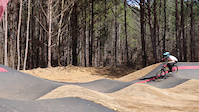
Popular Acworth Mountain Biking Trails
• 90 ★ 3.0 • 3,301 ft • 27 ft • 1,375 •
This is a two-way trail that provides a easy way to get to the Flow Trails and Mason's Loop.
• 95 ★ 3.0 • 2,228 ft • 3 ft • 1,331 •
This is a short doubletrack connector trail from the main lot that provides access to . You can use to reach the , and then from you can connect into .
• 100 ★ 3.7 • 4,396 ft • 16 ft • 666 •
is part of Allatoona Creek Park. It's a short one mile trail that is great for beginners, kids or as a warmup lap. It's relatively flat, but does have some tight, twisty turns that beginners and kids should be careful on while building...
• 85 ★ 4.5 • 2 miles • 131 ft • 663 •
is part of Allatoona Creek Park. It's a singletrack trail with lots of dips, turns and root sections. The trail connects to the optional and provides access to two difficult alternate lines called 3rd Brigade and . The trail direction...
• 95 ★ 4.1 • 2,303 ft • 12 ft • 653 •
is part of Allatoona Creek Park. It's a short trail with some sharp dips and root sections and is generally used as a singletrack connector through the shade of the woods. You can exit this trail at the Connector or the depending on...
• 95 ★ 4.4 • 968 ft • 3 ft • 622 •
is part of Allatoona Creek Park. It's 's big brother and is a downhill trail featuring big jumps and table tops. We strongly suggest you slow roll it the first time. The trail may close due to wet conditions. Please check for the...
Acworth Mountain Bike Routes
5,167 ft • 59 ft • 1 • Point to Point •
This is the fastest way to connect between Pitner Bike Park located on Pitner Road and the main Allatoona...
2 miles • 20 ft • 1 • Loop •
Not sure if you are ready to take on all of ? Use the route to test out the trails intermediate character....
8 miles • 575 ft • 12 • Loop •
This route will take you from to Moflo and then on to . All of these trails are flowy with many berms. and...
8 miles • 205 ft • 11 • Loop •
This route will take you to which is a flat trail that partially runs along Allatoona Creek with...
4 miles • 61 ft • 7 • Loop •
This route will take you to which is a flat trail that partially runs along Allatoona Creek with...
6 miles • 263 ft • 6 • Loop •
This route will take you to and trails. is a technical trail with rock and root obstructions, some tough...
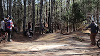
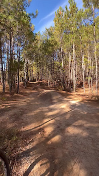
Photos of Acworth Mountain Bike
Videos of Acworth Mountain Bike
trail: Pitner Road Parking Lot
0:06 |
164 |
Feb 26, 2024
trail: Bravo
0:08 |
159 |
Feb 26, 2024
0:08 |
180 |
Nov 30, 2021
0:08 |
178 |
Nov 30, 2021
trail: Mo-Flo
0:49 |
1152 |
Oct 31, 2017
trail: Medusa Line #1
0:07 |
667 |
Aug 29, 2017
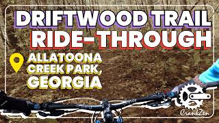
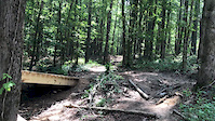
trail: Driftwood
30:35 |
37 |
May 1, 2026 , Acworth

trail: Rusty Bucket
5:33 |
27 |
Apr 27, 2026 , Acworth
Recent Trail Reports
Activity Feed
| username | action | type | title | date |
|---|---|---|---|---|
| Vitus2020 | add | report | activity #97723418 | Jun 24, 2026 @ 2:10pm 10 hours |
| thomcerny | add | event | activity #97535117 | Jun 21, 2026 @ 5:58pm Jun 21, 2026 |
| thomcerny | add | event | activity #97477712 | Jun 21, 2026 @ 6:19am Jun 21, 2026 |
| Andriyj2hKQn | wishlist | route | activity #97377503 | Jun 20, 2026 @ 3:22am Jun 20, 2026 |
| lincolnbailey03 | wishlist | route | activity #97363020 | Jun 19, 2026 @ 8:04pm Jun 19, 2026 |
Recent Comments
| username | type | title | comment | date |
|---|---|---|---|---|
| trail | this is a flow trail and seems to be designed... | May 21, 2026 @ 12:02pm May 21, 2026 | ||
| trail | This should be one of your first ever trails.... | Oct 7, 2025 @ 2:36pm Oct 7, 2025 | ||
| trail | After you ride, Rusty bucket low shack is for... | Oct 7, 2025 @ 2:33pm Oct 7, 2025 | ||
| trail | This is a fun trail for beginners each time... | Oct 7, 2025 @ 2:29pm Oct 7, 2025 | ||
| report | Our volunteer trail crew will get it tomorrow.... | Jul 26, 2025 @ 12:27pm Jul 26, 2025 |
Local Badges
-

10 Green Trails360 awarded -

Epic Ride Climb 2k1 awarded -

Climbing 10k Badge31 awarded -

Climbing 100k Badge1 awarded -

Epic Ride Descent 2k1 awarded -

Descent 10k Badge31 awarded
Bike & Skill Parks
| name | type | city | rating |
|---|---|---|---|
| Allatoona Creek Bike Park & Skills Area | skill park | Acworth | |
| Love Shack Skill Area | skill park | Acworth | |
| Hardwood Skills Area | skill park | Acworth |
Upcoming Local Events
Activity Type Stats
| activitytype | trails | distance | descent | descent distance | total vertical | rating | global rank | state rank | photos | reports | routes | ridelogs |
|---|---|---|---|---|---|---|---|---|---|---|---|---|
| Mountain Bike | 93 | 42 miles | 3,094 ft | 14 miles | 141 ft | #693 | #264 | 349 | 1,521 | 17 | 13,813 | |
| Gravel Bike | 1 | #504 | #1,068 | 46 | ||||||||
| Hike | 83 | 43 miles | 2,936 ft | 14 miles | 141 ft | #1,031 | #471 | 2 | 1,528 | 1,149 | ||
| Trail Running | 69 | 41 miles | 2,841 ft | 13 miles | 141 ft | #3,658 | #1,090 | 1,521 | 497 |
Frequently Asked Questions About Acworth
▼
What are the best places to ride in Acworth?
Acworth has 1 areas to explore for mountain biking. The top rated areas are:
▼
What are the highest rated mountain biking trails in Acworth?
The highest rated mountain biking trails in Acworth are:
- Turtle Back (4.3/5)
- Mumbo Jumbo (4.3/5)
- Voodoo Loop (4.3/5)
- Pump Track (Velosolutions Asphalt) (4.3/5)
- Mason's Bridge Loop (4.3/5)
▼
What is the best time of the year to ride in Acworth?
Based on ride log data, the most popular months to ride in Acworth are:
- July (142 activities)
- May (133 activities)
- June (126 activities)
▼
Where can I park to ride in Acworth?
There are 8 parking locations listed in Acworth. The most popular parking spots are:
- Allatoona Creek Park Parking
- Parking
- Parking (Limited)
- Additional Parking For Pitner Bike Park
- Parking (Limited)
Trails
- By jhato160 & contributors
- Admins: NGMBA
- #8359 - 6,759 views
- acworth activity log | embed map of Acworth mountain bike trails | acworth mountain biking points of interest
Downloading of trail gps tracks in kml & gpx formats is enabled for Acworth.
You must login to download files.