close
-
Layers w
- Weather Layers
- Pro
- Pro
- Pro
- Pro
- Pro
- Pro
- More Layers
- Pro
- Pro
- Pro
- Pro
-
Upgrade to

3D
Trail Conditions
- Unknown
- Snow Groomed
- Snow Packed
- Snow Covered
- Snow Cover Partial
- Freeze/thaw Cycle
- Icy
- Prevalent Mud
- Wet
- Variable
- Ideal
- Dry
- Very Dry
Trail Flow (Ridden Direction)
Trailforks scans users ridelogs to determine the most popular direction each trail is ridden. A good flowing trail network will have most trails flowing in a single direction according to their intension.
The colour categories are based on what percentage of riders are riding a trail in its intended direction.
The colour categories are based on what percentage of riders are riding a trail in its intended direction.
- > 96%
- > 90%
- > 80%
- > 70%
- > 50%
- < 50%
- bi-directional trail
- no data
Trail Last Ridden
Trailforks scans ridelogs to determine the last time a trail was ridden.
- < 2 days
- < 1 week
- < 2 weeks
- < 1 month
- < 6 months
- > 6 months
Trail Ridden Direction
The intended direction a trail should be ridden.
- Downhill Only
- Downhill Primary
- Both Directions
- Uphill Primary
- Uphill Only
- One Direction
Contribute Details
Colors indicate trail is missing specified detail.
- Description
- Photos
- Description & Photos
- Videos
Trail Popularity ?
Trailforks scans ridelogs to determine which trails are ridden the most in the last 9 months.
Trails are compared with nearby trails in the same city region with a possible 25 colour shades.
Think of this as a heatmap, more rides = more kinetic energy = warmer colors.
- most popular
- popular
- less popular
- not popular
ATV/ORV/OHV Filter
Max Vehicle Width
inches
US Cell Coverage
Legend

Radar Time
Activity Recordings
Trailforks uses anonymized public activity data.
?
Activity Recordings
Trailforks uses anonymized public activity data.
?
Personal Heatmap
▶
Activity Types
all
/
none
▶
Options
2
Date range
month
–
Winter Trails
Warning
A routing network for winter maps does not exist. Selecting trails using the winter trails layer has been disabled.
Missing Trails
Most Popular
Least Popular
Trails are colored based on popularity. The more popular a trail is, the more red. Less popular trails trend towards green.
Jump Magnitude Heatmap
Heatmap of where riders jump on trails. Zoom in to see individual jumps, click circles to view jump details.
BC Backroad Status
![map legend]()
Service Road Atlas is a free to use, community-driven service for viewing and creating reports on the numerous back-country service roads around B.C. and Alberta.

Slope Aspect
Direction the slope faces
Trails Deemphasized
Trails are shown in grey.
Only show trails with no bike usage.
Suggested Layers
Based on selected activity type
Save the current map location and zoom level as your default home location whenever this page is loaded.
Save
No description for Adarra has been added yet!
Login or register to submit one.
 google parking directions
Primary Trail Type: All-Mountain & Downhill
eBikes Allowed:
Yes
google parking directionsThis region uses the Uk/Euro style trail grading system.
Activities Click to view
- Mountain Bike
28 trails
- E-Bike
28 trails
- Hike
29 trails
- Trail Running
29 trails
Region Details
- 11
- 1
- 5
- 8
- 2
Region Status
Caution as of Jun 1, 2026Stats
- Avg Trail Rating
- Trails (view details)
- 28
- Trails Mountain Bike
- 28
- Trails E-Bike
- 28
- Trails Hike
- 29
- Trails Trail Running
- 29
- Total Distance
- 53 miles
- Total Descent Distance
- 23 miles
- Total Descent
- 12,690 ft
- Total Vertical
- 2,519 ft
- Highest Trailhead
- 2,699 ft
- Reports
- 152
- Photos
- 71
- Ridden Counter
- 264
Popular Adarra Mountain Biking Trails
• 60 ★ 4.8 • 2 miles • 37 ft • 63 •
Bonita bajada por el pinar, con tramos con flow y otros donde la trazada no está muy clara. Algunos saltos aprovechando árboles caídos y un salto más gordo
• 35 ★ 4.5 • 2 miles • 15 ft • 9 •
Less popular blue difficulty singletrack. This multi-use trail can be used downhill only and has a moderate overall physical rating with a 15 ft blue climb. Trail visibility is always easy to follow. On average it takes 13 minutes to complete this trail.
• 5 ★ 5.0 • 2,946 ft • 10 ft • 6 •
Less popular blue difficulty singletrack. This multi-use trail can be used both directions and has a hard overall physical rating with a 10 ft black diamond climb. Trail visibility is always easy to follow. On average it takes 7 minutes to complete this trail.
• 20 ★ 0.0 • 1 mile • 0 ft • 6 •
Less popular blue difficulty singletrack. This multi-use trail can be used downhill only and has a moderate overall physical rating with a 0 ft green climb. Trail visibility is always easy to follow. On average it takes 9 minutes to complete this trail.
• 30 ★ 5.0 • 1 mile • 111 ft • 6 •
Sendero paralelo a la pista de . Un tramo de rocas corto no ciclable y otro cruce de pequeño afluente a Leizaran.
• 5 ★ 4.0 • 5,187 ft • 271 ft • 5 •
Subida muy empinada dirección Gipuzkoa hasta la cima, la mitad empujando para luego bajar por la cresta hasta el camino viejo de . Buena opción si tienes tiempo y fuerzas para no ir por la pista.
Adarra Mountain Bike Routes
Photos of Adarra Mountain Bike
Videos of Adarra Mountain Bike
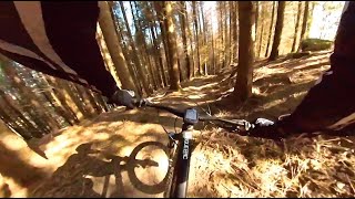
trail: Gozadera
5:36 |
184 |
May 8, 2025 , Donostia/San Sebastian
Recent Trail Reports
| status | trail | date | condition | info | user |
|---|---|---|---|---|---|
| Gozadera | Jun 1, 2026 @ 11:45am (Europe/Madrid) Jun 1, 2026 | Unknown | ikerX7UYQt | ||
| Los Okupas | Mar 31, 2026 @ 8:56pm (Europe/Madrid) Mar 31, 2026 | Unknown | nikelaos | ||
| Acceso Gozadera | Feb 7, 2026 @ 8:30am (Europe/Andorra) Feb 6, 2026 | Ideal | phel86 | ||
| Inicio Gozadera | Oct 13, 2025 @ 4:08pm (Europe/Madrid) Oct 13, 2025 | Unknown | Tioholtzman | ||
| Usabelartza Basoa | Oct 13, 2025 @ 4:06pm (Europe/Madrid) Oct 13, 2025 | Unknown | Tioholtzman | ||
| Plazaola | Sep 5, 2025 @ 7:59am Sep 5, 2025 | Ideal | Ralvarez2504 | ||
| Munixko | Aug 25, 2025 @ 6:58am Aug 25, 2025 | Variable | ekalga | ||
| Buruntza egaletik Azkortera | Feb 18, 2025 @ 9:43am Feb 18, 2025 | Ideal | ekalga | ||
| Belkoain gaina | Dec 9, 2023 @ 2:15am Dec 9, 2023 | Wet | otobike | ||
| Muntto-Otita | Nov 7, 2023 @ 8:07am Nov 7, 2023 | Very Dry | otobike |
Activity Feed
| username | action | type | title | date |
|---|---|---|---|---|
| ikerX7UYQt | add | report | activity #96005472 | Jun 1, 2026 @ 2:45am Jun 1, 2026 |
| izakai | add | report | activity #93528231 | Apr 27, 2026 @ 10:51am Apr 27, 2026 |
| itxasoetxabe | add | report | activity #93500336 | Apr 26, 2026 @ 10:55pm Apr 26, 2026 |
| itxasoetxabe | vote | trail | activity #93500329 | Apr 26, 2026 @ 10:55pm Apr 26, 2026 |
| ekalga | add | report | activity #93006808 | Apr 20, 2026 @ 2:13am Apr 20, 2026 |
Recent Comments
| username | type | title | comment | date |
|---|---|---|---|---|
| trail | El primer tramo después de la valla esta muy... | Sep 3, 2024 @ 4:51am Sep 3, 2024 | ||
| trail | Llegar al sendero es impracticable. La pista... | Sep 2, 2024 @ 6:08am Sep 2, 2024 | ||
| trail | Ruta inpracticable por desprendimientos | Mar 15, 2024 @ 2:37pm Mar 15, 2024 | ||
| report | Hola sabes que tal estará ahora esa bajada? | Feb 21, 2024 @ 10:02am Feb 21, 2024 | ||
| trail | Man, everything you say it's in the... | Feb 2, 2024 @ 11:17am Feb 2, 2024 |
Nearby Areas
| name | distance | ||||
|---|---|---|---|---|---|
| Andatza | 15 | 3.5 km | |||
| Tolosa-Irura | 1 | 4 | 5.2 km | ||
| Artikutza | 6.4 km | ||||
| Berastegi | 1 | 6 | 7.6 km | ||
| Alegia Mtb Enduro Zirkuitoa | 2 | 10 | 8.3 km |
Local Badges
-

Completionist0 awarded
Activity Type Stats
| activitytype | trails | distance | descent | descent distance | total vertical | rating | global rank | state rank | photos | reports | routes | ridelogs |
|---|---|---|---|---|---|---|---|---|---|---|---|---|
| Mountain Bike | 28 | 52 miles | 12,674 ft | 23 miles | 2,520 ft | #4,311 | #334 | 70 | 152 | 4 | 555 | |
| E-Bike | 28 | 53 miles | 12,690 ft | 23 miles | 2,520 ft | #2,757 | #559 | 1 | 145 | 1 | 117 | |
| Hike | 29 | 53 miles | 12,690 ft | 23 miles | 2,520 ft | #4,440 | #512 | 152 | 63 | |||
| Trail Running | 29 | 53 miles | 12,690 ft | 23 miles | 2,520 ft | #3,599 | #491 | 151 | 34 |
Frequently Asked Questions About Adarra
▼
What are the highest rated mountain biking trails in Adarra?
The highest rated mountain biking trails in Adarra are:
- Gozadera (4.4/5)
- Bertxin Otita (4.1/5)
- Adarra sur (4.1/5)
- Lapurtxulo (4.1/5)
- Usabelartza Basoa (4.1/5)
▼
Where can I park to ride in Adarra?
There are 1 parking locations listed in Adarra. The most popular parking spots are:
▼
What is the longest trail in Adarra?
The longest trail in Adarra is Arano bidea at 3.5 miles. View all trails sorted by distance.
▼
What are the best & highest rated hiking trails in Adarra?
The best hiking trails in Adarra are: View all hiking trails sorted by popularity score.
- adarra activity log | embed map of Adarra mountain bike trails | adarra mountain biking points of interest
Downloading of trail gps tracks in kml & gpx formats is enabled for Adarra.
You must login to download files.