close
-
Layers w
- Weather Layers
- Pro
- Pro
- Pro
- Pro
- Pro
- Pro
- More Layers
- Pro
- Pro
- Pro
- Pro
-
Upgrade to

3D
Trail Conditions
- Unknown
- Snow Groomed
- Snow Packed
- Snow Covered
- Snow Cover Partial
- Freeze/thaw Cycle
- Icy
- Prevalent Mud
- Wet
- Variable
- Ideal
- Dry
- Very Dry
Trail Flow (Ridden Direction)
Trailforks scans users ridelogs to determine the most popular direction each trail is ridden. A good flowing trail network will have most trails flowing in a single direction according to their intension.
The colour categories are based on what percentage of riders are riding a trail in its intended direction.
The colour categories are based on what percentage of riders are riding a trail in its intended direction.
- > 96%
- > 90%
- > 80%
- > 70%
- > 50%
- < 50%
- bi-directional trail
- no data
Trail Last Ridden
Trailforks scans ridelogs to determine the last time a trail was ridden.
- < 2 days
- < 1 week
- < 2 weeks
- < 1 month
- < 6 months
- > 6 months
Trail Ridden Direction
The intended direction a trail should be ridden.
- Downhill Only
- Downhill Primary
- Both Directions
- Uphill Primary
- Uphill Only
- One Direction
Contribute Details
Colors indicate trail is missing specified detail.
- Description
- Photos
- Description & Photos
- Videos
Trail Popularity ?
Trailforks scans ridelogs to determine which trails are ridden the most in the last 9 months.
Trails are compared with nearby trails in the same city region with a possible 25 colour shades.
Think of this as a heatmap, more rides = more kinetic energy = warmer colors.
- most popular
- popular
- less popular
- not popular
ATV/ORV/OHV Filter
Max Vehicle Width
inches
US Cell Coverage
Legend

Radar Time
Activity Recordings
Trailforks uses anonymized public activity data.
?
Activity Recordings
Trailforks uses anonymized public activity data.
?
Personal Heatmap
▶
Activity Types
all
/
none
▶
Options
2
Date range
month
–
Winter Trails
Warning
A routing network for winter maps does not exist. Selecting trails using the winter trails layer has been disabled.
Missing Trails
Most Popular
Least Popular
Trails are colored based on popularity. The more popular a trail is, the more red. Less popular trails trend towards green.
Jump Magnitude Heatmap
Heatmap of where riders jump on trails. Zoom in to see individual jumps, click circles to view jump details.
BC Backroad Status
![map legend]()
Service Road Atlas is a free to use, community-driven service for viewing and creating reports on the numerous back-country service roads around B.C. and Alberta.

Slope Aspect
Direction the slope faces
Trails Deemphasized
Trails are shown in grey.
Only show trails with no bike usage.
Suggested Layers
Based on selected activity type
Save the current map location and zoom level as your default home location whenever this page is loaded.
Save
No description for Addison County has been added yet!
Login or register to submit one.
Stats
- Avg Trail Rating
- Trails (view details)
- 325
- Trails Mountain Bike
- 186
- Trails E-Bike
- 17
- Trails Gravel Bike
- 7
- Trails Hike
- 253
- Trails Trail Running
- 253
- Trails Snowmobile
- 47
- Trails Snowshoe
- 100
- Trails Downhill Ski
- 25
- Trails Backcountry Ski
- 29
- Trails Nordic Ski
- 93
- Total Distance
- 408 miles
- Total Descent
- 56,965 ft
- Total Vertical
- 3,299 ft
- Highest Trailhead
- 3,392 ft
- Reports
- 820
- Photos
- 94
- Ridden Counter
- 11,356
Sub Regions
- Addison (3)
- Bristol (0)
- Goshen (60)
- Hancock (3)
- Leicester (6)
- Middlebury (65)
- Battel Woods (23)
- Chipman Hill (31)
- Means Woods (3)
- Murdock Woods (3)
- TAM (7)
- Wright Park (1)
- Monkton (0)
- Ripton (59)
- Vergennes (5)
- Weybridge (3)
Popular Addison County Mountain Biking Trails
• 100 ★ 4.4 • 4 miles • 885 ft • 174 •
This trail follows a ridge with gentle grades and portions of sustained climbs along switchbacks. The trail boast beautiful views to the east and west and the loop system has received numerous awards in recognition of partnership...
• 95 ★ 0.0 • 659 ft • 13 ft • 153 •
Popular blue difficulty singletrack. This multi-use trail can be used both directions and has a moderate overall physical rating with a 13 ft blue climb. Trail visibility is always easy to follow. On average it takes minutes to complete this trail.
• 95 ★ 2.0 • 2,159 ft • 59 ft • 152 •
Popular black diamond difficulty doubletrack. This multi-use trail can be used both directions with a 59 ft blue climb. On average it takes 5 minutes to complete this trail.
• 100 ★ 4.5 • 531 ft • 33 ft • 152 •
Popular blue difficulty singletrack. This multi-use trail can be used both directions with a 33 ft blue climb. Trail visibility is always easy to follow. On average it takes minutes to complete this trail.
• 80 ★ 0.0 • 3,619 ft • 28 ft • 136 •
Popular green difficulty singletrack. This multi-use trail can be used both directions and has a easy overall physical rating with a 28 ft green climb. Trail visibility is always easy to follow. On average it takes 7 minutes to complete this trail.
• 100 ★ 2.5 • 4,400 ft • 254 ft • 126 •
Though people ride this trail Downhill, we prefer to use it as a climber. Be aware as you ascend the trail. There are some blind high speed corners.
• 80 ★ 5.0 • 4,928 ft • 0 ft • 125 •
Sidewinder is part of the TAM trail system. It starts off the top of Chipman and is quite steep and high speed. Be on alert for hikers as this is a popular hiking trail. After you come off the hill the trail mellows out and has some fun...
Addison County Mountain Bike Routes
★ 4.0 • 10 miles • 879 ft • 3 • Loop •
This loop includes two of 's best mountain biking trails: and . Ride this loop counter-clockwise for a fun...
15 miles • 2,203 ft • 2 •
This route can be ridden in both directions, and provides a more backcountry experience of the Trails....
36 miles • 3,904 ft • 10 •
This loop utilizes the managed mountain bike trails of such as , , , and . It also uses some of the older...
7 miles • 702 ft • 3 • Out & Back •
A perfect family outing! Start with a quick lap on the Campground Loop before heading down the new . An...
11 miles • 2,331 ft • 7 • Shuttled •
12 mile ride up Swans Mill trails to Tunnel Ridge trail, assuming shuttle from USFS Rochester Ranger...
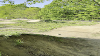
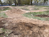
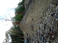
Photos of Addison County Mountain Bike
Videos of Addison County Mountain Bike

0:06 |
|
Jun 12, 2023
0:16 |
|
Jun 12, 2023
0:03 |
|
Jun 12, 2023

trail: Summit Trail
16:51 |
152 |
Apr 22, 2014

trail: TAM - Chipman Access Road
0:09 |
112 |
Nov 6, 2013
trail: TAM - Chipman Access Road
0:15 |
140 |
Nov 6, 2013
trail: Summit Trail
6:43 |
337 |
Apr 21, 2013

trail: Summit Trail
5:42 |
481 |
Mar 17, 2013
Recent Trail Reports
National Scenic Trails & Official Routes
-
Velomont Trail
- Mountain Bike
- E-Bike
- Hike
- Trail Running
Activity Feed
| username | action | type | title | date |
|---|---|---|---|---|
| sarn | wishlist | region | activity #97528517 | Jun 21, 2026 @ 4:08pm 22 hours |
| vanburenge | add | report | activity #97513142 | Jun 21, 2026 @ 12:57pm 1 day |
| vanburenge | comment | trail | activity #97513033 | Jun 21, 2026 @ 12:56pm 1 day |
| m5rTRz | add | report | activity #97329076 and 1 more | Jun 19, 2026 @ 10:36am Jun 19, 2026 |
| WillieJacobsz | update | region | activity #97272203 | Jun 18, 2026 @ 1:09pm Jun 18, 2026 |
Recent Comments
| username | type | title | comment | date |
|---|---|---|---|---|
| trail | Two large trees across trail, both chainsaw... | Jun 21, 2026 @ 12:56pm 1 day | ||
| trail | Not recommended, not bike-able. Once in a... | Jun 11, 2026 @ 4:54am Jun 11, 2026 | ||
| trail | Big dead tree down across the trail. | May 23, 2026 @ 3:32am May 23, 2026 | ||
| report | Trees cleared. Still too soft to ride | Apr 6, 2026 @ 12:34pm Apr 6, 2026 | ||
| trail | Be forewarned that is a XC ski trail, and not... | Sep 28, 2025 @ 11:44pm Sep 28, 2025 |
Local Badges
-

Completionist0 awarded -

10 Blue Trails0 awarded -
Completionist0 awarded -

Top 10 Trails0 awarded -

10 Green Trails3 awarded -
Completionist2 awarded
Bike & Skill Parks
| name | type | city | rating |
|---|---|---|---|
| Middlebury College Snow Bowl | bike park | Ripton | |
| Moosalamoo Pump Track | skill park | Ripton | |
| Bristol Pump Track | skill park | Bristol | |
| Middlebury Pump Track | skill park | Middlebury |
Activity Type Stats
| activitytype | trails | distance | descent | descent distance | total vertical | rating | global rank | state rank | photos | reports | routes | ridelogs |
|---|---|---|---|---|---|---|---|---|---|---|---|---|
| Mountain Bike | 186 | 150 miles | 15,203 ft | 58 miles | 2,208 ft | 97 | 791 | 5 | 11,083 | |||
| E-Bike | 17 | 28 miles | 2,648 ft | 10 miles | 1,631 ft | 258 | 126 | |||||
| Gravel Bike | 7 | 6 miles | 446 ft | 2 miles | 1,385 ft | 45 | 355 | |||||
| Hike | 253 | 221 miles | 28,957 ft | 90 miles | 3,228 ft | 2 | 786 | 2 | 1,367 | |||
| Trail Running | 253 | 221 miles | 28,957 ft | 90 miles | 3,228 ft | 786 | 2 | 611 | ||||
| Snowmobile | 47 | 188 miles | 21,194 ft | 82 miles | 2,175 ft | 235 | 4 | |||||
| Snowshoe | 100 | 87 miles | 8,917 ft | 31 miles | 2,369 ft | 293 | 42 | |||||
| Downhill Ski | 25 | 11 miles | 8,415 ft | 10 miles | 928 ft | 235 | 605 | |||||
| Backcountry Ski | 29 | 38 miles | 3,281 ft | 12 miles | 2,100 ft | 239 | 421 | |||||
| Nordic Ski | 93 | 81 miles | 8,612 ft | 31 miles | 2,011 ft | 289 | 1,074 |
Activities
- Addison County Mountain Biking Trails
- Addison County E-Biking Trails
- Addison County Gravel Biking Trails
- Addison County Hiking Trails
- Addison County Trail Running Trails
- Addison County Snowmobiling Trails
- Addison County Snowshoeing Trails
- Addison County Skiing Trails
- Addison County Backcountry Skiing Trails
- Addison County Nordic Skiing Trails
Trails
Points of Interest
- Bridge 1 TTF
- Blueberry Hill Outdoor Center Information
- Burgin Lodge Cabin
- Aframe TTF
- Texas Falls Sight
- Blueberry Recreational Arena Other
- Falls of Lana Sight
- Branbury State Park Camp Ground Camping
- Silver Lake Camp Site Camping
- Mount Moosalamoo Viewpoint
- Hoffman Mountain (3,701 ft)
- Blue Ridge Mountain (3,468 ft)
- Cape Lookoff Mountain (3,356 ft)
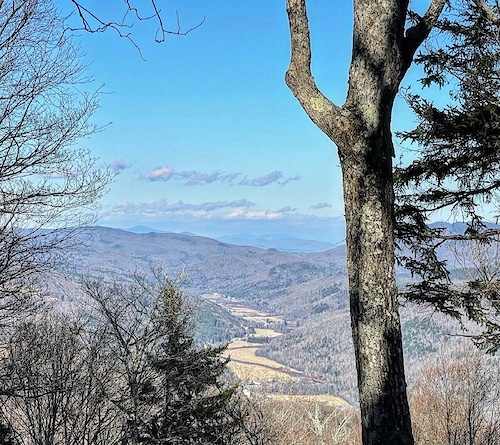
- By brenthillier
 NSMBA TRAILFORKS & contributors
 - Admins: VMBA, Velomont, Jwduston, ACBC
- #13274 - 3,598 views
- addison county activity log | embed map of Addison County mountain bike trails | addison county mountain biking points of interest polygons
Downloading of trail gps tracks in kml & gpx formats is enabled for Addison County.
You must login to download files.