close
-
Layers w
- Weather Layers
- Pro
- Pro
- Pro
- Pro
- Pro
- Pro
- More Layers
- Pro
- Pro
- Pro
- Pro
-
Upgrade to

3D
Trail Conditions
- Unknown
- Snow Groomed
- Snow Packed
- Snow Covered
- Snow Cover Partial
- Freeze/thaw Cycle
- Icy
- Prevalent Mud
- Wet
- Variable
- Ideal
- Dry
- Very Dry
Trail Flow (Ridden Direction)
Trailforks scans users ridelogs to determine the most popular direction each trail is ridden. A good flowing trail network will have most trails flowing in a single direction according to their intension.
The colour categories are based on what percentage of riders are riding a trail in its intended direction.
The colour categories are based on what percentage of riders are riding a trail in its intended direction.
- > 96%
- > 90%
- > 80%
- > 70%
- > 50%
- < 50%
- bi-directional trail
- no data
Trail Last Ridden
Trailforks scans ridelogs to determine the last time a trail was ridden.
- < 2 days
- < 1 week
- < 2 weeks
- < 1 month
- < 6 months
- > 6 months
Trail Ridden Direction
The intended direction a trail should be ridden.
- Downhill Only
- Downhill Primary
- Both Directions
- Uphill Primary
- Uphill Only
- One Direction
Contribute Details
Colors indicate trail is missing specified detail.
- Description
- Photos
- Description & Photos
- Videos
Trail Popularity ?
Trailforks scans ridelogs to determine which trails are ridden the most in the last 9 months.
Trails are compared with nearby trails in the same city region with a possible 25 colour shades.
Think of this as a heatmap, more rides = more kinetic energy = warmer colors.
- most popular
- popular
- less popular
- not popular
ATV/ORV/OHV Filter
Max Vehicle Width
inches
US Cell Coverage
Legend

Radar Time
Activity Recordings
Trailforks uses anonymized public activity data.
?
Activity Recordings
Trailforks uses anonymized public activity data.
?
Personal Heatmap
▶
Activity Types
all
/
none
▶
Options
2
Date range
month
–
Winter Trails
Warning
A routing network for winter maps does not exist. Selecting trails using the winter trails layer has been disabled.
Missing Trails
Most Popular
Least Popular
Trails are colored based on popularity. The more popular a trail is, the more red. Less popular trails trend towards green.
Jump Magnitude Heatmap
Heatmap of where riders jump on trails. Zoom in to see individual jumps, click circles to view jump details.
BC Backroad Status
![map legend]()
Service Road Atlas is a free to use, community-driven service for viewing and creating reports on the numerous back-country service roads around B.C. and Alberta.

Slope Aspect
Direction the slope faces
Trails Deemphasized
Trails are shown in grey.
Only show trails with no bike usage.
Suggested Layers
Based on selected activity type
Save the current map location and zoom level as your default home location whenever this page is loaded.
Save
No description for Aibar has been added yet!
Login or register to submit one.
 google parking directions
Primary Trail Type: All-Mountain & Downhill
eBikes Allowed:
Yes
Shuttleable: YES
Land Status: Managed by Local Riding Association
Land Manager: No Dig no Fun
google parking directionsThis region uses the Uk/Euro style trail grading system.
Activities Click to view
- Mountain Bike
62 trails
- E-Bike
62 trails
- Hike
62 trails
- Trail Running
62 trails
Region Details
- 30
- 4
- 21
- 5
Region Status
Open as of Jun 1, 2026Local Trail Association
Stats
- Avg Trail Rating
- Trails (view details)
- 60
- Trails Mountain Bike
- 62
- Trails E-Bike
- 62
- Trails Horse
- 1
- Trails Hike
- 62
- Trails Trail Running
- 62
- Total Distance
- 78 miles
- Total Descent Distance
- 41 miles
- Total Descent
- 14,785 ft
- Total Vertical
- 1,938 ft
- Highest Trailhead
- 3,284 ft
- Reports
- 123
- Photos
- 85
- Ridden Counter
- 790
Popular Aibar Mountain Biking Trails
• 70 ★ 4.3 • 3,976 ft • 0 ft • 36 •
Popular blue difficulty family friendly singletrack. This multi-use trail can be used downhill only and has a easy overall physical rating with a 0 ft double black diamond climb. It features berm, jump and skinny. Trail visibility is always easy to follow. On average it takes 4 minutes to complete this trail.
• 70 ★ 4.8 • 3,271 ft • 0 ft • 36 •
Sendero por bosque, en otoño dificil de seguir, gracias a los troncos que hacen de marcaje en las curvas, tramo final de fuerte pendiente de subida, y después del campo, paso de la alambrada. Este paso en descenso se puede saltar!!
• 65 ★ 4.0 • 3,287 ft • 0 ft • 27 •
Moderately popular blue difficulty singletrack. This multi-use trail can be used downhill primary and has a moderate overall physical rating. Trail visibility is sometimes hard to follow. On average it takes 5 minutes to complete this trail.
• 95 ★ 4.0 • 1 mile • 48 ft • 25 •
Tramo de senda ancha muy sencilla
• 45 ★ 3.3 • 2 miles • 5 ft • 24 •
Moderately popular blue difficulty machine groomed. This multi-use trail can be used downhill primary and has a extreme overall physical rating with a 5 ft black diamond climb. It features rock garden and skinny. Trail visibility is sometimes hard to follow. On average it takes 15 minutes to complete this trail.
• 65 ★ 5.0 • 2,612 ft • 0 ft • 20 •
Moderately popular blue difficulty singletrack. This multi-use trail can be used downhill primary and has a easy overall physical rating with a 0 ft double black diamond climb. Trail visibility is sometimes hard to follow. On average it takes 7 minutes to complete this trail.
Aibar Mountain Bike Routes
★ 5.0 • 17 miles • 3,448 ft • 12 • Loop •
Nueva entrega de senderos de Aibar. Con bajadas completamete nuevas y otras que retomamos del a con...
★ 4.0 • 16 miles • 2,879 ft • 5 • Loop •
Ruta Exigente con cuatro tramos muy buenos de bajada,partiendo desde el pueblo de Aibar.
★ 3.0 • 27 miles • 5,052 ft • 13 • Loop •
Peremusa BTT nace como la union lógica, y fluida de todos senderos y bajadas típicos de la zona de...
4 miles • 630 ft • 1 • Loop •
XC, circuito de cross country apto para BTT como para Running, con subibajas cortos pero intensos, y...
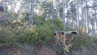
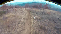
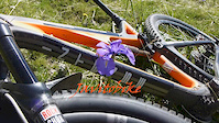
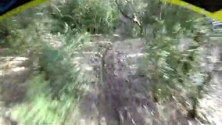
Photos of Aibar Mountain Bike
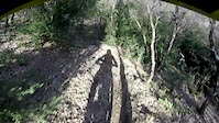
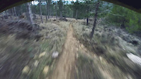
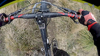
Videos of Aibar Mountain Bike
trail: Garro DH
0:13 |
62 |
Jul 26, 2022
trail: Las Mostakas v3
0:00 |
51 |
Feb 17, 2020

trail: Casales
0:00 |
42 |
Feb 10, 2020
trail: Las Pinillas
0:34 |
37 |
Feb 4, 2020
trail: La Eugi
0:56 |
54 |
Jan 27, 2020
trail: Los Coscojos
0:22 |
75 |
Jan 22, 2020
trail: La Plana
4:53 |
332 |
Aug 4, 2014
trail: Las Mostakas v3
3:45 |
367 |
Feb 17, 2020 , Sanguesa
Recent Trail Reports
| status | trail | date | condition | info | user |
|---|---|---|---|---|---|
| CS Abinzano-Salinas de Ibargoiti | Dec 28, 2025 @ 1:25am (Pacific/Midway) Dec 28, 2025 | Ideal | Angelreing TFSPAIN | ||
| Lantxurda | Dec 28, 2025 @ 1:25am (Pacific/Midway) Dec 28, 2025 | Variable | Angelreing TFSPAIN | ||
| Cordal Lantxurda-Gasu | Dec 28, 2025 @ 1:25am (Pacific/Midway) Dec 28, 2025 | Variable | Angelreing TFSPAIN | ||
| CS Salinas de Ibargoiti-Moreal/Elo | Dec 23, 2025 @ 11:59pm (Pacific/Midway) Dec 24, 2025 | Variable | Angelreing TFSPAIN | ||
| CS Barranco de Basobar | May 24, 2025 @ 5:55am May 24, 2025 | Variable | xatxo | ||
| CS Barranco Arangoiti | May 24, 2025 @ 5:55am May 24, 2025 | Ideal | xatxo | ||
| CS San Babil | May 24, 2025 @ 5:55am May 24, 2025 | Ideal | xatxo | ||
| CS La Cruz de Hierro | May 24, 2025 @ 5:55am May 24, 2025 | Ideal | xatxo | ||
| Llano Viñero CS | May 24, 2025 @ 5:55am May 24, 2025 | Ideal | xatxo | ||
| La Eugi | Jun 25, 2024 @ 12:05am Jun 25, 2024 | Ideal | banpeta |
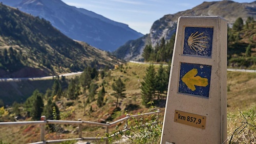
National Scenic Trails & Official Routes
-
GR 65.3 Camino Francés por Aragón
- Mountain Bike
- E-Bike
- Horse
- Hike
- Trail Running
Activity Feed
| username | action | type | title | date |
|---|---|---|---|---|
| Angelreing | ridden | trail | activity #86221579 and 1 more | Dec 28, 2025 @ 10:09am Dec 28, 2025 |
| Angelreing | vote | trail | activity #86221577 and 1 more | Dec 28, 2025 @ 10:09am Dec 28, 2025 |
| Angelreing | add | report | activity #86221517 and 2 more | Dec 28, 2025 @ 10:08am Dec 28, 2025 |
| Angelreing | add | trail | activity #86220445 | Dec 28, 2025 @ 9:51am Dec 28, 2025 |
| Angelreing | add | report | activity #85998807 | Dec 24, 2025 @ 9:45am Dec 24, 2025 |
Recent Comments
| username | type | title | comment | date |
|---|---|---|---|---|
| trail | Le vendría bien una limpieza, sales de... | Sep 16, 2024 @ 1:05pm Sep 16, 2024 | ||
| trail | Ha mitad de sendero hay un gran arbol caido... | Nov 23, 2023 @ 10:55am Nov 23, 2023 |
Nearby Areas
| name | distance | ||||
|---|---|---|---|---|---|
| Eslava y su Entorno | 3 | 19 | 5 km | ||
| Caseda-Gallipienzo | 32 | 6 km | |||
| Izaga | 1 | 10 | 8 km | ||
| Sierra de Leire | 8 | 9.5 km | |||
| Sierra de Alaiz | 1 | 35 | 12.2 km |
Local Badges
-

Completionist0 awarded
Activity Type Stats
| activitytype | trails | distance | descent | descent distance | total vertical | rating | global rank | state rank | photos | reports | routes | ridelogs |
|---|---|---|---|---|---|---|---|---|---|---|---|---|
| Mountain Bike | 62 | 78 miles | 14,787 ft | 41 miles | 1,939 ft | #4,041 | #319 | 83 | 123 | 4 | 333 | |
| E-Bike | 62 | 78 miles | 14,787 ft | 41 miles | 1,939 ft | #1,982 | #406 | 121 | 3 | 26 | ||
| Horse | 1 | 1 mile | 400 ft | 1 mile | 400 ft | 8 | ||||||
| Hike | 62 | 78 miles | 14,787 ft | 41 miles | 1,939 ft | #2,957 | #341 | 1 | 123 | 4 | 8 | |
| Trail Running | 62 | 78 miles | 14,787 ft | 41 miles | 1,939 ft | #2,233 | #317 | 123 | 46 |
Frequently Asked Questions About Aibar
▼
What are the highest rated mountain biking trails in Aibar?
The highest rated mountain biking trails in Aibar are:
- La Eugi (4.3/5)
- Valdojadero DH (4.1/5)
- La Termedia (4.1/5)
- Garro DH (4.1/5)
- Las Mostakas v3 (4.1/5)
▼
What is the best time of the year to ride in Aibar?
Based on ride log data, the most popular months to ride in Aibar are:
- November (2 activities)
- December (1 activities)
- October (1 activities)
▼
Where can I park to ride in Aibar?
There are 4 parking locations listed in Aibar. The most popular parking spots are: View all parking and trailhead locations on the map to plan your visit.
▼
What is the longest trail in Aibar?
The longest trail in Aibar is Klavillo at 3.8 miles. View all trails sorted by distance.
Activities
- By Esain & contributors
- Admins: Angelreing, raullopezch
- #33586 - 2,420 views
- aibar activity log | embed map of Aibar mountain bike trails | aibar mountain biking points of interest
Downloading of trail gps tracks in kml & gpx formats is enabled for Aibar.
You must login to download files.