close
-
Layers w
- Weather Layers
- Pro
- Pro
- Pro
- Pro
- Pro
- Pro
- More Layers
- Pro
- Pro
- Pro
- Pro
-
Upgrade to

3D
Trail Conditions
- Unknown
- Snow Groomed
- Snow Packed
- Snow Covered
- Snow Cover Partial
- Freeze/thaw Cycle
- Icy
- Prevalent Mud
- Wet
- Variable
- Ideal
- Dry
- Very Dry
Trail Flow (Ridden Direction)
Trailforks scans users ridelogs to determine the most popular direction each trail is ridden. A good flowing trail network will have most trails flowing in a single direction according to their intension.
The colour categories are based on what percentage of riders are riding a trail in its intended direction.
The colour categories are based on what percentage of riders are riding a trail in its intended direction.
- > 96%
- > 90%
- > 80%
- > 70%
- > 50%
- < 50%
- bi-directional trail
- no data
Trail Last Ridden
Trailforks scans ridelogs to determine the last time a trail was ridden.
- < 2 days
- < 1 week
- < 2 weeks
- < 1 month
- < 6 months
- > 6 months
Trail Ridden Direction
The intended direction a trail should be ridden.
- Downhill Only
- Downhill Primary
- Both Directions
- Uphill Primary
- Uphill Only
- One Direction
Contribute Details
Colors indicate trail is missing specified detail.
- Description
- Photos
- Description & Photos
- Videos
Trail Popularity ?
Trailforks scans ridelogs to determine which trails are ridden the most in the last 9 months.
Trails are compared with nearby trails in the same city region with a possible 25 colour shades.
Think of this as a heatmap, more rides = more kinetic energy = warmer colors.
- most popular
- popular
- less popular
- not popular
ATV/ORV/OHV Filter
Max Vehicle Width
inches
US Cell Coverage
Legend

Radar Time
Activity Recordings
Trailforks uses anonymized public activity data.
?
Activity Recordings
Trailforks uses anonymized public activity data.
?
Personal Heatmap
▶
Activity Types
all
/
none
▶
Options
2
Date range
month
–
Winter Trails
Warning
A routing network for winter maps does not exist. Selecting trails using the winter trails layer has been disabled.
Missing Trails
Most Popular
Least Popular
Trails are colored based on popularity. The more popular a trail is, the more red. Less popular trails trend towards green.
Jump Magnitude Heatmap
Heatmap of where riders jump on trails. Zoom in to see individual jumps, click circles to view jump details.
BC Backroad Status
![map legend]()
Service Road Atlas is a free to use, community-driven service for viewing and creating reports on the numerous back-country service roads around B.C. and Alberta.

Slope Aspect
Direction the slope faces
Trails Deemphasized
Trails are shown in grey.
Only show trails with no bike usage.
Suggested Layers
Based on selected activity type
Save the current map location and zoom level as your default home location whenever this page is loaded.
Save
No description for Aizac has been added yet!
Login or register to submit one.
This region uses the Uk/Euro style trail grading system.
Activities Click to view
- Mountain Bike
28 trails
- E-Bike
27 trails
- Adaptive Bike
- Hike
26 trails
- Trail Running
25 trails
Region Details
- 7
- 8
- 12
- 1
Region Status
Open as of May 25, 2025Stats
- Trails (view details)
- 28
- Trails Mountain Bike
- 28
- Trails E-Bike
- 27
- Trails Hike
- 26
- Trails Trail Running
- 25
- Trails Dirtbike/Moto
- 3
- Total Distance
- 21 miles
- Total Descent Distance
- 13 miles
- Total Descent
- 8,939 ft
- Total Vertical
- 2,297 ft
- Highest Trailhead
- 3,802 ft
- Reports
- 6
- Photos
- 4
- Ridden Counter
- 10
Popular Aizac Mountain Biking Trails
• 100 ★ 0.0 • 5,223 ft • 10 ft • 3 • • hike
Popular green difficulty mixed. This hike primary trail can be used downhill primary and has a easy overall physical rating with a 10 ft blue climb. It features rock garden. Trail visibility is always easy to follow.
• 5 ★ 5.0 • 2,825 ft • 13 ft • 1 • • hike
Less popular blue difficulty mixed. This hike primary trail can be used downhill primary and has a moderate overall physical rating with a 13 ft black diamond climb. It features rock garden. Adaptive MTB rating: amtb blue. Trail visibility is always easy to follow. On average it takes 2 minutes to complete this trail.
• 5 ★ 0.0 • 4,856 ft • 244 ft • 1 • • hike
Less popular green difficulty family friendly mixed. This hike primary trail can be used downhill primary and has a easy overall physical rating with a 244 ft blue climb. It features berm and rock garden. Trail visibility is always easy to follow.
• 5 ★ 0.0 • 876 ft • 0 ft • 1 •
Less popular blue difficulty singletrack. This mountain bike primary trail can be used downhill primary and has a moderate overall physical rating. It features rock garden and roller coaster. Trail visibility is always easy to follow. On average it takes minutes to complete this trail.
• 5 ★ 0.0 • 4,216 ft • 471 ft • • hike
Less popular green difficulty singletrack. This hike primary trail can be used downhill primary and has a moderate overall physical rating with a 471 ft black diamond climb. Trail visibility is always easy to follow.
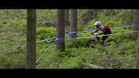
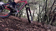
Videos of Aizac Mountain Bike
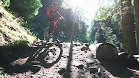
trail: Rocky
2:18 |
20 |
Aug 23, 2020
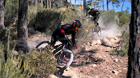
trail: Rocky
0:51 |
2296 |
Mar 6, 2020
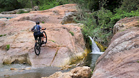
trail: Rocky
3:03 |
98 |
Jul 11, 2019
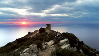
trail: Rocky
2:23 |
89 |
Mar 14, 2019

trail: Rocky
0:55 |
18 |
Mar 6, 2018
trail: Rocky
0:39 |
184 |
Aug 30, 2017
trail: Rocky
2:31 |
|
Jun 22, 2017
trail: Rocky
0:32 |
302 |
Feb 6, 2017
Recent Trail Reports
| status | trail | date | condition | info | user |
|---|---|---|---|---|---|
| Accès volcan d'aizac | Aug 7, 2023 @ 8:25am Aug 7, 2023 | Very Dry | JonasDeMan | ||
| Aizac to Moulin Lacoste | Nov 9, 2020 @ 12:34am Nov 9, 2020 | Dry | Gabrielchassan |
Activity Feed
| username | action | type | title | date |
|---|---|---|---|---|
| mattmalabanan | add | poi | activity #74399052 | Jun 23, 2025 @ 4:14am Jun 23, 2025 |
| provencemb | add | trail | activity #62746459 and 1 more | Dec 6, 2024 @ 4:51am Dec 6, 2024 |
| provencemb | update | trail | activity #62746243 and 16 more | Dec 6, 2024 @ 4:43am Dec 6, 2024 |
| provencemb | add | region | activity #62746181 | Dec 6, 2024 @ 4:40am Dec 6, 2024 |
Recent Comments
| username | type | title | comment | date |
|---|---|---|---|---|
| trail | Effectivement orange. Pas roulant du tout et... | Jul 18, 2024 @ 2:00am Jul 18, 2024 |
Local Badges
-

Epic Mountain Bike Climb 2k0 awarded -

Climbing 10k Badge0 awarded -

Mountain Biking 100k Badge0 awarded -

Epic Ride Descent 2k0 awarded -

Descent 10k Badge0 awarded -

Descent 100k Badge0 awarded
Activity Type Stats
| activitytype | trails | distance | descent | descent distance | total vertical | rating | global rank | state rank | photos | reports | routes | ridelogs |
|---|---|---|---|---|---|---|---|---|---|---|---|---|
| Mountain Bike | 28 | 21 miles | 8,940 ft | 13 miles | 2,297 ft | #12,453 | #798 | 4 | 6 | 2 | ||
| E-Bike | 27 | 20 miles | 8,514 ft | 13 miles | 2,297 ft | #4,902 | #318 | 6 | 1 | |||
| Hike | 26 | 21 miles | 8,484 ft | 13 miles | 2,297 ft | #6,948 | #261 | 6 | ||||
| Trail Running | 25 | 20 miles | 8,156 ft | 13 miles | 2,297 ft | #7,229 | #294 | 6 | 1 | |||
| Dirtbike/Moto | 3 | 4 miles | 335 ft | 4,610 ft | 906 ft |
Frequently Asked Questions About Aizac
▼
What are the highest rated mountain biking trails in Aizac?
The highest rated mountain biking trails in Aizac are:
- Aizac to Moulin Lacoste (4.1/5)
- DH Célas (4/5)
- Rocky (0/5)
- Devèse UpHill (0/5)
- Volc'Aizac (0/5)
▼
Where can I park to ride in Aizac?
Check the Aizac trail map for trailhead and parking information. Community members regularly update access and parking details for trails in the area.
▼
What is the longest trail in Aizac?
The longest trail in Aizac is Faux fay at 1.3 miles. View all trails sorted by distance.
▼
What are the best & highest rated hiking trails in Aizac?
The best hiking trails in Aizac are: View all hiking trails sorted by popularity score.
- By provencemb
 B MTB Co & contributors
 - Admins: Whipperman, freerider48, lunule07, provencemb
- #69495 - 275 views
- aizac activity log | embed map of Aizac mountain bike trails | aizac mountain biking points of interest
Downloading of trail gps tracks in kml & gpx formats is enabled for Aizac.
You must login to download files.