close
-
Layers w
- Weather Layers
- Pro
- Pro
- Pro
- Pro
- Pro
- Pro
- More Layers
- Pro
- Pro
- Pro
- Pro
-
Upgrade to

3D
Trail Conditions
- Unknown
- Snow Groomed
- Snow Packed
- Snow Covered
- Snow Cover Partial
- Freeze/thaw Cycle
- Icy
- Prevalent Mud
- Wet
- Variable
- Ideal
- Dry
- Very Dry
Trail Flow (Ridden Direction)
Trailforks scans users ridelogs to determine the most popular direction each trail is ridden. A good flowing trail network will have most trails flowing in a single direction according to their intension.
The colour categories are based on what percentage of riders are riding a trail in its intended direction.
The colour categories are based on what percentage of riders are riding a trail in its intended direction.
- > 96%
- > 90%
- > 80%
- > 70%
- > 50%
- < 50%
- bi-directional trail
- no data
Trail Last Ridden
Trailforks scans ridelogs to determine the last time a trail was ridden.
- < 2 days
- < 1 week
- < 2 weeks
- < 1 month
- < 6 months
- > 6 months
Trail Ridden Direction
The intended direction a trail should be ridden.
- Downhill Only
- Downhill Primary
- Both Directions
- Uphill Primary
- Uphill Only
- One Direction
Contribute Details
Colors indicate trail is missing specified detail.
- Description
- Photos
- Description & Photos
- Videos
Trail Popularity ?
Trailforks scans ridelogs to determine which trails are ridden the most in the last 9 months.
Trails are compared with nearby trails in the same city region with a possible 25 colour shades.
Think of this as a heatmap, more rides = more kinetic energy = warmer colors.
- most popular
- popular
- less popular
- not popular
ATV/ORV/OHV Filter
Max Vehicle Width
inches
US Cell Coverage
Legend

Radar Time
Activity Recordings
Trailforks uses anonymized public activity data.
?
Activity Recordings
Trailforks uses anonymized public activity data.
?
Personal Heatmap
▶
Activity Types
all
/
none
▶
Options
2
Date range
month
–
Winter Trails
Warning
A routing network for winter maps does not exist. Selecting trails using the winter trails layer has been disabled.
Missing Trails
Most Popular
Least Popular
Trails are colored based on popularity. The more popular a trail is, the more red. Less popular trails trend towards green.
Jump Magnitude Heatmap
Heatmap of where riders jump on trails. Zoom in to see individual jumps, click circles to view jump details.
BC Backroad Status
![map legend]()
Service Road Atlas is a free to use, community-driven service for viewing and creating reports on the numerous back-country service roads around B.C. and Alberta.

Slope Aspect
Direction the slope faces
Trails Deemphasized
Trails are shown in grey.
Only show trails with no bike usage.
Suggested Layers
Based on selected activity type
Save the current map location and zoom level as your default home location whenever this page is loaded.
SavePopular Trail Networks
view all areas »
No description for Alabama has been added yet!
Login or register to submit one.
Stats
- Avg Trail Rating
- Trails (view details)
- 1,848
- Trails Mountain Bike
- 1,518
- Trails E-Bike
- 1,000
- Trails Gravel Bike
- 149
- Trails Adaptive Bike
- 234
- Trails Winter Fat Bike
- 122
- Trails Horse
- 219
- Trails Hike
- 1,692
- Trails Trail Running
- 1,655
- Trails Dirtbike/Moto
- 27
- Trails Observed Trials
- 5
- Trails ATV/ORV/OHV
- 30
- Trails Snowshoe
- 2
- Trails Downhill Ski
- 1
- Trails Backcountry Ski
- 2
- Trails Nordic Ski
- 2
- Total Distance
- 2,175 miles
- Total Descent
- 217,037 ft
- Total Vertical
- 2,392 ft
- Highest Trailhead
- 2,392 ft
- Reports
- 88,956
- Photos
- 4,813
- Ridden Counter
- 170,086
Sub Regions
- Central Alabama (384)
- Jefferson County (212)
- Shelby County (175)
- East Alabama Region (166)
- Chambers County (4)
- Coosa County (30)
- Elmore County (13)
- Lee County (63)
- Macon County (26)
- Montgomery County (25)
- Tallapoosa County (14)
- Northeast Alabama (204)
- Calhoun County (104)
- Cherokee County (2)
- Clay County (1)
- Cleburne County (12)
- Etowah County (23)
- Randolph County (1)
- Talladega County (60)
- Northern Alabama (543)
- Blount County (1)
- Colbert County (8)
- Cullman County (10)
- DeKalb County (30)
- Jackson County (7)
- Lauderdale County (27)
- Lawrence County (18)
- Limestone County (3)
- Madison County (321)
- Marshall County (68)
- Morgan County (3)
- Walker County (5)
- Winston County (41)
- South Alabama (106)
- Baldwin County (66)
- Choctaw County (0)
- Mobile County (39)
- Wilcox County (1)
- Southeast Alabama (58)
- Barbour County (3)
- Covington County (5)
- Dale County (12)
- Houston County (41)
- West Alabama (61)
- Chilton County (3)
- Dallas County (0)
- Hale County (0)
- Tuscaloosa County (60)
Popular Alabama Mountain Biking Trails
• 100 ★ 5.0 • 2,293 ft • 51 ft • 1,388 •
Popular blue difficulty singletrack. This multi-use trail can be used both directions and has a easy overall physical rating with a 51 ft green climb. On average it takes 2 minutes to complete this trail.
• 100 ★ 4.5 • 2,559 ft • 8 ft • 1,270 •
Highly rated popular blue difficulty singletrack. This multi-use trail can be used both directions and has a easy overall physical rating with a 8 ft green climb. It features berm and bridge. On average it takes 2 minutes to complete this trail.
• 90 ★ 4.8 • 3 miles • 337 ft • 1,291 •
Highly rated popular green difficulty singletrack. This mountain bike primary trail can be used downhill primary and has a moderate overall physical rating with a 337 ft blue climb. On average it takes 23 minutes to complete this trail.
• 95 ★ 4.8 • 2 miles • 258 ft • 1,211 •
One of the fastest trails at oak mountain. This trail has a series of jumps and rocks.
• 100 ★ 3.5 • 2 miles • 145 ft • 1,219 •
Popular blue difficulty singletrack. This multi-use trail can be used both directions and has a moderate overall physical rating with a 145 ft blue climb. It features berm, bridge, ladder bridge and rock garden. On average it takes 13 minutes to complete this trail.
• 95 ★ 3.7 • 1 mile • 410 ft • 1,191 •
Be prepared for contouring and climbing for a few miles through the Alabama hardwood forest. You might be surprised that such beautiful places existed in the South if you've never been before. Near the top of the climb you'll notice...
• 90 ★ 4.2 • 3 miles • 203 ft • 1,174 •
Part of the Oak Mountain State Park trail network. Narrow in places and twisty througout, this leg churner is sure to keep you on you toes. Rocks for texture, obstacles for fun and some short fast downhils in this 2.6 mile thrill ride...
Alabama Mountain Bike Routes
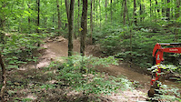
LIMITLESS Lake Trail Featured
3 miles • 205 ft • 1 • Loop •
Easiest route here at Oak Mountain. Can be ridden both directions, out and back. Mild rocks and roots....
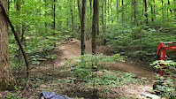
LIMITLESS Thunder Lightning Loop Featured
8 miles • 907 ft • 3 • Loop •
Gotta climb to get to it, but worth it! is a true enduro trail! pedaling between rocks, roots, and chunk....
★ 2.0 • 18 miles • 1,600 ft • 11 • Loop •
This is a true all mountain loop. Plenty of pedaling, tech, and long downhills to go around!
LIMITLESS North Trailhead Easy Loop Featured
7 miles • 542 ft • 3 • Loop •
Beginner to Intermediate friendly loop. Can be ridden both directions, no wrong way here! Rolling terrain,...
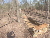
LIMITLESS Lightning Lap Featured
3 miles • 347 ft • 3 • Out & Back •
is a directional Flow/Jump trail. PRE-Ride, RE-Ride, THEN FREE-Ride. Lips, Table tops, Box Drop. This one...
LIMITLESS XC Long Loop Featured
22 miles • 2,039 ft • 10 • Loop •
This is the XC loop you dream about! Nothing too technical, but plenty of elevation with some excellent flow.
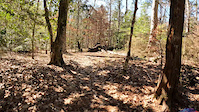
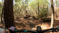
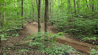
Photos of Alabama Mountain Bike
Videos of Alabama Mountain Bike
trail: Magnolia
10:28 |
14 |
Mar 25, 2026
trail: Mott Trail
0:12 |
13 |
Mar 1, 2025

0:35 |
9 |
Mar 1, 2025
trail: Bayonet Trail
0:23 |
32 |
Mar 1, 2025
trail: Bluebell Holler Alternate
0:11 |
77 |
Jun 20, 2024
trail: Bluebell Holler Alternate
0:13 |
27 |
Jun 20, 2024
trail: Bluebell Holler Alternate
0:14 |
22 |
Jun 20, 2024
trail: Forbidden Zone
0:09 |
137 |
Feb 6, 2024
Activity Feed
| username | action | type | title | date |
|---|---|---|---|---|
| ChadleyR | add | report | activity #97534988 | Jun 21, 2026 @ 5:56pm 9 hours |
| ChadleyR | add | photo | activity #97534735 and 1 more | Jun 21, 2026 @ 5:53pm 9 hours |
| Narsus | add | report | activity #97513187 | Jun 21, 2026 @ 12:58pm 14 hours |
| mach429 | ridden | trail | activity #97510607 | Jun 21, 2026 @ 12:29pm 15 hours |
| swifty9 | vote | route | activity #97478696 | Jun 21, 2026 @ 6:35am 21 hours |
Recent Comments
| username | type | title | comment | date |
|---|---|---|---|---|
| trail | Cleared a few trees off the trail but it’s... | Jun 20, 2026 @ 7:42am 2 days | ||
| report | The trail looks fantastic !! Thank you ! | Jun 17, 2026 @ 4:59pm Jun 17, 2026 | ||
| report | Cleared | Jun 17, 2026 @ 8:26am Jun 17, 2026 | ||
| report | Cleared | Jun 17, 2026 @ 8:26am Jun 17, 2026 | ||
| report | Trail Crew cleared 6/17/26 | Jun 17, 2026 @ 6:54am Jun 17, 2026 |
Local Badges
-

Gravity Lover0 awarded -
Trail Blazer0 awarded -
Long Haul Legend0 awarded -

10 Green Trails167 awarded -

Climbing 10k Badge35 awarded -

Epic Ride Climb 2k36 awarded
Bike & Skill Parks
| name | type | city | rating |
|---|---|---|---|
| Black Creek Mountain Bike Park | bike park | Hoover | |
| Dirt Jumps | skill park | Auburn | |
| Base CAMP Skills Area | skill park | Auburn | |
| Twin Pines Dual Slalom | skill park | Auburn | |
| Playground | skill park | Mobile |
Upcoming Local Events
Activity Type Stats
| activitytype | trails | distance | descent | descent distance | total vertical | rating | global rank | state rank | photos | reports | routes | ridelogs |
|---|---|---|---|---|---|---|---|---|---|---|---|---|
| Mountain Bike | 1,518 | 1,733 miles | 158,855 ft | 672 miles | 2,356 ft | #41 | 3,835 | 88,628 | 220 | 213,140 | ||
| E-Bike | 1,000 | 1,128 miles | 108,967 ft | 443 miles | 2,356 ft | #32 | 29 | 81,709 | 49 | 10,882 | ||
| Gravel Bike | 149 | 123 miles | 6,079 ft | 41 miles | 1,778 ft | #44 | 3 | 5,634 | 11 | 1,433 | ||
| Adaptive Bike | 234 | 206 miles | 13,235 ft | 72 miles | 1,778 ft | #40 | 6,534 | 5 | 6 | |||
| Winter Fat Bike | 122 | 125 miles | 9,951 ft | 44 miles | 1,696 ft | #43 | 6,789 | 5 | ||||
| Horse | 219 | 420 miles | 41,909 ft | 175 miles | 2,247 ft | #29 | 22 | 67,020 | 1 | 132 | ||
| Hike | 1,692 | 2,089 miles | 203,100 ft | 817 miles | 2,392 ft | #41 | 809 | 88,394 | 13 | 13,294 | ||
| Trail Running | 1,655 | 2,041 miles | 199,465 ft | 801 miles | 2,392 ft | #41 | 107 | 88,333 | 27 | 13,698 | ||
| Dirtbike/Moto | 27 | 116 miles | 11,640 ft | 50 miles | 1,401 ft | #40 | 7,699 | 3 | 44 | |||
| Observed Trials | 5 | 12 miles | 827 ft | 4 miles | 1,424 ft | #37 | 1 | 43 | 28 | |||
| ATV/ORV/OHV | 30 | 126 miles | 13,061 ft | 56 miles | 1,401 ft | #38 | 1 | 7,710 | 28 | |||
| Snowshoe | 2 | 1,381 ft | 23 ft | #50 | 493 | 3 | ||||||
| Downhill Ski | 1 | 663 ft | #46 | 7 | 8 | 12 | ||||||
| Backcountry Ski | 2 | 1,381 ft | 23 ft | #41 | 17 | 3 | ||||||
| Nordic Ski | 2 | 1,381 ft | 23 ft | #48 | 1 | 34 | 19 |
Activities
- Alabama Mountain Biking Trails
- Alabama E-Biking Trails
- Alabama Gravel Biking Trails
- Alabama Adaptive Biking Trails
- Alabama Winter Fat Biking Trails
- Alabama Horseback Trails
- Alabama Hiking Trails
- Alabama Trail Running Trails
- Alabama Dirtbiking Trails
- Alabama Observed Trials Trails
- Alabama ATVing/Offroading Trails
Trails
Points of Interest
- Park Fountain Sight
- Horseback Riding & Stables Sight
- North/Back Entrance Gate Information
- Playground Sight
- Catfish Overlook Viewpoint
- Backcountry Camp Camping
- Clover Pavilion Other
- Old Lake Dam Viewpoint
- Cabins
- BSA Camp Tranquility Sight
- Cheaha Mountain (2,402 ft)
- Odum Point (2,323 ft)
- Hernandez Peak (2,280 ft)
- By canadaka
 Trailforks & contributors
 - Admins: Map Team, IMBA, chuktA, msmcfate, WillieJacobsz, PlumbBobM, ReckitRolley, colinreuter, SORBA, ASP
- #3187 - 44,335 views
- alabama activity log | embed map of Alabama mountain bike trails | alabama mountain biking points of interest polygons
Downloading of trail gps tracks in kml & gpx formats is enabled for Alabama.
You must login to download files.