close
-
Layers w
- Weather Layers
- Pro
- Pro
- Pro
- Pro
- Pro
- Pro
- More Layers
- Pro
- Pro
- Pro
- Pro
-
Upgrade to

3D
Trail Conditions
- Unknown
- Snow Groomed
- Snow Packed
- Snow Covered
- Snow Cover Partial
- Freeze/thaw Cycle
- Icy
- Prevalent Mud
- Wet
- Variable
- Ideal
- Dry
- Very Dry
Trail Flow (Ridden Direction)
Trailforks scans users ridelogs to determine the most popular direction each trail is ridden. A good flowing trail network will have most trails flowing in a single direction according to their intension.
The colour categories are based on what percentage of riders are riding a trail in its intended direction.
The colour categories are based on what percentage of riders are riding a trail in its intended direction.
- > 96%
- > 90%
- > 80%
- > 70%
- > 50%
- < 50%
- bi-directional trail
- no data
Trail Last Ridden
Trailforks scans ridelogs to determine the last time a trail was ridden.
- < 2 days
- < 1 week
- < 2 weeks
- < 1 month
- < 6 months
- > 6 months
Trail Ridden Direction
The intended direction a trail should be ridden.
- Downhill Only
- Downhill Primary
- Both Directions
- Uphill Primary
- Uphill Only
- One Direction
Contribute Details
Colors indicate trail is missing specified detail.
- Description
- Photos
- Description & Photos
- Videos
Trail Popularity ?
Trailforks scans ridelogs to determine which trails are ridden the most in the last 9 months.
Trails are compared with nearby trails in the same city region with a possible 25 colour shades.
Think of this as a heatmap, more rides = more kinetic energy = warmer colors.
- most popular
- popular
- less popular
- not popular
ATV/ORV/OHV Filter
Max Vehicle Width
inches
US Cell Coverage
Legend

Radar Time
Activity Recordings
Trailforks uses anonymized public activity data.
?
Activity Recordings
Trailforks uses anonymized public activity data.
?
Personal Heatmap
▶
Activity Types
all
/
none
▶
Options
2
Date range
month
–
Winter Trails
Warning
A routing network for winter maps does not exist. Selecting trails using the winter trails layer has been disabled.
Missing Trails
Most Popular
Least Popular
Trails are colored based on popularity. The more popular a trail is, the more red. Less popular trails trend towards green.
Jump Magnitude Heatmap
Heatmap of where riders jump on trails. Zoom in to see individual jumps, click circles to view jump details.
BC Backroad Status
![map legend]()
Service Road Atlas is a free to use, community-driven service for viewing and creating reports on the numerous back-country service roads around B.C. and Alberta.

Slope Aspect
Direction the slope faces
Trails Deemphasized
Trails are shown in grey.
Only show trails with no bike usage.
Suggested Layers
Based on selected activity type
Save the current map location and zoom level as your default home location whenever this page is loaded.
Save
No description for Albany has been added yet!
Login or register to submit one.
Activities Click to view
- Mountain Bike
33 trails
- E-Bike
26 trails
- Gravel Bike
0 trails
- Adaptive Bike
7 trails
- Winter Fat Bike
13 trails
- Hike
113 trails
- Trail Running
113 trails
Region Details
- 2
- 8
- 17
- 6
Region Status
Open as of Feb 22, 2026Stats
- Avg Trail Rating
- Trails (view details)
- 117
- Trails Mountain Bike
- 33
- Trails E-Bike
- 26
- Trails Adaptive Bike
- 7
- Trails Winter Fat Bike
- 13
- Trails Hike
- 113
- Trails Trail Running
- 113
- Total Distance
- 61 miles
- Total Descent
- 8,285 ft
- Total Vertical
- 3,245 ft
- Highest Trailhead
- 3,249 ft
- Reports
- 62
- Photos
- 46
- Ridden Counter
- 3,821
Sub Regions
-
Albany Heritage Park
-
Mt. Clarence
- 6
- 11
- 2
-
Mt. Melville
- 2
- 5
- 3
-
Torndirrup National Park
-
Uredale Point
Popular Albany Mountain Biking Trails
• 100 ★ 4.5 • 2,556 ft • 15 ft • 218 •
This is the first of hopefully many new mtb trails as part of the trails hub. This is a great trail, with features that will keep all riders happy. It starts from the trail hub at the Apex Drive carpark and winds it's way down to the...
• 100 ★ 3.7 • 609 ft • 12 ft • 191 •
A short trail through a granite outcrop. The end part is a rocky uphill section to test your skills! Links well with the end of the . One way only to flow with the direction. Multi use trail!
• 85 ★ 4.5 • 2,087 ft • 0 ft • 140 •
The track is 700m long, drops 76m and takes in 41 technical trail features including jumps, drops and wooden berms. Beginners can tackle the track slowly, taking less challenging lines down the course, and more experienced riders can...
• 80 ★ 3.0 • 1,254 ft • 24 ft • 116 •
Chainring Rock ( To the theme of Fraggle Rock): Ride your cares away Worry's for another day Grind the teeth away Down at Chainring Rock! This is a fun and challenging trail that rides well both directions. Lots of rocks with some...
• 60 ★ 3.0 • 3,246 ft • 48 ft • 110 •
A main fire trail around Mount Adelaide. Flows very well both ways and is a great way to move around Mount Adelaide. Multi Use Trail! This trail is frequently used by walkers so please be courteous to all trail users.
• 85 ★ 3.7 • 449 ft • 0 ft • 106 •
Short fun down up track off . Twists through trees (watch your handlebars), over small pipe and through rock garden. This track is multi-use, please be courteous to other trail users.
• 80 ★ 2.0 • 1,197 ft • 46 ft • 94 •
This short narrow track between Hill Street and Serpentine Road East, follows next to an historic rock drain (1 foot deep) that needs to be avoided so not to crash into. It is an easy multi-purpose track often used by walkers and...
• 45 ★ 4.0 • 1,115 ft • 12 ft • 87 •
This trail follows a fence line around a , then turns into a nice section of single track before coming back to the fence line. Please be aware of the fence as your handlebars get really close! Can sometimes be accessed by walkers so...
Albany Mountain Bike Routes
★ 2.0 • 3 miles • 439 ft • 17 • Loop •
Loop ride using green and blue trails on lower part of Melville, including What Track, and Off Camber....
5 miles • 645 ft • 10 • Loop •
A great overview of riding on Mount Adelaide and Mount Clarence. Route starts and finishes at the car park...
5 miles • 599 ft • 5 • Out & Back •
Some nice views over Middleton beach and surrounding areas of Albany, fair bit of climbing, with rewards,...
47 miles • 1,307 ft • 0 • Point to Point •
Munda Biddi Albany => Denmark using 2019 MB route however the course can change.
• 3 miles • 345 ft • 5 •
• 8 miles • 1,621 ft • 13 •
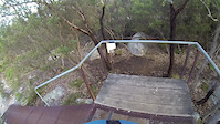
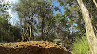
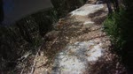
Photos of Albany Mountain Bike
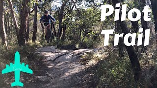
Videos of Albany Mountain Bike

trail: Pilot Trail
2:55 |
86 |
Jul 12, 2019
trail: Albany Downhill
0:42 |
463 |
Aug 12, 2018
trail: Albany Downhill
0:35 |
1103 |
Nov 28, 2013

trail: Albany Downhill
2:21 |
428 |
Jan 27, 2011
trail: Albany Downhill
0:51 |
318 |
Jan 27, 2011

trail: Albany Downhill
2:28 |
301 |
Apr 26, 2023 , Albany
trail: Pilot Trail
2:43 |
856 |
Jul 19, 2020 , Albany

trail: Albany Downhill
0:46 |
884 |
Jan 17, 2020 , Albany
Recent Trail Reports
| status | trail | date | condition | info | user |
|---|---|---|---|---|---|
| Albany Downhill | Jul 5, 2025 @ 3:08pm Jul 5, 2025 | Variable | UzlUu | ||
| Checkers Trail | Jan 11, 2024 @ 12:42am Jan 11, 2024 | Dry | mlhar3 | ||
| Wind Farm Gravel | Dec 24, 2023 @ 2:00am Dec 24, 2023 | Ideal | VSFN | ||
| Sticky Track Full | Jan 9, 2023 @ 6:31pm Jan 9, 2023 | Very Dry | AJvanBurgel | ||
| The Dirty Bush | Jan 9, 2023 @ 6:31pm Jan 9, 2023 | Dry | AJvanBurgel | ||
| Pilot Trail | Jan 10, 2023 @ 2:31am Jan 10, 2023 | Very Dry | AJvanBurgel | ||
| Historic Drain | Nov 5, 2022 @ 1:14pm Nov 5, 2022 | Ideal | gjmackay75 | ||
| Pipeline Track | Nov 5, 2022 @ 8:14pm Nov 5, 2022 | Ideal | gjmackay75 | ||
| Lake Seppings | Sep 18, 2022 @ 12:28am Sep 18, 2022 | Wet | gjmackay75 | ||
| Mt Adelaide Trail | Sep 18, 2022 @ 12:28am Sep 18, 2022 | Ideal | gjmackay75 |
Activity Feed
| username | action | type | title | date |
|---|---|---|---|---|
| sweatytechie | update | trail | activity #97300398 | Jun 19, 2026 @ 12:07am 3 days |
| sweatytechie | update | trail | activity #97300058 and 3 more | Jun 18, 2026 @ 11:54pm 3 days |
| sweatytechie | update | trail | activity #97299972 | Jun 18, 2026 @ 11:52pm 3 days |
| SSyTRG | ridden | trail | activity #92022753 | Apr 5, 2026 @ 6:43pm Apr 5, 2026 |
| Glennherbs | wishlist | route | activity #90238513 | Mar 8, 2026 @ 3:56pm Mar 8, 2026 |
Recent Comments
| username | type | title | comment | date |
|---|---|---|---|---|
| trail | The trail is blocked for rehab | Sep 22, 2023 @ 5:52pm Sep 22, 2023 | ||
| trail | Very good trail with challenging lines. Would... | Apr 21, 2021 @ 9:09pm Apr 21, 2021 | ||
| trail | Riding well. Dry but coping with it well. A... | Dec 25, 2020 @ 10:16pm Dec 25, 2020 | ||
| trail | One of the most convenient and complete trails... | Oct 12, 2020 @ 6:13am Oct 12, 2020 | ||
| trail | https://www.youtube.com/watch?v=XTqCiicAhOI | Jul 19, 2020 @ 2:59am Jul 19, 2020 |
Local Badges
-

10 Blue Trails49 awarded -

Epic Ride Climb 2k44 awarded -

Climbing 10k Badge27 awarded -

Climbing 100k Badge4 awarded -

Epic Ride Descent 2k41 awarded -

Descent 10k Badge27 awarded
Bike & Skill Parks
| name | type | city | rating |
|---|---|---|---|
| Flicks Milpara Pump Track | skill park | Albany |
Activity Type Stats
| activitytype | trails | distance | descent | descent distance | total vertical | rating | global rank | state rank | photos | reports | routes | ridelogs |
|---|---|---|---|---|---|---|---|---|---|---|---|---|
| Mountain Bike | 33 | 15 miles | 2,178 ft | 6 miles | 597 ft | #3,838 | #154 | 41 | 62 | 4 | 12,135 | |
| E-Bike | 26 | 13 miles | 1,545 ft | 5 miles | 597 ft | #3,571 | #168 | 60 | 2 | 788 | ||
| Adaptive Bike | 7 | 7 miles | 486 ft | 2 miles | 364 ft | #221 | #143 | 1 | 10 | |||
| Winter Fat Bike | 13 | 4 miles | 909 ft | 2 miles | 203 ft | #126 | #75 | 44 | ||||
| Hike | 113 | 55 miles | 7,848 ft | 25 miles | 3,245 ft | #1,764 | #57 | 57 | 936 | |||
| Trail Running | 113 | 55 miles | 7,848 ft | 25 miles | 3,245 ft | #2,465 | #72 | 57 | 219 |
Frequently Asked Questions About Albany
▼
What are the best places to ride in Albany?
Albany has 5 areas to explore for mountain biking. The top rated areas are:
▼
What are the highest rated mountain biking trails in Albany?
The highest rated mountain biking trails in Albany are:
- Pilot Trail (4.2/5)
- Albany Downhill (4.2/5)
- Spark Plug to Summit South (4.1/5)
- What Track (4.1/5)
- Water Tank (4/5)
▼
What is the best time of the year to ride in Albany?
Based on ride log data, the most popular months to ride in Albany are:
- December (32 activities)
- April (23 activities)
- January (21 activities)
▼
Where can I park to ride in Albany?
There are 10 parking locations listed in Albany. The most popular parking spots are:
- Mt. Clarence Carpark
- Whaling Cove Carpark
- Mount Toolbrunup Carpark
- Blowholes Trail Carpark
- Mount Trio Walk Carpark
Activities
Trails
Points of Interest
- Natural Bridge Information Board
- Padre White Lookout Viewpoint
- [monument] Desert Mounted Corps Memorial Other
- [monument] Point Possession Monument Other
- Camp Quaranup Camping
- Isthmus Hill - Bald Head Walk Information Board
- Peak Head Viewpoint
- Stony Hill Lookout Viewpoint
- Stony Hill Lookout Viewpoint
- Mount Trio Summit
- 1057 (1,052 m)
- Bluff Knoll East Peak (1,002 m)
- Bluff Knoll (1,001 m)
- By Jake-Hannah
 MPTA & contributors
 - Admins: MTBWA
- #6302 - 11,309 views
- albany activity log | embed map of Albany mountain bike trails | albany mountain biking points of interest
Downloading of trail gps tracks in kml & gpx formats is enabled for Albany.
You must login to download files.