close
-
Layers w
- Weather Layers
- Pro
- Pro
- Pro
- Pro
- Pro
- Pro
- More Layers
- Pro
- Pro
- Pro
- Pro
-
Upgrade to

3D
Trail Conditions
- Unknown
- Snow Groomed
- Snow Packed
- Snow Covered
- Snow Cover Partial
- Freeze/thaw Cycle
- Icy
- Prevalent Mud
- Wet
- Variable
- Ideal
- Dry
- Very Dry
Trail Flow (Ridden Direction)
Trailforks scans users ridelogs to determine the most popular direction each trail is ridden. A good flowing trail network will have most trails flowing in a single direction according to their intension.
The colour categories are based on what percentage of riders are riding a trail in its intended direction.
The colour categories are based on what percentage of riders are riding a trail in its intended direction.
- > 96%
- > 90%
- > 80%
- > 70%
- > 50%
- < 50%
- bi-directional trail
- no data
Trail Last Ridden
Trailforks scans ridelogs to determine the last time a trail was ridden.
- < 2 days
- < 1 week
- < 2 weeks
- < 1 month
- < 6 months
- > 6 months
Trail Ridden Direction
The intended direction a trail should be ridden.
- Downhill Only
- Downhill Primary
- Both Directions
- Uphill Primary
- Uphill Only
- One Direction
Contribute Details
Colors indicate trail is missing specified detail.
- Description
- Photos
- Description & Photos
- Videos
Trail Popularity ?
Trailforks scans ridelogs to determine which trails are ridden the most in the last 9 months.
Trails are compared with nearby trails in the same city region with a possible 25 colour shades.
Think of this as a heatmap, more rides = more kinetic energy = warmer colors.
- most popular
- popular
- less popular
- not popular
ATV/ORV/OHV Filter
Max Vehicle Width
inches
US Cell Coverage
Legend

Radar Time
Activity Recordings
Trailforks uses anonymized public activity data.
?
Activity Recordings
Trailforks uses anonymized public activity data.
?
Personal Heatmap
▶
Activity Types
all
/
none
▶
Options
2
Date range
month
–
Winter Trails
Warning
A routing network for winter maps does not exist. Selecting trails using the winter trails layer has been disabled.
Missing Trails
Most Popular
Least Popular
Trails are colored based on popularity. The more popular a trail is, the more red. Less popular trails trend towards green.
Jump Magnitude Heatmap
Heatmap of where riders jump on trails. Zoom in to see individual jumps, click circles to view jump details.
BC Backroad Status
![map legend]()
Service Road Atlas is a free to use, community-driven service for viewing and creating reports on the numerous back-country service roads around B.C. and Alberta.

Slope Aspect
Direction the slope faces
Trails Deemphasized
Trails are shown in grey.
Only show trails with no bike usage.
Suggested Layers
Based on selected activity type
Save the current map location and zoom level as your default home location whenever this page is loaded.
Save
No description for Allos has been added yet!
Login or register to submit one.
This region uses the Uk/Euro style trail grading system.
Activities Click to view
- Mountain Bike
53 trails
- E-Bike
53 trails
- Adaptive Bike
2 trails
- Horse
0 trails
- Hike
37 trails
- Trail Running
37 trails
Region Details
- 12
- 9
- 7
- 13
- 8
Region Status
Open as of May 7, 2026Local Trail Association
Stats
- Avg Trail Rating
- Trails (view details)
- 50
- Trails Mountain Bike
- 53
- Trails E-Bike
- 53
- Trails Adaptive Bike
- 3
- Trails Hike
- 37
- Trails Trail Running
- 37
- Total Distance
- 48 miles
- Total Descent
- 24,736 ft
- Total Vertical
- 3,711 ft
- Highest Trailhead
- 7,912 ft
- Reports
- 60
- Photos
- 22
- Ridden Counter
- 484
Articles

Race Report: French Enduro Series 2019 - Round 2, Allos
Jun 24, 2019 from pinkbike.com
Check out all the action from the second round of the 2019 French Enduro Series.
Sub Regions
-
Val d’Allos Bike Park
- 7
- 4
- 7
- 2
Popular Allos Mountain Biking Trails
• 100 ★ 5.0 • 2 miles • 466 ft • 63 • • hike
Sentier en montée direction la Montagne de Cheiroueche, quelques passages bien étroit, vue magnifique avant redescente. Nice climbing on a singletrack, some narrow parts, awesome view at the top
• 90 ★ 3.5 • 5,138 ft • 2 ft • 52 •
Popular blue difficulty singletrack. This mountain bike primary trail can be used downhill only. On average it takes 5 minutes to complete this trail.
• 95 ★ 0.0 • 1 mile • 0 ft • 45 •
Popular black difficulty singletrack. This mountain bike primary trail can be used downhill only. On average it takes 5 minutes to complete this trail.
• 85 ★ 3.0 • 2 miles • 14 ft • 40 •
Popular blue difficulty singletrack. This mountain bike primary trail can be used downhill only. On average it takes 13 minutes to complete this trail.
• 100 ★ 0.0 • 2 miles • 0 ft • 39 •
Popular green difficulty singletrack. This mountain bike primary trail can be used downhill only. On average it takes 13 minutes to complete this trail.
• 80 ★ 5.0 • 3,593 ft • 2 ft • 17 •
A nice trail with some steep sections and some drops and jumps.
• 40 ★ 5.0 • 2 miles • 18 ft • 14 •
Moderately popular green difficulty singletrack. This multi-use trail can be used downhill only. On average it takes 11 minutes to complete this trail.
• 5 ★ 2.0 • 2,070 ft • 0 ft • 13 •
Race trail from the 2015 French Enduro Championship / Spéciale 2 du CDF Enduro 2015
Allos Mountain Bike Routes
15 miles • 1,742 ft • 0 • Point to Point •
This is the first part of the TransVerdon Great Crossing for mtb, created with the help of the french...
7 miles • 1,624 ft • 0 • Loop •
Good uphill on a dirtroad then a beautiful singletrack downhill in a Mélézin.
6 miles • 1,003 ft • 0 • Loop •
7 miles • 1,164 ft • 1 • Loop •
14 miles • 2,782 ft • 0 • Loop •
Varied, intense and beautiful journey into the Lance valley.
Photos of Allos Mountain Bike
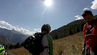
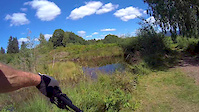
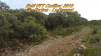
Videos of Allos Mountain Bike
trail: Baisse De Prenier
9:38 |
180 |
Jan 18, 2019
trail: Le Plateau
3:53 |
44 |
Dec 7, 2017
trail: Le Plateau
12:37 |
100 |
Jun 4, 2016

trail: Le Plateau
5:12 |
150 |
Nov 8, 2010
Recent Trail Reports
| status | trail | date | condition | info | user |
|---|---|---|---|---|---|
| Les Crêtes d'Allos | Aug 31, 2025 @ 10:04am Aug 31, 2025 | Ideal | 4BxGPH | ||
| Baisse De Prenier | Aug 31, 2025 @ 10:04am Aug 31, 2025 | Ideal | 4BxGPH | ||
| Prémin | Aug 14, 2025 @ 9:17pm Aug 14, 2025 | Ideal | MaelVeloVerdon | ||
| Herbe Blanche | Jul 11, 2025 @ 11:57am Jul 11, 2025 | Ideal | MaelVeloVerdon | ||
| Les Champons | Aug 15, 2024 @ 3:12pm Aug 15, 2024 | Variable | lbonvarl | ||
| Clos Bertrand | Aug 15, 2024 @ 3:12pm Aug 15, 2024 | Variable | lbonvarl | ||
| La Thune | Aug 15, 2024 @ 3:12pm Aug 15, 2024 | Variable | lbonvarl | ||
| Piste de la Vacheresse | Jul 24, 2024 @ 11:02pm Jul 24, 2024 | Ideal | freerider48 TRAILFORKS | ||
| Piste Haute Colette | Jul 24, 2024 @ 11:02pm Jul 24, 2024 | Ideal | freerider48 TRAILFORKS | ||
| Chadoulin | Jul 24, 2024 @ 11:01pm Jul 24, 2024 | Ideal | freerider48 TRAILFORKS |
Activity Feed
| username | action | type | title | date |
|---|---|---|---|---|
| provencemb | add | trail | activity #96668343 and 1 more | Jun 10, 2026 @ 6:23am Jun 10, 2026 |
| provencemb | add | trail | activity #96666806 and 6 more | Jun 10, 2026 @ 5:49am Jun 10, 2026 |
| zestyman | add | photo | activity #94012350 and 4 more | May 4, 2026 @ 2:31am May 4, 2026 |
| zestyman | add | report | activity #94008743 | May 3, 2026 @ 11:40pm May 3, 2026 |
| zestyman | vote | trail | activity #94008617 | May 3, 2026 @ 11:34pm May 3, 2026 |
Recent Comments
| username | type | title | comment | date |
|---|---|---|---|---|
| trail | Un pur délice malgré tous les branchages... | Jun 7, 2022 @ 9:47am Jun 7, 2022 | ||
| trail | Dies ist noch der beste Trail im insgesamt... | Aug 24, 2018 @ 4:59am Aug 24, 2018 |
Local Badges
-

Epic Mountain Bike Climb 2k0 awarded -

Climbing 10k Badge0 awarded -

Mountain Biking 100k Badge0 awarded -

Epic Ride Descent 2k0 awarded -

Descent 10k Badge0 awarded -

Descent 100k Badge0 awarded
Bike & Skill Parks
| name | type | city | rating |
|---|---|---|---|
| Val d’Allos Bike Park | bike park | Allos |
Activity Type Stats
| activitytype | trails | distance | descent | descent distance | total vertical | rating | global rank | state rank | photos | reports | routes | ridelogs |
|---|---|---|---|---|---|---|---|---|---|---|---|---|
| Mountain Bike | 53 | 48 miles | 24,734 ft | 36 miles | 3,711 ft | #3,069 | #87 | 88 | 61 | 9 | 635 | |
| E-Bike | 53 | 48 miles | 24,734 ft | 36 miles | 3,711 ft | #2,072 | #112 | 59 | 2 | 190 | ||
| Adaptive Bike | 2 | #359 | #207 | |||||||||
| Hike | 37 | 11 miles | 5,955 ft | 9 miles | 3,241 ft | #4,773 | #151 | 46 | 273 | |||
| Trail Running | 37 | 11 miles | 5,955 ft | 9 miles | 3,241 ft | #4,584 | #163 | 46 | 31 |
Frequently Asked Questions About Allos
▼
What are the best places to ride in Allos?
Allos has 1 areas to explore for mountain biking. The top rated areas are:
▼
What are the highest rated mountain biking trails in Allos?
The highest rated mountain biking trails in Allos are:
- Rocheline (4.1/5)
- Baisse De Prenier (4.1/5)
- Prémin (4.1/5)
- La Thune (3.9/5)
- La Serre (3.8/5)
▼
What is the best time of the year to ride in Allos?
Based on ride log data, the most popular months to ride in Allos are:
- June (9 activities)
- August (7 activities)
- September (4 activities)
▼
Where can I park to ride in Allos?
Check the Allos trail map for trailhead and parking information. Community members regularly update access and parking details for trails in the area.
- By tomzaniroli
 TRAILFORKS TFFRANCE & contributors
 - Admins: tomzaniroli, provencemb
- #23349 - 1,683 views
- allos activity log | embed map of Allos mountain bike trails |
Downloading of trail gps tracks in kml & gpx formats is enabled for Allos.
You must login to download files.