close
-
Layers w
- Weather Layers
- Pro
- Pro
- Pro
- Pro
- Pro
- Pro
- More Layers
- Pro
- Pro
- Pro
- Pro
-
Upgrade to

3D
Trail Conditions
- Unknown
- Snow Groomed
- Snow Packed
- Snow Covered
- Snow Cover Partial
- Freeze/thaw Cycle
- Icy
- Prevalent Mud
- Wet
- Variable
- Ideal
- Dry
- Very Dry
Trail Flow (Ridden Direction)
Trailforks scans users ridelogs to determine the most popular direction each trail is ridden. A good flowing trail network will have most trails flowing in a single direction according to their intension.
The colour categories are based on what percentage of riders are riding a trail in its intended direction.
The colour categories are based on what percentage of riders are riding a trail in its intended direction.
- > 96%
- > 90%
- > 80%
- > 70%
- > 50%
- < 50%
- bi-directional trail
- no data
Trail Last Ridden
Trailforks scans ridelogs to determine the last time a trail was ridden.
- < 2 days
- < 1 week
- < 2 weeks
- < 1 month
- < 6 months
- > 6 months
Trail Ridden Direction
The intended direction a trail should be ridden.
- Downhill Only
- Downhill Primary
- Both Directions
- Uphill Primary
- Uphill Only
- One Direction
Contribute Details
Colors indicate trail is missing specified detail.
- Description
- Photos
- Description & Photos
- Videos
Trail Popularity ?
Trailforks scans ridelogs to determine which trails are ridden the most in the last 9 months.
Trails are compared with nearby trails in the same city region with a possible 25 colour shades.
Think of this as a heatmap, more rides = more kinetic energy = warmer colors.
- most popular
- popular
- less popular
- not popular
ATV/ORV/OHV Filter
Max Vehicle Width
inches
US Cell Coverage
Legend

Radar Time
Activity Recordings
Trailforks uses anonymized public activity data.
?
Activity Recordings
Trailforks uses anonymized public activity data.
?
Personal Heatmap
▶
Activity Types
all
/
none
▶
Options
2
Date range
month
–
Winter Trails
Warning
A routing network for winter maps does not exist. Selecting trails using the winter trails layer has been disabled.
Missing Trails
Most Popular
Least Popular
Trails are colored based on popularity. The more popular a trail is, the more red. Less popular trails trend towards green.
Jump Magnitude Heatmap
Heatmap of where riders jump on trails. Zoom in to see individual jumps, click circles to view jump details.
BC Backroad Status
![map legend]()
Service Road Atlas is a free to use, community-driven service for viewing and creating reports on the numerous back-country service roads around B.C. and Alberta.

Slope Aspect
Direction the slope faces
Trails Deemphasized
Trails are shown in grey.
Only show trails with no bike usage.
Suggested Layers
Based on selected activity type
Save the current map location and zoom level as your default home location whenever this page is loaded.
Save
No description for Alma has been added yet!
Login or register to submit one.
Activities Click to view
- Mountain Bike
31 trails
- Gravel Bike
0 trails
- Adaptive Bike
0 trails
- Hike
61 trails
- Trail Running
61 trails
Region Details
- 4
- 1
- 11
- 7
- 7
Region Status
Open as of Apr 26, 2026Local Trail Association
Stats
- Avg Trail Rating
- Trails (view details)
- 34
- Trails Mountain Bike
- 31
- Trails E-Bike
- 1
- Trails Hike
- 61
- Trails Trail Running
- 61
- Total Distance
- 77 miles
- Total Descent
- 17,452 ft
- Total Vertical
- 1,186 ft
- Highest Trailhead
- 1,210 ft
- Reports
- 267
- Photos
- 133
- Ridden Counter
- 4,635
Articles
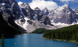
The 10 Most Beautiful National Parks in Canada
Jun 17, 2024 from outsideonline.com
Spectacular mountains and deep fjords, powder-blue lakes and sea stacks: here’s your bucket list of national parks to visit up north
Sub Regions
-
Fundy National Park
- 1
- 11
- 7
- 7
Popular Alma Mountain Biking Trails
• 100 ★ 4.8 • 3 miles • 94 ft • 382 •
Recently buffed by Parks Canada to IMBA standards. Watch for hikers as you can easily pick up speed in sections.
• 95 ★ 4.5 • 3,025 ft • 13 ft • 265 •
Popular blue difficulty singletrack. This mountain bike primary trail. On average it takes 3 minutes to complete this trail.
• 90 ★ 1.0 • 1,778 ft • 13 ft • 217 •
Popular green difficulty singletrack. This mountain bike primary trail and has a easy overall physical rating with a 13 ft blue climb. On average it takes 2 minutes to complete this trail.
• 60 ★ 4.0 • 2 miles • 143 ft • 211 •
Moderately popular black diamond difficulty singletrack. This mountain bike primary trail and has a moderate overall physical rating with a 143 ft blue climb. It features berm and bridge. On average it takes 19 minutes to complete this trail.
• 100 ★ 4.0 • 3 miles • 240 ft • 205 •
IMBA loop built by Parks Canada. Suitable for hybrid or 'cross bikes. A good place to introduce young kids to mountain biking.
• 65 ★ 0.0 • 5,095 ft • 84 ft • 190 •
Moderately popular green difficulty singletrack. This mountain bike primary trail and has a easy overall physical rating with a 84 ft green climb. On average it takes 9 minutes to complete this trail.
• 80 ★ 4.0 • 2,628 ft • 56 ft • 180 •
Popular green difficulty singletrack. This mountain bike primary trail. On average it takes 5 minutes to complete this trail.
• 80 ★ 4.2 • 6 miles • 1,409 ft • 157 •
Popular black diamond difficulty singletrack. This multi-use trail can be used both directions and has a hard overall physical rating with a 1,409 ft black diamond climb. On average it takes 1 hour31 minutes to complete this trail.
Alma Mountain Bike Routes
5 miles • 249 ft • 2 •
Ride from Chignecto Recreation Area pavilion to Point Wolfe parking lot at trailhead VIA and Tippenlot.
7 miles • 306 ft • 2 •
Ride from Chignecto Recreation Area ride centre pavilion to Point Wolfe Parking lot at trailhead VIA...
• 15 miles • 4,622 ft • 2 •
• 12 miles • 1,624 ft • 0 •
• 5 miles • 423 ft • 5 •
• 7 miles • 1,096 ft • 2 •
Photos of Alma Mountain Bike
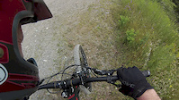
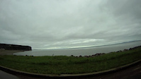
Videos of Alma Mountain Bike
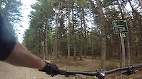
trail: Peregrine
3:44 |
172 |
Jul 24, 2020

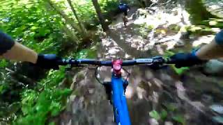
trail: Green Snake
0:50 |
341 |
Jun 25, 2018
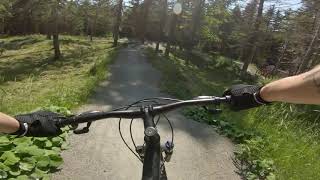
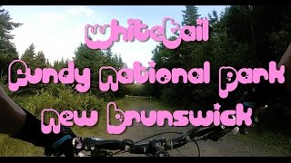
trail: Whitetail
14:14 |
513 |
Jul 25, 2017
trail: Green Snake
0:32 |
439 |
Jun 10, 2011
0:40 |
1540 |
Jul 14, 2020
youtuber
![Mountain Biking: The Green Snake, Alma, New...]()

trail: Green Snake
6:18 |
650 |
Jan 25, 2020 , Alma
trail: Whitetail
14:57 |
1274 |
Oct 6, 2019 , Alma
Recent Trail Reports
| status | trail | date | condition | info | user |
|---|---|---|---|---|---|
| Goose River | Apr 26, 2026 @ 1:28pm (America/Moncton) Apr 26, 2026 | Variable | gojo | ||
| Laverty Road | Apr 19, 2026 @ 12:57pm (America/Moncton) Apr 19, 2026 | Wet | gojo | ||
| Whitetail | Mar 28, 2026 @ 2:36pm (America/Moncton) Mar 28, 2026 | Snow Packed | gojo | ||
| Tippen Lot | Jan 10, 2026 @ 12:39pm (America/Moncton) Jan 10, 2026 | Snow Covered | gojo | ||
| Hasting's Auto trail | Nov 9, 2025 @ 12:21pm (America/Moncton) Nov 9, 2025 | Ideal | gojo | ||
| Cassiopeia | Nov 9, 2025 @ 12:21pm (America/Moncton) Nov 9, 2025 | Ideal | gojo | ||
| Orion | Sep 14, 2024 @ 12:35pm Sep 14, 2024 | Ideal | gojo | ||
| Black Hole | Jul 27, 2024 @ 6:30am Jul 27, 2024 | Dry | RockyJo1 | ||
| Ursa Major | Sep 23, 2023 @ 6:39am Sep 23, 2023 | Ideal | Sebastien685 | ||
| Lyra | Sep 23, 2023 @ 6:39am Sep 23, 2023 | Ideal | Sebastien685 |
Activity Feed
| username | action | type | title | date |
|---|---|---|---|---|
| pilafchef | wishlist | trail | activity #97327681 | Jun 19, 2026 @ 10:18am Jun 19, 2026 |
| Llammerss | wishlist | trail | activity #97263123 | Jun 18, 2026 @ 10:53am Jun 18, 2026 |
| gojo | add | report | activity #93479658 | Apr 26, 2026 @ 2:40pm Apr 26, 2026 |
| gojo | add | report | activity #92980487 | Apr 19, 2026 @ 2:17pm Apr 19, 2026 |
| gojo | add | report | activity #91480214 | Mar 28, 2026 @ 4:16pm Mar 28, 2026 |
Recent Comments
| username | type | title | comment | date |
|---|---|---|---|---|
| trail | A local told me about this drill while eating... | Sep 19, 2024 @ 2:20pm Sep 19, 2024 | ||
| trail | Sehr flowig und spaßig. Im oberen Teil aber... | Sep 11, 2023 @ 10:14am Sep 11, 2023 | ||
| trail | Plus difficile au début, rocailleux. Il faut... | Sep 7, 2023 @ 4:14pm Sep 7, 2023 | ||
| report | Why not have a connector to hit Goose river... | Sep 27, 2021 @ 9:29pm Sep 27, 2021 | ||
| trail | Good return road. Watch out for speeding... | Sep 12, 2021 @ 3:49pm Sep 12, 2021 |
Local Badges
-

10 Blue Trails53 awarded -

Epic Ride Climb 2k13 awarded -

Climbing 10k Badge8 awarded -

Climbing 100k Badge0 awarded -

Epic Ride Descent 2k17 awarded -

Descent 10k Badge12 awarded
Bike & Skill Parks
| name | type | city | rating |
|---|---|---|---|
| Fundy Pumptrack | skill park | Alma |
Activity Type Stats
| activitytype | trails | distance | descent | descent distance | total vertical | rating | global rank | state rank | photos | reports | routes | ridelogs |
|---|---|---|---|---|---|---|---|---|---|---|---|---|
| Mountain Bike | 31 | 50 miles | 8,051 ft | 23 miles | 1,188 ft | #3,837 | #14 | 132 | 267 | 2 | 3,256 | |
| E-Bike | 1 | 6 miles | 1,516 ft | 3 miles | 627 ft | 241 | 92 | |||||
| Hike | 61 | 77 miles | 17,451 ft | 36 miles | 1,188 ft | #2,491 | #4 | 1 | 261 | 1,528 | ||
| Trail Running | 61 | 77 miles | 17,451 ft | 36 miles | 1,188 ft | #2,971 | #4 | 261 | 198 |
Frequently Asked Questions About Alma
▼
What are the best places to ride in Alma?
Alma has 1 areas to explore for mountain biking. The top rated areas are:
▼
What are the highest rated mountain biking trails in Alma?
The highest rated mountain biking trails in Alma are:
- Whitetail (4.5/5)
- Green Snake (4.2/5)
- Peregrine (4.1/5)
- Goose River (4.1/5)
- Black Horse (4/5)
▼
What is the best time of the year to ride in Alma?
Based on ride log data, the most popular months to ride in Alma are:
- August (90 activities)
- July (86 activities)
- September (62 activities)
▼
Where can I park to ride in Alma?
Trails
- By ChrisNorfolk
 SJC RVC MTBM & contributors
 - Admins: ChrisNorfolk, themikekowalski, alexisberube
- #8599 - 5,368 views
- alma activity log | embed map of Alma mountain bike trails | alma mountain biking points of interest
Downloading of trail gps tracks in kml & gpx formats is enabled for Alma.
You must login to download files.