close
-
Layers w
- Weather Layers
- Pro
- Pro
- Pro
- Pro
- Pro
- Pro
- More Layers
- Pro
- Pro
- Pro
- Pro
-
Upgrade to

3D
Trail Conditions
- Unknown
- Snow Groomed
- Snow Packed
- Snow Covered
- Snow Cover Partial
- Freeze/thaw Cycle
- Icy
- Prevalent Mud
- Wet
- Variable
- Ideal
- Dry
- Very Dry
Trail Flow (Ridden Direction)
Trailforks scans users ridelogs to determine the most popular direction each trail is ridden. A good flowing trail network will have most trails flowing in a single direction according to their intension.
The colour categories are based on what percentage of riders are riding a trail in its intended direction.
The colour categories are based on what percentage of riders are riding a trail in its intended direction.
- > 96%
- > 90%
- > 80%
- > 70%
- > 50%
- < 50%
- bi-directional trail
- no data
Trail Last Ridden
Trailforks scans ridelogs to determine the last time a trail was ridden.
- < 2 days
- < 1 week
- < 2 weeks
- < 1 month
- < 6 months
- > 6 months
Trail Ridden Direction
The intended direction a trail should be ridden.
- Downhill Only
- Downhill Primary
- Both Directions
- Uphill Primary
- Uphill Only
- One Direction
Contribute Details
Colors indicate trail is missing specified detail.
- Description
- Photos
- Description & Photos
- Videos
Trail Popularity ?
Trailforks scans ridelogs to determine which trails are ridden the most in the last 9 months.
Trails are compared with nearby trails in the same city region with a possible 25 colour shades.
Think of this as a heatmap, more rides = more kinetic energy = warmer colors.
- most popular
- popular
- less popular
- not popular
ATV/ORV/OHV Filter
Max Vehicle Width
inches
US Cell Coverage
Legend

Radar Time
Activity Recordings
Trailforks uses anonymized public activity data.
?
Activity Recordings
Trailforks uses anonymized public activity data.
?
Personal Heatmap
▶
Activity Types
all
/
none
▶
Options
2
Date range
month
–
Winter Trails
Warning
A routing network for winter maps does not exist. Selecting trails using the winter trails layer has been disabled.
Missing Trails
Most Popular
Least Popular
Trails are colored based on popularity. The more popular a trail is, the more red. Less popular trails trend towards green.
Jump Magnitude Heatmap
Heatmap of where riders jump on trails. Zoom in to see individual jumps, click circles to view jump details.
BC Backroad Status
![map legend]()
Service Road Atlas is a free to use, community-driven service for viewing and creating reports on the numerous back-country service roads around B.C. and Alberta.

Slope Aspect
Direction the slope faces
Trails Deemphasized
Trails are shown in grey.
Only show trails with no bike usage.
Suggested Layers
Based on selected activity type
Save the current map location and zoom level as your default home location whenever this page is loaded.
SavePopular Trail Networks
view all areas »
No description for Almería has been added yet!
Login or register to submit one.
This region uses the Uk/Euro style trail grading system.
Activities Click to view
- Mountain Bike
466 trails
- E-Bike
466 trails
- Horse
15 trails
- Hike
464 trails
- Trail Running
465 trails
- Dirtbike/Moto
8 trails
Region Details
- 200
- 18
- 181
- 54
- 7
Stats
- Avg Trail Rating
- Trails (view details)
- 460
- Trails Mountain Bike
- 466
- Trails E-Bike
- 466
- Trails Horse
- 15
- Trails Hike
- 464
- Trails Trail Running
- 465
- Trails Dirtbike/Moto
- 8
- Total Distance
- 441 miles
- Total Descent
- 143,122 ft
- Total Vertical
- 6,847 ft
- Highest Trailhead
- 6,853 ft
- Reports
- 140
- Photos
- 50
- Ridden Counter
- 3,077
Sub Regions
- Adra (14)
- Almería (416)
- Alpujarra Almeriense (49)
- Desierto de Tabernas (114)
- El Zarzalón (14)
- Los Vélez (100)
- Sierra Alhamilla (40)
- Sierra Cabrera (14)
- Sierra de Gádor (61)
- Sierra de Los Filabres (16)
- San José (34)
- Cabo de Gata (35)
- Sierra Los Filabres (0)
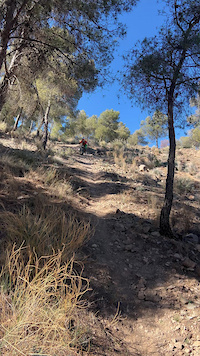
Popular Almería Mountain Biking Trails
• 100 ★ 3.0 • 1,217 ft • 9 ft • 117 •
This downhill starts from the highest point of the trail along the Cerro Cala Higuera towards viewpoint. There the surface is stone, with some steps and loose rocks. After the viewpoint, the trail turns and the descent continues over a...
• 100 ★ 3.5 • 3,369 ft • 47 ft • 108 •
This trail starts from the highest point of the trail by Cerro Cala Higuera. It's a fast and technical descent over a rocky surface with many loose rocks and some small drops. Be careful when the path comes too close to the edge of the...
• 85 ★ 4.0 • 4,252 ft • 5 ft • 59 •
Popular blue difficulty singletrack. This multi-use trail can be used both directions and has a moderate overall physical rating with a 5 ft blue climb. Trail visibility is always easy to follow. On average it takes 6 minutes to complete this trail.
• 100 ★ 0.0 • 2,897 ft • 86 ft • 28 •
Popular blue difficulty singletrack. This multi-use trail can be used both directions and has a moderate overall physical rating with a 86 ft blue climb. Trail visibility is sometimes hard to follow. On average it takes 9 minutes to complete this trail.
• 80 ★ 5.0 • 2,438 ft • 2 ft • 26 •
Popular black difficulty singletrack. This multi-use trail can be used downhill only. It features berm, drop, gap jump and rock garden. On average it takes 5 minutes to complete this trail.
• 95 ★ 4.5 • 2,618 ft • 74 ft • 21 •
Sendero azul exceptuando un cortado con recepción en rampa de mas de 150 cm
• 95 ★ 0.0 • 1 mile • 0 ft • 21 •
Popular blue difficulty singletrack. This multi-use trail can be used downhill primary and has a moderate overall physical rating with a 0 ft blue climb. It features drop, jump and rock garden. Trail visibility is always easy to follow.
Almería Mountain Bike Routes
28 miles • 1,604 ft • 1 • Point to Point •
This section started travelling over Sendero de Loma Pelada, that is the track of a projected road between...
28 miles • 5,044 ft • 1 •
Ruta desde instincion bajando por el barranco hacia barriada de alcora
6 miles • 1,712 ft • 1 •
verea antigua mitica de instincion que sube hacia los morales
★ 4.0 • 14 miles • 2,348 ft • 0 •
Bajada rapida por caminos y senderos. No muy tecnica, si rapida.
7 miles • 2,145 ft • 2 •
iNSTINCION 4 VOLVIENDO POR LA PISTA DE RAGOL
13 miles • 2,839 ft • 2 •
Subida al campillo y bajada po el barranco de las losas
Photos of Almería Mountain Bike
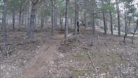
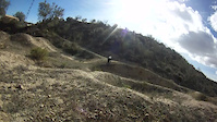
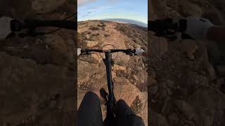
Videos of Almería Mountain Bike
trail: Alhama 2
0:19 |
8 |
Feb 2, 2025
trail: La Antena
3:19 |
98 |
Jul 6, 2016
trail: Mini DH
2:11 |
236 |
Sep 18, 2014
trail: Enlace Goyas
14:26 |
108 |
Feb 28, 2025 , Almería
trail: Coasttrail
8:40 |
131 |
Apr 13, 2024 , San José
trail: Mini Hollywood
4:17 |
358 |
Jan 16, 2023 , Almería
trail: Coasttrail
0:57 |
170 |
Nov 11, 2022 , San José
3:39 |
98 |
Nov 11, 2022
Recent Trail Reports
| status | trail | date | condition | info | user |
|---|---|---|---|---|---|
| Sendero Loma Pelada Cabo de Gata | Apr 27, 2025 @ 8:51am Apr 27, 2025 | Very Dry | piyayojuanjo | ||
| Cerro Cala Higuera a Barranco Cala Tomate Cabo de Gata | Apr 27, 2025 @ 8:51am Apr 27, 2025 | Very Dry | piyayojuanjo | ||
| Punta Cala Higuera Cabo de Gata | Apr 27, 2025 @ 8:51am Apr 27, 2025 | Dry | piyayojuanjo | ||
| Escullos-San José Cabo de Gata | Apr 27, 2025 @ 8:51am Apr 27, 2025 | Very Dry | piyayojuanjo | ||
| Barranco del Pasillo Alpujarra Almeriense | Feb 2, 2025 @ 11:49pm Feb 2, 2025 | Unknown | Elof84 | ||
| Peñas Negras Sierra de Gádor | Dec 23, 2024 @ 1:16pm Dec 23, 2024 | Ideal | DrKlaus | ||
| Cerro del Ave María Cabo de Gata | Aug 23, 2024 @ 7:03pm Aug 23, 2024 | Very Dry | yeahhhh | ||
| No Name Desierto de Tabernas | Jun 3, 2024 @ 11:45am Jun 3, 2024 | Very Dry | rafaello79alm | ||
| Coasttrail Cabo de Gata | Apr 13, 2024 @ 12:28pm Apr 13, 2024 | Very Dry | Jmpozo91 | ||
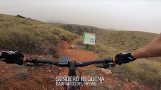
| Requena Cabo de Gata | Apr 13, 2024 @ 12:28pm Apr 13, 2024 | Very Dry | Jmpozo91 |
Activity Feed
| username | action | type | title | date |
|---|---|---|---|---|
| TrailJoe26 | add | photo | activity #96786965 | Jun 11, 2026 @ 11:34pm Jun 11, 2026 |
| juanx | add | trail | activity #96785492 | Jun 11, 2026 @ 10:35pm Jun 11, 2026 |
| juanx | update | trail | activity #96785451 and 1 more | Jun 11, 2026 @ 10:33pm Jun 11, 2026 |
| TrailJoe26 | add | trail | activity #96785433 | Jun 11, 2026 @ 10:33pm Jun 11, 2026 |
| AMG | update | trail | activity #95695797 | May 28, 2026 @ 3:47am May 28, 2026 |
Recent Comments
| username | type | title | comment | date |
|---|---|---|---|---|
| trail | Tricky but do-able this year! | Jan 13, 2026 @ 1:06am Jan 13, 2026 | ||
| trail | Run and rained out, to much rollin’ rocks | Jan 13, 2026 @ 1:04am Jan 13, 2026 | ||
| trail | Very nice! Tricky and technical, stay away... | Jan 13, 2026 @ 12:56am Jan 13, 2026 | ||
| trail | Sur OSM le nom de ce sentier est REQUENA sur... | Jan 12, 2026 @ 10:29am Jan 12, 2026 | ||
| trail | Sentier technique avec beaucoup d'arbustes et... | Jan 12, 2026 @ 10:19am Jan 12, 2026 |
Local Badges
-

Epic Ride Descent 2k15 awarded -

Big Ride 30k179 awarded -

Descent 100k Badge0 awarded -

Descent 10k Badge3 awarded -

Epic Ride 50k114 awarded -

Mountain Biking 100k Badge0 awarded
Bike & Skill Parks
| name | type | city | rating |
|---|---|---|---|
| Campillo La Gaida | skill park | Almería | |
| Pumptrack Los Pinos | skill park | Almería | |
| Campillo Daniels Trails | skill park | Almería | |
| Roquetas de mar motocross | skill park | Almería |
Local Trail Supporters
- Team Pedrusco
Activity Type Stats
| activitytype | trails | distance | descent | descent distance | total vertical | rating | global rank | state rank | photos | reports | routes | ridelogs |
|---|---|---|---|---|---|---|---|---|---|---|---|---|
| Mountain Bike | 466 | 441 miles | 143,123 ft | 251 miles | 6,847 ft | 50 | 138 | 33 | 9,310 | |||
| E-Bike | 466 | 441 miles | 143,123 ft | 251 miles | 6,847 ft | 114 | 11 | 1,458 | ||||
| Horse | 15 | 15 miles | 2,474 ft | 7 miles | 3,652 ft | 15 | ||||||
| Hike | 464 | 437 miles | 142,008 ft | 249 miles | 6,847 ft | 132 | 113 | 407 | ||||
| Trail Running | 465 | 437 miles | 142,080 ft | 249 miles | 6,847 ft | 131 | 161 | |||||
| Dirtbike/Moto | 8 | 14 miles | 2,651 ft | 7 miles | 2,927 ft | 13 |
Frequently Asked Questions About Almería
▼
What are the best places to ride in Almería?
Almería has 17 areas to explore for mountain biking. The top rated areas are:
▼
What are the highest rated mountain biking trails in Almería?
The highest rated mountain biking trails in Almería are:
- Pandémica 6.0 (4.3/5)
- BC (4.2/5)
- Instinción 2 (4.2/5)
- Nuevo Mundo - Fuente Alta (4.2/5)
- Bolaños Upper (4.1/5)
▼
What is the best time of the year to ride in Almería?
Based on ride log data, the most popular months to ride in Almería are:
- September (28 activities)
- August (24 activities)
- February (20 activities)
▼
What is the longest trail in Almería?
The longest trail in Almería is SL-A 145 La Umbría de la Virgen at 4.6 miles. View all trails sorted by distance.
Activities
Trails
- By brenthillier
 NSMBA TRAILFORKS & contributors
 - Admins: mul0w, elyari, AMG, juanx, Angelreing, AMG, juanx
- #8832 - 3,276 views
- almería activity log | embed map of Almería mountain bike trails | almería mountain biking points of interest
Downloading of trail gps tracks in kml & gpx formats is enabled for Almería.
You must login to download files.