close
-
Layers w
- Weather Layers
- Pro
- Pro
- Pro
- Pro
- Pro
- Pro
- More Layers
- Pro
- Pro
- Pro
- Pro
-
Upgrade to

3D
Trail Conditions
- Unknown
- Snow Groomed
- Snow Packed
- Snow Covered
- Snow Cover Partial
- Freeze/thaw Cycle
- Icy
- Prevalent Mud
- Wet
- Variable
- Ideal
- Dry
- Very Dry
Trail Flow (Ridden Direction)
Trailforks scans users ridelogs to determine the most popular direction each trail is ridden. A good flowing trail network will have most trails flowing in a single direction according to their intension.
The colour categories are based on what percentage of riders are riding a trail in its intended direction.
The colour categories are based on what percentage of riders are riding a trail in its intended direction.
- > 96%
- > 90%
- > 80%
- > 70%
- > 50%
- < 50%
- bi-directional trail
- no data
Trail Last Ridden
Trailforks scans ridelogs to determine the last time a trail was ridden.
- < 2 days
- < 1 week
- < 2 weeks
- < 1 month
- < 6 months
- > 6 months
Trail Ridden Direction
The intended direction a trail should be ridden.
- Downhill Only
- Downhill Primary
- Both Directions
- Uphill Primary
- Uphill Only
- One Direction
Contribute Details
Colors indicate trail is missing specified detail.
- Description
- Photos
- Description & Photos
- Videos
Trail Popularity ?
Trailforks scans ridelogs to determine which trails are ridden the most in the last 9 months.
Trails are compared with nearby trails in the same city region with a possible 25 colour shades.
Think of this as a heatmap, more rides = more kinetic energy = warmer colors.
- most popular
- popular
- less popular
- not popular
ATV/ORV/OHV Filter
Max Vehicle Width
inches
US Cell Coverage
Legend

Radar Time
Activity Recordings
Trailforks uses anonymized public activity data.
?
Activity Recordings
Trailforks uses anonymized public activity data.
?
Personal Heatmap
▶
Activity Types
all
/
none
▶
Options
2
Date range
month
–
Winter Trails
Warning
A routing network for winter maps does not exist. Selecting trails using the winter trails layer has been disabled.
Missing Trails
Most Popular
Least Popular
Trails are colored based on popularity. The more popular a trail is, the more red. Less popular trails trend towards green.
Jump Magnitude Heatmap
Heatmap of where riders jump on trails. Zoom in to see individual jumps, click circles to view jump details.
BC Backroad Status
![map legend]()
Service Road Atlas is a free to use, community-driven service for viewing and creating reports on the numerous back-country service roads around B.C. and Alberta.

Slope Aspect
Direction the slope faces
Trails Deemphasized
Trails are shown in grey.
Only show trails with no bike usage.
Suggested Layers
Based on selected activity type
Save the current map location and zoom level as your default home location whenever this page is loaded.
SaveWhile collectively known as Alpine it is actually a combination of parcels with many different owners and land managers. This makes advocacy and access difficult. JORBA Chapter, Palisades MTB has been working with a variety of land managers to improve access.
Region Supporters & Maintainers
![]()
Bicycle-WorkshopSponsor
Activities Click to view
- Mountain Bike
91 trails
- E-Bike
37 trails
- Gravel Bike
0 trails
- Adaptive Bike
- Hike
94 trails
- Trail Running
93 trails
- Snowshoe
9 trails
- Backcountry Ski
9 trails
- Nordic Ski
21 trails
Region Details
- 28
- 36
- 18
- 9
Region Status
Open as of 3 daysStats
- Avg Trail Rating
- Trails (view details)
- 94
- Trails Mountain Bike
- 91
- Trails E-Bike
- 37
- Trails Hike
- 94
- Trails Trail Running
- 93
- Trails Snowshoe
- 9
- Trails Backcountry Ski
- 9
- Trails Nordic Ski
- 21
- Total Distance
- 63 miles
- Total Descent Distance
- 26 miles
- Total Descent
- 7,254 ft
- Total Vertical
- 545 ft
- Highest Trailhead
- 546 ft
- Reports
- 1,463
- Photos
- 66
- Ridden Counter
- 15,515
Sub Regions
-
Bergen Alpine
-
Camp Alpine
- 12
- 13
- 8
-
Palisades Interstate Park
-
PIPC Alpine
Popular Alpine Mountain Biking Trails
• 100 ★ 5.0 • 1,539 ft • 0 ft • 444 •
Popular green difficulty family friendly alpine singletrack. This multi-use trail can be used both directions and has a easy overall physical rating with a 0 ft green climb. Trail visibility is always easy to follow. On average it takes 3 minutes to complete this trail.
• 100 ★ 0.0 • 643 ft • 0 ft • 431 •
Progression rock drop/step up with some flow and a rock roller jump midway.
• 95 ★ 3.5 • 1,939 ft • 12 ft • 392 •
Popular blue difficulty singletrack. This multi-use trail can be used both directions. On average it takes 3 minutes to complete this trail.
• 95 ★ 4.7 • 1,634 ft • 0 ft • 392 •
A short blast that's only .2 miles long with a handful of jumps, a small log over, a few rock faces and a steep decline at the end in a fast area littered with rocks. There are a few tight sections where trees get close during fast...
• 100 ★ 0.0 • 1,086 ft • 77 ft • 378 •
Popular green difficulty singletrack. This multi-use trail can be used both directions. On average it takes 3 minutes to complete this trail.
• 100 ★ 3.0 • 4,137 ft • 76 ft • 362 •
Most southern trail in the forest around Alpine NJ.
• 80 ★ 4.0 • 1 mile • 78 ft • 355 •
Highly rated popular black diamond difficulty singletrack. This multi-use trail can be used downhill primary and has a hard overall physical rating with a 78 ft black diamond climb. It features drop, jump, log ride, rock face, rock garden and skinny. On average it takes 6 minutes to complete this trail.
• 70 ★ 4.0 • 2,110 ft • 0 ft • 324 •
Another fun descent on the north side of the stream that kicks out to the /Ruckman road. There is a very steep ravine section that is almost always filled with scree and leaves at the fastest section. Also, on the weekends, especially...
Alpine Mountain Bike Routes
★ 3.4 • 12 miles • 1,627 ft • 4 • Loop •
If you're looking for a big day on the bike give this route a try - you will cover just about all the...
12 miles • 1,525 ft • 5 • Loop •
Perfect route after a long week and needing to blow off some steam - ample short climb kickers, a few...
★ 1.0 • 11 miles • 1,500 ft • 6 • Loop •
Great route option with a mix of varied terrain\difficulty which will also get you familiar with the many...
15 miles • 2,250 ft • 11 • Loop •
A logical and cohesive loop that clears Alpine, hits Rockleigh, and loops back.
4 miles • 365 ft • 0 • Loop •
Quick loop when in a crunch for time but want to get out and ride your bike. Gentle fast terrain with 1...
Photos of Alpine Mountain Bike
Videos of Alpine Mountain Bike
trail: Ravine Trail GNYC/NNJC
2:18 |
289 |
Aug 25, 2017
trail: Wild Turkey
9:38 |
940 |
Nov 9, 2015
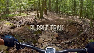
trail: Sidewinder
9:48 |
297 |
May 28, 2022 , Alpine
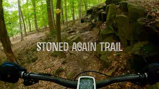
trail: Stoned Again
4:48 |
214 |
May 28, 2022 , Alpine
trail: Yellow
17:27 |
248 |
May 27, 2022 , Alpine
trail: Stoned Again
4:24 |
240 |
May 26, 2022 , Alpine
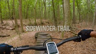
trail: Sidewinder
5:32 |
448 |
May 26, 2022 , Alpine
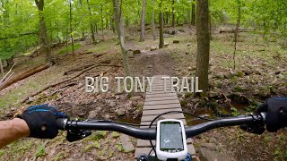
trail: Big Tony
3:19 |
379 |
May 26, 2022 , Alpine
Current Trail Warnings
| status | trail | date | condition | user | info |
|---|---|---|---|---|---|
| Hang Em High | Jun 15, 2026 @ 4:41pm (America/New_York) 3 days | Unknown | gone-skiing | Tree down |
Recent Trail Reports
| status | trail | date | condition | info | user |
|---|---|---|---|---|---|
| Henry Hudson Drive | May 22, 2026 @ 9:31am (America/New_York) May 22, 2026 | Ideal | RobJSinger | ||
| Henry Hudson Drive | May 22, 2026 @ 9:31am (America/New_York) May 22, 2026 | Ideal | RobJSinger | ||
| Henry Hudson Drive | May 22, 2026 @ 9:31am (America/New_York) May 22, 2026 | Ideal | RobJSinger | ||
| HH Drive | May 22, 2026 @ 9:31am (America/New_York) May 22, 2026 | Ideal | RobJSinger | ||
| Alt Red | May 15, 2026 @ 11:17am (America/New_York) May 15, 2026 | Variable | RobJSinger | ||
| Orange | May 15, 2026 @ 11:17am (America/New_York) May 15, 2026 | Variable | RobJSinger | ||
| White | May 15, 2026 @ 11:17am (America/New_York) May 15, 2026 | Variable | RobJSinger | ||
| White | May 15, 2026 @ 11:17am (America/New_York) May 15, 2026 | Variable | RobJSinger | ||
| White DH | May 15, 2026 @ 11:17am (America/New_York) May 15, 2026 | Variable | RobJSinger | ||
| Red Camp | May 15, 2026 @ 11:17am (America/New_York) May 15, 2026 | Wet | RobJSinger |
Activity Feed
| username | action | type | title | date |
|---|---|---|---|---|
| gone-skiing | add | report | activity #97063229 | Jun 15, 2026 @ 1:41pm 3 days |
| JohnJuCaPd | ridden | trail | activity #96337370 | Jun 5, 2026 @ 7:09pm Jun 5, 2026 |
| AAmsBn | difficultyvote | trail | activity #95683073 | May 27, 2026 @ 8:16pm May 27, 2026 |
| RemiDHp7QE | wishlist | route | activity #95297419 | May 23, 2026 @ 2:17am May 23, 2026 |
| RobJSinger | add | report | activity #95261965 and 3 more | May 22, 2026 @ 12:41pm May 22, 2026 |
Recent Comments
| username | type | title | comment | date |
|---|---|---|---|---|
| trail | Techy in a nutshell | Mar 29, 2026 @ 12:30pm Mar 29, 2026 | ||
| trail | Techy off camber corners | Mar 29, 2026 @ 12:29pm Mar 29, 2026 | ||
| trail | Be careful not to miss sharp right turn at... | Sep 10, 2025 @ 8:00am Sep 10, 2025 | ||
| trail | Fantastic downhill and the features are great | Jul 15, 2025 @ 8:07am Jul 15, 2025 | ||
| trail | Good singletrack, with lots of fun optional... | Jul 15, 2025 @ 8:06am Jul 15, 2025 |
Local Badges
-

Epic Ride Climb 2k35 awarded -

Climbing 10k Badge99 awarded -

Climbing 100k Badge4 awarded -

Epic Ride Descent 2k35 awarded -

Descent 10k Badge98 awarded -

Descent 100k Badge4 awarded
Activity Type Stats
| activitytype | trails | distance | descent | descent distance | total vertical | rating | global rank | state rank | photos | reports | routes | ridelogs |
|---|---|---|---|---|---|---|---|---|---|---|---|---|
| Mountain Bike | 91 | 61 miles | 7,165 ft | 25 miles | 545 ft | #1,223 | #474 | 64 | 1,459 | 6 | 19,950 | |
| E-Bike | 37 | 23 miles | 4,265 ft | 11 miles | 463 ft | #3,326 | #1,183 | 1,252 | 1,111 | |||
| Hike | 94 | 63 miles | 7,254 ft | 26 miles | 545 ft | #2,893 | #1,070 | 1 | 1,458 | 5 | 1,301 | |
| Trail Running | 93 | 62 miles | 7,254 ft | 26 miles | 545 ft | #3,087 | #901 | 1 | 1,458 | 7 | 492 | |
| Snowshoe | 9 | 3 miles | 344 ft | 1 mile | 184 ft | #1,088 | #553 | 3 | 13 | |||
| Backcountry Ski | 9 | 3 miles | 344 ft | 1 mile | 184 ft | #500 | #130 | 3 | 6 | |||
| Nordic Ski | 21 | 4 miles | 407 ft | 2 miles | 528 ft | #1,056 | #452 | 3 | 9 |
Frequently Asked Questions About Alpine
▼
What are the best places to ride in Alpine?
Alpine has 4 areas to explore for mountain biking. The top rated areas are:
▼
What are the highest rated mountain biking trails in Alpine?
The highest rated mountain biking trails in Alpine are:
- Hang Em High (4.3/5)
- Yellow Scout (4.2/5)
- Orange (4.1/5)
- Anthony Jr. (4.1/5)
- Sidewinder (4.1/5)
▼
What is the best time of the year to ride in Alpine?
Based on ride log data, the most popular months to ride in Alpine are:
- October (151 activities)
- July (150 activities)
- November (149 activities)
▼
Where can I park to ride in Alpine?
There are 7 parking locations listed in Alpine. The most popular parking spots are: View all parking and trailhead locations on the map to plan your visit.
Activities
Trails
- By mstewart80 & contributors
- Admins: NYNJTC, josowski, Tkeyworth, Bicycle-Workshop
- #10601 - 24,127 views
- alpine activity log | embed map of Alpine mountain bike trails | alpine mountain biking points of interest polygons
Downloading of trail gps tracks in kml & gpx formats is enabled for Alpine.
You must login to download files.