close
-
Layers w
- Weather Layers
- Pro
- Pro
- Pro
- Pro
- Pro
- Pro
- More Layers
- Pro
- Pro
- Pro
- Pro
-
Upgrade to

3D
Trail Conditions
- Unknown
- Snow Groomed
- Snow Packed
- Snow Covered
- Snow Cover Partial
- Freeze/thaw Cycle
- Icy
- Prevalent Mud
- Wet
- Variable
- Ideal
- Dry
- Very Dry
Trail Flow (Ridden Direction)
Trailforks scans users ridelogs to determine the most popular direction each trail is ridden. A good flowing trail network will have most trails flowing in a single direction according to their intension.
The colour categories are based on what percentage of riders are riding a trail in its intended direction.
The colour categories are based on what percentage of riders are riding a trail in its intended direction.
- > 96%
- > 90%
- > 80%
- > 70%
- > 50%
- < 50%
- bi-directional trail
- no data
Trail Last Ridden
Trailforks scans ridelogs to determine the last time a trail was ridden.
- < 2 days
- < 1 week
- < 2 weeks
- < 1 month
- < 6 months
- > 6 months
Trail Ridden Direction
The intended direction a trail should be ridden.
- Downhill Only
- Downhill Primary
- Both Directions
- Uphill Primary
- Uphill Only
- One Direction
Contribute Details
Colors indicate trail is missing specified detail.
- Description
- Photos
- Description & Photos
- Videos
Trail Popularity ?
Trailforks scans ridelogs to determine which trails are ridden the most in the last 9 months.
Trails are compared with nearby trails in the same city region with a possible 25 colour shades.
Think of this as a heatmap, more rides = more kinetic energy = warmer colors.
- most popular
- popular
- less popular
- not popular
ATV/ORV/OHV Filter
Max Vehicle Width
inches
US Cell Coverage
Legend

Radar Time
Activity Recordings
Trailforks uses anonymized public activity data.
?
Activity Recordings
Trailforks uses anonymized public activity data.
?
Personal Heatmap
▶
Activity Types
all
/
none
▶
Options
2
Date range
month
–
Winter Trails
Warning
A routing network for winter maps does not exist. Selecting trails using the winter trails layer has been disabled.
Missing Trails
Most Popular
Least Popular
Trails are colored based on popularity. The more popular a trail is, the more red. Less popular trails trend towards green.
Jump Magnitude Heatmap
Heatmap of where riders jump on trails. Zoom in to see individual jumps, click circles to view jump details.
BC Backroad Status
![map legend]()
Service Road Atlas is a free to use, community-driven service for viewing and creating reports on the numerous back-country service roads around B.C. and Alberta.

Slope Aspect
Direction the slope faces
Trails Deemphasized
Trails are shown in grey.
Only show trails with no bike usage.
Suggested Layers
Based on selected activity type
Save the current map location and zoom level as your default home location whenever this page is loaded.
SaveAlpine Meadows (Palisades Tahoe)
Alpine Meadows is a renowned ski area in California’s Sierra Nevada mountains and is part of the larger Palisades Tahoe resort. Located near Lake Tahoe, Alpine Meadows is known for its wide-open bowls, scenic tree skiing, and expansive alpine terrain.
The mountain offers a variety of runs suited to all skill levels, from gentle beginner slopes to challenging advanced terrain and backcountry-style bowls. Its natural layout provides long, flowing descents and excellent powder skiing during strong Sierra snow seasons. Alpine Meadows also features terrain parks, groomed cruisers, and access to high-alpine areas that appeal to expert skiers and snowboarders.
Since being connected to Palisades Tahoe through the Base to Base Gondola, visitors can easily explore both mountains in a single day, significantly expanding the available terrain and lift access. The area retains a slightly quieter and more laid-back atmosphere compared to the main Palisades base, making it a favorite among locals and returning visitors.
With spectacular views of Lake Tahoe, diverse terrain, and deep snowfalls typical of the Sierra Nevada, Alpine Meadows remains one of the most beloved ski destinations in the western United States.
Primary Trail Type: Cross-Country
 google parking directions
Links
Activities Click to view
- Mountain Bike
20 trails
- E-Bike
1 trails
- Horse
21 trails
- Hike
23 trails
- Trail Running
23 trails
- Downhill Ski
158 trails
- Backcountry Ski
69 trails
Region Details
- 6
- 2
- 9
- 3
Region Status
Caution as of Jun 11, 2026Stats
- Avg Trail Rating
- Trails (view details)
- 184
- Trails Mountain Bike
- 20
- Trails E-Bike
- 1
- Trails Gravel Bike
- 4
- Trails Horse
- 21
- Trails Hike
- 23
- Trails Trail Running
- 23
- Trails Downhill Ski
- 158
- Trails Backcountry Ski
- 69
- Total Distance
- 56 miles
- Total Descent
- 42,564 ft
- Total Vertical
- 2,220 ft
- Highest Trailhead
- 8,501 ft
- Reports
- 242
- Photos
- 47
- Ridden Counter
- 58,870
Popular Alpine Meadows Palisades Tahoe Trails
• 100 ★ 3.4 • 1 mile • 27 ft • 540 •
The singletrack-width remains of an abandoned forest road. Loose and rocky (not the fun kind), the climb slogs, and due to the clear-cutting when the road was built, there is little relief from the sun during the afternoon.
• 90 ★ 4.4 • 2 miles • 0 ft • 310 •
Most of this trail follows an old road bed which has morphed into a single track. After an initial kick upwards at the turn off, the first 3/4+ of the trail is moderate in grade, including several flat zones. It then tips up notably,...
• 35 ★ 0.0 • 4,117 ft • 18 ft • 54 • • hike
Less popular black diamond difficulty singletrack. This hike primary trail can be used both directions and has a hard overall physical rating with a 18 ft black diamond climb. Trail visibility is sometimes hard to follow. On average it takes 13 minutes to complete this trail.
• 5 ★ 2.0 • 1 mile • 178 ft • 35 • • hike
This is a neighborhood connector trail that runs from the bottom of Scott Chair to the Page s trail system. It is mostly a decommissioned logging road. Best ridden from top to bottom. The top 1/3 mile is steep, rocky and loose...
• 10 ★ 0.0 • 3,946 ft • 502 ft • 5 • • hike
Note- this is for the strong backcountry adventurist! If you want groomed trails and buff singletrack, this may not be for you. This trail includes a significant hike-a-bike along the spine of the ridge on a (decades old) neighborhood...
Mountain Bike Routes
★ 3.0 • 13 miles • 1,199 ft • 9 • Loop •
Loop from Alpine Meadows valley through Page Meadows to Tahoe City and then back up the Truckee River Bike...
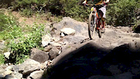
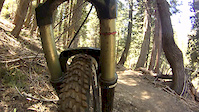
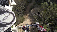
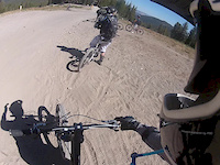
Photos of Alpine Meadows Palisades Tahoe Mountain Bike
Videos of Alpine Meadows Palisades Tahoe Mountain Bike
trail: Waterfall
0:42 |
307 |
Jul 9, 2014
trail: Waterfall
2:36 |
323 |
May 4, 2013
trail: Waterfall
5:15 |
772 |
Jan 14, 2013
trail: Twilight Zone
2:18 |
139 |
Sep 20, 2012
trail: Meadow
0:46 |
111 |
Apr 14, 2010
trail: Gunner's Cirque
0:07 |
3 |
Jan 6, 2026
Current Trail Warnings
| status | trail | date | condition | user | info |
|---|---|---|---|---|---|
| Deer Park (South) | Jun 11, 2026 @ 2:13pm (America/Los_Angeles) Jun 11, 2026 | Dry | buzzoff | 36" tree down, blocking trail - less than... |
Recent Trail Reports
Activity Feed
| username | action | type | title | date |
|---|---|---|---|---|
| buzzoff | add | report | activity #96760842 | Jun 11, 2026 @ 2:15pm Jun 11, 2026 |
| TommyfSxegh | ridden | trail | activity #96708653 | Jun 10, 2026 @ 6:05pm Jun 10, 2026 |
| Sarde | wishlist | route | activity #96432333 | Jun 6, 2026 @ 11:13pm Jun 6, 2026 |
| JeffpEbYTN | ridden | route | activity #96274506 | Jun 4, 2026 @ 8:38pm Jun 4, 2026 |
| X5vpgKCw | add | photo | activity #96258870 | Jun 4, 2026 @ 4:18pm Jun 4, 2026 |
Recent Comments
| username | type | title | comment | date |
|---|---|---|---|---|
| trail | Boring trail but amazing views at the top | Aug 10, 2024 @ 8:04pm Aug 10, 2024 | ||
| trail | Better for hiking than Mtn biking - not much fun | Jun 1, 2024 @ 12:51pm Jun 1, 2024 | ||
| trail | Not a Mtn bike trail - boring | Jun 1, 2024 @ 12:49pm Jun 1, 2024 | ||
| trail | Expect a boring climb, pretty much no... | Oct 4, 2023 @ 8:39pm Oct 4, 2023 | ||
| trail | This goes to the top of the Lakeview chair,... | Sep 25, 2023 @ 10:59pm Sep 25, 2023 |
Nearby Areas
| name | distance | ||||
|---|---|---|---|---|---|
| Stanford Rock | 7 | 2 | 2.4 km | ||
| Paige Meadows | 23 | 8 | 2 | 2.9 km | |
| Olympic Valley at Palisades Tahoe Summer | 2 | 13 | 6 | 2 | 3.1 km |
| Ward Creek Park | 8 | 1 | 4.2 km | ||
| Painted Rock | 7 | 4 | 4.6 km |
Local Badges
-

Completionist1 awarded
Local Mountain Biking Directory
-
Tahoe Cross-Country Ski Area
-
Gravity ShopBike Shop
-
Olympic Bike ShopBike Shop
Activity Type Stats
| activitytype | trails | distance | descent | descent distance | total vertical | rating | global rank | state rank | photos | reports | routes | ridelogs |
|---|---|---|---|---|---|---|---|---|---|---|---|---|
| Mountain Bike | 20 | 17 miles | 3,796 ft | 9 miles | 2,221 ft | #7,813 | #3,016 | 44 | 191 | 1 | 910 | |
| E-Bike | 1 | 850 ft | 157 ft | 850 ft | 157 ft | #8,640 | #2,736 | 1 | 152 | 97 | ||
| Gravel Bike | 4 | 4 miles | 131 ft | 1,381 ft | 1,775 ft | #4,693 | #2,078 | 35 | ||||
| Horse | 21 | 19 miles | 4,167 ft | 9 miles | 2,221 ft | #1,414 | #717 | 102 | 2 | |||
| Hike | 23 | 21 miles | 4,180 ft | 9 miles | 2,221 ft | #5,794 | #2,091 | 2 | 195 | 807 | ||
| Trail Running | 23 | 21 miles | 4,180 ft | 9 miles | 2,221 ft | #6,166 | #1,945 | 195 | 187 | |||
| Downhill Ski | 158 | 33 miles | 35,633 ft | 28 miles | 1,640 ft | #6 | #5 | 97 | 9,313 | |||
| Backcountry Ski | 69 | 12 miles | 10,436 ft | 9 miles | 1,611 ft | #119 | #28 | 98 | 432 |
Frequently Asked Questions About Alpine Meadows Palisades Tahoe
▼
What are the highest rated mountain biking trails in Alpine Meadows Palisades Tahoe?
The highest rated mountain biking trails in Alpine Meadows Palisades Tahoe are:
- Scott Peak Trail (4.1/5)
- Alpine Crags/Chalet Connector (4/5)
- Bear Creek Trail (West) (3.8/5)
- Bear Creek Trail (East) (3.8/5)
- Bear Creek/Chalet Connector (3.8/5)
▼
What is the best time of the year to ride in Alpine Meadows Palisades Tahoe?
Based on ride log data, the most popular months to ride in Alpine Meadows Palisades Tahoe are:
- July (60 activities)
- August (55 activities)
- June (51 activities)
▼
Where can I park to ride in Alpine Meadows Palisades Tahoe?
There are 1 parking locations listed in Alpine Meadows Palisades Tahoe. The most popular parking spots are:
▼
What is the longest trail in Alpine Meadows Palisades Tahoe?
The longest trail in Alpine Meadows Palisades Tahoe is Scott Peak Trail at 2.4 miles. View all trails sorted by distance.
Activities
- Alpine Meadows Palisades Tahoe Mountain Biking Trails
- Alpine Meadows Palisades Tahoe Horseback Trails
- Alpine Meadows Palisades Tahoe Hiking Trails
- Alpine Meadows Palisades Tahoe Trail Running Trails
- Alpine Meadows Palisades Tahoe Skiing Trails
- Alpine Meadows Palisades Tahoe Backcountry Skiing Trails
Trails
- Hard trails in Alpine Meadows Palisades Tahoe
- Easy trails in Alpine Meadows Palisades Tahoe
- Favorite trails in Alpine Meadows Palisades Tahoe
- Most ridden trails in Alpine Meadows Palisades Tahoe
- Singletrack in Alpine Meadows Palisades Tahoe
- Viewpoint trails in Alpine Meadows Palisades Tahoe
- Trails with technical features in Alpine Meadows Palisades Tahoe
Points of Interest
- By pedrodelmonte
 & contributors
 - Admins: TAMBA, TRTA, Indorhino
- #20018 - 8,614 views
- alpine meadows palisades tahoe activity log | embed map of Alpine Meadows Palisades Tahoe mountain bike trails | alpine meadows palisades tahoe mountain biking points of interest
Downloading of trail gps tracks in kml & gpx formats is enabled for Alpine Meadows Palisades Tahoe.
You must login to download files.