close
-
Layers w
- Weather Layers
- Pro
- Pro
- Pro
- Pro
- Pro
- Pro
- More Layers
- Pro
- Pro
- Pro
- Pro
-
Upgrade to

3D
Trail Conditions
- Unknown
- Snow Groomed
- Snow Packed
- Snow Covered
- Snow Cover Partial
- Freeze/thaw Cycle
- Icy
- Prevalent Mud
- Wet
- Variable
- Ideal
- Dry
- Very Dry
Trail Flow (Ridden Direction)
Trailforks scans users ridelogs to determine the most popular direction each trail is ridden. A good flowing trail network will have most trails flowing in a single direction according to their intension.
The colour categories are based on what percentage of riders are riding a trail in its intended direction.
The colour categories are based on what percentage of riders are riding a trail in its intended direction.
- > 96%
- > 90%
- > 80%
- > 70%
- > 50%
- < 50%
- bi-directional trail
- no data
Trail Last Ridden
Trailforks scans ridelogs to determine the last time a trail was ridden.
- < 2 days
- < 1 week
- < 2 weeks
- < 1 month
- < 6 months
- > 6 months
Trail Ridden Direction
The intended direction a trail should be ridden.
- Downhill Only
- Downhill Primary
- Both Directions
- Uphill Primary
- Uphill Only
- One Direction
Contribute Details
Colors indicate trail is missing specified detail.
- Description
- Photos
- Description & Photos
- Videos
Trail Popularity ?
Trailforks scans ridelogs to determine which trails are ridden the most in the last 9 months.
Trails are compared with nearby trails in the same city region with a possible 25 colour shades.
Think of this as a heatmap, more rides = more kinetic energy = warmer colors.
- most popular
- popular
- less popular
- not popular
ATV/ORV/OHV Filter
Max Vehicle Width
inches
US Cell Coverage
Legend

Radar Time
Activity Recordings
Trailforks uses anonymized public activity data.
?
Activity Recordings
Trailforks uses anonymized public activity data.
?
Personal Heatmap
▶
Activity Types
all
/
none
▶
Options
2
Date range
month
–
Winter Trails
Warning
A routing network for winter maps does not exist. Selecting trails using the winter trails layer has been disabled.
Missing Trails
Most Popular
Least Popular
Trails are colored based on popularity. The more popular a trail is, the more red. Less popular trails trend towards green.
Jump Magnitude Heatmap
Heatmap of where riders jump on trails. Zoom in to see individual jumps, click circles to view jump details.
BC Backroad Status
![map legend]()
Service Road Atlas is a free to use, community-driven service for viewing and creating reports on the numerous back-country service roads around B.C. and Alberta.

Slope Aspect
Direction the slope faces
Trails Deemphasized
Trails are shown in grey.
Only show trails with no bike usage.
Suggested Layers
Based on selected activity type
Save the current map location and zoom level as your default home location whenever this page is loaded.
Save
No description for Altadena has been added yet!
Login or register to submit one.
Activities Click to view
- Mountain Bike
39 trails
- E-Bike
6 trails
- Gravel Bike
0 trails
- Adaptive Bike
0 trails
- Winter Fat Bike
0 trails
- Horse
14 trails
- Hike
46 trails
- Trail Running
46 trails
Region Details
- 11
- 3
- 12
- 12
- 1
Region Status
Caution as of 15 hoursStats
- Avg Trail Rating
- Trails (view details)
- 46
- Trails Mountain Bike
- 39
- Trails E-Bike
- 6
- Trails Horse
- 14
- Trails Hike
- 46
- Trails Trail Running
- 46
- Trails Dirtbike/Moto
- 3
- Trails ATV/ORV/OHV
- 3
- Total Distance
- 78 miles
- Total Descent
- 12,842 ft
- Total Vertical
- 7,018 ft
- Highest Trailhead
- 7,953 ft
- Reports
- 618
- Photos
- 374
- Ridden Counter
- 12,901
Sub Regions
-
Brown Mountain
- 2
- 5
- 5
-
Chilao-Charlton
- 4
- 4
Popular Altadena Mountain Biking Trails
• 100 ★ 4.5 • 2 miles • 9 ft • 1,650 •
is definitely one of the best single track experiences in Southern California. Extreme exposure, tight switch backs, fun turns, stream crossings, and rock gardens all within a ~2 mile descent through a oak lined canyon. This is classic...
• 100 ★ 3.7 • 3 miles • 1,216 ft • 1,476 •
Many riders use as the climb to come down . It is roughly a steady 10% incline, although there is a little relief near the top where it is not quite as steep. The views are fantastic so if that is important to you, this one is highly...
• 95 ★ 4.2 • 3,747 ft • 20 ft • 852 •
Lower Sunset is a fantastic flowing trail that drops down from the Chaney Trail / Mt Lowe fire road into Millard Campground. An intermediate trail with no serious drops, Lower Sunset is great for beginning riders and also enjoyed by...
• 95 ★ 4.2 • 4 miles • 323 ft • 671 •
Highly rated popular blue difficulty singletrack. This mountain bike primary trail can be used both directions with a 323 ft blue climb. On average it takes 33 minutes to complete this trail.
• 90 ★ 4.2 • 4 miles • 654 ft • 620 •
This lowest section of the Gabrelino Trail is probably as beginner as it gets in the San Gabriel Mountains when it comes to single track, and even so, its still a very fun ride. Starting at the JPL Parking Lot on Windsor, you ride the...
• 85 ★ 3.7 • 2 miles • 54 ft • 334 •
The trail in the Angeles National Forest is a milestone in Southern California mountain bike history. It represents the success of the local group and their strong, positive relationship with the USFS land managers in the 1990s. MWBA...
• 75 ★ 3.0 • 820 ft • 0 ft • 312 •
Popular black diamond difficulty singletrack. This mountain bike primary trail can be used downhill primary. On average it takes 1 minutes to complete this trail.
• 70 ★ 3.9 • 6 miles • 2,023 ft • 302 •
A winding, exposed cross-country styled downhill with fair amount of tech though multiple ecological zones. Recently restored after a ten year absence, the classic route can be ridden from Switzers station to JPL.
Altadena Mountain Bike Routes
★ 5.0 • 10 miles • 2,773 ft • 5 • Shuttled •
This is the complete Strawberry Peak Route going from the ranger station to red box parking lot.
14 miles • 3,449 ft • 3 •
Take to Brown Mtn Saddle to Millard to top of Sunset. Descend Sunset and
13 miles • 2,362 ft • 2 • Loop •
Loop up and then keep climbing up brown mountain. Then loop around on the .
32 miles • 5,751 ft • 6 • Loop •
I wanted to put a loop together to ride Red Box-JPL without the shuttle. This worked great. The climb is...
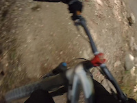
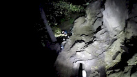
Photos of Altadena Mountain Bike
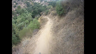
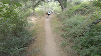
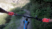
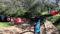
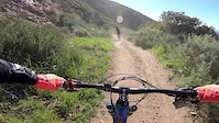
Videos of Altadena Mountain Bike
trail: El Prieto Trail
0:20 |
42 |
Sep 26, 2025
trail: El Prieto Trail
0:25 |
152 |
Jul 31, 2020
trail: El Prieto Trail
3:22 |
63 |
Sep 15, 2019
trail: El Prieto Trail
0:48 |
207 |
Jul 10, 2019

trail: El Prieto Trail
0:48 |
|
Jul 9, 2019
trail: Lower Sunset Ridge
4:04 |
114 |
Mar 28, 2019
trail: Millard Canyon Road
0:57 |
143 |
Mar 22, 2019
trail: Fern Truck Trail
2:18 |
348 |
Mar 16, 2019
Current Trail Warnings
| status | trail | date | condition | user | info |
|---|---|---|---|---|---|
| Mt Lowe Firebreak | Jun 22, 2026 @ 9:30am (America/Los_Angeles) 15 hours | Very Dry | brianpetry TRAILFORKS | Report from user... |
Recent Trail Reports
Activity Feed
| username | action | type | title | date |
|---|---|---|---|---|
| EmKer | vote | trail | activity #97600702 and 1 more | Jun 22, 2026 @ 7:48pm 5 hours |
| brianpetry | add | report | activity #97567268 | Jun 22, 2026 @ 9:31am 15 hours |
| Bigairbrady | wishlist | route | activity #97451746 | Jun 20, 2026 @ 7:54pm 2 days |
| pvuk | wishlist | trail | activity #97222533 | Jun 17, 2026 @ 6:08pm Jun 17, 2026 |
| TrailOneComponents | ridden | trail | activity #97124804 | Jun 16, 2026 @ 11:09am Jun 16, 2026 |
Recent Comments
| username | type | title | comment | date |
|---|---|---|---|---|
| report | Why don't the 3 of us do this on Sunday? ... | May 8, 2026 @ 12:17pm May 8, 2026 | ||
| trail | meant to say: if you like that kind of ride,... | May 2, 2026 @ 8:35pm May 2, 2026 | ||
| trail | Rode yesterday, couple of rock gardens and... | Mar 4, 2026 @ 10:42am Mar 4, 2026 | ||
| trail | Super bumpy trail. I am a beginner not super... | Feb 8, 2026 @ 2:51pm Feb 8, 2026 | ||
| trail | You're welcome. Enjoy. Everyone be kind to it... | Feb 3, 2026 @ 3:27pm Feb 3, 2026 |
Local Badges
-

10 Black Trails271 awarded -

Epic Ride Climb 2k385 awarded -

Climbing 10k Badge225 awarded -

Climbing 100k Badge19 awarded -

Epic Ride Descent 2k510 awarded -

Descent 10k Badge252 awarded
Activity Type Stats
| activitytype | trails | distance | descent | descent distance | total vertical | rating | global rank | state rank | photos | reports | routes | ridelogs |
|---|---|---|---|---|---|---|---|---|---|---|---|---|
| Mountain Bike | 39 | 67 miles | 11,791 ft | 24 miles | 5,066 ft | #1,839 | #674 | 375 | 617 | 9 | 26,060 | |
| E-Bike | 6 | 9 miles | 817 ft | 3 miles | 3,642 ft | #5,700 | #1,762 | 2 | 385 | 1 | 2,576 | |
| Horse | 14 | 27 miles | 2,710 ft | 9 miles | 6,654 ft | #1,412 | #842 | 137 | 2 | |||
| Hike | 46 | 78 miles | 12,841 ft | 27 miles | 7,018 ft | #1,002 | #452 | 5 | 618 | 1 | 1,975 | |
| Trail Running | 46 | 78 miles | 12,841 ft | 27 miles | 7,018 ft | #2,732 | #777 | 618 | 1 | 503 | ||
| Dirtbike/Moto | 3 | 6 miles | 679 ft | 2 miles | 830 ft | 85 | ||||||
| ATV/ORV/OHV | 3 | 6 miles | 679 ft | 2 miles | 830 ft | 85 |
Frequently Asked Questions About Altadena
▼
What are the best places to ride in Altadena?
Altadena has 2 areas to explore for mountain biking. The top rated areas are:
▼
What are the highest rated mountain biking trails in Altadena?
The highest rated mountain biking trails in Altadena are:
- El Prieto Trail (4.4/5)
- Mt Hillyer Trail (4.4/5)
- Lower Sunset Ridge (4.1/5)
- Silver Moccasin Trail (Christian Camp to Chilao DH) (4.1/5)
- Mt Lowe Firebreak (4.1/5)
▼
What is the best time of the year to ride in Altadena?
Based on ride log data, the most popular months to ride in Altadena are:
- July (146 activities)
- October (131 activities)
- November (119 activities)
▼
Where can I park to ride in Altadena?
There are 9 parking locations listed in Altadena. The most popular parking spots are: View all parking and trailhead locations on the map to plan your visit.
Activities
Trails
- By BlazeNawaY & contributors
- Admins: CORBA
- #9518 - 11,326 views
- altadena activity log | embed map of Altadena mountain bike trails | altadena mountain biking points of interest
Downloading of trail gps tracks in kml & gpx formats is enabled for Altadena.
You must login to download files.