close
-
Layers w
- Weather Layers
- Pro
- Pro
- Pro
- Pro
- Pro
- Pro
- More Layers
- Pro
- Pro
- Pro
- Pro
-
Upgrade to

3D
Trail Conditions
- Unknown
- Snow Groomed
- Snow Packed
- Snow Covered
- Snow Cover Partial
- Freeze/thaw Cycle
- Icy
- Prevalent Mud
- Wet
- Variable
- Ideal
- Dry
- Very Dry
Trail Flow (Ridden Direction)
Trailforks scans users ridelogs to determine the most popular direction each trail is ridden. A good flowing trail network will have most trails flowing in a single direction according to their intension.
The colour categories are based on what percentage of riders are riding a trail in its intended direction.
The colour categories are based on what percentage of riders are riding a trail in its intended direction.
- > 96%
- > 90%
- > 80%
- > 70%
- > 50%
- < 50%
- bi-directional trail
- no data
Trail Last Ridden
Trailforks scans ridelogs to determine the last time a trail was ridden.
- < 2 days
- < 1 week
- < 2 weeks
- < 1 month
- < 6 months
- > 6 months
Trail Ridden Direction
The intended direction a trail should be ridden.
- Downhill Only
- Downhill Primary
- Both Directions
- Uphill Primary
- Uphill Only
- One Direction
Contribute Details
Colors indicate trail is missing specified detail.
- Description
- Photos
- Description & Photos
- Videos
Trail Popularity ?
Trailforks scans ridelogs to determine which trails are ridden the most in the last 9 months.
Trails are compared with nearby trails in the same city region with a possible 25 colour shades.
Think of this as a heatmap, more rides = more kinetic energy = warmer colors.
- most popular
- popular
- less popular
- not popular
ATV/ORV/OHV Filter
Max Vehicle Width
inches
US Cell Coverage
Legend

Radar Time
Activity Recordings
Trailforks uses anonymized public activity data.
?
Activity Recordings
Trailforks uses anonymized public activity data.
?
Personal Heatmap
▶
Activity Types
all
/
none
▶
Options
2
Date range
month
–
Winter Trails
Warning
A routing network for winter maps does not exist. Selecting trails using the winter trails layer has been disabled.
Missing Trails
Most Popular
Least Popular
Trails are colored based on popularity. The more popular a trail is, the more red. Less popular trails trend towards green.
Jump Magnitude Heatmap
Heatmap of where riders jump on trails. Zoom in to see individual jumps, click circles to view jump details.
BC Backroad Status
![map legend]()
Service Road Atlas is a free to use, community-driven service for viewing and creating reports on the numerous back-country service roads around B.C. and Alberta.

Slope Aspect
Direction the slope faces
Trails Deemphasized
Trails are shown in grey.
Only show trails with no bike usage.
Suggested Layers
Based on selected activity type
Save the current map location and zoom level as your default home location whenever this page is loaded.
Save
No description for Amanalco has been added yet!
Login or register to submit one.
Activities Click to view
- Mountain Bike
65 trails
- E-Bike
36 trails
- Gravel Bike
0 trails
- Adaptive Bike
0 trails
- Winter Fat Bike
0 trails
- Hike
57 trails
- Trail Running
63 trails
Region Details
- 18
- 6
- 23
- 14
Region Status
Caution as of Apr 4, 2026Stats
- Avg Trail Rating
- Trails (view details)
- 62
- Trails Mountain Bike
- 65
- Trails E-Bike
- 36
- Trails Horse
- 2
- Trails Hike
- 57
- Trails Trail Running
- 63
- Total Distance
- 66 miles
- Total Descent
- 21,809 ft
- Total Vertical
- 2,869 ft
- Highest Trailhead
- 10,532 ft
- Reports
- 62
- Photos
- 39
- Ridden Counter
- 2,206
Sub Regions
-
Amanalco/Rincon/San Lucas
- 4
- 17
- 9
Popular Amanalco Mountain Biking Trails
• 100 ★ 5.0 • 3,589 ft • 3 ft • 166 •
Single black flow/jump trail. Expect big table top jumps, wooden road gaps, wall rides and step down jumps. Last section is steep and slick.
• 95 ★ 5.0 • 4,019 ft • 19 ft • 142 •
A mix of flow trail with some technical sections. 3 steep rock face descents along with small table top jumps and fun big berms.
• 100 ★ 5.0 • 3,599 ft • 3 ft • 141 •
Mati Flow is a flowy single black trail with two advanced features, one is a rock drop at the top of 2 m vertical drop and a small 4 m road gap with a very mellow take off and a big landing ramp, These features are not mandatory. Other...
• 90 ★ 5.0 • 1,145 ft • 0 ft • 124 •
This is a fun short trail that surfs a small and wide ravine. Only one short gap jump, not mandatory.
• 90 ★ 4.0 • 4,534 ft • 194 ft • 114 •
Flowy single black trail, berms are well supported but sharp and steep. Some deep bumps and small drops.
• 95 ★ 5.0 • 2,365 ft • 112 ft • 105 •
Flowy blue trail with high and open berms. One medium size step down and one small jump. Not mandatory.
Amanalco Mountain Bike Routes
★ 5.0 • 37 miles • 1,585 ft • 0 • Point to Point •
El Mapa a Valle de Bravo es una clásica ruta punto a punto de ciclismo de montaña que inicia en la zona...
7 miles • 1,198 ft • 0 • Loop •
..........................................................................................
16 miles • 4,547 ft • 15 •
Rock & Ride Vol. 2: dia 2 de la segunda fecha del nacional MTB Enduro.
25 miles • 2,224 ft • 0 • Point to Point •
Subida de , empinada pero lograble
17 miles • 4,202 ft • 13 • Point to Point • Race •
Ruta del dia 1 de la Segunda Fecha del Serial Intense MTB Enduro.
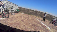
Photos of Amanalco Mountain Bike

Recent Trail Reports
Activity Feed
| username | action | type | title | date |
|---|---|---|---|---|
| iOly2 | wishlist | route | activity #93098296 | Apr 21, 2026 @ 12:09pm Apr 21, 2026 |
| iOly2 | ridden | route | activity #93097533 | Apr 21, 2026 @ 11:57am Apr 21, 2026 |
| Ozzye | comment | trail | activity #92491317 | Apr 12, 2026 @ 12:42pm Apr 12, 2026 |
| DreyMX | add | report | activity #91889139 and 4 more | Apr 4, 2026 @ 6:14am Apr 4, 2026 |
| DreyMX | update | route | activity #89437155 | Feb 23, 2026 @ 3:59pm Feb 23, 2026 |
Recent Comments
| username | type | title | comment | date |
|---|---|---|---|---|
| trail | D ex XXX | Apr 12, 2026 @ 12:42pm Apr 12, 2026 | ||
| trail | Cerrada temporalmente por aprovechamiento... | Apr 2, 2024 @ 3:30pm Apr 2, 2024 | ||
| report | Árboles retirados | Jul 9, 2023 @ 5:18pm Jul 9, 2023 |
Local Badges
-

10 Blue Trails6 awarded -

Epic Ride Climb 2k87 awarded -

Climbing 10k Badge14 awarded -

Climbing 100k Badge1 awarded -

Epic Ride Descent 2k173 awarded -

Descent 10k Badge29 awarded
Local Trail Supporters
- Procuenca A. C.
Activity Type Stats
| activitytype | trails | distance | descent | descent distance | total vertical | rating | global rank | state rank | photos | reports | routes | ridelogs |
|---|---|---|---|---|---|---|---|---|---|---|---|---|
| Mountain Bike | 65 | 64 miles | 21,552 ft | 35 miles | 2,776 ft | #2,506 | #27 | 37 | 62 | 5 | 1,886 | |
| E-Bike | 36 | 27 miles | 9,711 ft | 15 miles | 2,776 ft | #2,534 | #40 | 2 | 57 | 104 | ||
| Horse | 2 | 1,906 ft | 13 ft | 125 ft | 23 ft | 7 | ||||||
| Hike | 57 | 58 miles | 16,490 ft | 29 miles | 2,867 ft | #3,136 | #29 | 58 | 159 | |||
| Trail Running | 63 | 64 miles | 20,000 ft | 33 miles | 2,867 ft | #2,398 | #27 | 62 | 10 |
Frequently Asked Questions About Amanalco
▼
What are the best places to ride in Amanalco?
Amanalco has 1 areas to explore for mountain biking. The top rated areas are:
▼
What are the highest rated mountain biking trails in Amanalco?
The highest rated mountain biking trails in Amanalco are:
- Rodavento Flying (AMS) (4.3/5)
- La Vieja Innes (4.2/5)
- Mati Flow (4.1/5)
- Grandulón Guadalupanos (4.1/5)
- Bici Jueves Upper (4.1/5)
▼
What is the best time of the year to ride in Amanalco?
Based on ride log data, the most popular months to ride in Amanalco are:
- December (19 activities)
- July (17 activities)
- November (17 activities)
▼
Where can I park to ride in Amanalco?
There are 1 parking locations listed in Amanalco. The most popular parking spots are:
Activities
Trails
Points of Interest
- By denitopia
 TRAILFORKS VTA & contributors
 - Admins: FPVB
- #12369 - 2,886 views
- amanalco activity log | embed map of Amanalco mountain bike trails | amanalco mountain biking points of interest
Downloading of trail gps tracks in kml & gpx formats is enabled for Amanalco.
You must login to download files.