close
-
Layers w
- Weather Layers
- Pro
- Pro
- Pro
- Pro
- Pro
- Pro
- More Layers
- Pro
- Pro
- Pro
- Pro
-
Upgrade to

3D
Trail Conditions
- Unknown
- Snow Groomed
- Snow Packed
- Snow Covered
- Snow Cover Partial
- Freeze/thaw Cycle
- Icy
- Prevalent Mud
- Wet
- Variable
- Ideal
- Dry
- Very Dry
Trail Flow (Ridden Direction)
Trailforks scans users ridelogs to determine the most popular direction each trail is ridden. A good flowing trail network will have most trails flowing in a single direction according to their intension.
The colour categories are based on what percentage of riders are riding a trail in its intended direction.
The colour categories are based on what percentage of riders are riding a trail in its intended direction.
- > 96%
- > 90%
- > 80%
- > 70%
- > 50%
- < 50%
- bi-directional trail
- no data
Trail Last Ridden
Trailforks scans ridelogs to determine the last time a trail was ridden.
- < 2 days
- < 1 week
- < 2 weeks
- < 1 month
- < 6 months
- > 6 months
Trail Ridden Direction
The intended direction a trail should be ridden.
- Downhill Only
- Downhill Primary
- Both Directions
- Uphill Primary
- Uphill Only
- One Direction
Contribute Details
Colors indicate trail is missing specified detail.
- Description
- Photos
- Description & Photos
- Videos
Trail Popularity ?
Trailforks scans ridelogs to determine which trails are ridden the most in the last 9 months.
Trails are compared with nearby trails in the same city region with a possible 25 colour shades.
Think of this as a heatmap, more rides = more kinetic energy = warmer colors.
- most popular
- popular
- less popular
- not popular
ATV/ORV/OHV Filter
Max Vehicle Width
inches
US Cell Coverage
Legend

Radar Time
Activity Recordings
Trailforks uses anonymized public activity data.
?
Activity Recordings
Trailforks uses anonymized public activity data.
?
Personal Heatmap
▶
Activity Types
all
/
none
▶
Options
2
Date range
month
–
Winter Trails
Warning
A routing network for winter maps does not exist. Selecting trails using the winter trails layer has been disabled.
Missing Trails
Most Popular
Least Popular
Trails are colored based on popularity. The more popular a trail is, the more red. Less popular trails trend towards green.
Jump Magnitude Heatmap
Heatmap of where riders jump on trails. Zoom in to see individual jumps, click circles to view jump details.
BC Backroad Status
![map legend]()
Service Road Atlas is a free to use, community-driven service for viewing and creating reports on the numerous back-country service roads around B.C. and Alberta.

Slope Aspect
Direction the slope faces
Trails Deemphasized
Trails are shown in grey.
Only show trails with no bike usage.
Suggested Layers
Based on selected activity type
Save the current map location and zoom level as your default home location whenever this page is loaded.
Save
No description for Amesbury has been added yet!
Login or register to submit one.
Activities Click to view
- Mountain Bike
43 trails
- E-Bike
4 trails
- Adaptive Bike
0 trails
- Winter Fat Bike
0 trails
- Horse
1 trails
- Hike
42 trails
- Trail Running
42 trails
- Snowshoe
4 trails
- Nordic Ski
4 trails
Region Details
- 1
- 3
- 25
- 9
- 3
Region Status
Open as of Apr 2, 2024Stats
- Avg Trail Rating
- Trails (view details)
- 41
- Trails Mountain Bike
- 43
- Trails E-Bike
- 4
- Trails Horse
- 1
- Trails Hike
- 42
- Trails Trail Running
- 42
- Trails Snowshoe
- 4
- Trails Nordic Ski
- 4
- Total Distance
- 11 miles
- Total Descent
- 1,486 ft
- Total Vertical
- 244 ft
- Highest Trailhead
- 330 ft
- Reports
- 34
- Photos
- 9
- Ridden Counter
- 1,287
Sub Regions
-
Amesbury Town Forest
- 2
- 16
- 9
Popular Amesbury Mountain Biking Trails
• 90 ★ 0.0 • 2,732 ft • 40 ft • 55 •
Popular green difficulty singletrack. This mountain bike primary trail. On average it takes 3 minutes to complete this trail.
• 100 ★ 0.0 • 909 ft • 0 ft • 53 •
Popular green difficulty singletrack. This mountain bike primary trail can be used both directions. On average it takes 1 minutes to complete this trail.
• 100 ★ 0.0 • 671 ft • 9 ft • 49 •
Popular green difficulty singletrack. This mountain bike primary trail can be used both directions. On average it takes minutes to complete this trail.
• 95 ★ 0.0 • 883 ft • 27 ft • 48 •
Popular green difficulty singletrack. This mountain bike primary trail can be used both directions. It features other. On average it takes 2 minutes to complete this trail.
• 85 ★ 0.0 • 1,204 ft • 16 ft • 47 •
Popular green difficulty mixed. This mountain bike primary trail can be used both directions. It features jump. On average it takes 1 minutes to complete this trail.
• 95 ★ 0.0 • 998 ft • 32 ft • 45 •
Popular green difficulty singletrack. This mountain bike primary trail. On average it takes 2 minutes to complete this trail.
• 80 ★ 0.0 • 430 ft • 0 ft • 41 •
Popular green difficulty mixed. This mountain bike primary trail can be used both directions. On average it takes minutes to complete this trail.
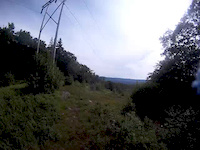
Videos of Amesbury Mountain Bike
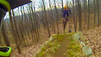
trail: Yellow
2:19 |
329 |
Nov 28, 2016

trail: Power Lines
2:47 |
206 |
Mar 20, 2014
trail: Power Lines
2:00 |
150 |
Mar 23, 2013

trail: Yellow
4:18 |
232 |
Jun 30, 2010

trail: Power Lines
3:42 |
1509 |
Nov 23, 2009
Recent Trail Reports
| status | trail | date | condition | info | user |
|---|---|---|---|---|---|
| Yellow | Apr 2, 2024 @ 11:36am Apr 2, 2024 | Ideal | mikewae | ||
| Milk Snake | Apr 2, 2024 @ 11:36am Apr 2, 2024 | Prevalent Mud | mikewae | ||
| Little Ridge | Apr 2, 2024 @ 11:36am Apr 2, 2024 | Ideal | mikewae | ||
| Shrine | Apr 2, 2024 @ 11:36am Apr 2, 2024 | Dry | mikewae | ||
| Pinebrook | Apr 2, 2024 @ 11:36am Apr 2, 2024 | Ideal | mikewae | ||
| Scampering Squirrel | Apr 2, 2024 @ 11:36am Apr 2, 2024 | Ideal | mikewae | ||
| Central Corridor | Apr 2, 2024 @ 11:36am Apr 2, 2024 | Ideal | mikewae | ||
| Lycopodium | Apr 2, 2024 @ 11:36am Apr 2, 2024 | Dry | mikewae | ||
| SawzAll | Apr 2, 2024 @ 11:36am Apr 2, 2024 | Variable | mikewae | ||
| Great Swamp | Apr 2, 2024 @ 11:36am Apr 2, 2024 | Dry | mikewae |
Activity Feed
| username | action | type | title | date |
|---|---|---|---|---|
| notar16 | wishlist | region | activity #96383279 | Jun 6, 2026 @ 10:05am Jun 6, 2026 |
| grimgravity | comment | trail | activity #75484957 and 2 more | Jul 8, 2025 @ 3:25pm Jul 8, 2025 |
| Dstreeter | wishlist | region | activity #63881967 | Jan 1, 2025 @ 5:23am Jan 1, 2025 |
| mikewae | add | trail | activity #62021560 | Nov 19, 2024 @ 5:54am Nov 19, 2024 |
| KzW9dA | wishlist | region | activity #53951822 | Jun 11, 2024 @ 1:12am Jun 11, 2024 |
Recent Comments
| username | type | title | comment | date |
|---|---|---|---|---|
| trail | Climb trail. Could ride it downhill but it’s... | Jul 8, 2025 @ 3:31pm Jul 8, 2025 | ||
| trail | Best trail of the 3. Couple turns. Some rocks... | Jul 8, 2025 @ 3:30pm Jul 8, 2025 | ||
| trail | Few down trees at the top. Kinda breaks up the... | Jul 8, 2025 @ 3:25pm Jul 8, 2025 | ||
| trail | Another great downhill. A little less steep... | Sep 10, 2021 @ 6:56pm Sep 10, 2021 | ||
| trail | Damn! What a great down hill! Make sure to... | Sep 10, 2021 @ 6:50pm Sep 10, 2021 |
Local Badges
-

10 Green Trails24 awarded -

Epic Ride Climb 2k0 awarded -

Climbing 10k Badge5 awarded -

Climbing 100k Badge0 awarded -

Epic Ride Descent 2k0 awarded -

Descent 10k Badge5 awarded
Activity Type Stats
| activitytype | trails | distance | descent | descent distance | total vertical | rating | global rank | state rank | photos | reports | routes | ridelogs |
|---|---|---|---|---|---|---|---|---|---|---|---|---|
| Mountain Bike | 43 | 11 miles | 1,486 ft | 5 miles | 243 ft | #8,098 | #2,609 | 9 | 34 | 1,534 | ||
| E-Bike | 4 | 2 miles | 167 ft | 4,783 ft | 52 ft | #9,968 | #3,114 | 30 | 5 | |||
| Horse | 1 | 1 mile | 89 ft | 2,625 ft | 39 ft | #3,454 | #2,003 | 14 | 2 | |||
| Hike | 42 | 10 miles | 1,470 ft | 4 miles | 243 ft | #8,601 | #3,011 | 34 | 93 | |||
| Trail Running | 42 | 10 miles | 1,470 ft | 4 miles | 243 ft | #8,582 | #2,866 | 34 | 324 | |||
| Snowshoe | 4 | 2 miles | 167 ft | 4,783 ft | 52 ft | #1,754 | #1,015 | 9 | ||||
| Nordic Ski | 4 | 2 miles | 167 ft | 4,783 ft | 52 ft | #1,860 | #985 | 23 |
Frequently Asked Questions About Amesbury
▼
What are the best places to ride in Amesbury?
Amesbury has 1 areas to explore for mountain biking. The top rated areas are:
▼
What are the highest rated mountain biking trails in Amesbury?
The highest rated mountain biking trails in Amesbury are:
- Lycopodium (4/5)
- Milk Snake (0/5)
- Scampering Squirrel (0/5)
- Great Swamp (0/5)
- Lion's Swamp (0/5)
▼
What is the best time of the year to ride in Amesbury?
Based on ride log data, the most popular months to ride in Amesbury are:
- July (13 activities)
- May (13 activities)
- August (8 activities)
▼
Where can I park to ride in Amesbury?
There are 1 parking locations listed in Amesbury. The most popular parking spots are:
- By mikewae
 & contributors
 - Admins: NS NEMBA, MV NEMBA, SiamDelightRules
- #19314 - 3,566 views
- amesbury activity log | embed map of Amesbury mountain bike trails | amesbury mountain biking points of interest
Downloading of trail gps tracks in kml & gpx formats is enabled for Amesbury.
You must login to download files.