close
-
Layers w
- Weather Layers
- Pro
- Pro
- Pro
- Pro
- Pro
- Pro
- More Layers
- Pro
- Pro
- Pro
- Pro
-
Upgrade to

3D
Trail Conditions
- Unknown
- Snow Groomed
- Snow Packed
- Snow Covered
- Snow Cover Partial
- Freeze/thaw Cycle
- Icy
- Prevalent Mud
- Wet
- Variable
- Ideal
- Dry
- Very Dry
Trail Flow (Ridden Direction)
Trailforks scans users ridelogs to determine the most popular direction each trail is ridden. A good flowing trail network will have most trails flowing in a single direction according to their intension.
The colour categories are based on what percentage of riders are riding a trail in its intended direction.
The colour categories are based on what percentage of riders are riding a trail in its intended direction.
- > 96%
- > 90%
- > 80%
- > 70%
- > 50%
- < 50%
- bi-directional trail
- no data
Trail Last Ridden
Trailforks scans ridelogs to determine the last time a trail was ridden.
- < 2 days
- < 1 week
- < 2 weeks
- < 1 month
- < 6 months
- > 6 months
Trail Ridden Direction
The intended direction a trail should be ridden.
- Downhill Only
- Downhill Primary
- Both Directions
- Uphill Primary
- Uphill Only
- One Direction
Contribute Details
Colors indicate trail is missing specified detail.
- Description
- Photos
- Description & Photos
- Videos
Trail Popularity ?
Trailforks scans ridelogs to determine which trails are ridden the most in the last 9 months.
Trails are compared with nearby trails in the same city region with a possible 25 colour shades.
Think of this as a heatmap, more rides = more kinetic energy = warmer colors.
- most popular
- popular
- less popular
- not popular
ATV/ORV/OHV Filter
Max Vehicle Width
inches
US Cell Coverage
Legend

Radar Time
Activity Recordings
Trailforks uses anonymized public activity data.
?
Activity Recordings
Trailforks uses anonymized public activity data.
?
Personal Heatmap
▶
Activity Types
all
/
none
▶
Options
2
Date range
month
–
Winter Trails
Warning
A routing network for winter maps does not exist. Selecting trails using the winter trails layer has been disabled.
Missing Trails
Most Popular
Least Popular
Trails are colored based on popularity. The more popular a trail is, the more red. Less popular trails trend towards green.
Jump Magnitude Heatmap
Heatmap of where riders jump on trails. Zoom in to see individual jumps, click circles to view jump details.
BC Backroad Status
![map legend]()
Service Road Atlas is a free to use, community-driven service for viewing and creating reports on the numerous back-country service roads around B.C. and Alberta.

Slope Aspect
Direction the slope faces
Trails Deemphasized
Trails are shown in grey.
Only show trails with no bike usage.
Suggested Layers
Based on selected activity type
Save the current map location and zoom level as your default home location whenever this page is loaded.
Save
No description for Anaconda has been added yet!
Login or register to submit one.
Activities Click to view
- Mountain Bike
124 trails
- E-Bike
30 trails
- Gravel Bike
24 trails
- Adaptive Bike
0 trails
- Winter Fat Bike
0 trails
- Horse
65 trails
- Hike
135 trails
- Trail Running
135 trails
- Dirtbike/Moto
48 trails
- ATV/ORV/OHV
44 trails
- Snowmobile
13 trails
- Snowshoe
6 trails
- Downhill Ski
7 trails
- Nordic Ski
22 trails
Region Details
- 51
- 12
- 3
- 45
- 11
- 1
Region Status
Caution as of Jun 25, 2026Local Trail Association
Stats
- Avg Trail Rating
- Trails (view details)
- 162
- Trails Mountain Bike
- 124
- Trails E-Bike
- 30
- Trails Gravel Bike
- 24
- Trails Horse
- 65
- Trails Hike
- 135
- Trails Trail Running
- 135
- Trails Dirtbike/Moto
- 48
- Trails ATV/ORV/OHV
- 44
- Trails Snowmobile
- 13
- Trails Snowshoe
- 6
- Trails Downhill Ski
- 7
- Trails Backcountry Ski
- 1
- Trails Nordic Ski
- 22
- Total Distance
- 396 miles
- Total Descent
- 45,811 ft
- Total Vertical
- 5,726 ft
- Highest Trailhead
- 10,525 ft
- Reports
- 213
- Photos
- 201
- Ridden Counter
- 2,330
Sub Regions
-
Anaconda Hills
- 3
- 12
- 2
-
CDT - Mt Haggin
- 5
- 2
-
Flint Creek Range - Anaconda
- 7
- 5
-
Stucky Ridge
- 5
- 2
-
Warm Springs Wildlife Management Area
- 5
Popular Anaconda Mountain Biking Trails
• 95 ★ 4.0 • 4 miles • 1,232 ft • 58 •
This is an out and back to the beautiful Mountain Lake. Bring a lunch and enjoy the view at the top, before coming back down. Feel like a little more riding? Ride over to Lower to see another mountain lake before you come back out. The...
• 75 ★ 4.0 • 2 miles • 371 ft • 54 •
This trail takes you up to the first and smaller of the . From there you can hike to the , to the second Twin Lake, or even over to . Although you are mostly in a valley there are some great views of the surrounding mountains, and of...
• 5 ★ 0.0 • 2,890 ft • 526 ft • 51 • • atv
Steep doubletrack that is loose in places. Not a great trail for mountain bikes. If you are a strong climber you could challenge yourself by trying to ride up this trail, although be prepared to at least push your bike on the steepest...
• 90 ★ 4.0 • 7 miles • 1,450 ft • 49 •
This is a 8 mile trail that can be ridden as an out and back for a total of 16 miles or as a shuttle from either end. The trail is a combination of old and new trail with a lot of rocks and creek crossings. This is a very wet trail in...
• 5 ★ 5.0 • 889 ft • 0 ft • 47 • • atv
Less popular blue difficulty singletrack. This atv/orv/ohv primary trail can be used downhill primary and has a moderate overall physical rating with a 0 ft blue climb. On average it takes 3 minutes to complete this trail.
• 55 ★ 0.0 • 4,917 ft • 401 ft • 46 •
Moderately popular blue difficulty doubletrack. This mountain bike primary trail can be used both directions and has a moderate overall physical rating with a 401 ft blue climb. On average it takes 18 minutes to complete this trail.
• 100 ★ 5.0 • 2,178 ft • 113 ft • 45 •
This section of trail was built in 2021. There are currently 3 sections of this trail completed as of June 2022 with more trail to come.
• 100 ★ 5.0 • 3,077 ft • 107 ft • 43 •
This section of trail was started in 2021. As of June 2022 it was almost completed with a small amount of trees needing removed at the northern end. There are "Trail" signs located at either end of the trail.
Anaconda Mountain Bike Routes
★ 4.0 • 23 miles • 2,545 ft • 7 • Loop •
Loop is best ridden clockwise to maximize downhill singletrack fun.
19 miles • 3,354 ft • 7 • Loop •
If you are new to the Butte-Anaconda area, go and ride some other areas that are all single-track and...
8 miles • 280 ft • 0 • Loop •
This gravel bike route is very accessible and a great way to see the Anaconda Valley. Half of this route...
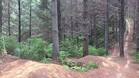
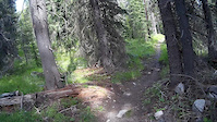
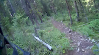
Photos of Anaconda Mountain Bike
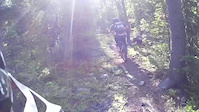
Videos of Anaconda Mountain Bike
trail: Failing Grade
0:12 |
150 |
May 8, 2020
trail: Lost Creek-Foster Creek
3:01 |
262 |
Jul 27, 2016
trail: Lake of the Isles
3:01 |
271 |
Jul 27, 2015
trail: Lake of the Isles
0:12 |
156 |
Jul 27, 2015
Recent Trail Reports
| status | trail | date | condition | info | user |
|---|---|---|---|---|---|
| Upper 4-Mile Basin | Jun 24, 2026 @ 8:36pm (America/Denver) Jun 24, 2026 | Ideal | MTBhoser | ||
| 4-Mile Basin | Jun 24, 2026 @ 8:33pm (America/Denver) Jun 24, 2026 | Variable | MTBhoser | ||
| Trail to Storm Lake | Jun 25, 2026 @ 1:19pm (America/Denver) Jun 25, 2026 | Dry | MTBhoser | ||
| Copper Link | Jun 23, 2026 @ 12:12pm (America/Denver) Jun 23, 2026 | Dry | Mgorman402 | ||
| CDT Continued | Jun 17, 2026 @ 3:56pm (America/Denver) Jun 17, 2026 | Ideal | HHskier | ||
| CDT - Lower Seymour Lake to Sullivan Creek | Jun 17, 2026 @ 3:35pm (America/Denver) Jun 17, 2026 | Ideal | HHskier | ||
| Slaughterhouse Creek Rd | Jun 17, 2026 @ 3:35pm (America/Denver) Jun 17, 2026 | Ideal | HHskier | ||
| Westfork 12 Mile Creek Rd | Jun 17, 2026 @ 3:35pm (America/Denver) Jun 17, 2026 | Ideal | HHskier | ||
| CDT So Far | Jun 17, 2026 @ 3:35pm (America/Denver) Jun 17, 2026 | Ideal | HHskier | ||
| New Tin Can Trail | Jan 2, 2026 @ 4:53pm (America/Denver) Jan 2, 2026 | Snow Covered | MattinButte ATS |
National Scenic Trails & Official Routes
-
Continental Divide Trail
- Mountain Bike
- Hike
- Trail Running

Activity Feed
| username | action | type | title | date |
|---|---|---|---|---|
| nucleargers | checkin | trail | activity #97910911 | Jun 27, 2026 @ 9:19am 1 day |
| nucleargers | ridden | trail | activity #97910910 | Jun 27, 2026 @ 9:19am 1 day |
| rileski | wishlist | route | activity #97793889 | Jun 25, 2026 @ 2:36pm Jun 25, 2026 |
| MTBhoser | add | report | activity #97785644 and 2 more | Jun 25, 2026 @ 12:21pm Jun 25, 2026 |
| MattinButte | add | trail | activity #97662069 | Jun 23, 2026 @ 5:14pm Jun 23, 2026 |
Recent Comments
| username | type | title | comment | date |
|---|---|---|---|---|
| trail | Having biked this trail in both directions and... | Jan 2, 2026 @ 4:11pm Jan 2, 2026 | ||
| trail | Late July and still plenty of wildflowers. | Jul 25, 2025 @ 9:32pm Jul 25, 2025 | ||
| trail | Hikers and e-bikes may like this trail. If you... | Jun 15, 2025 @ 3:24pm Jun 15, 2025 | ||
| trail | Great trail. Can’t wait to see more like... | Jun 3, 2025 @ 2:16pm Jun 3, 2025 | ||
| trail | This trail crosses a beautiful clear creek in... | Sep 2, 2024 @ 1:58pm Sep 2, 2024 |
Local Badges
-

10 Black Trails0 awarded -

Epic Ride 50k256 awarded -

Top 10 Trails0 awarded -

Completionist0 awarded -

Big Ride 30k547 awarded -

10 Green Trails0 awarded
Activity Type Stats
| activitytype | trails | distance | descent | descent distance | total vertical | rating | global rank | state rank | photos | reports | routes | ridelogs |
|---|---|---|---|---|---|---|---|---|---|---|---|---|
| Mountain Bike | 124 | 296 miles | 32,713 ft | 97 miles | 3,845 ft | #948 | #375 | 191 | 199 | 3 | 2,631 | |
| E-Bike | 30 | 96 miles | 12,126 ft | 39 miles | 3,629 ft | #453 | #712 | 107 | 1 | 121 | ||
| Gravel Bike | 24 | 61 miles | 3,980 ft | 14 miles | 3,186 ft | #287 | #899 | 19 | 1 | 76 | ||
| Horse | 65 | 185 miles | 24,636 ft | 69 miles | 4,570 ft | #161 | #399 | 65 | 1 | |||
| Hike | 135 | 348 miles | 40,846 ft | 115 miles | 5,725 ft | #501 | #231 | 7 | 200 | 2 | 471 | |
| Trail Running | 135 | 348 miles | 40,846 ft | 115 miles | 5,725 ft | #368 | #142 | 1 | 200 | 3 | 183 | |
| Dirtbike/Moto | 48 | 149 miles | 19,777 ft | 55 miles | 3,461 ft | #186 | #111 | 53 | 10 | |||
| ATV/ORV/OHV | 44 | 143 miles | 18,812 ft | 54 miles | 3,461 ft | #104 | #54 | 50 | 3 | |||
| Snowmobile | 13 | 60 miles | 3,406 ft | 16 miles | 2,723 ft | #161 | #69 | 5 | 2 | |||
| Snowshoe | 6 | 18 miles | 312 ft | 6 miles | 2,546 ft | #865 | #405 | 4 | 9 | |||
| Downhill Ski | 7 | 2 miles | 1,476 ft | 2 miles | 469 ft | #656 | #308 | 12 | 2 | |||
| Backcountry Ski | 1 | 2 miles | 361 ft | 3,720 ft | 361 ft | #119 | 3 | 91 | ||||
| Nordic Ski | 22 | 30 miles | 2,290 ft | 12 miles | 2,484 ft | #189 | #51 | 1 | 13 | 380 |
Frequently Asked Questions About Anaconda
▼
What are the best places to ride in Anaconda?
Anaconda has 7 areas to explore for mountain biking. The top rated areas are:
▼
What are the highest rated mountain biking trails in Anaconda?
The highest rated mountain biking trails in Anaconda are:
- Foster Creek New Trail 2 (4.2/5)
- Foster Creek New Trail 1 (4.2/5)
- CDT - Lower Seymour Lake to Sullivan Creek (4.2/5)
- Foster Creek New Trail 3 (4.1/5)
- Foster Creek New Trail 4 (4.1/5)
▼
What is the best time of the year to ride in Anaconda?
Based on ride log data, the most popular months to ride in Anaconda are:
- August (25 activities)
- September (21 activities)
- July (21 activities)
▼
Where can I park to ride in Anaconda?
There are 28 parking locations listed in Anaconda. The most popular parking spots are: View all parking and trailhead locations on the map to plan your visit.
Activities
- Anaconda Mountain Biking Trails
- Anaconda E-Biking Trails
- Anaconda Gravel Biking Trails
- Anaconda Horseback Trails
- Anaconda Hiking Trails
- Anaconda Trail Running Trails
- Anaconda Dirtbiking Trails
- Anaconda ATVing/Offroading Trails
- Anaconda Snowmobiling Trails
- Anaconda Snowshoeing Trails
- Anaconda Skiing Trails
- Anaconda Nordic Skiing Trails
Trails
Points of Interest
- Small Lake Viewpoint
- Showers Lake Viewpoint
- Albicaulis Lake Viewpoint
- Small Lake Viewpoint
- Impressive Rock Outcrops Sight
- Footbridge
- Viewpoint, information and picnic shelter
- Interpretive sign and shelter Information
- Seymour Lake Campground Camping
- Old Cabins
- West Goat Peak (10,784 ft)
- Mount Haggin (10,607 ft)
- Mount Evans (10,594 ft)
- By MONTANABIKERMAN
 FTF & contributors
 - Admins: ATS
- #9376 - 16,611 views
- anaconda activity log | embed map of Anaconda mountain bike trails | anaconda mountain biking points of interest polygons
Downloading of trail gps tracks in kml & gpx formats is enabled for Anaconda.
You must login to download files.