close
-
Layers w
- Weather Layers
- Pro
- Pro
- Pro
- Pro
- Pro
- Pro
- More Layers
- Pro
- Pro
- Pro
- Pro
-
Upgrade to

3D
Trail Conditions
- Unknown
- Snow Groomed
- Snow Packed
- Snow Covered
- Snow Cover Partial
- Freeze/thaw Cycle
- Icy
- Prevalent Mud
- Wet
- Variable
- Ideal
- Dry
- Very Dry
Trail Flow (Ridden Direction)
Trailforks scans users ridelogs to determine the most popular direction each trail is ridden. A good flowing trail network will have most trails flowing in a single direction according to their intension.
The colour categories are based on what percentage of riders are riding a trail in its intended direction.
The colour categories are based on what percentage of riders are riding a trail in its intended direction.
- > 96%
- > 90%
- > 80%
- > 70%
- > 50%
- < 50%
- bi-directional trail
- no data
Trail Last Ridden
Trailforks scans ridelogs to determine the last time a trail was ridden.
- < 2 days
- < 1 week
- < 2 weeks
- < 1 month
- < 6 months
- > 6 months
Trail Ridden Direction
The intended direction a trail should be ridden.
- Downhill Only
- Downhill Primary
- Both Directions
- Uphill Primary
- Uphill Only
- One Direction
Contribute Details
Colors indicate trail is missing specified detail.
- Description
- Photos
- Description & Photos
- Videos
Trail Popularity ?
Trailforks scans ridelogs to determine which trails are ridden the most in the last 9 months.
Trails are compared with nearby trails in the same city region with a possible 25 colour shades.
Think of this as a heatmap, more rides = more kinetic energy = warmer colors.
- most popular
- popular
- less popular
- not popular
ATV/ORV/OHV Filter
Max Vehicle Width
inches
US Cell Coverage
Legend

Radar Time
Activity Recordings
Trailforks uses anonymized public activity data.
?
Activity Recordings
Trailforks uses anonymized public activity data.
?
Personal Heatmap
▶
Activity Types
all
/
none
▶
Options
2
Date range
month
–
Winter Trails
Warning
A routing network for winter maps does not exist. Selecting trails using the winter trails layer has been disabled.
Missing Trails
Most Popular
Least Popular
Trails are colored based on popularity. The more popular a trail is, the more red. Less popular trails trend towards green.
Jump Magnitude Heatmap
Heatmap of where riders jump on trails. Zoom in to see individual jumps, click circles to view jump details.
BC Backroad Status
![map legend]()
Service Road Atlas is a free to use, community-driven service for viewing and creating reports on the numerous back-country service roads around B.C. and Alberta.

Slope Aspect
Direction the slope faces
Trails Deemphasized
Trails are shown in grey.
Only show trails with no bike usage.
Suggested Layers
Based on selected activity type
Save the current map location and zoom level as your default home location whenever this page is loaded.
Save
No description for Anchorage has been added yet!
Login or register to submit one.
Activities Click to view
- Mountain Bike
404 trails
- E-Bike
87 trails
- Gravel Bike
11 trails
- Adaptive Bike
0 trails
- Winter Fat Bike
5 trails
- Horse
7 trails
- Hike
537 trails
- Trail Running
542 trails
- Snowmobile
11 trails
- Snowshoe
243 trails
- Downhill Ski
43 trails
- Backcountry Ski
155 trails
- Nordic Ski
203 trails
Region Details
- 47
- 30
- 97
- 162
- 56
- 2
Region Status
Open as of 1 dayStats
- Avg Trail Rating
- Trails (view details)
- 643
- Trails Mountain Bike
- 405
- Trails E-Bike
- 87
- Trails Gravel Bike
- 11
- Trails Winter Fat Bike
- 5
- Trails Horse
- 7
- Trails Hike
- 537
- Trails Trail Running
- 542
- Trails Dirtbike/Moto
- 1
- Trails Observed Trials
- 1
- Trails ATV/ORV/OHV
- 1
- Trails Snowmobile
- 11
- Trails Snowshoe
- 243
- Trails Downhill Ski
- 43
- Trails Backcountry Ski
- 155
- Trails Nordic Ski
- 203
- Total Distance
- 673 miles
- Total Descent
- 81,806 ft
- Total Vertical
- 7,622 ft
- Highest Trailhead
- 7,632 ft
- Reports
- 5,664
- Photos
- 1,037
- Ridden Counter
- 105,613
Sub Regions
-
APU/Mahaffey Trail
- 1
- 1
-
Campbell Tract
- 15
- 19
- 11
-
Chugach State Park
- 1
- 9
- 24
- 3
-
Far North Bicentennial Park
- 13
- 8
- 5
-
Hillside Park
- 1
- 4
- 19
- 6
-
Hilltop Bike Park
- 2
- 4
- 1
- 2
-
Kincaid Park
- 1
- 24
- 48
- 22
-
North Bivouac
- 2
- 17
- 3
-
Russian Jack Springs Park
- 1
- 18
- 10
- 3
-
Ruth Arcand Park
- 3
- 1
Popular Anchorage Mountain Biking Trails
• 100 ★ 4.8 • 2 miles • 17 ft • 1,047 •
Now the longest trail in the new trail network, this Intermediate Blue level flow trail will leave you hooting and hollering. This top-to-bottom one way downhill is filled with flowy berms, fast rollers, and a variety of jumps. Designed...
• 100 ★ 3.5 • 1,368 ft • 119 ft • 998 •
This trail is the entrance of the Hillside trail system.
• 95 ★ 4.6 • 1,680 ft • 0 ft • 932 •
This is the third downhill only trail on the north side trail network. This trail begins with a small pump section with two smaller jumps and a third larger hip jump. after the jump you will enter the trail between two trees (fairly...
• 95 ★ 4.2 • 2,099 ft • 25 ft • 928 •
This is a connector trail from the Raspberry parking lot to and . Fun flowy trail going back to the parking lot.
• 100 ★ 4.7 • 2 miles • 446 ft • 914 •
You have to pay to play and this blue flow uptrack is your ticket to the show. Designed as a climbing only trail, this directional uphill trail will connect the major intersections so you can do laps all day long. May - October: UPHILL...
• 95 ★ 4.7 • 414 ft • 1 ft • 899 •
Gravity is a new flow and skills development trail. There are mandatory ladder drops right off the start into a large left hand berm. at the exit of the berm you will have two distinct line choices A) a hip jump to the left and B) a...
• 90 ★ 4.1 • 4 miles • 275 ft • 890 •
is the main trail of the North Kincaid bike trails. This will connect you from the Raspberry parking lot to the Tony Knowls Coastal trail, not only this but this is the only way to get to the downhill trails on this side of Raspberry.
• 95 ★ 4.4 • 2,937 ft • 66 ft • 883 •
This is more of a connector trail from to the Jodhpur parking lot.
Anchorage Mountain Bike Routes
★ 5.0 • 9 miles • 1,312 ft • 2 • Loop •
Classic Middlefork loop. Starting at Prospect Heights, take Southfork Rim trail until it rejoins...
★ 5.0 • 1 mile • 487 ft • 3 • Out & Back •
Short way to the top of the STA trails at hillside
★ 3.0 • 37 miles • 1,115 ft • 3 • Loop •
Anchorage Park Foundation is a non-profit charity supporting local parks and trails in partnership with...
★ 3.0 • 32 miles • 995 ft • 4 • Loop •
This is the 33 Mile loop put out by Bike Anchorage for the "Bike the Moose". You can find more info at...
★ 4.0 • 5 miles • 207 ft • 0 •
is a very easy introduction to riding in Anchorage. With a mix of relatively flat singletrack and...
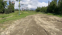
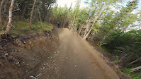
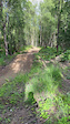
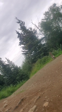
Photos of Anchorage Mountain Bike
Videos of Anchorage Mountain Bike
trail: Osteoblast Jump Line
0:16 |
114 |
Feb 20, 2025
trail: Millertime
0:30 |
208 |
Aug 18, 2024
trail: Juicy Juice
0:16 |
170 |
Jul 15, 2024
trail: Eh-Line
0:38 |
138 |
Aug 28, 2023
trail: Osteoblast Jump Line
0:11 |
|
Aug 9, 2021
trail: Eh-Line
0:10 |
530 |
Aug 23, 2020
trail: Good Greeff
0:47 |
|
Aug 11, 2020
trail: Eh-Line
2:31 |
291 |
Jul 2, 2020
Recent Trail Reports
| status | trail | date | condition | info | user |
|---|---|---|---|---|---|
| C$ and Bluff Connector | Jun 19, 2026 @ 1:21pm (America/Anchorage) 1 day | Dry | BigRedAK | ||
| Hanging Chad | Jun 16, 2026 @ 1:22pm (America/Anchorage) Jun 16, 2026 | Ideal | wolfdoodle5017 | ||
| Queen Bee | Jun 14, 2026 @ 10:50am (America/Anchorage) Jun 14, 2026 | Dry | wolfdoodle5017 | ||
| Gauer Power | Jun 14, 2026 @ 10:49am (America/Anchorage) Jun 14, 2026 | Dry | wolfdoodle5017 | ||
| Nunaka Tunnel | Jun 10, 2026 @ 10:38am (America/Anchorage) Jun 10, 2026 | Ideal | bneffer | ||
| Nunaka Valley Bike Path | Jun 10, 2026 @ 10:38am (America/Anchorage) Jun 10, 2026 | Ideal | bneffer | ||
| East Tikishla Spur | Jun 10, 2026 @ 10:38am (America/Anchorage) Jun 10, 2026 | Ideal | bneffer | ||
| Fun House | Jun 6, 2026 @ 10:22am (America/Anchorage) Jun 6, 2026 | Ideal | bneffer | ||
| Wheels Up | Jun 6, 2026 @ 10:22am (America/Anchorage) Jun 6, 2026 | Ideal | bneffer | ||
| Dropout | Jun 6, 2026 @ 10:22am (America/Anchorage) Jun 6, 2026 | Ideal | bneffer |
Activity Feed
| username | action | type | title | date |
|---|---|---|---|---|
| BigRedAK | add | report | activity #97368205 | Jun 19, 2026 @ 11:21pm 16 hours |
| wolfdoodle5017 | vote | skillpark | activity #97227443 | Jun 17, 2026 @ 7:43pm 3 days |
| r94HUwMA | wishlist | trail | activity #97219811 | Jun 17, 2026 @ 5:22pm 3 days |
| wolfdoodle5017 | comment | trail | activity #97212361 | Jun 17, 2026 @ 3:21pm 3 days |
| FMxGnk | wishlist | trail | activity #97206098 | Jun 17, 2026 @ 1:19pm Jun 17, 2026 |
Recent Comments
| username | type | title | comment | date |
|---|---|---|---|---|
| trail | Caution, watch for people hanging out on rock,... | Jun 17, 2026 @ 3:21pm 3 days | ||
| trail | Winter fat bike trail. | Jun 14, 2026 @ 11:51am Jun 14, 2026 | ||
| trail | First lower section has been graveled, use Do... | Jun 12, 2026 @ 10:24am Jun 12, 2026 | ||
| trail | Shelter has been removed! | Jun 1, 2026 @ 4:09pm Jun 1, 2026 | ||
| report | Tree on trail. Easily walked around. | May 18, 2026 @ 5:29pm May 18, 2026 |
Local Badges
-

Completionist2 awarded -

Epic Ride 50k2,824 awarded -

Top 10 Trails71 awarded -
Completionist3 awarded -
Completionist11 awarded -
Completionist0 awarded
Bike & Skill Parks
| name | type | city | rating |
|---|---|---|---|
| Hilltop Bike Park | bike park | Anchorage | |
| Jodhpur MX | skill park | Anchorage | |
| Skinny Garden Skills Park | skill park | Anchorage | |
| Skinny Garden Skills Park | skill park | Anchorage |
Local Trail Supporters
- Alaska Trails
- single track advocates
Activity Type Stats
| activitytype | trails | distance | descent | descent distance | total vertical | rating | global rank | state rank | photos | reports | routes | ridelogs |
|---|---|---|---|---|---|---|---|---|---|---|---|---|
| Mountain Bike | 404 | 393 miles | 34,970 ft | 137 miles | 4,577 ft | #81 | #30 | 954 | 4,977 | 43 | 143,435 | |
| E-Bike | 87 | 116 miles | 5,023 ft | 39 miles | 1,076 ft | #970 | #787 | 1 | 3,438 | 5 | 4,677 | |
| Gravel Bike | 11 | 23 miles | 3,675 ft | 6 miles | 3,412 ft | #144 | #837 | 185 | 3 | 1,401 | ||
| Winter Fat Bike | 5 | #1 | #456 | 30 | 45 | 1 | 1,759 | |||||
| Horse | 7 | 21 miles | 853 ft | 5 miles | 1,217 ft | #1,115 | #709 | 902 | 12 | |||
| Hike | 537 | 624 miles | 66,906 ft | 182 miles | 7,621 ft | #38 | #33 | 39 | 4,563 | 8 | 14,212 | |
| Trail Running | 542 | 619 miles | 65,312 ft | 177 miles | 7,621 ft | #38 | #27 | 20 | 4,540 | 11 | 13,093 | |
| Dirtbike/Moto | 1 | 12 miles | 413 ft | 3 miles | 220 ft | 896 | 24 | |||||
| Observed Trials | 1 | 12 miles | 413 ft | 3 miles | 220 ft | 48 | 19 | |||||
| ATV/ORV/OHV | 1 | 12 miles | 413 ft | 3 miles | 220 ft | 893 | 10 | |||||
| Snowmobile | 11 | 20 miles | 1,175 ft | 5 miles | 3,563 ft | #47 | #36 | 713 | 16 | |||
| Snowshoe | 243 | 311 miles | 36,017 ft | 73 miles | 7,621 ft | #15 | #8 | 1 | 1,074 | 1 | 569 | |
| Downhill Ski | 43 | 9 miles | 9,199 ft | 9 miles | 3,911 ft | #262 | #106 | 709 | 739 | |||
| Backcountry Ski | 155 | 186 miles | 25,961 ft | 46 miles | 5,318 ft | #43 | #10 | 781 | 1 | 1,645 | ||
| Nordic Ski | 203 | 176 miles | 10,679 ft | 59 miles | 5,427 ft | #7 | #1 | 5 | 1,035 | 15 | 16,619 |
Frequently Asked Questions About Anchorage
▼
What are the best places to ride in Anchorage?
Anchorage has 15 areas to explore for mountain biking. The top rated areas are:
▼
What are the highest rated mountain biking trails in Anchorage?
The highest rated mountain biking trails in Anchorage are:
- Eh-Line (4.6/5)
- Jeff's Whoop Whoop (4.6/5)
- Dig Deep (4.5/5)
- Dome Trail (4.4/5)
- Super Cub (4.4/5)
▼
What is the best time of the year to ride in Anchorage?
Based on ride log data, the most popular months to ride in Anchorage are:
- July (1,978 activities)
- June (1,657 activities)
- February (1,566 activities)
▼
Where can I park to ride in Anchorage?
There are 68 parking locations listed in Anchorage. The most popular parking spots are:
- Hillside Trail Parking
- Hilltop Ski Area Parking
- Jodhpur Parking Lot
- Abbot Loop Community Park Parking Lot
- Parking - Campbell Airstrip Trail head
Activities
- Anchorage Mountain Biking Trails
- Anchorage E-Biking Trails
- Anchorage Gravel Biking Trails
- Anchorage Winter Fat Biking Trails
- Anchorage Horseback Trails
- Anchorage Hiking Trails
- Anchorage Trail Running Trails
- Anchorage Snowmobiling Trails
- Anchorage Snowshoeing Trails
- Anchorage Skiing Trails
- Anchorage Backcountry Skiing Trails
- Anchorage Nordic Skiing Trails
Trails
Points of Interest
- Bird Ridge Overlook Summit
- Roundtop Summit
- Blacktail Ptarmigan Rocks Summit
- Mount Baldy Peak Summit
- Mount Magnificent Summit
- The Nipple Summit
- Blueberry Hill Summit
- Yesorno Point Summit
- Little Teton Mountain Summit
- Harp Mountain Summit
- Concerto Peak (5,449 ft)
- Mount Williwaw (5,367 ft)
- East Tanaina Peak (5,233 ft)
- By brenthillier
 NSMBA TRAILFORKS & contributors
 - Admins: STA, CMBR, LeeBolling, forrestt30, JDUERParks, A-Lens-for-Wanderlust
- #3433 - 43,917 views
- anchorage activity log | embed map of Anchorage mountain bike trails | anchorage mountain biking points of interest polygons
Downloading of trail gps tracks in kml & gpx formats is enabled for Anchorage.
You must login to download files.