close
-
Layers w
- Weather Layers
- Pro
- Pro
- Pro
- Pro
- Pro
- Pro
- More Layers
- Pro
- Pro
- Pro
- Pro
-
Upgrade to

3D
Trail Conditions
- Unknown
- Snow Groomed
- Snow Packed
- Snow Covered
- Snow Cover Partial
- Freeze/thaw Cycle
- Icy
- Prevalent Mud
- Wet
- Variable
- Ideal
- Dry
- Very Dry
Trail Flow (Ridden Direction)
Trailforks scans users ridelogs to determine the most popular direction each trail is ridden. A good flowing trail network will have most trails flowing in a single direction according to their intension.
The colour categories are based on what percentage of riders are riding a trail in its intended direction.
The colour categories are based on what percentage of riders are riding a trail in its intended direction.
- > 96%
- > 90%
- > 80%
- > 70%
- > 50%
- < 50%
- bi-directional trail
- no data
Trail Last Ridden
Trailforks scans ridelogs to determine the last time a trail was ridden.
- < 2 days
- < 1 week
- < 2 weeks
- < 1 month
- < 6 months
- > 6 months
Trail Ridden Direction
The intended direction a trail should be ridden.
- Downhill Only
- Downhill Primary
- Both Directions
- Uphill Primary
- Uphill Only
- One Direction
Contribute Details
Colors indicate trail is missing specified detail.
- Description
- Photos
- Description & Photos
- Videos
Trail Popularity ?
Trailforks scans ridelogs to determine which trails are ridden the most in the last 9 months.
Trails are compared with nearby trails in the same city region with a possible 25 colour shades.
Think of this as a heatmap, more rides = more kinetic energy = warmer colors.
- most popular
- popular
- less popular
- not popular
ATV/ORV/OHV Filter
Max Vehicle Width
inches
US Cell Coverage
Legend

Radar Time
Activity Recordings
Trailforks uses anonymized public activity data.
?
Activity Recordings
Trailforks uses anonymized public activity data.
?
Personal Heatmap
▶
Activity Types
all
/
none
▶
Options
2
Date range
month
–
Winter Trails
Warning
A routing network for winter maps does not exist. Selecting trails using the winter trails layer has been disabled.
Missing Trails
Most Popular
Least Popular
Trails are colored based on popularity. The more popular a trail is, the more red. Less popular trails trend towards green.
Jump Magnitude Heatmap
Heatmap of where riders jump on trails. Zoom in to see individual jumps, click circles to view jump details.
BC Backroad Status
![map legend]()
Service Road Atlas is a free to use, community-driven service for viewing and creating reports on the numerous back-country service roads around B.C. and Alberta.

Slope Aspect
Direction the slope faces
Trails Deemphasized
Trails are shown in grey.
Only show trails with no bike usage.
Suggested Layers
Based on selected activity type
Save the current map location and zoom level as your default home location whenever this page is loaded.
Save
No description for Anderson has been added yet!
Login or register to submit one.
Activities Click to view
- Mountain Bike
11 trails
- Adaptive Bike
0 trails
- Winter Fat Bike
0 trails
- Hike
28 trails
- Trail Running
27 trails
Region Details
- 1
- 1
- 1
- 1
- 5
- 1
Region Status
Caution as of 2 daysStats
- Avg Trail Rating
- Trails (view details)
- 26
- Trails Mountain Bike
- 12
- Trails E-Bike
- 2
- Trails Hike
- 28
- Trails Trail Running
- 27
- Total Distance
- 18 miles
- Total Descent Distance
- 5 miles
- Total Descent
- 794 ft
- Total Vertical
- 94 ft
- Highest Trailhead
- 920 ft
- Reports
- 2,036
- Photos
- 30
- Ridden Counter
- 969
Sub Regions
-
Mounds State Park
-
Rangeline Nature Preserve
- 1
- 1
- 5
- 1
Popular Anderson Mountain Biking Trails
• 85 ★ 3.7 • 2 miles • 26 ft • 154 •
Smooth, Fast, Flowy trail with two creek crossings and lots of berms. Please support RNP by shopping on the RNP Merch Store. $5 of each item will go towards RNP trail fund. Thank you. https://bit.ly/rangelineNP -
• 100 ★ 3.6 • 4,751 ft • 24 ft • 138 •
This is an extension of the with a bit more challenge in the form of climbs and tighter turns. Please support RNP by shopping on the RNP Merch Store. $5 of each item will go towards RNP trail fund. Thank you. https://bit.ly/rangelineNP -
• 95 ★ 2.9 • 2,598 ft • 26 ft • 124 •
This is the first expert section of the Expert Loop. This one is the least challenging of the group, but the trail does have a small drop and a larger one at the end. Please support RNP by shopping on the RNP Merch Store. $5 of each...
• 65 ★ 3.2 • 1,801 ft • 16 ft • 114 •
Second Expert section in the Expert Loop. Includes a steep climb and other challenges. Please support RNP by shopping on the RNP Merch Store. $5 of each item will go towards RNP trail fund. Thank you. https://bit.ly/rangelineNP -
• 75 ★ 3.4 • 5,138 ft • 24 ft • 108 •
The Expert Loop gets a bit more flowy in this section. The natural mounds create an almost constant up and down trail. There are never-ending log crossings. Many manmade jumps and obstacles paired with natural terrain will challenge any...
• 55 ★ 3.6 • 2,316 ft • 5 ft • 97 •
The Expert Loop gets a bit easier in this section. The mounds create an almost constant up and down trail. Most climbing is a blue level but there is one sharp switchback that is challenging. Please support RNP by shopping on the RNP...
• 45 ★ 5.0 • 2 miles • 46 ft • 19 •
This Intermediate level flowing waterside trail borders Lake and White River for its entire distance. Along its length are constant aquatic views, swooping descents, jumps, banked turns, bridges, an artesian spring, and more. Take a...
• 20 ★ 0.0 • 5 miles • 19 ft • 8 •
Less popular white difficulty family friendly paved path. This multi-use trail can be used both directions and has a easy overall physical rating with a 19 ft green climb. Trail visibility is always easy to follow. On average it takes 36 minutes to complete this trail.
Anderson Mountain Bike Routes
Expert Loop Featured
★ 4.0 • 8 miles • 179 ft • 10 • Loop •
This loop begins with the fast and flowy Beginner loop but branches off for much more challenging terrain...
★ 4.5 • 5 miles • 98 ft • 3 • Loop •
Smooth, fast, flowy trail with creek crossings, jumps, bridges, and many aquatic views. Begins with the...
2 miles • 26 ft • 1 •
This is an easy moderately flat 2 mile loop which connects both the Intermediate and Expert trails. Please...
• 15 miles • 417 ft • 10 •
• 2 miles • 37 ft • 1 •
• 5 miles • 197 ft • 5 •
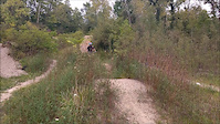
Photos of Anderson Mountain Bike
Videos of Anderson Mountain Bike
trail: Intermediate Loop
0:15 |
346 |
Sep 6, 2017
Recent Trail Reports
| status | trail | date | condition | info | user |
|---|---|---|---|---|---|
| Vulcan | Jun 21, 2026 @ 3:45pm (America/Indiana/Indianapolis) 2 days | Unknown | Jeff1462 | ||
| Intermediate Loop | Jun 21, 2026 @ 3:45pm (America/Indiana/Indianapolis) 2 days | Unknown | Jeff1462 | ||
| Novice Loop | Jun 21, 2026 @ 3:45pm (America/Indiana/Indianapolis) 2 days | Unknown | Jeff1462 | ||
| Mesa | May 28, 2026 @ 12:24pm (America/Indiana/Indianapolis) May 28, 2026 | Unknown | Jeff1462 | ||
| Gravel Access Road | May 28, 2026 @ 12:24pm (America/Indiana/Indianapolis) May 28, 2026 | Unknown | Jeff1462 | ||
| Expert 4 | May 28, 2026 @ 12:24pm (America/Indiana/Indianapolis) May 28, 2026 | Unknown | Jeff1462 | ||
| Expert 3 | May 28, 2026 @ 12:24pm (America/Indiana/Indianapolis) May 28, 2026 | Unknown | Jeff1462 | ||
| Expert 2 | May 28, 2026 @ 12:24pm (America/Indiana/Indianapolis) May 28, 2026 | Unknown | Jeff1462 | ||
| Expert 1 | May 28, 2026 @ 12:24pm (America/Indiana/Indianapolis) May 28, 2026 | Unknown | Jeff1462 | ||
| White River Trace | Feb 2, 2020 @ 1:53pm Feb 2, 2020 | Variable | Benorcutt |
Activity Feed
| username | action | type | title | date |
|---|---|---|---|---|
| Jeff1462 | add | report | activity #97555028 and 2 more | Jun 22, 2026 @ 5:29am 1 day |
| Jeff1462 | add | photo | activity #97055010 | Jun 15, 2026 @ 11:24am Jun 15, 2026 |
| Jeff1462 | vote | trail | activity #96682319 and 1 more | Jun 10, 2026 @ 10:29am Jun 10, 2026 |
| Jeff1462 | vote | route | activity #96616176 | Jun 9, 2026 @ 10:42am Jun 9, 2026 |
| Jeff1462 | update | trail | activity #96613108 and 5 more | Jun 9, 2026 @ 9:59am Jun 9, 2026 |
Recent Comments
| username | type | title | comment | date |
|---|---|---|---|---|
| report | Wet | Apr 23, 2024 @ 2:26pm Apr 23, 2024 | ||
| report | Wet | Apr 23, 2024 @ 2:26pm Apr 23, 2024 | ||
| trail | Somehow this is my favorite, and least... | Sep 19, 2020 @ 12:28pm Sep 19, 2020 | ||
| trail | Very fun trail with many challenges, but easy... | Oct 27, 2015 @ 8:19am Oct 27, 2015 |
Local Badges
-

Epic Mountain Bike Climb 2k0 awarded -

Climbing 10k Badge0 awarded -

Mountain Biking 100k Badge0 awarded -

Big Ride 30k57 awarded -

Epic Ride 50k9 awarded -

Epic Ride Descent 2k0 awarded
Local Trail Supporters
- City of Anderson
Activity Type Stats
| activitytype | trails | distance | descent | descent distance | total vertical | rating | global rank | state rank | photos | reports | routes | ridelogs |
|---|---|---|---|---|---|---|---|---|---|---|---|---|
| Mountain Bike | 11 | 12 miles | 157 ft | 3 miles | 72 ft | #5,515 | #1,852 | 32 | 2,361 | 2 | 1,509 | |
| E-Bike | 2 | 128 | 133 | |||||||||
| Hike | 28 | 18 miles | 794 ft | 5 miles | 95 ft | #6,712 | #2,367 | 2,357 | 58 | |||
| Trail Running | 27 | 18 miles | 794 ft | 5 miles | 95 ft | #7,294 | #2,408 | 2,357 | 17 |
Frequently Asked Questions About Anderson
▼
What are the best places to ride in Anderson?
Anderson has 2 areas to explore for mountain biking. The top rated areas are:
▼
What are the highest rated mountain biking trails in Anderson?
The highest rated mountain biking trails in Anderson are:
- Vulcan (4.1/5)
- Mesa (4.1/5)
- Intermediate Loop (3.8/5)
- Expert 4 (3.8/5)
- Novice Loop (3.8/5)
▼
What is the best time of the year to ride in Anderson?
Based on ride log data, the most popular months to ride in Anderson are:
- May (31 activities)
- September (27 activities)
- June (25 activities)
▼
Where can I park to ride in Anderson?
There are 1 parking locations listed in Anderson. The most popular parking spots are:
- By Warburrito & contributors
- Admins: HMBA
- #7404 - 4,171 views
- anderson activity log | embed map of Anderson mountain bike trails | anderson mountain biking points of interest
Downloading of trail gps tracks in kml & gpx formats is enabled for Anderson.
You must login to download files.