close
-
Layers w
- Weather Layers
- Pro
- Pro
- Pro
- Pro
- Pro
- Pro
- More Layers
- Pro
- Pro
- Pro
- Pro
-
Upgrade to

3D
Trail Conditions
- Unknown
- Snow Groomed
- Snow Packed
- Snow Covered
- Snow Cover Partial
- Freeze/thaw Cycle
- Icy
- Prevalent Mud
- Wet
- Variable
- Ideal
- Dry
- Very Dry
Trail Flow (Ridden Direction)
Trailforks scans users ridelogs to determine the most popular direction each trail is ridden. A good flowing trail network will have most trails flowing in a single direction according to their intension.
The colour categories are based on what percentage of riders are riding a trail in its intended direction.
The colour categories are based on what percentage of riders are riding a trail in its intended direction.
- > 96%
- > 90%
- > 80%
- > 70%
- > 50%
- < 50%
- bi-directional trail
- no data
Trail Last Ridden
Trailforks scans ridelogs to determine the last time a trail was ridden.
- < 2 days
- < 1 week
- < 2 weeks
- < 1 month
- < 6 months
- > 6 months
Trail Ridden Direction
The intended direction a trail should be ridden.
- Downhill Only
- Downhill Primary
- Both Directions
- Uphill Primary
- Uphill Only
- One Direction
Contribute Details
Colors indicate trail is missing specified detail.
- Description
- Photos
- Description & Photos
- Videos
Trail Popularity ?
Trailforks scans ridelogs to determine which trails are ridden the most in the last 9 months.
Trails are compared with nearby trails in the same city region with a possible 25 colour shades.
Think of this as a heatmap, more rides = more kinetic energy = warmer colors.
- most popular
- popular
- less popular
- not popular
ATV/ORV/OHV Filter
Max Vehicle Width
inches
US Cell Coverage
Legend

Radar Time
Activity Recordings
Trailforks uses anonymized public activity data.
?
Activity Recordings
Trailforks uses anonymized public activity data.
?
Personal Heatmap
▶
Activity Types
all
/
none
▶
Options
2
Date range
month
–
Winter Trails
Warning
A routing network for winter maps does not exist. Selecting trails using the winter trails layer has been disabled.
Missing Trails
Most Popular
Least Popular
Trails are colored based on popularity. The more popular a trail is, the more red. Less popular trails trend towards green.
Jump Magnitude Heatmap
Heatmap of where riders jump on trails. Zoom in to see individual jumps, click circles to view jump details.
BC Backroad Status
![map legend]()
Service Road Atlas is a free to use, community-driven service for viewing and creating reports on the numerous back-country service roads around B.C. and Alberta.

Slope Aspect
Direction the slope faces
Trails Deemphasized
Trails are shown in grey.
Only show trails with no bike usage.
Suggested Layers
Based on selected activity type
Save the current map location and zoom level as your default home location whenever this page is loaded.
Save
No description for Andora has been added yet!
Login or register to submit one.
This region uses the Uk/Euro style trail grading system.
Activities Click to view
- Mountain Bike
90 trails
- E-Bike
82 trails
- Gravel Bike
1 trails
- Adaptive Bike
1 trails
- Winter Fat Bike
0 trails
- Horse
4 trails
- Hike
72 trails
- Trail Running
72 trails
Region Details
- 26
- 1
- 16
- 29
Region Status
Open as of May 29, 2026Stats
- Avg Trail Rating
- Trails (view details)
- 91
- Trails Mountain Bike
- 90
- Trails E-Bike
- 82
- Trails Gravel Bike
- 1
- Trails Adaptive Bike
- 1
- Trails Horse
- 4
- Trails Hike
- 72
- Trails Trail Running
- 72
- Trails Dirtbike/Moto
- 2
- Trails Observed Trials
- 2
- Total Distance
- 68 miles
- Total Descent
- 19,230 ft
- Total Vertical
- 1,956 ft
- Highest Trailhead
- 1,966 ft
- Reports
- 988
- Photos
- 135
- Ridden Counter
- 10,601
Sub Regions
-
Andora Bike Resort
- 1
- 15
- 28
Popular Andora Mountain Biking Trails
• 100 ★ 4.7 • 3,996 ft • 28 ft • 426 •
Highly rated popular blue difficulty singletrack. This mountain bike primary trail can be used downhill only and has a moderate overall physical rating. It features a-frame, berm, drop, jump, gap jump, rock face, rock garden and roller coaster. Trail visibility is always easy to follow. On average it takes 10 minutes to complete this trail.
• 100 ★ 3.3 • 2,106 ft • 0 ft • 385 •
Popular blue difficulty singletrack. This mountain bike primary trail can be used one direction and has a moderate overall physical rating. Trail visibility is always easy to follow. On average it takes 3 minutes to complete this trail.
• 80 ★ 3.5 • 4,150 ft • 0 ft • 264 •
Amazing downhill trail. Small double jump and a steep up-hill ramp in the first part of the track.
• 85 ★ 3.7 • 1 mile • 275 ft • 261 •
Popular green difficulty mixed. This mountain bike primary trail can be used both directions and has a moderate overall physical rating with a 275 ft blue climb. On average it takes 15 minutes to complete this trail.
• 100 ★ 5.0 • 702 ft • 16 ft • 255 •
Popular green difficulty family friendly singletrack. This multi-use trail can be used both directions and has a easy overall physical rating with a 16 ft green climb. It features rock garden. Adaptive MTB rating: amtb blue. Trail visibility is always easy to follow. On average it takes minutes to complete this trail.
• 100 ★ 4.3 • 1,847 ft • 0 ft • 242 •
IT: Sentiero vario e tortuoso che si snoda fra gli alberi della zona "Campo Sportivo". EN: Varied and winding path that winds through the trees of the "Campo Sportivo" area.
• 70 ★ 4.2 • 2 miles • 269 ft • 222 •
IT: Stradone sterrato di 3-4 metri di larghezza sulla cresta della collina che divide Andora da Laigueglia, che alterna sezioni di ripida salita a discese larghe, lunghe e molto divertenti. Lo sterrato è a doppio senso, e va dal parco...
• 95 ★ 5.0 • 978 ft • 27 ft • 197 •
Popular green difficulty singletrack. This mountain bike primary trail can be used both directions and has a easy overall physical rating with a 27 ft green climb. It features rock garden and roller coaster. Trail visibility is always easy to follow. On average it takes minutes to complete this trail.
Andora Mountain Bike Routes
25 miles • 2,499 ft • 4 •
Il percorso che nessun visitatore di Andora dovrebbe farsi scappa- re. Un vero e proprio viaggio verso la...
12 miles • 1,662 ft • 7 • Loop •
Un vero e proprio tuffo nella macchia mediterranea alla scoperta del territorio sopra Andora.
4 miles • 1,249 ft • 2 • Point to Point •
First part of the itinerary very smooth. At the beginning of the path I begin the difference in height and...
9 miles • 1,172 ft • 10 • Loop •
Si sale fino a Poggio Brea dove si può ammirare uno dei panorami più belli della Liguria passando da...
15 miles • 2,284 ft • 3 • Point to Point •
Percorso che collega Andora a Conna attraverso il versante del Monte Chiappa.
12 miles • 2,030 ft • 7 •
Piacevole pedalata che collega Andora a Laigueglia passando dall’antico abitato di Colla Micheri.
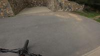
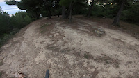
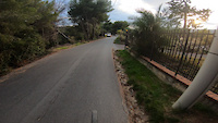
Photos of Andora Mountain Bike
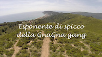
Videos of Andora Mountain Bike
trail: Salita Via della Bura
0:26 |
51 |
Nov 29, 2020
trail: Labirinto Del Boschetto
0:28 |
93 |
Nov 29, 2020
trail: Upper Carrubo 2
5:16 |
55 |
Nov 28, 2020
2:17 |
343 |
Jun 2, 2016

trail: Junior
5:41 |
2450 |
May 31, 2013

trail: Antenne
18:40 |
33 |
Apr 18, 2026 , Andora
trail: Antenne
2:49 |
70 |
Nov 17, 2025 , Andora

trail: Jocker
2:49 |
93 |
Nov 17, 2025 , Andora
Recent Trail Reports
Activity Feed
| username | action | type | title | date |
|---|---|---|---|---|
| HolgerSchmitt | ridden | trail | activity #96349235 | Jun 6, 2026 @ 2:10am Jun 6, 2026 |
| HolgerSchmitt | ridden | trail | activity #96349228 and 1 more | Jun 6, 2026 @ 2:10am Jun 6, 2026 |
| ValtBio | add | report | activity #95838708 and 2 more | May 30, 2026 @ 4:41am May 30, 2026 |
| clemz | ridden | trail | activity #95798872 and 1 more | May 29, 2026 @ 1:27pm May 29, 2026 |
| LMS0202 | wishlist | region | activity #95223883 | May 21, 2026 @ 10:39pm May 21, 2026 |
Recent Comments
| username | type | title | comment | date |
|---|---|---|---|---|
| trail | Trail forse in disuso? Sarebbe da sistemare,... | May 17, 2026 @ 5:06am May 17, 2026 | ||
| trail | Ci posso essere anche dei pedoni sul sentiero... | Nov 25, 2025 @ 12:37am Nov 25, 2025 | ||
| trail | La linea ora è molto più veloce, fare... | Nov 25, 2025 @ 12:36am Nov 25, 2025 | ||
| trail | L’ultima parte del sentiero è scavato... | Nov 25, 2025 @ 12:28am Nov 25, 2025 | ||
| trail | Overgrown to point where it make no sense to ride | Nov 17, 2025 @ 5:01am Nov 17, 2025 |
Local Badges
-

Completionist0 awarded -

10 Blue Trails60 awarded -

10 Black Trails9 awarded -

Epic Mountain Bike Climb 2k361 awarded -

Climbing 10k Badge60 awarded -

Mountain Biking 100k Badge4 awarded
Local Trail Supporters
- a.s.d. AndoraRace
![]()
Activity Type Stats
| activitytype | trails | distance | descent | descent distance | total vertical | rating | global rank | state rank | photos | reports | routes | ridelogs |
|---|---|---|---|---|---|---|---|---|---|---|---|---|
| Mountain Bike | 90 | 68 miles | 19,222 ft | 33 miles | 1,955 ft | #1,359 | #35 | 97 | 987 | 13 | 5,602 | |
| E-Bike | 82 | 65 miles | 17,979 ft | 31 miles | 1,955 ft | #327 | #29 | 38 | 952 | 11 | 1,081 | |
| Gravel Bike | 1 | #346 | #140 | 73 | ||||||||
| Adaptive Bike | 1 | #320 | #467 | |||||||||
| Horse | 4 | 5 miles | 1,135 ft | 3 miles | 1,217 ft | #1,590 | #67 | 38 | ||||
| Hike | 72 | 54 miles | 13,281 ft | 23 miles | 1,946 ft | #3,930 | #146 | 902 | 125 | |||
| Trail Running | 72 | 53 miles | 13,448 ft | 23 miles | 1,946 ft | #3,462 | #133 | 910 | 123 | |||
| Dirtbike/Moto | 2 | 5 miles | 223 ft | 2 miles | 1,319 ft | 32 | ||||||
| Observed Trials | 2 | 5 miles | 223 ft | 2 miles | 1,319 ft |
Frequently Asked Questions About Andora
▼
What are the best places to ride in Andora?
Andora has 1 areas to explore for mountain biking. The top rated areas are:
▼
What are the highest rated mountain biking trails in Andora?
The highest rated mountain biking trails in Andora are:
- Tecci (4.4/5)
- Antenne (4.4/5)
- Mezzacosta Campo Sportivo (4.4/5)
- Taglio Basso Cresta (4.3/5)
- Taglio Basso Poggio Balaie (4.3/5)
▼
What is the best time of the year to ride in Andora?
Based on ride log data, the most popular months to ride in Andora are:
- August (55 activities)
- July (25 activities)
- June (12 activities)
▼
Where can I park to ride in Andora?
There are 2 parking locations listed in Andora. The most popular parking spots are:
Activities
Trails
Points of Interest
- Il Guado di Mezz'acqua TTF
- Chiesa Sconsacrata di Mezz'acqua Viewpoint
- Punto Panoramico Poggio Balaie Viewpoint
- Borgo di Colla Micheri Viewpoint
- Cima Tecci Altissimi Summit
- Vista Panoramica "Panchine" Viewpoint
- Drop Della Tagliafuoco TTF
- Drop Di Angelo Nè TTF
- Mappa Percorsi Postazione "Le Rocce" Information
- Drop Del Labirinto TTF
- Monte Mezzogiorno (2,451 ft)
- Monte Aguzzo (2,428 ft)
- Pizzo Pegno (2,402 ft)
- By lorcarg & contributors
- Admins: denitopia
- #7682 - 6,078 views
- andora activity log | embed map of Andora mountain bike trails | andora mountain biking points of interest
Downloading of trail gps tracks in kml & gpx formats is enabled for Andora.
You must login to download files.