close
-
Layers w
- Weather Layers
- Pro
- Pro
- Pro
- Pro
- Pro
- Pro
- More Layers
- Pro
- Pro
- Pro
- Pro
-
Upgrade to

3D
Trail Conditions
- Unknown
- Snow Groomed
- Snow Packed
- Snow Covered
- Snow Cover Partial
- Freeze/thaw Cycle
- Icy
- Prevalent Mud
- Wet
- Variable
- Ideal
- Dry
- Very Dry
Trail Flow (Ridden Direction)
Trailforks scans users ridelogs to determine the most popular direction each trail is ridden. A good flowing trail network will have most trails flowing in a single direction according to their intension.
The colour categories are based on what percentage of riders are riding a trail in its intended direction.
The colour categories are based on what percentage of riders are riding a trail in its intended direction.
- > 96%
- > 90%
- > 80%
- > 70%
- > 50%
- < 50%
- bi-directional trail
- no data
Trail Last Ridden
Trailforks scans ridelogs to determine the last time a trail was ridden.
- < 2 days
- < 1 week
- < 2 weeks
- < 1 month
- < 6 months
- > 6 months
Trail Ridden Direction
The intended direction a trail should be ridden.
- Downhill Only
- Downhill Primary
- Both Directions
- Uphill Primary
- Uphill Only
- One Direction
Contribute Details
Colors indicate trail is missing specified detail.
- Description
- Photos
- Description & Photos
- Videos
Trail Popularity ?
Trailforks scans ridelogs to determine which trails are ridden the most in the last 9 months.
Trails are compared with nearby trails in the same city region with a possible 25 colour shades.
Think of this as a heatmap, more rides = more kinetic energy = warmer colors.
- most popular
- popular
- less popular
- not popular
ATV/ORV/OHV Filter
Max Vehicle Width
inches
US Cell Coverage
Legend

Radar Time
Activity Recordings
Trailforks uses anonymized public activity data.
?
Activity Recordings
Trailforks uses anonymized public activity data.
?
Personal Heatmap
▶
Activity Types
all
/
none
▶
Options
2
Date range
month
–
Winter Trails
Warning
A routing network for winter maps does not exist. Selecting trails using the winter trails layer has been disabled.
Missing Trails
Most Popular
Least Popular
Trails are colored based on popularity. The more popular a trail is, the more red. Less popular trails trend towards green.
Jump Magnitude Heatmap
Heatmap of where riders jump on trails. Zoom in to see individual jumps, click circles to view jump details.
BC Backroad Status
![map legend]()
Service Road Atlas is a free to use, community-driven service for viewing and creating reports on the numerous back-country service roads around B.C. and Alberta.

Slope Aspect
Direction the slope faces
Trails Deemphasized
Trails are shown in grey.
Only show trails with no bike usage.
Suggested Layers
Based on selected activity type
Save the current map location and zoom level as your default home location whenever this page is loaded.
Save
No description for Andorra has been added yet!
Login or register to submit one.
This region uses the Uk/Euro style trail grading system.
Region Details
- 49
- 21
- 104
- 93
- 41
Stats
- Avg Trail Rating
- Trails (view details)
- 578
- Trails Mountain Bike
- 336
- Trails E-Bike
- 325
- Trails Horse
- 20
- Trails Hike
- 240
- Trails Trail Running
- 228
- Trails Dirtbike/Moto
- 2
- Trails Observed Trials
- 2
- Trails ATV/ORV/OHV
- 2
- Trails Snowmobile
- 4
- Trails Snowshoe
- 4
- Trails Downhill Ski
- 248
- Trails Backcountry Ski
- 11
- Trails Nordic Ski
- 5
- Total Distance
- 384 miles
- Total Descent
- 261,950 ft
- Total Vertical
- 7,806 ft
- Highest Trailhead
- 9,560 ft
- Reports
- 1,204
- Photos
- 464
- Ridden Counter
- 70,577
Articles

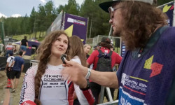
Interview: Max Commencal on Racing Roots, E-Bikes, & the Future of Mountain Biking
Sep 24, 2025 from pinkbike.com
“Avoid following others like a sheep — believe in yourself and your instincts.”
Video: WynTV Q2 Rapid Reactions - 2025 Andorra DH World Cup
Jul 11, 2025 from pinkbike.com
Wyn catches up with everyone following a flat out Q2 session in Andorra.
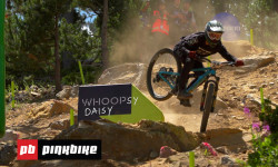
Video: Maybe You Do Need A DH Bike | Inside The Tape with Ben Cathro
Jul 11, 2025 from pinkbike.com
Potentially the fastest and loosest World Cup Track of the season, big jumps, loose dust and rocks, and some ridiculous speeds.
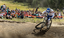
Wildcard Teams Announced for Andorra World Cup Round
Jun 26, 2025 from pinkbike.com
Eight XC and eight DH teams are set to join Round 11 of the 2025 WHOOP UCI Mountain Bike World Series.
Sub Regions
- Andorra la Vella (16)
- Canillo (24)
- Encamp (50)
- La Massana (132)
- Arinsal (5)
- La Massana (127)
- Arinsal (1)
- Arinsal (5)
- Ordino (47)
- Arcalis Ordino (1)
- San Julián de Loria (26)
- Sant Julia de Loria (30)
- Naturland Bike Center (10)
- Sant Julia de Loria (30)
- Escaldes (19)
Popular Andorra Mountain Biking Trails
• 95 ★ 4.5 • 1,962 ft • 2 ft • 1,188 •
Highly rated popular blue difficulty singletrack. This mountain bike primary trail can be used downhill only. It features bridge and ladder bridge. Trail visibility is always easy to follow. On average it takes 1 minutes to complete this trail.
• 85 ★ 4.6 • 2 miles • 65 ft • 1,157 •
Highly rated popular blue difficulty singletrack. This mountain bike primary trail can be used downhill only and has a moderate overall physical rating. It features berm, jump and roller coaster. Trail visibility is always easy to follow. On average it takes 14 minutes to complete this trail.
• 100 ★ 4.4 • 1 mile • 0 ft • 1,120 •
Highly rated popular blue difficulty singletrack. This mountain bike primary trail can be used downhill only and has a moderate overall physical rating. It features berm and jump. Trail visibility is always easy to follow. On average it takes 6 minutes to complete this trail.
• 100 ★ 4.7 • 4,485 ft • 0 ft • 1,006 •
Highly rated popular blue difficulty singletrack. This mountain bike primary trail can be used downhill only. On average it takes 3 minutes to complete this trail.
• 90 ★ 4.7 • 1,982 ft • 0 ft • 962 •
Highly rated popular blue difficulty singletrack. This multi-use trail can be used downhill only. Trail visibility is always easy to follow. On average it takes 1 minutes to complete this trail.
• 90 ★ 4.9 • 2 miles • 38 ft • 881 •
Highly rated popular blue difficulty singletrack. This multi-use trail can be used downhill only. On average it takes 6 minutes to complete this trail.
• 75 ★ 4.8 • 1 mile • 0 ft • 723 •
Highly rated popular red difficulty machine groomed. This multi-use trail can be used downhill only. It features berm, jump, gap jump and wallride. Trail visibility is always easy to follow. On average it takes 5 minutes to complete this trail.
• 100 ★ 3.8 • 636 ft • 0 ft • 721 •
Popular blue difficulty singletrack. This multi-use trail can be used downhill only and has a easy overall physical rating. It features berm. Trail visibility is always easy to follow. On average it takes minutes to complete this trail.
Andorra Mountain Bike Routes
★ 5.0 • 13 miles • 2,611 ft • 0 • Shuttled •
Ruta que conecta la estación de Grau Roig con Les Escaldes a través del circo de Pessons, el pico del...
18 miles • 3,424 ft • 1 • Loop •
Dificultat: Dura • 29,58 km • 4h35
★ 4.0 • 5 miles • 139 ft • 0 • Point to Point •
This trail has som diferent parts like rock gardens, close turns and so much flow
9 miles • 2,403 ft • 0 • Loop •
Desde el Naturland Bike Center sale esta exigente y espectacular, por pista de 4x4 hasta el punto más...
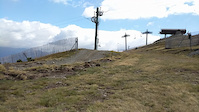
Photos of Andorra Mountain Bike
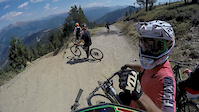
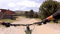
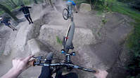
Videos of Andorra Mountain Bike
trail: Maxiavalanche Inferior 2
2:29 |
94 |
Apr 21, 2023
trail: Commençal Superior
0:12 |
164 |
Mar 28, 2022
trail: Cubil
0:39 |
266 |
Aug 29, 2020

trail: Commençal Final
0:38 |
138 |
Jul 10, 2020
trail: Cubil
3:19 |
47 |
Jul 2, 2019

trail: World Cup DHI 2019
3:03 |
31 |
Mar 7, 2019
trail: World Cup DHI 2019
3:01 |
274 |
Jan 2, 2018
trail: World Cup DHI 2019
3:10 |
209 |
Oct 14, 2017
Recent Comments
| username | type | title | comment | date |
|---|---|---|---|---|
| trail | Je tombe de mon vélo en lisant les... | May 26, 2026 @ 5:07am May 26, 2026 | ||
| trail | Esta también es por lo menos NEGRA 100% | May 11, 2026 @ 12:30pm May 11, 2026 | ||
| trail | Es Negra por lo menos 100% | May 11, 2026 @ 12:30pm May 11, 2026 | ||
| trail | Per mí és negra, negríssima... Primer terç... | Oct 6, 2025 @ 9:27am Oct 6, 2025 | ||
| trail | Comparing the trail with the description,... | Sep 19, 2025 @ 12:07am Sep 19, 2025 |
Bike & Skill Parks
| name | type | city | rating |
|---|---|---|---|
| Pal Arinsal Bike Park | bike park | La Massana | |
| Grandvalira E-Bikes Trails | bike park | ||
| Pal Arinsal Pump Track | skill park | La Massana | |
| Naturland | skill park | Sant Julia de Loria | |
| Les Berques | skill park | Arinsal |
Upcoming Local Events
Activity Type Stats
| activitytype | trails | distance | descent | descent distance | total vertical | rating | global rank | state rank | photos | reports | routes | ridelogs |
|---|---|---|---|---|---|---|---|---|---|---|---|---|
| Mountain Bike | 334 | 230 miles | 137,484 ft | 144 miles | 7,149 ft | #55 | 417 | 1,203 | 21 | 41,303 | ||
| E-Bike | 325 | 218 miles | 131,020 ft | 138 miles | 7,149 ft | #44 | 21 | 1,173 | 15 | 5,482 | ||
| Horse | 20 | 7 miles | 1,480 ft | 2 miles | 3,212 ft | #59 | 21 | |||||
| Hike | 240 | 182 miles | 91,332 ft | 97 miles | 7,805 ft | #65 | 6 | 864 | 9 | 7,244 | ||
| Trail Running | 228 | 169 miles | 87,438 ft | 91 miles | 7,805 ft | #66 | 861 | 9 | 2,333 | |||
| Dirtbike/Moto | 2 | 2 miles | 26 ft | 371 ft | 1,486 ft | #62 | 21 | 2 | ||||
| Observed Trials | 2 | 2 miles | 26 ft | 371 ft | 1,486 ft | #44 | ||||||
| ATV/ORV/OHV | 2 | 2 miles | 26 ft | 371 ft | 1,486 ft | #51 | 21 | |||||
| Snowmobile | 4 | 3 miles | 561 ft | 1,870 ft | 4,488 ft | #30 | 2 | |||||
| Snowshoe | 4 | 3 miles | 561 ft | 1,870 ft | 4,488 ft | #26 | 2 | 110 | ||||
| Downhill Ski | 248 | 133 miles | 117,848 ft | 126 miles | 5,492 ft | #20 | 12 | 30 | 3,927 | |||
| Backcountry Ski | 11 | 15 miles | 2,087 ft | 2 miles | 4,488 ft | #23 | 2 | 3,133 | ||||
| Nordic Ski | 5 | 3 miles | 561 ft | 1,870 ft | 4,488 ft | #27 | 2 | 629 |
Activities
Trails
- By canadaka
 Trailforks & contributors
 - Admins: tomzaniroli, elyari, snaker4, AMG, kai-bcn
- #3232 - 28,078 views
- andorra activity log | embed map of Andorra mountain bike trails | andorra mountain biking points of interest
Downloading of trail gps tracks in kml & gpx formats is enabled for Andorra.
You must login to download files.