close
-
Layers w
- Weather Layers
- Pro
- Pro
- Pro
- Pro
- Pro
- Pro
- More Layers
- Pro
- Pro
- Pro
- Pro
-
Upgrade to

3D
Trail Conditions
- Unknown
- Snow Groomed
- Snow Packed
- Snow Covered
- Snow Cover Partial
- Freeze/thaw Cycle
- Icy
- Prevalent Mud
- Wet
- Variable
- Ideal
- Dry
- Very Dry
Trail Flow (Ridden Direction)
Trailforks scans users ridelogs to determine the most popular direction each trail is ridden. A good flowing trail network will have most trails flowing in a single direction according to their intension.
The colour categories are based on what percentage of riders are riding a trail in its intended direction.
The colour categories are based on what percentage of riders are riding a trail in its intended direction.
- > 96%
- > 90%
- > 80%
- > 70%
- > 50%
- < 50%
- bi-directional trail
- no data
Trail Last Ridden
Trailforks scans ridelogs to determine the last time a trail was ridden.
- < 2 days
- < 1 week
- < 2 weeks
- < 1 month
- < 6 months
- > 6 months
Trail Ridden Direction
The intended direction a trail should be ridden.
- Downhill Only
- Downhill Primary
- Both Directions
- Uphill Primary
- Uphill Only
- One Direction
Contribute Details
Colors indicate trail is missing specified detail.
- Description
- Photos
- Description & Photos
- Videos
Trail Popularity ?
Trailforks scans ridelogs to determine which trails are ridden the most in the last 9 months.
Trails are compared with nearby trails in the same city region with a possible 25 colour shades.
Think of this as a heatmap, more rides = more kinetic energy = warmer colors.
- most popular
- popular
- less popular
- not popular
ATV/ORV/OHV Filter
Max Vehicle Width
inches
US Cell Coverage
Legend

Radar Time
Activity Recordings
Trailforks uses anonymized public activity data.
?
Activity Recordings
Trailforks uses anonymized public activity data.
?
Personal Heatmap
▶
Activity Types
all
/
none
▶
Options
2
Date range
month
–
Winter Trails
Warning
A routing network for winter maps does not exist. Selecting trails using the winter trails layer has been disabled.
Missing Trails
Most Popular
Least Popular
Trails are colored based on popularity. The more popular a trail is, the more red. Less popular trails trend towards green.
Jump Magnitude Heatmap
Heatmap of where riders jump on trails. Zoom in to see individual jumps, click circles to view jump details.
BC Backroad Status
![map legend]()
Service Road Atlas is a free to use, community-driven service for viewing and creating reports on the numerous back-country service roads around B.C. and Alberta.

Slope Aspect
Direction the slope faces
Trails Deemphasized
Trails are shown in grey.
Only show trails with no bike usage.
Suggested Layers
Based on selected activity type
Save the current map location and zoom level as your default home location whenever this page is loaded.
SavePopular Trail Networks
view all areas »
No description for Ann Arbor has been added yet!
Login or register to submit one.
Links
Activities Click to view
- Mountain Bike
99 trails
- Gravel Bike
0 trails
- Adaptive Bike
0 trails
- Hike
184 trails
- Trail Running
184 trails
Region Details
- 6
- 15
- 31
- 43
- 2
Region Status
Open as of May 14, 2026Stats
- Avg Trail Rating
- Trails (view details)
- 169
- Trails Mountain Bike
- 101
- Trails E-Bike
- 2
- Trails Horse
- 1
- Trails Hike
- 184
- Trails Trail Running
- 184
- Trails Observed Trials
- 1
- Trails Snowmobile
- 1
- Trails Snowshoe
- 1
- Trails Downhill Ski
- 1
- Trails Backcountry Ski
- 1
- Trails Nordic Ski
- 1
- Total Distance
- 85 miles
- Total Descent Distance
- 25 miles
- Total Descent
- 3,500 ft
- Total Vertical
- 345 ft
- Highest Trailhead
- 1,037 ft
- Reports
- 137
- Photos
- 47
- Ridden Counter
- 5,722
Sub Regions
-
Barton Nature Area
- 2
-
Black Pond Woods
- 3
-
Bluffs Nature Area
- 19
-
Britton Woods
-
Cedar Bend Nature Area
- 10
- 1
-
Dhu Varren Woods Nature Area
- 2
-
Huron Parkway Right of Way
- 3
- 3
-
Kuebler Langford Nature Area
- 4
- 6
- 1
-
Leslie Park
- 1
-
Leslie Woods Nature Area
- 3
-
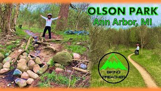
Olson Park
- 4
- 4
- 4
-
Pioneer Woods
- 1
-
Stapp Nature Area
- 5
-
Sunset Brooks Nature Area
- 2
-
Tuebingen Parkway
- 2
Popular Ann Arbor Mountain Biking Trails
• 90 ★ 3.8 • 1 mile • 57 ft • 161 •
Popular blue difficulty singletrack. This multi-use trail can be used one direction. On average it takes 12 minutes to complete this trail.
• 95 ★ 0.0 • 1 mile • 38 ft • 156 •
The Border-to-Border Trail (B2B) is a non-motorized B2B Huron River Greenway Border-to-Border Trail pathway that connects cities, parks, and many destinations throughout Washtenaw County. More than 40 miles of trail exist as a part of...
• 100 ★ 0.0 • 459 ft • 23 ft • 147 •
Popular blue difficulty singletrack. This multi-use trail can be used both directions. On average it takes minutes to complete this trail.
• 90 ★ 5.0 • 1 mile • 0 ft • 144 •
The Border-to-Border Trail ( ) is a non-motorized Huron River Greenway Border-to-Border Trail pathway that connects cities, parks, and many destinations throughout Washtenaw County. More than 40 miles of trail exist as a part of the...
• 90 ★ 2.0 • 1,690 ft • 12 ft • 133 •
Popular blue difficulty singletrack. This multi-use trail can be used both directions. On average it takes 1 minutes to complete this trail.
• 100 ★ 0.0 • 2,569 ft • 24 ft • 131 •
Popular blue difficulty singletrack. This multi-use trail can be used both directions. On average it takes 3 minutes to complete this trail.
• 100 ★ 0.0 • 2 miles • 71 ft • 129 •
The is a paved hiking and biking path that connects the University of Michigan with a network of trail systems throughout the area. The trail provides an important non-motorized link from the botanical gardens to Washtenaw County’s...
• 95 ★ 2.0 • 3,960 ft • 61 ft • 127 •
Tight and twisty singletrack that traverses from Whitmore Lake Rd underneath US23 to Pontiac Trail with access to .
Ann Arbor Mountain Bike Routes
22 miles • 1,352 ft • 30 • Loop •
This route covers the ideal trails for an epic A2 Local Lap, including all the best trails and systems as...
Photos of Ann Arbor Mountain Bike
Videos of Ann Arbor Mountain Bike
trail: Pioneer Woods Trail
0:09 |
70 |
Oct 17, 2020

trail: Woods Trail
13:22 |
531 |
May 18, 2022 , Ann Arbor
13:22 |
214 |
May 17, 2022
Recent Trail Reports
Activity Feed
| username | action | type | title | date |
|---|---|---|---|---|
| ftgeib | add | photo | activity #97007116 | Jun 14, 2026 @ 2:59pm Jun 14, 2026 |
| DylanGjKBN0 | ridden | trail | activity #96557161 | Jun 8, 2026 @ 12:22pm Jun 8, 2026 |
| unsafeAtAnySpeed | ridden | trail | activity #94857446 | May 16, 2026 @ 3:40pm May 16, 2026 |
| ftgeib | add | report | activity #94507601 | May 11, 2026 @ 11:32am May 11, 2026 |
| snowman51789BrAdQG | wishlist | skillpark | activity #92993919 | Apr 19, 2026 @ 5:34pm Apr 19, 2026 |
Recent Comments
| username | type | title | comment | date |
|---|---|---|---|---|
| skillpark | I managed to go to my first work day last... | Aug 30, 2023 @ 12:12pm Aug 30, 2023 | ||
| trail | Can't wait for the tunnel under the RR tracks... | Nov 29, 2022 @ 2:15pm Nov 29, 2022 | ||
| trail | Great bit of trail along the river, part of... | Nov 29, 2022 @ 2:01pm Nov 29, 2022 | ||
| trail | Discovered this in the worst of covid. Good... | Nov 29, 2022 @ 1:59pm Nov 29, 2022 |
Local Badges
-

Epic Ride Climb 2k1 awarded -

Climbing 10k Badge34 awarded -

Climbing 100k Badge1 awarded -

Epic Ride Descent 2k1 awarded -

Descent 10k Badge34 awarded -

Descent 100k Badge1 awarded
Bike & Skill Parks
| name | type | city | rating |
|---|---|---|---|
| Bandemer Dirt Jump Bike Park | skill park | Ann Arbor | |
| Tuebingen Dirt Jumps | skill park | Ann Arbor |
Activity Type Stats
| activitytype | trails | distance | descent | descent distance | total vertical | rating | global rank | state rank | photos | reports | routes | ridelogs |
|---|---|---|---|---|---|---|---|---|---|---|---|---|
| Mountain Bike | 99 | 54 miles | 2,110 ft | 15 miles | 249 ft | #4,232 | #1,425 | 47 | 137 | 1 | 13,272 | |
| E-Bike | 2 | 140 | 199 | |||||||||
| Horse | 1 | 6 | ||||||||||
| Hike | 184 | 85 miles | 3,501 ft | 25 miles | 344 ft | #1,972 | #843 | 150 | 634 | |||
| Trail Running | 184 | 85 miles | 3,501 ft | 25 miles | 344 ft | 150 | 1,199 | |||||
| Observed Trials | 1 | |||||||||||
| Snowmobile | 1 | |||||||||||
| Snowshoe | 1 | 5 | ||||||||||
| Downhill Ski | 1 | 1 | ||||||||||
| Backcountry Ski | 1 | 4 | ||||||||||
| Nordic Ski | 1 | 22 |
Frequently Asked Questions About Ann Arbor
▼
What are the best places to ride in Ann Arbor?
Ann Arbor has 25 areas to explore for mountain biking. The top rated areas are:
▼
What are the highest rated mountain biking trails in Ann Arbor?
The highest rated mountain biking trails in Ann Arbor are:
- Argo Dam B2B (4.1/5)
- Woods Trail (3.9/5)
- Tunnel under M14 (3.7/5)
- Kuebler Langford Access (3.7/5)
- Kuebler Ridge (3.7/5)
▼
What is the best time of the year to ride in Ann Arbor?
Based on ride log data, the most popular months to ride in Ann Arbor are:
- August (55 activities)
- July (49 activities)
- October (38 activities)
▼
Where can I park to ride in Ann Arbor?
Trails
Points of Interest
- By brenthillier
 NSMBA TRAILFORKS & contributors
 - Admins: PotoMBA, PotoMBA
- #4475 - 17,009 views
- ann arbor activity log | embed map of Ann Arbor mountain bike trails | ann arbor mountain biking points of interest
Downloading of trail gps tracks in kml & gpx formats is enabled for Ann Arbor.
You must login to download files.