close
-
Layers w
- Weather Layers
- Pro
- Pro
- Pro
- Pro
- Pro
- Pro
- More Layers
- Pro
- Pro
- Pro
- Pro
-
Upgrade to

3D
Trail Conditions
- Unknown
- Snow Groomed
- Snow Packed
- Snow Covered
- Snow Cover Partial
- Freeze/thaw Cycle
- Icy
- Prevalent Mud
- Wet
- Variable
- Ideal
- Dry
- Very Dry
Trail Flow (Ridden Direction)
Trailforks scans users ridelogs to determine the most popular direction each trail is ridden. A good flowing trail network will have most trails flowing in a single direction according to their intension.
The colour categories are based on what percentage of riders are riding a trail in its intended direction.
The colour categories are based on what percentage of riders are riding a trail in its intended direction.
- > 96%
- > 90%
- > 80%
- > 70%
- > 50%
- < 50%
- bi-directional trail
- no data
Trail Last Ridden
Trailforks scans ridelogs to determine the last time a trail was ridden.
- < 2 days
- < 1 week
- < 2 weeks
- < 1 month
- < 6 months
- > 6 months
Trail Ridden Direction
The intended direction a trail should be ridden.
- Downhill Only
- Downhill Primary
- Both Directions
- Uphill Primary
- Uphill Only
- One Direction
Contribute Details
Colors indicate trail is missing specified detail.
- Description
- Photos
- Description & Photos
- Videos
Trail Popularity ?
Trailforks scans ridelogs to determine which trails are ridden the most in the last 9 months.
Trails are compared with nearby trails in the same city region with a possible 25 colour shades.
Think of this as a heatmap, more rides = more kinetic energy = warmer colors.
- most popular
- popular
- less popular
- not popular
ATV/ORV/OHV Filter
Max Vehicle Width
inches
US Cell Coverage
Legend

Radar Time
Activity Recordings
Trailforks uses anonymized public activity data.
?
Activity Recordings
Trailforks uses anonymized public activity data.
?
Personal Heatmap
▶
Activity Types
all
/
none
▶
Options
2
Date range
month
–
Winter Trails
Warning
A routing network for winter maps does not exist. Selecting trails using the winter trails layer has been disabled.
Missing Trails
Most Popular
Least Popular
Trails are colored based on popularity. The more popular a trail is, the more red. Less popular trails trend towards green.
Jump Magnitude Heatmap
Heatmap of where riders jump on trails. Zoom in to see individual jumps, click circles to view jump details.
BC Backroad Status
![map legend]()
Service Road Atlas is a free to use, community-driven service for viewing and creating reports on the numerous back-country service roads around B.C. and Alberta.

Slope Aspect
Direction the slope faces
Trails Deemphasized
Trails are shown in grey.
Only show trails with no bike usage.
Suggested Layers
Based on selected activity type
Save the current map location and zoom level as your default home location whenever this page is loaded.
SaveAnnapolis is a 2026 IMBA Trail Town — one of the first communities in the country to earn the designation — with 39 miles of volunteer-built natural surface singletrack across two trail systems: Annapolis Waterworks and Bacon Ridge.
Bacon Ridge is a rolling network of flowy singletrack on 900+ acres of Anne Arundel County parkland in Crownsville. Trails accessed from the Hawkins Road trailhead (1822 Hawkins Rd) are smoother and more beginner-friendly, with difficulty stepping up as you move north through the system. A third trailhead at 1350 Bacon Ridge Road provides central access. Expect roots, tight radius turns, and plenty of out-sloped contour trail. No rock to speak of.
The Bacon Ridge Bike Park at the northern entrance (1214 Severn Chapel Rd) is a 3-line skills zone with progressive jumps and features that connect directly into the larger trail network. Whether you're learning to get air for the first time or sessioning laps, the Bike Park is worth a stop on its own or as part of a bigger ride.
Annapolis Waterworks is built on City of Annapolis land and features diverse terrain including pine groves, mountain laurel, and a trail that runs along the fence of one of the largest landfill solar projects in the country. The southern trailhead on Housley Road is the most accessible starting point. The northern trailhead on Honeysuckle Lane is about 1.5 miles by road from Bacon Ridge's Hawkins Road lot, making it easy to combine both systems into a 30+ mile day. Hillier than Bacon Ridge, with some legit climbs and fast descents.
The Annapolis Flow Trails, accessed from the Waterworks trail system, add jump lines and features for riders looking for more airtime. The Helios Advanced Jump Line is a directional double-black with gap jumps, step ups/downs, chutes, and hips — one of the more aggressive purpose-built features in the region. There's also a skills trail for riders working their way up to the bigger stuff.
Both trail systems are multi-use and open to hikers, mountain bikers, and dogs on leash. All trails are built and maintained by volunteers from Mid-Atlantic Off-Road Enthusiasts (MORE). Crownsville Hospital Memorial Park, a new county park between the two existing systems, is in development and will eventually connect Waterworks and Bacon Ridge into one continuous network.
After your ride, head into town. Annapolis has a growing brewery scene worth checking out. Forward Brewing in Eastport is a neighborhood nano-brewery with a rotating tap list, a full food menu, and a dog-friendly patio — a solid post-ride stop about 15 minutes from either trailhead. RAR Brewing's Chessie's Wharf in West Annapolis has 38 taps pouring out of their Cambridge, MD brewery, plus burgers and bar food. Both are easy detours on the way home and a good reason to make a day of it.
For current Waterworks trail conditions, visit waterworkstrail.com. Support the trails by joining MORE at more-mtb.org.
Activities Click to view
- Mountain Bike
71 trails
- Adaptive Bike
0 trails
- Winter Fat Bike
0 trails
- Hike
72 trails
- Trail Running
72 trails
Region Details
- 6
- 11
- 16
- 25
- 6
- 2
Region Status
Caution as of May 3, 2026Local Trail Association
Stats
- Avg Trail Rating
- Trails (view details)
- 65
- Trails Mountain Bike
- 74
- Trails Hike
- 72
- Trails Trail Running
- 72
- Trails Dirtbike/Moto
- 1
- Total Distance
- 32 miles
- Total Descent
- 2,646 ft
- Total Vertical
- 149 ft
- Highest Trailhead
- 150 ft
- Reports
- 627
- Photos
- 197
- Ridden Counter
- 10,898
Sub Regions
-
Annapolis Waterworks
- 1
- 1
- 13
- 6
- 2
-
Broad Creek Park
- 1
-
Generals Highway Corridor Park
- 1
- 3
-
Quiet Waters Park
- 4
- 2
-
Quiet Waters Park
- 2
- 9
- 7
-
Truxton Park
- 1
- 1
Popular Annapolis Mountain Biking Trails
• 95 ★ 4.0 • 3,763 ft • 86 ft • 579 •
Unique connector trail that connects the Housley Loop to the Defense Highway Parking Lot and Solar Park Loop. Progressive benched design.
• 90 ★ 4.2 • 4,108 ft • 113 ft • 535 •
This is the upper side of the Solar Park Loop, which follows the fence of the largest solar project located on a landfill in the United States. Offers dramatic views of the topography below and a much easier experience than the lower line.
• 80 ★ 4.2 • 2 miles • 137 ft • 446 •
This is the innermost loop in the Annapolis Waterworks Trail. Similar to Bacon Ridge. Flowy contour trail that traverses some unique pine groves.
• 100 ★ 3.8 • 1,214 ft • 11 ft • 424 •
Short loop through mountain laurel groves.
• 75 ★ 4.0 • 1 mile • 150 ft • 400 •
This is the most accessible loop in the Annapolis Waterworks Trail and provides public access and parking from Housley Road. Fast and flowy single track.
• 90 ★ 3.9 • 2,621 ft • 83 ft • 369 •
Largest Honeysuckle Loop with a fun downhill.
• 85 ★ 3.5 • 2 miles • 215 ft • 369 •
The most direct route from the Silopanna Loop to Honeysuckle Lane and the Bacon Ridge southern trailhead. Also provides access to three distinct loops off main trail. Hilly terrain with some awesome downhills and challenging climbs....
• 90 ★ 2.9 • 817 ft • 38 ft • 365 •
Small off camber loop, no features.
Annapolis Mountain Bike Routes
★ 5.0 • 43 miles • 2,180 ft • 21 •
Fun adventure route that combines dirt trails on west side of Severn River (Waterworks, Bacon Ridge,...
★ 3.5 • 30 miles • 2,644 ft • 23 • Loop •
This route combines all of Bacon Ridge and Waterworks into one epic ride consisting mostly of singletrack,...
★ 3.5 • 11 miles • 1,725 ft • 13 • Loop •
Out and back loop of all of the trails and side loops at Annapolis Waterworks
13 miles • 1,365 ft • 12 •
Route that hits all of the best trails at Waterworks in the best directions. Start at dam parking lot...
40 miles • 4,464 ft • 57 •
This is a draft of the route for the AACo Epic in Summer 2026
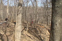
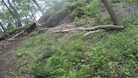
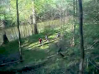
Photos of Annapolis Mountain Bike
Videos of Annapolis Mountain Bike

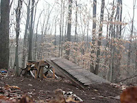
trail: The Bowl
0:15 |
83 |
Mar 31, 2015

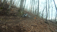
trail: The Bowl
2:05 |
36 |
Jun 27, 2013
trail: The Bowl
5:55 |
149 |
Jun 10, 2013
trail: The Bowl
0:12 |
92 |
May 24, 2013
trail: The Bowl
0:52 |
70 |
May 2, 2013
trail: The Bowl
0:08 |
54 |
May 1, 2013
trail: The Bowl
0:52 |
133 |
Feb 22, 2013
trail: The Bowl
0:14 |
99 |
Jan 30, 2013
Recent Trail Reports
Activity Feed
| username | action | type | title | date |
|---|---|---|---|---|
| Lucas0gKuzm | wishlist | trail | activity #97940767 | Jun 27, 2026 @ 3:12pm Jun 27, 2026 |
| GamerDad | wishlist | route | activity #97556367 | Jun 22, 2026 @ 6:04am Jun 22, 2026 |
| dan99gpgt | wishlist | region | activity #97152461 | Jun 16, 2026 @ 6:05pm Jun 16, 2026 |
| dan99gpgt | wishlist | badge | activity #97151851 and 1 more | Jun 16, 2026 @ 5:57pm Jun 16, 2026 |
| dan99gpgt | wishlist | badge | activity #97151816 | Jun 16, 2026 @ 5:56pm Jun 16, 2026 |
Recent Comments
| username | type | title | comment | date |
|---|---|---|---|---|
| trail | Possibly my favorite trail at WW. Definitely... | Jun 11, 2026 @ 12:31pm Jun 11, 2026 | ||
| trail | I liked it! Couldn't clean it, plenty of dabs... | Jun 11, 2026 @ 12:24pm Jun 11, 2026 | ||
| trail | jumps are fun, although difficult to see where... | May 17, 2026 @ 12:57pm May 17, 2026 | ||
| trail | very smooth and has some nice and huge... | May 17, 2026 @ 12:55pm May 17, 2026 | ||
| trail | very smooth for mtbs | May 17, 2026 @ 12:53pm May 17, 2026 |
Local Badges
-

10 Blue Trails233 awarded -

Epic Ride Climb 2k1 awarded -

Climbing 10k Badge36 awarded -

Climbing 100k Badge4 awarded -

Epic Ride Descent 2k1 awarded -

Descent 10k Badge36 awarded
Local Mountain Biking Directory
-
Annapolis VeloBike Shop
![Annapolis Velo]()
-
Bike Doctor - AnnapolisBike Shop
Activity Type Stats
| activitytype | trails | distance | descent | descent distance | total vertical | rating | global rank | state rank | photos | reports | routes | ridelogs |
|---|---|---|---|---|---|---|---|---|---|---|---|---|
| Mountain Bike | 71 | 31 miles | 2,635 ft | 11 miles | 148 ft | #1,804 | #666 | 207 | 629 | 9 | 11,356 | |
| Hike | 72 | 31 miles | 2,592 ft | 11 miles | 148 ft | #5,341 | #1,883 | 1 | 628 | 812 | ||
| Trail Running | 72 | 31 miles | 2,592 ft | 11 miles | 148 ft | #4,962 | #1,545 | 628 | 1 | 404 | ||
| Dirtbike/Moto | 1 |
Frequently Asked Questions About Annapolis
▼
What are the best places to ride in Annapolis?
Annapolis has 7 areas to explore for mountain biking. The top rated areas are:
▼
What are the highest rated mountain biking trails in Annapolis?
The highest rated mountain biking trails in Annapolis are:
- Woodland Trail Loop (4.2/5)
- Solstice Valley Trail (4.2/5)
- Overlook Connector (4.2/5)
- Solar Park Loop (Low Line) (4.1/5)
- Overlook Trail (4.1/5)
▼
What is the best time of the year to ride in Annapolis?
Based on ride log data, the most popular months to ride in Annapolis are:
- June (89 activities)
- October (87 activities)
- September (79 activities)
▼
Where can I park to ride in Annapolis?
There are 18 parking locations listed in Annapolis. The most popular parking spots are: View all parking and trailhead locations on the map to plan your visit.
Trails
- By MichaelHunt & contributors
- Admins: MORE-MD LDRSH, kmihm100
- #9050 - 7,461 views
- annapolis activity log | embed map of Annapolis mountain bike trails | annapolis mountain biking points of interest
Downloading of trail gps tracks in kml & gpx formats is enabled for Annapolis.
You must login to download files.