close
-
Layers w
- Weather Layers
- Pro
- Pro
- Pro
- Pro
- Pro
- Pro
- More Layers
- Pro
- Pro
- Pro
- Pro
-
Upgrade to

3D
Trail Conditions
- Unknown
- Snow Groomed
- Snow Packed
- Snow Covered
- Snow Cover Partial
- Freeze/thaw Cycle
- Icy
- Prevalent Mud
- Wet
- Variable
- Ideal
- Dry
- Very Dry
Trail Flow (Ridden Direction)
Trailforks scans users ridelogs to determine the most popular direction each trail is ridden. A good flowing trail network will have most trails flowing in a single direction according to their intension.
The colour categories are based on what percentage of riders are riding a trail in its intended direction.
The colour categories are based on what percentage of riders are riding a trail in its intended direction.
- > 96%
- > 90%
- > 80%
- > 70%
- > 50%
- < 50%
- bi-directional trail
- no data
Trail Last Ridden
Trailforks scans ridelogs to determine the last time a trail was ridden.
- < 2 days
- < 1 week
- < 2 weeks
- < 1 month
- < 6 months
- > 6 months
Trail Ridden Direction
The intended direction a trail should be ridden.
- Downhill Only
- Downhill Primary
- Both Directions
- Uphill Primary
- Uphill Only
- One Direction
Contribute Details
Colors indicate trail is missing specified detail.
- Description
- Photos
- Description & Photos
- Videos
Trail Popularity ?
Trailforks scans ridelogs to determine which trails are ridden the most in the last 9 months.
Trails are compared with nearby trails in the same city region with a possible 25 colour shades.
Think of this as a heatmap, more rides = more kinetic energy = warmer colors.
- most popular
- popular
- less popular
- not popular
ATV/ORV/OHV Filter
Max Vehicle Width
inches
US Cell Coverage
Legend

Radar Time
Activity Recordings
Trailforks uses anonymized public activity data.
?
Activity Recordings
Trailforks uses anonymized public activity data.
?
Personal Heatmap
▶
Activity Types
all
/
none
▶
Options
2
Date range
month
–
Winter Trails
Warning
A routing network for winter maps does not exist. Selecting trails using the winter trails layer has been disabled.
Missing Trails
Most Popular
Least Popular
Trails are colored based on popularity. The more popular a trail is, the more red. Less popular trails trend towards green.
Jump Magnitude Heatmap
Heatmap of where riders jump on trails. Zoom in to see individual jumps, click circles to view jump details.
BC Backroad Status
![map legend]()
Service Road Atlas is a free to use, community-driven service for viewing and creating reports on the numerous back-country service roads around B.C. and Alberta.

Slope Aspect
Direction the slope faces
Trails Deemphasized
Trails are shown in grey.
Only show trails with no bike usage.
Suggested Layers
Based on selected activity type
Save the current map location and zoom level as your default home location whenever this page is loaded.
Save
No description for Val d'Anniviers has been added yet!
Login or register to submit one.
Links
This region uses the Uk/Euro style trail grading system.
Activities Click to view
- Mountain Bike
239 trails
- E-Bike
206 trails
- Hike
222 trails
- Trail Running
223 trails
- Snowshoe
0 trails
- Downhill Ski
0 trails
- Backcountry Ski
0 trails
- Nordic Ski
0 trails
Region Details
- 42
- 16
- 111
- 51
- 14
Stats
- Avg Trail Rating
- Trails (view details)
- 236
- Trails Mountain Bike
- 239
- Trails E-Bike
- 206
- Trails Horse
- 1
- Trails Hike
- 223
- Trails Trail Running
- 223
- Total Distance
- 176 miles
- Total Descent
- 88,442 ft
- Total Vertical
- 7,594 ft
- Highest Trailhead
- 9,849 ft
- Reports
- 655
- Photos
- 182
- Ridden Counter
- 6,848
Sub Regions
Popular Val d'Anniviers Mountain Biking Trails
• 100 ★ 3.5 • 1 mile • 30 ft • 205 • • hike
Début au pied du barrage de Moiry, alpine singletrack qui suit la rivière jusqu'à Grimentz ! C'est la partie finale du célèbre Grand Raid. Start in front of the Moiry dam, alpine singletrack that follows the river untill Grimentz....
• 100 ★ 4.0 • 1 mile • 87 ft • 130 • • hike
Popular blue difficulty singletrack. This hike primary trail can be used both directions and has a moderate overall physical rating with a 87 ft blue climb. Trail visibility is always easy to follow. On average it takes 6 minutes to complete this trail.
• 100 ★ 5.0 • 3,461 ft • 7 ft • 121 •
La ( ) est la piste principale du bikepark, super fun et agréable a rouler... idéal pour les débutants mais un vrai plaisir pour les plus expérimentés aussi. The (blue run) is just so fun to ride, whether you are a beginners or a...
• 95 ★ 4.5 • 2,835 ft • 281 ft • 115 • • hike
Singletrail reliant Le Tsapé au , portage sur toute la montée. -- Hike-a-Bike singletrack linking Le Tsapé to the . -- Singletrail, der Le Tsapé mit dem verbindet, schieben Sie Ihr Fahrrad nach oben.
• 70 ★ 4.0 • 1,201 ft • 0 ft • 108 •
La ( ) contient plus de sauts et de passage techniques que la (piste bleue).
• 75 ★ 3.5 • 863 ft • 0 ft • 90 •
just HARD to ride ! super technical and naturally rough... if you can ride with flow you're a champ :D ! Big bike needed, really hard with less than 160mm front
• 100 ★ 0.0 • 1 mile • 0 ft • 86 •
A two-kilometre-long mountain bike trail with challenging elements, side hits and jumps.
• 90 ★ 4.5 • 2 miles • 63 ft • 67 •
Highly rated popular red difficulty singletrack. This multi-use trail can be used downhill primary and has a easy overall physical rating with a 63 ft green climb. Trail visibility is always easy to follow. On average it takes 13 minutes to complete this trail.
Val d'Anniviers Mountain Bike Routes
9 miles • 2,402 ft • 2 • Loop •
EN: This mountain bike loop from Vercorin is an invitation to discover the region's natural wealth and...
15 miles • 3,150 ft • 6 • Loop •
Rustic Hotel Weisshorn sits on an outcrop high above Val d’Anniviers. The mountain inn marks the end of...
33 miles • 5,999 ft • 0 • Point to Point •
Frühmorgens lassen wir uns von Sierre mit dem Postauto nach Grimentz transportieren (fürs Postauto...
57 miles • 14,188 ft • 6 • Point to Point • Race •
Grand Raid BCVS, Swiss Moutain Bike Race Marathon has been thrilling bikers since 1990. This marathon will...
43 miles • 10,292 ft • 6 • Point to Point • Race •
Grand Raid BCVS, Swiss Moutain Bike Race Marathon has been thrilling bikers since 1990. This marathon will...
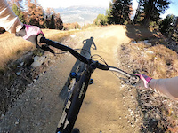
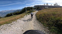
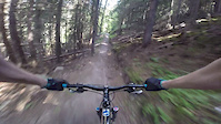
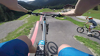
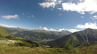
Photos of Val d'Anniviers Mountain Bike
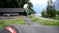
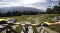
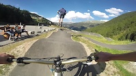
Videos of Val d'Anniviers Mountain Bike
trail: Crêt-du-Midi Flowtrail
0:36 |
42 |
Dec 3, 2024
trail: Sigeroulaz Familytrail
0:30 |
|
Dec 3, 2024
trail: Prillet to Fields
3:39 |
225 |
Jan 28, 2018
trail: Velosolutions' Pumptrack
0:43 |
215 |
Jan 27, 2018
trail: Velosolutions' Pumptrack
0:35 |
272 |
Aug 9, 2017
trail: Ginette I
5:32 |
929 |
Sep 6, 2016
trail: Ginette I
7:24 |
235 |
Sep 4, 2016
trail: Velosolutions' Pumptrack
0:33 |
189 |
Aug 31, 2016
Recent Trail Reports
Activity Feed
| username | action | type | title | date |
|---|---|---|---|---|
| swissmountainleader | wishlist | trail | activity #97254955 | Jun 18, 2026 @ 8:44am 2 days |
| MiguMigu | comment | report | activity #96371699 | Jun 6, 2026 @ 8:06am Jun 6, 2026 |
| MiguMigu | add | report | activity #96371652 | Jun 6, 2026 @ 8:05am Jun 6, 2026 |
| BertramYy6iNc | ridden | trail | activity #96208805 | Jun 3, 2026 @ 11:57pm Jun 3, 2026 |
| paraenggu | add | report | activity #95686801 and 1 more | May 27, 2026 @ 10:23pm May 27, 2026 |
Recent Comments
| username | type | title | comment | date |
|---|---|---|---|---|
| report | no Snow left, fun Enduro trail! | Jun 6, 2026 @ 8:06am Jun 6, 2026 | ||
| trail | First part blackish with some very big roots... | Sep 18, 2025 @ 12:32pm Sep 18, 2025 | ||
| trail | More red than black. Non stop switch backs,... | Sep 18, 2025 @ 12:24pm Sep 18, 2025 | ||
| trail | Beginning could be rated black, second half... | Sep 18, 2025 @ 12:22pm Sep 18, 2025 | ||
| trail | C | Sep 11, 2025 @ 12:06am Sep 11, 2025 |
Local Badges
-

Big Ride 30k185 awarded -

Epic Ride Descent 2k45 awarded -

Descent 10k Badge6 awarded -

Descent 100k Badge0 awarded -
Big Ride 30k60 awarded -

Completionist0 awarded
Bike & Skill Parks
| name | type | city | rating |
|---|---|---|---|
| Bikepark St-Luc | bike park | Anniviers | |
| Bunny Up Park | skill park | Anniviers | |
| Velosolution Pumptrack | skill park | Anniviers | |
| Lavioz Pumptrack | skill park | Vercorin |
Activity Type Stats
| activitytype | trails | distance | descent | descent distance | total vertical | rating | global rank | state rank | photos | reports | routes | ridelogs |
|---|---|---|---|---|---|---|---|---|---|---|---|---|
| Mountain Bike | 239 | 172 miles | 86,040 ft | 102 miles | 7,595 ft | 173 | 655 | 7 | 2,094 | |||
| E-Bike | 206 | 155 miles | 76,519 ft | 92 miles | 6,864 ft | 584 | 2 | 257 | ||||
| Horse | 1 | 1 mile | 774 ft | 1 mile | 735 ft | 4 | ||||||
| Hike | 222 | 170 miles | 83,425 ft | 100 miles | 7,595 ft | 646 | 1 | 819 | ||||
| Trail Running | 223 | 170 miles | 83,369 ft | 100 miles | 7,595 ft | 646 | 1 | 134 |
Frequently Asked Questions About Val d'Anniviers
▼
What are the best places to ride in Val d'Anniviers?
Val d'Anniviers has 6 areas to explore for mountain biking. The top rated areas are:
▼
What are the highest rated mountain biking trails in Val d'Anniviers?
The highest rated mountain biking trails in Val d'Anniviers are:
- Ginette I (4.5/5)
- Tsirouc (4.4/5)
- Zombie Fence (4.3/5)
- Nava Trail (4.3/5)
- La Barneuza (4.2/5)
▼
What is the best time of the year to ride in Val d'Anniviers?
Based on ride log data, the most popular months to ride in Val d'Anniviers are:
- September (14 activities)
- August (13 activities)
- July (12 activities)
▼
What is the longest trail in Val d'Anniviers?
The longest trail in Val d'Anniviers is Tsirouc at 3.1 miles. View all trails sorted by distance.
Activities
Trails
Points of Interest
- By inversedotch
 & contributors
 - Admins: swiss, trailpapst, VS-Admin, VS-Admin
- #28378 - 4,785 views
- val d'anniviers activity log | embed map of Val d'Anniviers mountain bike trails | val d'anniviers mountain biking points of interest
Downloading of trail gps tracks in kml & gpx formats is enabled for Val d'Anniviers.
You must login to download files.