close
-
Layers w
- Weather Layers
- Pro
- Pro
- Pro
- Pro
- Pro
- Pro
- More Layers
- Pro
- Pro
- Pro
- Pro
-
Upgrade to

3D
Trail Conditions
- Unknown
- Snow Groomed
- Snow Packed
- Snow Covered
- Snow Cover Partial
- Freeze/thaw Cycle
- Icy
- Prevalent Mud
- Wet
- Variable
- Ideal
- Dry
- Very Dry
Trail Flow (Ridden Direction)
Trailforks scans users ridelogs to determine the most popular direction each trail is ridden. A good flowing trail network will have most trails flowing in a single direction according to their intension.
The colour categories are based on what percentage of riders are riding a trail in its intended direction.
The colour categories are based on what percentage of riders are riding a trail in its intended direction.
- > 96%
- > 90%
- > 80%
- > 70%
- > 50%
- < 50%
- bi-directional trail
- no data
Trail Last Ridden
Trailforks scans ridelogs to determine the last time a trail was ridden.
- < 2 days
- < 1 week
- < 2 weeks
- < 1 month
- < 6 months
- > 6 months
Trail Ridden Direction
The intended direction a trail should be ridden.
- Downhill Only
- Downhill Primary
- Both Directions
- Uphill Primary
- Uphill Only
- One Direction
Contribute Details
Colors indicate trail is missing specified detail.
- Description
- Photos
- Description & Photos
- Videos
Trail Popularity ?
Trailforks scans ridelogs to determine which trails are ridden the most in the last 9 months.
Trails are compared with nearby trails in the same city region with a possible 25 colour shades.
Think of this as a heatmap, more rides = more kinetic energy = warmer colors.
- most popular
- popular
- less popular
- not popular
ATV/ORV/OHV Filter
Max Vehicle Width
inches
US Cell Coverage
Legend

Radar Time
Activity Recordings
Trailforks uses anonymized public activity data.
?
Activity Recordings
Trailforks uses anonymized public activity data.
?
Personal Heatmap
▶
Activity Types
all
/
none
▶
Options
2
Date range
month
–
Winter Trails
Warning
A routing network for winter maps does not exist. Selecting trails using the winter trails layer has been disabled.
Missing Trails
Most Popular
Least Popular
Trails are colored based on popularity. The more popular a trail is, the more red. Less popular trails trend towards green.
Jump Magnitude Heatmap
Heatmap of where riders jump on trails. Zoom in to see individual jumps, click circles to view jump details.
BC Backroad Status
![map legend]()
Service Road Atlas is a free to use, community-driven service for viewing and creating reports on the numerous back-country service roads around B.C. and Alberta.

Slope Aspect
Direction the slope faces
Trails Deemphasized
Trails are shown in grey.
Only show trails with no bike usage.
Suggested Layers
Based on selected activity type
Save the current map location and zoom level as your default home location whenever this page is loaded.
Save
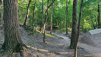
No description for Anthills Hike and Bike Trails has been added yet!
Login or register to submit one.
 google parking directions
Primary Trail Type: Cross-Country
Land Status: Community Forest
google parking directionsLinks
Activities Click to view
- Mountain Bike
4 trails
- Hike
4 trails
- Trail Running
4 trails
Region Details
- 1
- 3
Region Status
Open as of May 9, 2026Stats
- Avg Trail Rating
- Trails (view details)
- 4
- Trails Mountain Bike
- 4
- Trails E-Bike
- 1
- Trails Hike
- 4
- Trails Trail Running
- 4
- Total Distance
- 7 miles
- Total Descent
- 267 ft
- Total Vertical
- 38 ft
- Highest Trailhead
- 85 ft
- Reports
- 177
- Photos
- 156
- Ridden Counter
- 946
Popular Anthills Hike and Bike Trails Trails
• 55 ★ 4.4 • 3 miles • 100 ft • 479 •
These trails parallel the Buffalo Bayou trail between Beltway 8 and Dairy Ashford Road, it used to extend to Eldridge Parkway but some trail was removed for flood control retention ponds. The trail is trough a heavily wooded area...
• 30 ★ 4.0 • 1 mile • 55 ft • 211 •
Terrain is nicer than average, with bigger drops and climbs, sort of. Two trampolines, one big and one small. The line close to the bayou is easier than the other one.
• 50 ★ 4.0 • 2 miles • 39 ft • 183 •
West end of running along Buffalo bayou from Dairy Ashford to Wilcrest. Exposed and tree covered single track with a few small jump tracks, gulley descent/climbs. Trail is mainly root free until the western most portion near Wilcrest.
• 25 ★ 0.0 • 2 miles • 9 ft • 11 •
Less popular white difficulty gravel path. This multi-use trail can be used both directions. On average it takes 6 minutes to complete this trail.
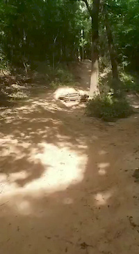
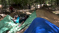
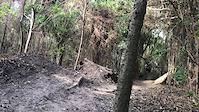
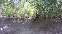
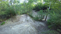
Photos of Anthills Hike and Bike Trails Mountain Bike
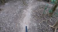
Videos of Anthills Hike and Bike Trails Mountain Bike
trail: Anthills
0:14 |
422 |
May 7, 2021

trail: Anthills
0:09 |
653 |
Dec 17, 2020
trail: Anthills
0:18 |
357 |
Aug 31, 2020
trail: Anthills
0:12 |
363 |
Jul 28, 2020
trail: Anthills
0:22 |
631 |
Jul 15, 2019
trail: Anthills
0:07 |
500 |
Nov 19, 2018
trail: Anthills
0:16 |
1758 |
May 25, 2016
trail: Anthills
0:49 |
973 |
Nov 3, 2015
Recent Trail Reports
| status | trail | date | condition | info | user |
|---|---|---|---|---|---|
| Anthills West | Feb 20, 2026 @ 4:35pm (America/Matamoros) Feb 20, 2026 | Dry | gradplanner | ||
| Beyond Trail | Feb 20, 2026 @ 4:35pm (America/Matamoros) Feb 20, 2026 | Dry | gradplanner | ||
| Anthills | Feb 20, 2026 @ 4:35pm (America/Matamoros) Feb 20, 2026 | Dry | gradplanner |
Activity Feed
| username | action | type | title | date |
|---|---|---|---|---|
| ikarls | add | photo | activity #96057116 and 4 more | Jun 1, 2026 @ 7:06pm Jun 1, 2026 |
| Reese_FTW | ridden | trail | activity #94950651 | May 17, 2026 @ 5:00pm May 17, 2026 |
| Puggg | wishlist | region | activity #91412924 | Mar 27, 2026 @ 7:41pm Mar 27, 2026 |
| gradplanner | add | report | activity #89256230 and 2 more | Feb 20, 2026 @ 6:39pm Feb 20, 2026 |
| magicdiceflow | wishlist | region | activity #88954921 | Feb 15, 2026 @ 6:37am Feb 15, 2026 |
Recent Comments
| username | type | title | comment | date |
|---|---|---|---|---|
| trail | Some trails are uni-directional but very... | Nov 7, 2025 @ 7:40am Nov 7, 2025 | ||
| trail | These trails are rated as Blue, but the... | Aug 23, 2022 @ 7:59am Aug 23, 2022 | ||
| trail | Nice trail with some good flows. Pretty scenic... | May 31, 2022 @ 9:04pm May 31, 2022 | ||
| trail | Absolutely love Anthills. Lots of flow lines... | Apr 27, 2022 @ 4:59pm Apr 27, 2022 | ||
| trail | Hello! August 2020 update here. As of now the... | Aug 9, 2020 @ 3:32pm Aug 9, 2020 |
Nearby Areas
| name | distance | ||||
|---|---|---|---|---|---|
| Mason Creek Trails | 2 | 6.3 km | |||
| Memorial Park | 6 | 5 | 4 | 9.7 km | |
| HARRIS COUNTY DEPUTY DARREN GOFORTH PARK | 11.2 km | ||||
| Oyster Creek | 4 | 4 | 12.9 km | ||
| Brazos River Trails | 16 | 5 | 1 | 13.8 km |
Activity Type Stats
| activitytype | trails | distance | descent | descent distance | total vertical | rating | global rank | state rank | photos | reports | routes | ridelogs |
|---|---|---|---|---|---|---|---|---|---|---|---|---|
| Mountain Bike | 4 | 7 miles | 266 ft | 2 miles | 39 ft | #6,486 | #2,452 | 158 | 172 | 8,784 | ||
| E-Bike | 1 | 2 miles | 30 ft | 2,008 ft | 20 ft | 95 | 75 | |||||
| Hike | 4 | 7 miles | 266 ft | 2 miles | 39 ft | #15,179 | #6,790 | 172 | 40 | |||
| Trail Running | 4 | 7 miles | 266 ft | 2 miles | 39 ft | #13,669 | #5,700 | 172 | 132 |
- By brenthillier
 NSMBA TRAILFORKS & contributors
 - Admins: GHORBA, GHORBA-AH
- #3688 - 16,094 views
- anthills hike and bike trails activity log | embed map of Anthills Hike and Bike Trails mountain bike trails | anthills hike and bike trails mountain biking points of interest
Downloading of trail gps tracks in kml & gpx formats is enabled for Anthills Hike and Bike Trails.
You must login to download files.