close
-
Layers w
- Weather Layers
- Pro
- Pro
- Pro
- Pro
- Pro
- Pro
- More Layers
- Pro
- Pro
- Pro
- Pro
-
Upgrade to

3D
Trail Conditions
- Unknown
- Snow Groomed
- Snow Packed
- Snow Covered
- Snow Cover Partial
- Freeze/thaw Cycle
- Icy
- Prevalent Mud
- Wet
- Variable
- Ideal
- Dry
- Very Dry
Trail Flow (Ridden Direction)
Trailforks scans users ridelogs to determine the most popular direction each trail is ridden. A good flowing trail network will have most trails flowing in a single direction according to their intension.
The colour categories are based on what percentage of riders are riding a trail in its intended direction.
The colour categories are based on what percentage of riders are riding a trail in its intended direction.
- > 96%
- > 90%
- > 80%
- > 70%
- > 50%
- < 50%
- bi-directional trail
- no data
Trail Last Ridden
Trailforks scans ridelogs to determine the last time a trail was ridden.
- < 2 days
- < 1 week
- < 2 weeks
- < 1 month
- < 6 months
- > 6 months
Trail Ridden Direction
The intended direction a trail should be ridden.
- Downhill Only
- Downhill Primary
- Both Directions
- Uphill Primary
- Uphill Only
- One Direction
Contribute Details
Colors indicate trail is missing specified detail.
- Description
- Photos
- Description & Photos
- Videos
Trail Popularity ?
Trailforks scans ridelogs to determine which trails are ridden the most in the last 9 months.
Trails are compared with nearby trails in the same city region with a possible 25 colour shades.
Think of this as a heatmap, more rides = more kinetic energy = warmer colors.
- most popular
- popular
- less popular
- not popular
ATV/ORV/OHV Filter
Max Vehicle Width
inches
US Cell Coverage
Legend

Radar Time
Activity Recordings
Trailforks uses anonymized public activity data.
?
Activity Recordings
Trailforks uses anonymized public activity data.
?
Personal Heatmap
▶
Activity Types
all
/
none
▶
Options
2
Date range
month
–
Winter Trails
Warning
A routing network for winter maps does not exist. Selecting trails using the winter trails layer has been disabled.
Missing Trails
Most Popular
Least Popular
Trails are colored based on popularity. The more popular a trail is, the more red. Less popular trails trend towards green.
Jump Magnitude Heatmap
Heatmap of where riders jump on trails. Zoom in to see individual jumps, click circles to view jump details.
BC Backroad Status
![map legend]()
Service Road Atlas is a free to use, community-driven service for viewing and creating reports on the numerous back-country service roads around B.C. and Alberta.

Slope Aspect
Direction the slope faces
Trails Deemphasized
Trails are shown in grey.
Only show trails with no bike usage.
Suggested Layers
Based on selected activity type
Save the current map location and zoom level as your default home location whenever this page is loaded.
Save
No description for Antioquia has been added yet!
Login or register to submit one.
Region Details
- 15
- 3
- 11
- 63
- 38
- 12
- 1
Stats
- Avg Trail Rating
- Trails (view details)
- 147
- Trails Mountain Bike
- 146
- Trails E-Bike
- 72
- Trails Horse
- 19
- Trails Hike
- 130
- Trails Trail Running
- 122
- Trails Dirtbike/Moto
- 4
- Trails ATV/ORV/OHV
- 1
- Total Distance
- 167 miles
- Total Descent
- 102,599 ft
- Total Vertical
- 7,316 ft
- Highest Trailhead
- 9,145 ft
- Reports
- 178
- Photos
- 308
- Ridden Counter
- 1,190
Sub Regions
- Caldas (5)
- Medellin (94)
- Santa Elena (33)
- Yarumal (1)
- El Tablazo (1)
Popular Antioquia Mountain Biking Trails
• 65 ★ 5.0 • 2 miles • 35 ft • 36 •
Este trail se puede hacer completo desde la carretera principal donde hay una frutera o se acorta un poco y se parte desde la antigua carpinteria en la carretera que sube del Cairo a Santa Barbara. Muy rapido, solo al final hay como 3...
• 100 ★ 5.0 • 3 miles • 38 ft • 33 •
Triada 1 hace parte de la zona llamada Triadas. Comparte el primer tramo con la cual se bifurca en la primera 1/3 parte.
• 90 ★ 0.0 • 3,957 ft • 0 ft • 30 •
Trocha que se encuentra cerca de Tres Puertas al final. Por la via principal se ingresa, la entrada esta al lado de una casa. La trocha es un bosque con un terreno estable, al final la trocha se pone mas tecnica.
• 100 ★ 4.0 • 7 miles • 2,191 ft • 30 •
Climb is very tough, you need to pedal 1/5 or 2 hours to be able to get on top, then bajada is like 15 - 20 minutes, its not hard, technical DH, Its mostly rocky canalones but not super technical. Its a cool ride but be prepared to...
• 95 ★ 5.0 • 3 miles • 240 ft • 27 •
This is the longest trail in the Cairo region. It drops down from the opposite side of the mountain near to La Casa en el Aire.
• 80 ★ 5.0 • 5 miles • 509 ft • 26 •
Triada 3. La mas larga y épica de todas las Triadas. Mas un trail Enduro/AM ya que tiene varios tramos en subida, cortas pero toca dar pedal. Las mejores vistas.
• 5 ★ 5.0 • 1 mile • 161 ft • 23 •
DH Track Tres Cruces. Host to Panamerican DH Campionships.
• 90 ★ 5.0 • 2,396 ft • 12 ft • 21 •
Fast open wide trial with some rockgardens
Antioquia Mountain Bike Routes
★ 5.0 • 4 miles • 339 ft • 3 • Point to Point •
Ruta que conecta 3 trochas en una sola. Desde hasta Tres Puertas El Cerezo hasta y finalizando en . Se...
3 miles • 246 ft • 2 • Point to Point •
Ruta que conecta dos trochas de Downhill. Va desde hasta . Son trochas muy tecnicas, cuidado con los...
21 miles • 4,211 ft • 1 • Loop •
All the climbing is done through unpaved roads. Descent is a singletrack that recently was repaired. Great...
★ 5.0 • 9 miles • 1,044 ft • 0 •
very narrow canalones. all descent. Great views
34 miles • 7,086 ft • 0 • Point to Point •
Este es un recorrido que se hace desde el municipio del retiro hasta la vereda del municipio de Montebello...
13 miles • 964 ft • 0 • Point to Point •
pure adrenaline. fast as hell!!! full speed
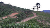
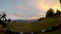
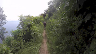
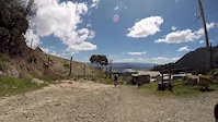
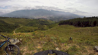
Videos of Antioquia Mountain Bike
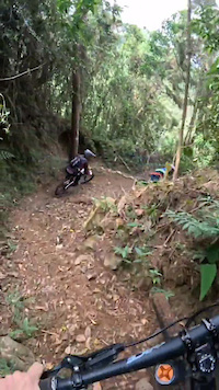
trail: Niebla
0:26 |
7 |
Jul 14, 2025
trail: Tres Cruces DH
0:10 |
61 |
Jan 14, 2021

trail: Tres Cruces DH
0:16 |
18 |
Jan 11, 2021
trail: Las Mercedes
6:28 |
91 |
Apr 18, 2016
trail: Llanadas
4:33 |
93 |
Sep 3, 2015
trail: La Cascada
0:34 |
105 |
Mar 24, 2015

0:40 |
388 |
Mar 8, 2015
trail: Las Mercedes
8:07 |
87 |
Feb 18, 2015
Recent Trail Reports
| status | trail | date | condition | info | user |
|---|---|---|---|---|---|
| Matamanos Santa Elena | Nov 23, 2025 @ 11:33am (America/Bogota) Nov 23, 2025 | Ideal | Davojapan | ||
| C1 Santa Elena | Nov 23, 2025 @ 9:45am (America/Bogota) Nov 23, 2025 | Ideal | Davojapan | ||
| Cerro Verde Santa Elena | Nov 23, 2025 @ 9:45am (America/Bogota) Nov 23, 2025 | Ideal | Davojapan | ||
| Slalom Santa Elena | Nov 23, 2025 @ 9:45am (America/Bogota) Nov 23, 2025 | Unknown | Davojapan | ||
| Las Mercedes Medellin | May 25, 2025 @ 9:18am May 25, 2025 | Variable | AndresFR7jEI | ||
| acesso bindi bike park Escobero trails | Jan 15, 2024 @ 5:57am Jan 15, 2024 | Ideal | allaroundjoe | ||
| San Paleste High Speed Escobero trails | Jan 15, 2024 @ 5:57am Jan 15, 2024 | Ideal | allaroundjoe | ||
| Niebla Escobero trails | Jan 15, 2024 @ 5:57am Jan 15, 2024 | Ideal | allaroundjoe | ||
| Bindi Escobero trails | Jan 15, 2024 @ 5:57am Jan 15, 2024 | Ideal | allaroundjoe | ||
| Triada 3 Triadas-Santa Fe de Antioquia | Jan 13, 2024 @ 7:06am Jan 13, 2024 | Dry | allaroundjoe |
Activity Feed
| username | action | type | title | date |
|---|---|---|---|---|
| Tjerro | wishlist | trail | activity #94691606 | May 14, 2026 @ 8:23am May 14, 2026 |
| Davojapan | wishlist | trail | activity #84952094 | Nov 30, 2025 @ 3:22am Nov 30, 2025 |
| Davojapan | wishlist | route | activity #84818339 | Nov 27, 2025 @ 12:30pm Nov 27, 2025 |
| Davojapan | wishlist | trail | activity #84818291 | Nov 27, 2025 @ 12:29pm Nov 27, 2025 |
| Davojapan | add | report | activity #84596599 and 4 more | Nov 23, 2025 @ 6:45am Nov 23, 2025 |
Recent Comments
| username | type | title | comment | date |
|---|---|---|---|---|
| trail | Trail no longer exists? Looks like there used... | Nov 1, 2025 @ 12:40pm Nov 1, 2025 | ||
| trail | This place is awesome! I can't wait to go back! | Oct 22, 2024 @ 9:19am Oct 22, 2024 | ||
| trail | Super fun. The top part is steep and... | Jan 16, 2024 @ 11:58am Jan 16, 2024 | ||
| trail | VERY fun trail!! | Jan 15, 2024 @ 12:26pm Jan 15, 2024 | ||
| trail | Excelente muy recomendada tiene saltos y... | Apr 3, 2020 @ 8:10am Apr 3, 2020 |
Local Badges
-

Descent 100k Badge4 awarded -

Big Ride 30k633 awarded -
Big Ride 30k2,905 awarded -

Epic Ride 50k1,139 awarded -
Descent 100k Badge20 awarded -

Descent 10k Badge28 awarded
Activity Type Stats
| activitytype | trails | distance | descent | descent distance | total vertical | rating | global rank | state rank | photos | reports | routes | ridelogs |
|---|---|---|---|---|---|---|---|---|---|---|---|---|
| Mountain Bike | 146 | 165 miles | 102,270 ft | 118 miles | 7,316 ft | 305 | 178 | 9 | 21,208 | |||
| E-Bike | 72 | 70 miles | 54,288 ft | 55 miles | 7,310 ft | 3 | 94 | 2 | 1,581 | |||
| Horse | 19 | 29 miles | 23,169 ft | 23 miles | 6,053 ft | 44 | ||||||
| Hike | 130 | 151 miles | 93,734 ft | 109 miles | 7,316 ft | 168 | 785 | |||||
| Trail Running | 122 | 144 miles | 89,049 ft | 103 miles | 7,316 ft | 165 | 16 | |||||
| Dirtbike/Moto | 4 | 5 miles | 2,946 ft | 4 miles | 2,438 ft | 34 | 1 | |||||
| ATV/ORV/OHV | 1 | 2 miles | 463 ft | 1 mile | 315 ft | 33 |
Activities
Trails
Points of Interest
- By LSDbrand
 & contributors
 - Admins: apply
- #7707 - 2,613 views
- antioquia activity log | embed map of Antioquia mountain bike trails |
Downloading of trail gps tracks in kml & gpx formats is enabled for Antioquia.
You must login to download files.