
close
-
Layers w
- Weather Layers
- Pro
- Pro
- Pro
- Pro
- Pro
- Pro
- More Layers
- Pro
- Pro
- Pro
- Pro
-
Upgrade to

3D
Trail Conditions
- Unknown
- Snow Groomed
- Snow Packed
- Snow Covered
- Snow Cover Partial
- Freeze/thaw Cycle
- Icy
- Prevalent Mud
- Wet
- Variable
- Ideal
- Dry
- Very Dry
Trail Flow (Ridden Direction)
Trailforks scans users ridelogs to determine the most popular direction each trail is ridden. A good flowing trail network will have most trails flowing in a single direction according to their intension.
The colour categories are based on what percentage of riders are riding a trail in its intended direction.
The colour categories are based on what percentage of riders are riding a trail in its intended direction.
- > 96%
- > 90%
- > 80%
- > 70%
- > 50%
- < 50%
- bi-directional trail
- no data
Trail Last Ridden
Trailforks scans ridelogs to determine the last time a trail was ridden.
- < 2 days
- < 1 week
- < 2 weeks
- < 1 month
- < 6 months
- > 6 months
Trail Ridden Direction
The intended direction a trail should be ridden.
- Downhill Only
- Downhill Primary
- Both Directions
- Uphill Primary
- Uphill Only
- One Direction
Contribute Details
Colors indicate trail is missing specified detail.
- Description
- Photos
- Description & Photos
- Videos
Trail Popularity ?
Trailforks scans ridelogs to determine which trails are ridden the most in the last 9 months.
Trails are compared with nearby trails in the same city region with a possible 25 colour shades.
Think of this as a heatmap, more rides = more kinetic energy = warmer colors.
- most popular
- popular
- less popular
- not popular
ATV/ORV/OHV Filter
Max Vehicle Width
inches
US Cell Coverage
Legend

Radar Time
Activity Recordings
Trailforks uses anonymized public activity data.
?
Activity Recordings
Trailforks uses anonymized public activity data.
?
Personal Heatmap
▶
Activity Types
all
/
none
▶
Options
2
Date range
month
–
Winter Trails
Warning
A routing network for winter maps does not exist. Selecting trails using the winter trails layer has been disabled.
Missing Trails
Most Popular
Least Popular
Trails are colored based on popularity. The more popular a trail is, the more red. Less popular trails trend towards green.
Jump Magnitude Heatmap
Heatmap of where riders jump on trails. Zoom in to see individual jumps, click circles to view jump details.
BC Backroad Status
![map legend]()
Service Road Atlas is a free to use, community-driven service for viewing and creating reports on the numerous back-country service roads around B.C. and Alberta.

Slope Aspect
Direction the slope faces
Trails Deemphasized
Trails are shown in grey.
Only show trails with no bike usage.
Suggested Layers
Based on selected activity type
Save the current map location and zoom level as your default home location whenever this page is loaded.
SaveAt over 14,000 mostly forested acres, the Arcadia Management Area is the state’s largest recreational area, offering users a great variety of opportunities to enjoy the outdoors. Co-managed by DEM’s Divisions of Forest Environment and Fish & Wildlife, it is promoted as, and actively managed for hunting, as well as fishing, boating, hiking, mountain biking, and horseback riding, to name a few activities. “Multiple use” management principles apply, assuring a safe and satisfying experience for hunters and non-hunters alike.
Miles upon miles of gravel roads and well marked and maintained trails entice hikers to return to a different section each visit. These same trails are often used by mountain bikers or horseback riders so all users need to act responsibly, show courtesy, and “share the road”. Recommended parking for mountain bikers is at either the Browning Mill Pond Recreation Area lot, or the Brook Trail lot which accesses Midway Trail.
Fishing and boating is allowed in Breakheart Pond, but not swimming, cooking, or fires. If you are 14 years old or under, try fishing for trout in the stocked Frosty Hollow Pond, which has a handicapped accessible fishing platform. The Wood River, which flows through the heart of the Management Area is also stocked with trout and offers anglers one of the best freshwater fishing experiences available in the state. But remember, some parts of the river are available to fly fisherman only, and others are “catch and release” only. (Contact DEM’s Division of Fish & Wildlife for more information about fishing these areas.)
Canoeists and kayakers can enjoy the Wood River ’s Class I and Class II stream rating that assures an unforgettable outdoor experience for both novice and experienced alike. A designated canoe launch area is found at the Deer Check Station on Route 165, and there are put-in or take-out areas at each major road crossing. Horseback riders can enjoy camping at the Reynold’s Horseman Area. “Walk in” camping is also available, by permit, at the “Backpack Area”, and a shelter is available for overnight rental at the Frosty Hollow Pond Recreation area.
Miles upon miles of gravel roads and well marked and maintained trails entice hikers to return to a different section each visit. These same trails are often used by mountain bikers or horseback riders so all users need to act responsibly, show courtesy, and “share the road”. Recommended parking for mountain bikers is at either the Browning Mill Pond Recreation Area lot, or the Brook Trail lot which accesses Midway Trail.
Fishing and boating is allowed in Breakheart Pond, but not swimming, cooking, or fires. If you are 14 years old or under, try fishing for trout in the stocked Frosty Hollow Pond, which has a handicapped accessible fishing platform. The Wood River, which flows through the heart of the Management Area is also stocked with trout and offers anglers one of the best freshwater fishing experiences available in the state. But remember, some parts of the river are available to fly fisherman only, and others are “catch and release” only. (Contact DEM’s Division of Fish & Wildlife for more information about fishing these areas.)
Canoeists and kayakers can enjoy the Wood River ’s Class I and Class II stream rating that assures an unforgettable outdoor experience for both novice and experienced alike. A designated canoe launch area is found at the Deer Check Station on Route 165, and there are put-in or take-out areas at each major road crossing. Horseback riders can enjoy camping at the Reynold’s Horseman Area. “Walk in” camping is also available, by permit, at the “Backpack Area”, and a shelter is available for overnight rental at the Frosty Hollow Pond Recreation area.
 google parking directions
Links
Files
- Arcadia_Winter_Loop_Image.jpg (608 KB)
Activities Click to view
- Mountain Bike
230 trails
- Horse
79 trails
- Hike
245 trails
- Trail Running
244 trails
- Snowshoe
151 trails
- Backcountry Ski
8 trails
- Nordic Ski
125 trails
Region Details
- 58
- 1
- 47
- 73
- 39
- 3
Region Status
Caution as of Jul 2, 2026

Stats
- Avg Trail Rating
- Trails (view details)
- 238
- Trails Mountain Bike
- 231
- Trails E-Bike
- 3
- Trails Horse
- 79
- Trails Hike
- 245
- Trails Trail Running
- 244
- Trails Snowshoe
- 151
- Trails Downhill Ski
- 1
- Trails Backcountry Ski
- 8
- Trails Nordic Ski
- 125
- Total Distance
- 134 miles
- Total Descent
- 10,160 ft
- Total Vertical
- 455 ft
- Highest Trailhead
- 561 ft
- Reports
- 1,408
- Photos
- 477
- Ridden Counter
- 28,258
Popular Arcadia Management Area Mountain Biking Trails
• 95 ★ 3.0 • 1,581 ft • 9 ft • 373 •
Popular green difficulty doubletrack. This multi-use trail can be used both directions. Adaptive MTB rating: amtb green. On average it takes 2 minutes to complete this trail.
• 95 ★ 3.0 • 4,537 ft • 0 ft • 353 •
Part of the yellow-blazed Trail, this trail is a classic Arcadia rocky, rooty doubletrack, climbing steadily from the north end of Pond to .
• 100 ★ 3.0 • 3,350 ft • 26 ft • 331 •
Popular blue difficulty singletrack. This multi-use trail can be used both directions. Adaptive MTB rating: amtb blue. On average it takes 4 minutes to complete this trail.
• 95 ★ 4.5 • 3,107 ft • 0 ft • 331 •
Popular green difficulty doubletrack. This multi-use trail can be used both directions. Adaptive MTB rating: amtb green. On average it takes 3 minutes to complete this trail.
• 95 ★ 4.5 • 3,527 ft • 57 ft • 330 •
Popular black diamond difficulty singletrack. This mountain bike primary trail can be used both directions. On average it takes 8 minutes to complete this trail.
• 100 ★ 4.0 • 1,037 ft • 9 ft • 279 •
Popular blue difficulty singletrack. This multi-use trail can be used both directions. On average it takes 1 minutes to complete this trail.
• 90 ★ 5.0 • 1 mile • 73 ft • 271 •
Popular blue difficulty singletrack. This multi-use trail can be used both directions with a 73 ft blue climb. It features bridge and rock garden. Adaptive MTB rating: amtb blue. On average it takes 9 minutes to complete this trail.
Arcadia Management Area Mountain Bike Routes
2022 Fun Ride Short Loop Featured
9 miles • 412 ft • 8 •
2022 Fun Ride Short Loop. Geared for those that want a shorter loop.
2022 Fun Ride Long Loop Featured
22 miles • 1,691 ft • 16 •
2022 Fun Ride Long Loop - for those that wish to experience the best of Arcadia north of 165.
★ 3.0 • 16 miles • 1,171 ft • 11 • Loop •
This is the big loop for the 2021 RINEMBA Fun Ride taking you through the classic and Trails then up to...
3 miles • 131 ft • 3 •
The goes from John B. Hudson Trail at the eastern end to Breakheart Trail at the northern end. Highlights...
9 miles • 426 ft • 6 • Loop •
This is the Blue intermediate route for the 2021 RINEMBA Fun Ride. Taking you into the Arcadia "back...
Photos of Arcadia Management Area Mountain Bike
Videos of Arcadia Management Area Mountain Bike
trail: Mt Tom Trail
0:53 |
438 |
Jan 4, 2012
trail: Mt Tom Trail
3:31 |
240 |
Jan 4, 2012
trail: Browning Mill Pond
0:54 |
171 |
Nov 27, 2011

8:46 |
208 |
Aug 16, 2023

9:07 |
246 |
Aug 16, 2023

trail: 95 Trail
0:35 |
163 |
Aug 7, 2023 , Exeter

6:45 |
215 |
Mar 25, 2023
youtuber
![Arcadia Fun Ride 2022 - RI Nemba Event -...]()

4:15 |
344 |
Jun 13, 2022
Recent Trail Reports
National Scenic Trails & Official Routes
-
North-South Trail
- Mountain Bike
- Hike
- Trail Running
- Snowshoe
- Nordic Ski
Activity Feed
| username | action | type | title | date |
|---|---|---|---|---|
| JoeDDcmef | wishlist | route | activity #98683805 and 1 more | Jul 7, 2026 @ 7:00pm Jul 7, 2026 |
| AndrewWT6pxZ | wishlist | region | activity #98384723 | Jul 3, 2026 @ 8:27pm Jul 3, 2026 |
| Collina68sr7 | add | report | activity #98261564 | Jul 2, 2026 @ 5:58am Jul 2, 2026 |
| cavemanf8 | wishlist | route | activity #98104519 | Jun 29, 2026 @ 7:47pm Jun 29, 2026 |
| Davidepalmer74 | add | report | activity #97356114 and 1 more | Jun 19, 2026 @ 5:30pm Jun 19, 2026 |
Recent Comments
| username | type | title | comment | date |
|---|---|---|---|---|
| report | AMC Narragansett Chapter has removed those... | Jan 5, 2026 @ 3:13pm Jan 5, 2026 | ||
| trail | Fun down slope with lots of obstacles (mostly... | Aug 31, 2025 @ 3:55pm Aug 31, 2025 | ||
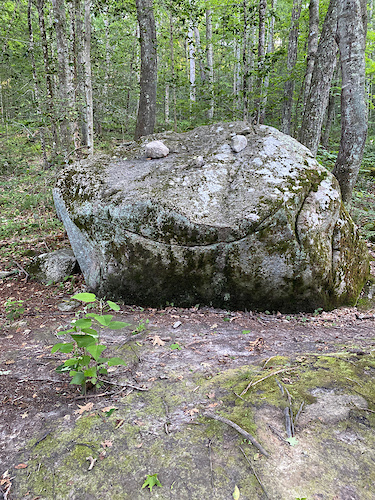
| trail | Mind the tourists visiting the new troll... | Aug 29, 2025 @ 12:28pm Aug 29, 2025 | ||
| report | This one is more of a Black Diamond thanks to... | Aug 29, 2025 @ 12:11pm Aug 29, 2025 | ||
| trail | This is a mid to low blue, one easy rock... | Aug 29, 2025 @ 12:09pm Aug 29, 2025 |
Nearby Areas
| name | distance | ||||
|---|---|---|---|---|---|
| Beach Pond | 1 | 6 | 15 | 3 | 3.5 km |
| Wickaboxet Management Area | 4.4 km | ||||
| Camp Yawgoog | 1 | 18 | 5 | 2 | 5.5 km |
| Green Falls (Pachaug State Forest) | 1 | 7 | 3 | 6 km | |
| Hillsdale Preserve | 2 | 1 | 6.1 km |
Local Badges
-

Completionist2 awarded

Activity Type Stats
| activitytype | trails | distance | descent | descent distance | total vertical | rating | global rank | state rank | photos | reports | routes | ridelogs |
|---|---|---|---|---|---|---|---|---|---|---|---|---|
| Mountain Bike | 230 | 123 miles | 9,646 ft | 50 miles | 456 ft | #508 | #196 | 267 | 1,396 | 21 | 8,840 | |
| E-Bike | 3 | 3 miles | 148 ft | 2,674 ft | 197 ft | 693 | 104 | |||||
| Horse | 79 | 30 miles | 1,722 ft | 11 miles | 456 ft | #807 | #426 | 408 | 1 | 9 | ||
| Hike | 245 | 131 miles | 9,951 ft | 53 miles | 456 ft | #401 | #224 | 209 | 1,397 | 11 | 1,039 | |
| Trail Running | 244 | 131 miles | 9,951 ft | 53 miles | 456 ft | #426 | #181 | 2 | 1,394 | 4 | 453 | |
| Snowshoe | 151 | 82 miles | 4,505 ft | 30 miles | 456 ft | #64 | #25 | 349 | 4 | 12 | ||
| Downhill Ski | 1 | |||||||||||
| Backcountry Ski | 8 | 4 miles | 177 ft | 1 mile | 197 ft | #305 | #66 | 12 | 1 | |||
| Nordic Ski | 125 | 66 miles | 3,635 ft | 25 miles | 456 ft | #204 | #59 | 287 | 1 | 11 |
Frequently Asked Questions About Arcadia Management Area
▼
What are the highest rated mountain biking trails in Arcadia Management Area?
The highest rated mountain biking trails in Arcadia Management Area are:
- Jeff's (4.2/5)
- 95 Trail West (4.1/5)
- Ben Utter + Tippecansett Trails (4.1/5)
- Shelter Trail (4.1/5)
- Power Line (4.1/5)
▼
What is the best time of the year to ride in Arcadia Management Area?
Based on ride log data, the most popular months to ride in Arcadia Management Area are:
- May (169 activities)
- June (161 activities)
- September (145 activities)
▼
Where can I park to ride in Arcadia Management Area?
There are 33 parking locations listed in Arcadia Management Area. The most popular parking spots are:
- Shelter Tr - Frosty Hollow Rd
- Shelter Tr - Plain Rd
- Main Lot
- Shelter Tr - Plain Rd
- Escoheag Trailhead - Plain Rd
▼
What is the longest trail in Arcadia Management Area?
The longest trail in Arcadia Management Area is Wickaboxet North at 3.7 miles. View all trails sorted by distance.
Activities
- Arcadia Management Area Mountain Biking Trails
- Arcadia Management Area Horseback Trails
- Arcadia Management Area Hiking Trails
- Arcadia Management Area Trail Running Trails
- Arcadia Management Area Snowshoeing Trails
- Arcadia Management Area Backcountry Skiing Trails
- Arcadia Management Area Nordic Skiing Trails
Trails
- Hard trails in Arcadia Management Area
- Easy trails in Arcadia Management Area
- Favorite trails in Arcadia Management Area
- Most ridden trails in Arcadia Management Area
- Singletrack in Arcadia Management Area
- Viewpoint trails in Arcadia Management Area
- Trails with technical features in Arcadia Management Area
- Race routes in Arcadia Management Area
- By brenthillier
 NSMBA TRAILFORKS & contributors
 - Admins: AMC-NARR, CTNebraska, CTNebraska
- #3579 - 30,695 views
- arcadia management area activity log | embed map of Arcadia Management Area mountain bike trails | arcadia management area mountain biking points of interest
Downloading of trail gps tracks in kml & gpx formats is enabled for Arcadia Management Area.
You must login to download files.