close
-
Layers w
- Weather Layers
- Pro
- Pro
- Pro
- Pro
- Pro
- Pro
- More Layers
- Pro
- Pro
- Pro
- Pro
-
Upgrade to

3D
Trail Conditions
- Unknown
- Snow Groomed
- Snow Packed
- Snow Covered
- Snow Cover Partial
- Freeze/thaw Cycle
- Icy
- Prevalent Mud
- Wet
- Variable
- Ideal
- Dry
- Very Dry
Trail Flow (Ridden Direction)
Trailforks scans users ridelogs to determine the most popular direction each trail is ridden. A good flowing trail network will have most trails flowing in a single direction according to their intension.
The colour categories are based on what percentage of riders are riding a trail in its intended direction.
The colour categories are based on what percentage of riders are riding a trail in its intended direction.
- > 96%
- > 90%
- > 80%
- > 70%
- > 50%
- < 50%
- bi-directional trail
- no data
Trail Last Ridden
Trailforks scans ridelogs to determine the last time a trail was ridden.
- < 2 days
- < 1 week
- < 2 weeks
- < 1 month
- < 6 months
- > 6 months
Trail Ridden Direction
The intended direction a trail should be ridden.
- Downhill Only
- Downhill Primary
- Both Directions
- Uphill Primary
- Uphill Only
- One Direction
Contribute Details
Colors indicate trail is missing specified detail.
- Description
- Photos
- Description & Photos
- Videos
Trail Popularity ?
Trailforks scans ridelogs to determine which trails are ridden the most in the last 9 months.
Trails are compared with nearby trails in the same city region with a possible 25 colour shades.
Think of this as a heatmap, more rides = more kinetic energy = warmer colors.
- most popular
- popular
- less popular
- not popular
ATV/ORV/OHV Filter
Max Vehicle Width
inches
US Cell Coverage
Legend

Radar Time
Activity Recordings
Trailforks uses anonymized public activity data.
?
Activity Recordings
Trailforks uses anonymized public activity data.
?
Personal Heatmap
▶
Activity Types
all
/
none
▶
Options
2
Date range
month
–
Winter Trails
Warning
A routing network for winter maps does not exist. Selecting trails using the winter trails layer has been disabled.
Missing Trails
Most Popular
Least Popular
Trails are colored based on popularity. The more popular a trail is, the more red. Less popular trails trend towards green.
Jump Magnitude Heatmap
Heatmap of where riders jump on trails. Zoom in to see individual jumps, click circles to view jump details.
BC Backroad Status
![map legend]()
Service Road Atlas is a free to use, community-driven service for viewing and creating reports on the numerous back-country service roads around B.C. and Alberta.

Slope Aspect
Direction the slope faces
Trails Deemphasized
Trails are shown in grey.
Only show trails with no bike usage.
Suggested Layers
Based on selected activity type
Save the current map location and zoom level as your default home location whenever this page is loaded.
Save
No description for Ardgartan has been added yet!
Login or register to submit one.
This region uses the Uk/Euro style trail grading system.
Activities Click to view
- Mountain Bike
35 trails
- E-Bike
35 trails
- Horse
14 trails
- Hike
20 trails
- Trail Running
20 trails
Region Details
- 15
- 5
- 4
- 11
Region Status
Open as of May 9, 2026Stats
- Avg Trail Rating
- Trails (view details)
- 35
- Trails Mountain Bike
- 35
- Trails E-Bike
- 35
- Trails Horse
- 14
- Trails Hike
- 20
- Trails Trail Running
- 20
- Total Distance
- 36 miles
- Total Descent
- 13,659 ft
- Total Vertical
- 2,727 ft
- Highest Trailhead
- 2,740 ft
- Reports
- 187
- Photos
- 86
- Ridden Counter
- 1,106
Popular Ardgartan Mountain Biking Trails
• 95 ★ 5.0 • 1,171 ft • 0 ft • 61 •
Popular black difficulty singletrack. This mountain bike primary trail can be used one direction and has a moderate overall physical rating. Trail visibility is always easy to follow. On average it takes 2 minutes to complete this trail.
• 100 ★ 5.0 • 922 ft • 0 ft • 57 •
Popular black difficulty singletrack. This mountain bike primary trail can be used one direction and has a moderate overall physical rating. Trail visibility is always easy to follow. On average it takes 1 minutes to complete this trail.
Double Bubble Permanently Closed
• 5 ★ 3.0 • 1,368 ft • 0 ft • 51 •
Less popular red difficulty closed singletrack. This mountain bike primary trail can be used one direction. On average it takes 4 minutes to complete this trail.
• 100 ★ 0.0 • 541 ft • 7 ft • 50 •
Popular blue difficulty singletrack. This mountain bike primary trail can be used both directions and has a easy overall physical rating with a 7 ft green climb. Trail visibility is always easy to follow. On average it takes 3 minutes to complete this trail.
Brooke's Permanently Closed
• 5 ★ 1.0 • 666 ft • 0 ft • 50 •
Less popular red difficulty closed singletrack. This mountain bike primary trail can be used one direction. On average it takes minutes to complete this trail.
• 85 ★ 5.0 • 1,598 ft • 0 ft • 49 •
Popular black difficulty singletrack. This mountain bike primary trail can be used one direction and has a moderate overall physical rating. Trail visibility is always easy to follow. On average it takes 7 minutes to complete this trail.
• 80 ★ 0.0 • 2,444 ft • 267 ft • 32 • • hike
Popular blue difficulty singletrack. This hike primary trail can be used both directions. Trail visibility is sometimes hard to follow. On average it takes 14 minutes to complete this trail.
• 65 ★ 5.0 • 3,524 ft • 52 ft • 27 •
Moderately popular black difficulty singletrack. This mountain bike primary trail can be used one direction and has a moderate overall physical rating. Trail visibility is always easy to follow. On average it takes 12 minutes to complete this trail.
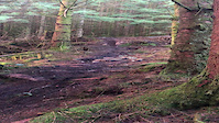
Photos of Ardgartan Mountain Bike
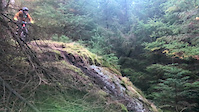
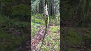
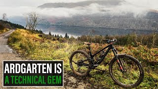
Videos of Ardgartan Mountain Bike
trail: Brooke's
0:13 |
|
Jan 16, 2022
trail: Lagavulin
0:21 |
100 |
Jan 16, 2022
trail: Foggy Moss
0:17 |
96 |
Oct 23, 2024 , Ardgartan

trail: Double Bubble
15:36 |
248 |
Jan 26, 2022 , Ardgartan

trail: Guano
15:36 |
135 |
Jan 26, 2022 , Ardgartan

trail: Brooke's
15:36 |
123 |
Jan 26, 2022 , Ardgartan

trail: Bunnahabhain
15:36 |
194 |
Jan 26, 2022 , Ardgartan
trail: Lagavulin
15:36 |
134 |
Jan 26, 2022 , Ardgartan
Recent Trail Reports
| status | trail | date | condition | info | user |
|---|---|---|---|---|---|
| Spam Fritters | May 10, 2026 @ 7:09am (Europe/London) May 9, 2026 | Ideal | DumbBot | ||
| Foggy Moss | Apr 24, 2026 @ 9:03pm (Europe/London) Apr 24, 2026 | Dry | steviedoc | ||
| Bunnahabhain | Jan 19, 2026 @ 1:27am (Europe/London) Jan 18, 2026 | Wet | Seasaw | ||
| Lagavulin | Jan 19, 2026 @ 1:23am (Europe/London) Jan 18, 2026 | Wet | Seasaw | ||
| Winter Gold | Jan 19, 2026 @ 1:21am (Europe/London) Jan 18, 2026 | Wet | Seasaw | ||
| Trail Access | Oct 12, 2025 @ 5:47pm (Europe/London) Oct 12, 2025 | Ideal | smogweegie | ||
| Guano | Sep 27, 2025 @ 11:11pm (Europe/London) Sep 27, 2025 | Unknown | PHmotorsport | ||
| Trail | Sep 22, 2025 @ 12:33pm (Europe/London) Sep 22, 2025 | Wet | jambon921 | ||
| Access Road | Sep 22, 2025 @ 12:32pm (Europe/London) Sep 22, 2025 | Ideal | jambon921 | ||
| Spam Fritters | Jul 26, 2025 @ 1:35pm Jul 26, 2025 | Unknown | obiwankenobi |
Activity Feed
| username | action | type | title | date |
|---|---|---|---|---|
| DumbBot | add | report | activity #94400606 | May 9, 2026 @ 11:09pm May 9, 2026 |
| DumbBot | vote | trail | activity #94368900 | May 9, 2026 @ 12:32pm May 9, 2026 |
| steviedoc | add | report | activity #93301319 | Apr 24, 2026 @ 1:03pm Apr 24, 2026 |
| Seasaw | add | report | activity #87452795 and 3 more | Jan 18, 2026 @ 5:21pm Jan 18, 2026 |
| Connorlindsay93 | add | report | activity #86797929 | Jan 7, 2026 @ 8:01am Jan 7, 2026 |
Recent Comments
| username | type | title | comment | date |
|---|---|---|---|---|
| report | Legend!! 💪🏼 | Sep 16, 2025 @ 1:34pm Sep 16, 2025 | ||
| report | All fixed 😎👌🏼 | Sep 7, 2025 @ 2:20pm Sep 7, 2025 | ||
| report | Couple of days work getting the full trail... | Sep 7, 2025 @ 2:18pm Sep 7, 2025 | ||
| report | Thanks ph! Glad to get this trail back running... | Aug 5, 2025 @ 1:20am Aug 5, 2025 | ||
| report | Cheers for that mate! I’ll hopefully get up... | Jul 28, 2025 @ 1:27pm Jul 28, 2025 |
Local Badges
-

Epic Mountain Bike Climb 2k0 awarded -

Climbing 10k Badge3 awarded -

Mountain Biking 100k Badge0 awarded -

Epic Ride Descent 2k0 awarded -

Descent 10k Badge3 awarded -

Descent 100k Badge0 awarded
Activity Type Stats
| activitytype | trails | distance | descent | descent distance | total vertical | rating | global rank | state rank | photos | reports | routes | ridelogs |
|---|---|---|---|---|---|---|---|---|---|---|---|---|
| Mountain Bike | 35 | 36 miles | 13,658 ft | 17 miles | 2,726 ft | #5,147 | #180 | 86 | 187 | 330 | ||
| E-Bike | 35 | 36 miles | 13,658 ft | 17 miles | 2,726 ft | #3,295 | #114 | 171 | 80 | |||
| Horse | 14 | 26 miles | 6,286 ft | 9 miles | 1,181 ft | #1,403 | #74 | 29 | ||||
| Hike | 20 | 33 miles | 9,711 ft | 14 miles | 2,726 ft | #5,730 | #136 | 112 | 94 | |||
| Trail Running | 20 | 33 miles | 9,711 ft | 14 miles | 2,726 ft | #5,379 | #131 | 112 | 20 |
Frequently Asked Questions About Ardgartan
▼
What are the highest rated mountain biking trails in Ardgartan?
The highest rated mountain biking trails in Ardgartan are:
- Winter Gold (4.1/5)
- Lagavulin (4.1/5)
- Bunnahabhain (4.1/5)
- Spam Fritters (4.1/5)
- Heeftarate (4.1/5)
▼
What is the best time of the year to ride in Ardgartan?
Based on ride log data, the most popular months to ride in Ardgartan are:
- April (3 activities)
- May (2 activities)
- October (2 activities)
▼
Where can I park to ride in Ardgartan?
There are 1 parking locations listed in Ardgartan. The most popular parking spots are:
▼
What is the longest trail in Ardgartan?
The longest trail in Ardgartan is Over The Top (LLCW Section) at 2.0 miles. View all trails sorted by distance.
Activities
Trails
Points of Interest
- By gav-s
 & contributors
 - Admins: DMBinS, FLS
- #33813 - 3,367 views
- ardgartan activity log | embed map of Ardgartan mountain bike trails | ardgartan mountain biking points of interest
Downloading of trail gps tracks in kml & gpx formats is enabled for Ardgartan.
You must login to download files.