close
-
Layers w
- Weather Layers
- Pro
- Pro
- Pro
- Pro
- Pro
- Pro
- More Layers
- Pro
- Pro
- Pro
- Pro
-
Upgrade to

3D
Trail Conditions
- Unknown
- Snow Groomed
- Snow Packed
- Snow Covered
- Snow Cover Partial
- Freeze/thaw Cycle
- Icy
- Prevalent Mud
- Wet
- Variable
- Ideal
- Dry
- Very Dry
Trail Flow (Ridden Direction)
Trailforks scans users ridelogs to determine the most popular direction each trail is ridden. A good flowing trail network will have most trails flowing in a single direction according to their intension.
The colour categories are based on what percentage of riders are riding a trail in its intended direction.
The colour categories are based on what percentage of riders are riding a trail in its intended direction.
- > 96%
- > 90%
- > 80%
- > 70%
- > 50%
- < 50%
- bi-directional trail
- no data
Trail Last Ridden
Trailforks scans ridelogs to determine the last time a trail was ridden.
- < 2 days
- < 1 week
- < 2 weeks
- < 1 month
- < 6 months
- > 6 months
Trail Ridden Direction
The intended direction a trail should be ridden.
- Downhill Only
- Downhill Primary
- Both Directions
- Uphill Primary
- Uphill Only
- One Direction
Contribute Details
Colors indicate trail is missing specified detail.
- Description
- Photos
- Description & Photos
- Videos
Trail Popularity ?
Trailforks scans ridelogs to determine which trails are ridden the most in the last 9 months.
Trails are compared with nearby trails in the same city region with a possible 25 colour shades.
Think of this as a heatmap, more rides = more kinetic energy = warmer colors.
- most popular
- popular
- less popular
- not popular
ATV/ORV/OHV Filter
Max Vehicle Width
inches
US Cell Coverage
Legend

Radar Time
Activity Recordings
Trailforks uses anonymized public activity data.
?
Activity Recordings
Trailforks uses anonymized public activity data.
?
Personal Heatmap
▶
Activity Types
all
/
none
▶
Options
2
Date range
month
–
Winter Trails
Warning
A routing network for winter maps does not exist. Selecting trails using the winter trails layer has been disabled.
Missing Trails
Most Popular
Least Popular
Trails are colored based on popularity. The more popular a trail is, the more red. Less popular trails trend towards green.
Jump Magnitude Heatmap
Heatmap of where riders jump on trails. Zoom in to see individual jumps, click circles to view jump details.
BC Backroad Status
![map legend]()
Service Road Atlas is a free to use, community-driven service for viewing and creating reports on the numerous back-country service roads around B.C. and Alberta.

Slope Aspect
Direction the slope faces
Trails Deemphasized
Trails are shown in grey.
Only show trails with no bike usage.
Suggested Layers
Based on selected activity type
Save the current map location and zoom level as your default home location whenever this page is loaded.
Save
No description for Arezzo has been added yet!
Login or register to submit one.
This region uses the Uk/Euro style trail grading system.
Activities Click to view
- Mountain Bike
249 trails
- E-Bike
229 trails
- Horse
37 trails
- Hike
155 trails
- Trail Running
160 trails
- Dirtbike/Moto
5 trails
Region Details
- 44
- 4
- 60
- 83
- 1
Stats
- Avg Trail Rating
- Trails (view details)
- 221
- Trails Mountain Bike
- 256
- Trails E-Bike
- 229
- Trails Gravel Bike
- 2
- Trails Horse
- 37
- Trails Hike
- 155
- Trails Trail Running
- 160
- Trails Dirtbike/Moto
- 5
- Trails Observed Trials
- 1
- Total Distance
- 245 miles
- Total Descent
- 85,501 ft
- Total Vertical
- 4,442 ft
- Highest Trailhead
- 4,997 ft
- Reports
- 575
- Photos
- 65
- Ridden Counter
- 6,128
Sub Regions
- Arezzo (97)
- Alpe di Poti (49)
- Colle di San Cornelio (3)
- Monte Lignano Trails (46)
- Valdichiana (1)
- Villa Severi (2)
- Badia Prataglia (25)
- Bucine (19)
- Chiusi Della Verna (1)
- Cortona (12)
- Sestino (4)
- Terontola (17)
- Botolandia (1)
- Pratomagno (56)
Popular Arezzo Mountain Biking Trails
• 95 ★ 4.3 • 4,654 ft • 2 ft • 86 •
Il sentiero enduro più famoso di Arezzo, da fare assolutamente! E' il classico sentiero che si fa al rientro dopo aver girato sui trail dell'Alpe di Poti. E' stato prova speciale del Toscano Enduro Series per due anni, nel 2017 e nel...
• 90 ★ 4.9 • 4,203 ft • 3 ft • 85 •
Single track Flow con sponde e alcuni ripidi Single track Flow with banks and some steep sections.
• 100 ★ 4.5 • 3,921 ft • 0 ft • 81 •
Sentiero Flow con curve spondate senza apparenti difficoltà, ma che prensenta molti salti, alcuni lunghi. Procedere con attenzione.
• 95 ★ 5.0 • 4,980 ft • 0 ft • 80 •
Sentiero misto che alterna tratti flow a tratti con curve strette e spondate. Presenti vari doppi o salti.
• 100 ★ 3.4 • 2,549 ft • 0 ft • 80 •
E' la prima parte del Cinghiale. Molto veloce e leggermente scassata. Percorribile con ogni tipo di bici.
• 95 ★ 4.5 • 3,328 ft • 118 ft • 74 •
Popular green difficulty singletrack. This mountain bike primary trail can be used both directions with a 118 ft blue climb. Trail visibility is always easy to follow. On average it takes 8 minutes to complete this trail.
• 95 ★ 3.4 • 1 mile • 0 ft • 63 •
Alterna tratti Flow e veloci a tratti natural e guidati.
• 5 ★ 4.0 • 2 miles • 131 ft • 55 •
Less popular blue difficulty singletrack. This mountain bike primary trail can be used downhill primary and has a hard overall physical rating with a 131 ft blue climb. Trail visibility is always easy to follow. On average it takes 13 minutes to complete this trail.
Arezzo Mountain Bike Routes
16 miles • 4,171 ft • 7 • Loop •
Partendo dal parcheggio dietro la chiesa di rigutino, si sale per la bella strada forestale detta "di "...
24 miles • 5,477 ft • 11 • Loop •
Questo bel giro ideale per chi ama l'enduro/all mountain, ma anche per e-bikers purché pratici di discese...
10 miles • 1,635 ft • 3 • Loop •
un anello ideale per il cross-country, meglio farlo in senso antiorario
6 miles • 960 ft • 2 • Out & Back •
Escursione da alla Vetta del monte Lignano dove poter ammirare una bellissima vista. Durante il tragitto...
12 miles • 2,620 ft • 5 • Loop •
Giro tipico MTB enduro con due PS (L'IGNORANTE e L'IGNARO) la partenza della traccia è dal parcheggio...
Photos of Arezzo Mountain Bike
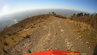
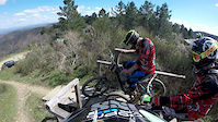
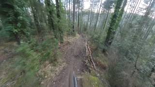
Videos of Arezzo Mountain Bike
trail: Il Cero
5:58 |
99 |
Jan 18, 2021
trail: Nusenna DH
4:04 |
299 |
Apr 12, 2015
trail: Michelino
2:42 |
41 |
Feb 27, 2026 , Arezzo
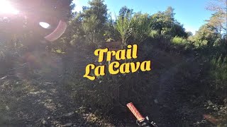
trail: La Cava
3:32 |
40 |
Dec 30, 2025 , Arezzo
youtuber
![This was my BEST ride of 2025!]()
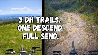
trail: ALBERETA PS2
10:41 |
59 |
Dec 29, 2025 , Loro Ciufenna
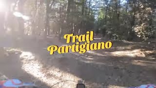
trail: Partigiano
6:56 |
56 |
Dec 28, 2025 , Arezzo
trail: El Cabron II parte
4:13 |
93 |
Apr 12, 2025 , Arezzo

trail: El Cabron I parte
4:13 |
66 |
Apr 12, 2025 , Arezzo
Recent Trail Reports
Activity Feed
| username | action | type | title | date |
|---|---|---|---|---|
| mmIaks | wishlist | badge | activity #97548608 | Jun 22, 2026 @ 1:29am 22 hours |
| mchesi | add | report | activity #97235163 and 2 more | Jun 17, 2026 @ 11:45pm Jun 17, 2026 |
| Skasmir | wishlist | trail | activity #95817826 | May 29, 2026 @ 6:57pm May 29, 2026 |
| Avoig88 | add | report | activity #95354587 and 1 more | May 23, 2026 @ 2:18pm May 23, 2026 |
| MrRuinsAl2QCo | ridden | trail | activity #95328280 | May 23, 2026 @ 9:37am May 23, 2026 |
Recent Comments
| username | type | title | comment | date |
|---|---|---|---|---|
| trail | Veramente top trail divertentissimo e super... | Dec 29, 2025 @ 2:28pm Dec 29, 2025 | ||
| trail | Perfetto !! | May 30, 2025 @ 2:07pm May 30, 2025 | ||
| report | Un po’ scavato parte finale | Apr 20, 2025 @ 1:14am Apr 20, 2025 | ||
| trail | Bellissimo, ma lo classificherei come rosso e... | Feb 27, 2025 @ 1:49am Feb 27, 2025 | ||
| trail | Si riesce a prendere risalendo... | Feb 5, 2025 @ 7:55am Feb 5, 2025 |
Local Badges
-

Descent 100k Badge2 awarded -

Descent 10k Badge14 awarded -
Descent 10k Badge4 awarded -

Epic Ride Descent 2k0 awarded -
Descent 100k Badge1 awarded -

Big Ride 30k610 awarded
Bike & Skill Parks
| name | type | city | rating |
|---|---|---|---|
| Circuit di Gioiella | skill park | Arezzo | |
| Crossdromo Brilli Peri (Montevarchi) | skill park | Bucine | |
| Ponte alla Chiassa? | skill park | Arezzo |
Activity Type Stats
| activitytype | trails | distance | descent | descent distance | total vertical | rating | global rank | state rank | photos | reports | routes | ridelogs |
|---|---|---|---|---|---|---|---|---|---|---|---|---|
| Mountain Bike | 249 | 245 miles | 85,502 ft | 152 miles | 4,442 ft | 58 | 610 | 10 | 22,346 | |||
| E-Bike | 229 | 180 miles | 72,812 ft | 117 miles | 4,442 ft | 6 | 564 | 7 | 4,231 | |||
| Gravel Bike | 2 | 2 | 90 | |||||||||
| Horse | 37 | 66 miles | 9,577 ft | 33 miles | 4,219 ft | 75 | ||||||
| Hike | 155 | 176 miles | 48,497 ft | 101 miles | 4,432 ft | 1 | 487 | 490 | ||||
| Trail Running | 160 | 184 miles | 51,083 ft | 106 miles | 4,432 ft | 490 | 2 | 283 | ||||
| Dirtbike/Moto | 5 | 6 miles | 3,205 ft | 5 miles | 1,683 ft | 68 | ||||||
| Observed Trials | 1 | 2 miles | 1,243 ft | 2 miles | 1,230 ft | 1 |
Frequently Asked Questions About Arezzo
▼
What are the best places to ride in Arezzo?
Arezzo has 9 areas to explore for mountain biking. The top rated areas are:
▼
What are the highest rated mountain biking trails in Arezzo?
The highest rated mountain biking trails in Arezzo are:
- Nepo (4.5/5)
- Super G (4.5/5)
- L'InDiaNo TrAiL (4.4/5)
- Partigiano (4.4/5)
- Nusenna DH (4.4/5)
▼
What is the best time of the year to ride in Arezzo?
Based on ride log data, the most popular months to ride in Arezzo are:
- April (40 activities)
- August (37 activities)
- May (36 activities)
▼
What is the longest trail in Arezzo?
The longest trail in Arezzo is Sentiero della Bonifica at 63.0 km. View all trails sorted by distance.
Activities
Trails
Points of Interest
- By denitopia
 TRAILFORKS VTA & contributors
 - Admins: denitopia, marcoangeletti, cemoorelife, DanielePracchia
- #11650 - 8,072 views
- arezzo activity log | embed map of Arezzo mountain bike trails | arezzo mountain biking points of interest
Downloading of trail gps tracks in kml & gpx formats is enabled for Arezzo.
You must login to download files.