close
-
Layers w
- Weather Layers
- Pro
- Pro
- Pro
- Pro
- Pro
- Pro
- More Layers
- Pro
- Pro
- Pro
- Pro
-
Upgrade to

3D
Trail Conditions
- Unknown
- Snow Groomed
- Snow Packed
- Snow Covered
- Snow Cover Partial
- Freeze/thaw Cycle
- Icy
- Prevalent Mud
- Wet
- Variable
- Ideal
- Dry
- Very Dry
Trail Flow (Ridden Direction)
Trailforks scans users ridelogs to determine the most popular direction each trail is ridden. A good flowing trail network will have most trails flowing in a single direction according to their intension.
The colour categories are based on what percentage of riders are riding a trail in its intended direction.
The colour categories are based on what percentage of riders are riding a trail in its intended direction.
- > 96%
- > 90%
- > 80%
- > 70%
- > 50%
- < 50%
- bi-directional trail
- no data
Trail Last Ridden
Trailforks scans ridelogs to determine the last time a trail was ridden.
- < 2 days
- < 1 week
- < 2 weeks
- < 1 month
- < 6 months
- > 6 months
Trail Ridden Direction
The intended direction a trail should be ridden.
- Downhill Only
- Downhill Primary
- Both Directions
- Uphill Primary
- Uphill Only
- One Direction
Contribute Details
Colors indicate trail is missing specified detail.
- Description
- Photos
- Description & Photos
- Videos
Trail Popularity ?
Trailforks scans ridelogs to determine which trails are ridden the most in the last 9 months.
Trails are compared with nearby trails in the same city region with a possible 25 colour shades.
Think of this as a heatmap, more rides = more kinetic energy = warmer colors.
- most popular
- popular
- less popular
- not popular
ATV/ORV/OHV Filter
Max Vehicle Width
inches
US Cell Coverage
Legend

Radar Time
Activity Recordings
Trailforks uses anonymized public activity data.
?
Activity Recordings
Trailforks uses anonymized public activity data.
?
Personal Heatmap
▶
Activity Types
all
/
none
▶
Options
2
Date range
month
–
Winter Trails
Warning
A routing network for winter maps does not exist. Selecting trails using the winter trails layer has been disabled.
Missing Trails
Most Popular
Least Popular
Trails are colored based on popularity. The more popular a trail is, the more red. Less popular trails trend towards green.
Jump Magnitude Heatmap
Heatmap of where riders jump on trails. Zoom in to see individual jumps, click circles to view jump details.
BC Backroad Status
![map legend]()
Service Road Atlas is a free to use, community-driven service for viewing and creating reports on the numerous back-country service roads around B.C. and Alberta.

Slope Aspect
Direction the slope faces
Trails Deemphasized
Trails are shown in grey.
Only show trails with no bike usage.
Suggested Layers
Based on selected activity type
Save the current map location and zoom level as your default home location whenever this page is loaded.
SaveArizona has five official tourism regions:
Northern Region: Coconino, Apache and Navajo counties
North Central Region: Gila and Yavapa counties
Phoenix & Central Region: Maricopa and Pinal counties
West Coast Region: Mohave, La Paz and Yuma counties
Tucson & Southern Region: Pima, Santa Cruz, Cochise, Graham and Greenlee counties.
For more information on these regions and comprehensive visitor information please visit the official Arizona Office of Tourism website as well as the VisitArizona.com website (links below).
Links
Stats
- Avg Trail Rating
- Trails (view details)
- 8,158
- Trails Mountain Bike
- 6,371
- Trails E-Bike
- 2,535
- Trails Gravel Bike
- 665
- Trails Adaptive Bike
- 890
- Trails Winter Fat Bike
- 500
- Trails Horse
- 2,884
- Trails Hike
- 7,723
- Trails Trail Running
- 7,524
- Trails Dirtbike/Moto
- 895
- Trails Observed Trials
- 111
- Trails ATV/ORV/OHV
- 758
- Trails Snowmobile
- 1
- Trails Snowshoe
- 27
- Trails Downhill Ski
- 130
- Trails Backcountry Ski
- 8
- Trails Nordic Ski
- 67
- Total Distance
- 14,844 miles
- Total Descent
- 1,690,285 ft
- Total Vertical
- 12,597 ft
- Highest Trailhead
- 12,600 ft
- Reports
- 65,862
- Photos
- 24,861
- Ridden Counter
- 1,977,255
Articles
Video: Brice Shirbach Heads Home to Tempe, Arizona in 'Underexposed'
Mar 24, 2026 from pinkbike.com
In the kickoff to the final season, Brice explores the rugged desert trails and advocacy efforts that serve as the literal testing ground for...

Specialized Cactus Cup Adds Standalone Vintage Event for 2026
Mar 11, 2026 from pinkbike.com
Industry veteran Mark Salmon and VORBA bring the collector community to the desert for a $20 throwback race and a pro-wrestling-style winner's belt.
Sedona Mountain Bike Festival Release New Schedule for 2026
Sep 4, 2025 from pinkbike.com
The Sedona Mountain Bike Festival is trading its spring slot for a full-send fall edition.
Destination Showcase - Tucson, AZ
Jun 30, 2025 from pinkbike.com
Everything you need to know about riding in the Arizona desert.
Popular Trail Networks
view all areas »Sub Regions
- AZ - North Central Region (1,314)
- Coconino County (1)
- Cottonwood Area (184)
- Prescott Area (561)
- Prescott National Forest (Valley District) (51)
- Sedona Area (247)
- AZ - Northern Region (1,063)
- Apache Sitgreaves National Forest (265)
- Coconino Plateau (38)
- Colorado Plateau (34)
- Flagstaff Area (509)
- Grand Canyon National Park (20)
- Kaibab National Forest (North) (65)
- Kaibab National Forest (Tusayan District) (38)
- Kaibab National Forest (Williams District) (57)
- Mohave County (17)
- Navajo Reservation (5)
- Painted Desert Region (1)
- AZ - Tucson & Southeast Region (1,341)
- Central Arizona (2,155)
- East Valley (597)
- Greater North Valley (96)
- Maricopa County (1,049)
- Tonto Basin (4)
- Tonto National Forest (133)
- West Valley (271)
- Western Arizona (305)
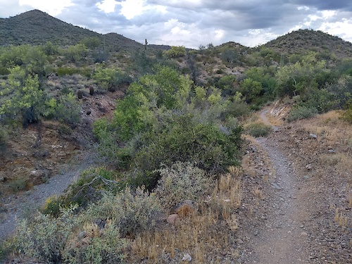
Popular Arizona Mountain Biking Trails
• 100 ★ 3.9 • 1,621 ft • 50 ft • 9,154 •
This 1/3 mile trail that takes you from the trail to the trail. The trail surface is packed dirt and winds up to the very popular trail.
• 90 ★ 4.6 • 3 miles • 300 ft • 6,648 •
Beginner 20%, intermediate 40%, advanced 20% and expert 20%, 2.62 mile very technical MTB trail which is a bi-directional singletrack, that is up and down with about 400 yards of technical exposed and really steep sections a lesser...
• 95 ★ 4.5 • 2 miles • 106 ft • 6,524 •
Beginner 10%, intermediate 70% and advanced 20%, twisty with numerous up and down sections of trail that cross a number of dry washes. The trail tread is mostly packed dirt mixed with rocks. There are also several sections of slickrock...
• 100 ★ 3.4 • 1,555 ft • 0 ft • 6,089 •
Intermediate 90% and advanced 10%, 1/3 mile MTB trail which is a bi-directional singletrack that is a slightly twisty trail with a couple of slightly technical spots that will be a little challenging to a lesser skilled rider. The trail...
• 100 ★ 4.2 • 4,741 ft • 81 ft • 6,090 •
The trail is 2.7 miles long and is one of the best intermediate skill level trails in Sedona. The east end starts at the parking lot which a lot of the time is full due to its popularity. The west end of the trail starts from a huge...
• 100 ★ 3.0 • 2,598 ft • 3 ft • 6,013 •
Popular black diamond difficulty singletrack. This multi-use trail can be used both directions and has a easy overall physical rating with a 3 ft green climb. Trail visibility is always easy to follow. On average it takes 2 minutes to complete this trail.
• 90 ★ 4.5 • 1 mile • 15 ft • 6,001 •
Mostly downhill, fast and fun, with some rocks thrown in here and there. This section is really fun as a downhill, but also goes just fine as an uphill. Keep in mind if you ride down, you get closer and closer to the trail head, and...
• 100 ★ 3.2 • 5,148 ft • 135 ft • 4,834 •
The south end starts at the parking and the north end intersects with the and wilderness hiking trail. An entry level beginner's trail.
Arizona Mountain Bike Routes
★ 4.0 • 9 miles • 519 ft • 12 • Out & Back •
Ride all of the easy trails at Sweetwater in one go. Head clockwise on Desperado, at the end of the loop...
★ 3.3 • 10 miles • 764 ft • 7 • Loop •
Classic loop of the best trails on the east side of the mountain park. Starting at TH, taking , , , , and...
★ 3.5 • 13 miles • 860 ft • 23 • Loop •
Ride all of the moderate and easy trails at Sweetwater, including twice for good measure!
★ 3.0 • 10 miles • 727 ft • 2 •
Pima County's first competitive mountain bike race course, fast and smooth. Ride both the and on the...
★ 4.0 • 28 miles • 1,274 ft • 17 • Loop •
Ride all of the trails in the Honeybee Canyon network, starting from the Big Wash TH. The main Honeybee...
★ 5.0 • 10 miles • 659 ft • 14 • Loop •
Ride most of the easy and intermediate trails in the Robles Pass area of Tucson Mountain Park. If you want...
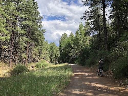
Photos of Arizona Mountain Bike
Videos of Arizona Mountain Bike
trail: Gauntlet
0:14 |
4 |
Jun 10, 2026
trail: RMR Extension
0:31 |
21 |
May 17, 2026
trail: Easy Breezy
0:10 |
24 |
May 8, 2026
trail: Lower Geocache
0:17 |
22 |
May 5, 2026
trail: Upper Geocache
0:11 |
46 |
Apr 30, 2026
trail: Lower Geotech
3:30 |
28 |
Apr 29, 2026
trail: Pyro
0:04 |
32 |
Apr 18, 2026
trail: Magma
0:22 |
12 |
Apr 18, 2026
National Scenic Trails & Official Routes
-
Arizona Trail
- Mountain Bike
- Hike
- Trail Running
-
Black Canyon Trail
- Mountain Bike
- Horse
- Hike
- Trail Running
-
Flagstaff Urban Trails System
- Mountain Bike
- E-Bike
- Gravel Bike
Activity Feed
| username | action | type | title | date |
|---|---|---|---|---|
| schillingsworth | add | report | activity #97450420 | Jun 20, 2026 @ 7:19pm 3 hours |
| pTjE8b | wishlist | trail | activity #97449853 | Jun 20, 2026 @ 7:05pm 4 hours |
| Labatt911 | wishlist | region | activity #97448695 | Jun 20, 2026 @ 6:39pm 4 hours |
| rinzler05 | wishlist | route | activity #97447943 | Jun 20, 2026 @ 6:22pm 4 hours |
| Hawki2 | wishlist | region | activity #97437627 | Jun 20, 2026 @ 3:27pm 7 hours |
Recent Comments
| username | type | title | comment | date |
|---|---|---|---|---|
| trail | An amazing flow trail. The dirt was perfect. | Jun 17, 2026 @ 4:42pm Jun 17, 2026 | ||
| trail | This is… not a blue. Black diamond for sure. | Jun 16, 2026 @ 6:31am Jun 16, 2026 | ||
| trail | Trail work being done on this July 24-26th... | Jun 15, 2026 @ 9:34am Jun 15, 2026 | ||
| trail | This trail is NOT a blue trail. It’s pretty... | Jun 13, 2026 @ 9:24pm Jun 13, 2026 | ||
| report | This is one of my favorite trails at honeybee.... | Jun 12, 2026 @ 11:16pm Jun 12, 2026 |
Local Badges
-

Hawes Baker's Dozen46 awarded -

Descent 10k Badge12 awarded -

Descent 100k Badge84 awarded -
Descent 100k Badge69 awarded -
Descent 10k Badge7 awarded -
Descent 10k Badge32 awarded
Bike & Skill Parks
| name | type | city | rating |
|---|---|---|---|
| Sunrise Park Resort | bike park | Greer | |
| Papago Dirt Jumps | skill park | Tempe | |
| Sedona Bike Skills Park | skill park | Sedona | |
| Fort Tuthill MTB Park | skill park | Flagstaff | |
| Estrella Foothills Bike Park | skill park | Goodyear |
Upcoming Local Events
Activity Type Stats
| activitytype | trails | distance | descent | descent distance | total vertical | rating | global rank | state rank | photos | reports | routes | ridelogs |
|---|---|---|---|---|---|---|---|---|---|---|---|---|
| Mountain Bike | 6,370 | 11,712 miles | 1,107,723 ft | 4,808 miles | 10,886 ft | #8 | 22,616 | 65,683 | 1,483 | 1,924,288 | ||
| E-Bike | 2,535 | 5,664 miles | 463,015 ft | 2,294 miles | 10,886 ft | #7 | 163 | 57,076 | 95 | 95,555 | ||
| Gravel Bike | 665 | 1,447 miles | 93,789 ft | 544 miles | 10,476 ft | #15 | 31 | 7,238 | 56 | 10,130 | ||
| Adaptive Bike | 890 | 2,355 miles | 145,531 ft | 854 miles | 10,656 ft | #7 | 3 | 8,002 | 13 | 123 | ||
| Winter Fat Bike | 500 | 1,516 miles | 104,977 ft | 602 miles | 9,869 ft | #10 | 925 | 13 | 147 | |||
| Horse | 2,884 | 7,522 miles | 874,993 ft | 3,184 miles | 10,410 ft | #2 | 47 | 21,741 | 121 | 2,657 | ||
| Hike | 7,723 | 14,151 miles | 1,603,707 ft | 5,779 miles | 12,598 ft | #7 | 1,794 | 64,776 | 705 | 219,083 | ||
| Trail Running | 7,524 | 13,631 miles | 1,514,416 ft | 5,542 miles | 12,598 ft | #8 | 78 | 64,715 | 395 | 96,010 | ||
| Dirtbike/Moto | 895 | 3,836 miles | 277,822 ft | 1,577 miles | 9,616 ft | #8 | 28 | 18,863 | 8 | 2,030 | ||
| Observed Trials | 111 | 385 miles | 28,980 ft | 151 miles | 9,449 ft | #9 | 6 | 509 | 2 | 375 | ||
| ATV/ORV/OHV | 758 | 3,411 miles | 224,406 ft | 1,361 miles | 9,616 ft | #6 | 25 | 18,776 | 6 | 936 | ||
| Snowmobile | 1 | 18 miles | 1,325 ft | 15 miles | 863 ft | #27 | 74 | 55 | ||||
| Snowshoe | 27 | 62 miles | 10,213 ft | 33 miles | 10,233 ft | #35 | 2 | 335 | 5 | 405 | ||
| Downhill Ski | 130 | 46 miles | 34,797 ft | 42 miles | 8,022 ft | #25 | 53 | 4,747 | ||||
| Backcountry Ski | 8 | 2 miles | 1,093 ft | 4,560 ft | 8,022 ft | #24 | 1 | 109 | 1,577 | |||
| Nordic Ski | 67 | 81 miles | 5,259 ft | 33 miles | 5,873 ft | #35 | 1 | 234 | 9 | 1,099 |
Activities
- Arizona Mountain Biking Trails
- Arizona E-Biking Trails
- Arizona Gravel Biking Trails
- Arizona Adaptive Biking Trails
- Arizona Winter Fat Biking Trails
- Arizona Horseback Trails
- Arizona Hiking Trails
- Arizona Trail Running Trails
- Arizona Dirtbiking Trails
- Arizona Observed Trials Trails
- Arizona ATVing/Offroading Trails
- Arizona Snowshoeing Trails
- Arizona Skiing Trails
- Arizona Backcountry Skiing Trails
- Arizona Nordic Skiing Trails
Trails
Points of Interest
- North Timp Pt. Viewpoint
- Devin's Clavicle Memorial Jump TTF
- The Amphitheater Sight
- Cathedral Rock Sight
- Sunset Vista Viewpoint
- North Rim CG Camping
- Blue Ridge CG Camping
- Great Gig in the Sky TTF
- Tequila Tree Sight
- Timp Pt. Viewpoint
- Humphreys Peak (12,621 ft)
- Agassiz Peak (12,323 ft)
- Fremont Peak (11,972 ft)
- By canadaka
 Trailforks & contributors
 - Admins: Map Team, IMBA, chuktA, msmcfate, WillieJacobsz, PlumbBobM, ReckitRolley, colinreuter, AZT, chainslapAZ
- #3181 - 184,054 views
- arizona activity log | embed map of Arizona mountain bike trails | arizona mountain biking points of interest polygons
Downloading of trail gps tracks in kml & gpx formats is enabled for Arizona.
You must login to download files.