close
-
Layers w
- Weather Layers
- Pro
- Pro
- Pro
- Pro
- Pro
- Pro
- More Layers
- Pro
- Pro
- Pro
- Pro
-
Upgrade to

3D
Trail Conditions
- Unknown
- Snow Groomed
- Snow Packed
- Snow Covered
- Snow Cover Partial
- Freeze/thaw Cycle
- Icy
- Prevalent Mud
- Wet
- Variable
- Ideal
- Dry
- Very Dry
Trail Flow (Ridden Direction)
Trailforks scans users ridelogs to determine the most popular direction each trail is ridden. A good flowing trail network will have most trails flowing in a single direction according to their intension.
The colour categories are based on what percentage of riders are riding a trail in its intended direction.
The colour categories are based on what percentage of riders are riding a trail in its intended direction.
- > 96%
- > 90%
- > 80%
- > 70%
- > 50%
- < 50%
- bi-directional trail
- no data
Trail Last Ridden
Trailforks scans ridelogs to determine the last time a trail was ridden.
- < 2 days
- < 1 week
- < 2 weeks
- < 1 month
- < 6 months
- > 6 months
Trail Ridden Direction
The intended direction a trail should be ridden.
- Downhill Only
- Downhill Primary
- Both Directions
- Uphill Primary
- Uphill Only
- One Direction
Contribute Details
Colors indicate trail is missing specified detail.
- Description
- Photos
- Description & Photos
- Videos
Trail Popularity ?
Trailforks scans ridelogs to determine which trails are ridden the most in the last 9 months.
Trails are compared with nearby trails in the same city region with a possible 25 colour shades.
Think of this as a heatmap, more rides = more kinetic energy = warmer colors.
- most popular
- popular
- less popular
- not popular
ATV/ORV/OHV Filter
Max Vehicle Width
inches
US Cell Coverage
Legend

Radar Time
Activity Recordings
Trailforks uses anonymized public activity data.
?
Activity Recordings
Trailforks uses anonymized public activity data.
?
Personal Heatmap
▶
Activity Types
all
/
none
▶
Options
2
Date range
month
–
Winter Trails
Warning
A routing network for winter maps does not exist. Selecting trails using the winter trails layer has been disabled.
Missing Trails
Most Popular
Least Popular
Trails are colored based on popularity. The more popular a trail is, the more red. Less popular trails trend towards green.
Jump Magnitude Heatmap
Heatmap of where riders jump on trails. Zoom in to see individual jumps, click circles to view jump details.
BC Backroad Status
![map legend]()
Service Road Atlas is a free to use, community-driven service for viewing and creating reports on the numerous back-country service roads around B.C. and Alberta.

Slope Aspect
Direction the slope faces
Trails Deemphasized
Trails are shown in grey.
Only show trails with no bike usage.
Suggested Layers
Based on selected activity type
Save the current map location and zoom level as your default home location whenever this page is loaded.
SaveLittle Bit of everything in this fun state. Anything from flat open trials to some short burly trails. from easy to double black diamond.
Region Details
- 142
- 288
- 488
- 604
- 217
- 24
- 5
- 1
Stats
- Avg Trail Rating
- Trails (view details)
- 2,078
- Trails Mountain Bike
- 1,748
- Trails E-Bike
- 1,479
- Trails Gravel Bike
- 166
- Trails Adaptive Bike
- 259
- Trails Winter Fat Bike
- 25
- Trails Horse
- 117
- Trails Hike
- 1,908
- Trails Trail Running
- 1,896
- Trails Dirtbike/Moto
- 13
- Trails Observed Trials
- 3
- Trails ATV/ORV/OHV
- 26
- Trails Snowshoe
- 3
- Total Distance
- 2,450 miles
- Total Descent
- 277,336 ft
- Total Vertical
- 2,583 ft
- Highest Trailhead
- 2,745 ft
- Reports
- 33,129
- Photos
- 6,773
- Ridden Counter
- 1,258,505
Articles
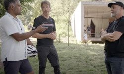
Video: Exploring Bentonville Arkansas's Mountain Biking & Food Scenes With Biju Thomas
Jun 17, 2025 from pinkbike.com
You know about Walmart. You’ve heard about the trails. But how’s the food?
The 12 Most Stunning Trails in the U.S.
May 29, 2025 from outsideonline.com
In celebration of National Trails Day, discover some of the best hikes in the U.S.—from slot canyons to grasslands, waterfalls, and secluded...

Bentonville Bike Fest Announce 2025 Event Details
Feb 6, 2025 from pinkbike.com
Early bird Bentonville Bike Fest passes are available now.
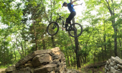
Video: Remy Metailler & Ryan Rodriguez Chase Rock Features In Bentonville
Jun 8, 2023 from pinkbike.com
Remy went to check out the huge investment that has gone into building trails in Arkansas.... courtesy of Walmart.
Popular Trail Networks
view all areas »Sub Regions
- Central Arkansas (178)
- Conway County (1)
- Faulkner County (10)
- Lonoke County (1)
- Perry County (1)
- Prairie County (1)
- Pulaski County (151)
- Saline County (14)
- White County (1)
- North Central Arkansas (109)
- Baxter County (41)
- Cleburne County (4)
- Fulton County (0)
- Independence County (4)
- Marion County (13)
- Searcy County (11)
- Sharp County (0)
- Stone County (30)
- Van Buren County (19)
- Northeast Arkansas (72)
- Chitterden County (5)
- Clay County (0)
- Craighead County (43)
- Cross County (18)
- Greene County (0)
- Jackson County (0)
- Lawrence County (1)
- Mississippi County (0)
- Poinsett County (3)
- Randolph County (0)
- St Francis County (2)
- Woodruff County (0)
- Northwest Arkansas (1,243)
- Benton County (671)
- Boone County (3)
- Carroll County (128)
- Crawford County (42)
- Franklin County (0)
- Johnson County (6)
- Logan County (1)
- Madison County (5)
- Newton County (108)
- Pope County (43)
- Scott County (1)
- Sebastian County (36)
- Washington County (240)
- Yell County (14)
- Ouachitas (0)
- Southeast Arkansas (12)
- Arkansas County (0)
- Bradley County (1)
- Drew County (8)
- Lee County (0)
- Lincoln County (1)
- Monroe County (0)
- Phillips County (2)
- Southwest Arkansas (140)
- Clark County (10)
- Garland County (80)
- Miller County (1)
- Ouachita County (2)
- Polk County (26)
- Quachita National Forest (13)
- Sevier County (8)
Popular Arkansas Mountain Biking Trails
• 90 ★ 3.5 • 2,001 ft • 55 ft • 8,747 •
has almost completely replaced this in places. Great for the wee ones and relaxing way to get down to the new trails in the south section of Phase 1
• 100 ★ 4.4 • 2,405 ft • 0 ft • 8,218 •
Highly rated popular green difficulty singletrack. This multi-use trail can be used downhill only. Adaptive MTB rating: amtb green. On average it takes 1 minutes to complete this trail.
• 95 ★ 4.4 • 2,457 ft • 80 ft • 7,288 •
Highly rated popular green difficulty singletrack. This multi-use trail can be used downhill only. Adaptive MTB rating: amtb green. On average it takes 3 minutes to complete this trail.
• 90 ★ 4.8 • 3,520 ft • 43 ft • 7,286 •
This directional intermediate downhill flow/jump trail starts at the Hub and ends at the northeast end of . The trail includes many rollers, jumps and berms. It is great fun for all ages that are moderately skilled on a mountain bike.
• 95 ★ 3.7 • 725 ft • 0 ft • 7,200 •
is a green flow downhill in Phase III of the Slaughter Pen Trail
• 100 ★ 4.7 • 1,447 ft • 0 ft • 6,700 •
New dual-slalom racetrack, it has been re-constructed for all abilities. There is an egress for timid riders to leave before the last bridge feature. When in doubt, walk it out! This trail is a super fun trail that the family can lap as...
• 95 ★ 4.3 • 784 ft • 0 ft • 6,818 •
Highly rated popular blue difficulty singletrack. This multi-use trail can be used downhill only and has a hard overall physical rating. It features berm, bridge, jump, gap jump and roller coaster. Adaptive MTB rating: amtb green. Trail visibility is always easy to follow. On average it takes 1 minutes to complete this trail.
Arkansas Mountain Bike Routes
Wet Weather Route Featured
★ 4.0 • 7 miles • 477 ft • 6 • Loop •
Wet weather route that will help riders and runners to avoid the newer clay capped trails during rainy...
Mt Nebo by Jackalope Cycling Featured
18 miles • 1,988 ft • 7 • Loop •
This route tours the machine built flow trails on Nebo. All trail features on this route are rollable or...
23 miles • 1,279 ft • 0 • Loop •
Spring Lake is GRAVEL-CENTRAL for the RVOORC club. This route is a good example of the sweet and...
★ 3.7 • 7 miles • 707 ft • 0 • Loop •
This route is best started at the Bear Hollow Trailhead, which offers immediately access to the Loop....
★ 4.5 • 5 miles • 270 ft • 13 • Loop •
This is a route for beginner rides who are focusing on learning the basics of mountain biking. There is...
★ 4.0 • 4 miles • 295 ft • 2 •
RiderS at Blowing Springs quickly discover that they can hit rock drops, roll up and over challenging...
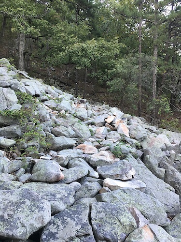
Photos of Arkansas Mountain Bike
Videos of Arkansas Mountain Bike
trail: Lake Loop (East)
4:12 |
4 |
Apr 16, 2026
trail: Go Ride
2:59 |
45 |
Aug 19, 2025
trail: Precipitous
0:07 |
90 |
Jul 1, 2025
trail: Air-Raid
0:14 |
37 |
Jun 24, 2025
trail: Air-Raid
0:29 |
17 |
Jun 24, 2025
trail: Air-Raid
0:53 |
17 |
Jun 24, 2025
trail: Air-Raid
0:44 |
7 |
Jun 24, 2025
trail: Air-Raid
0:51 |
5 |
Jun 24, 2025
National Scenic Trails & Official Routes
-
Ouachita National Recreation Trail
- Mountain Bike
- Hike
- Trail Running
-
Ozark Trail
- Mountain Bike
- Horse
- Hike
- Trail Running
Activity Feed
| username | action | type | title | date |
|---|---|---|---|---|
| gcon2000 | add | report | activity #97271801 | Jun 18, 2026 @ 1:02pm 20 mins |
| DRkC8wpn | comment | report | activity #97265689 and 1 more | Jun 18, 2026 @ 11:31am 2 hours |
| DRkC8wpn | comment | report | activity #97247541 and 1 more | Jun 18, 2026 @ 6:26am 7 hours |
| DRkC8wpn | comment | report | activity #97247524 | Jun 18, 2026 @ 6:26am 7 hours |
| gtowndude | wishlist | badge | activity #97244734 | Jun 18, 2026 @ 5:19am 8 hours |
Recent Comments
| username | type | title | comment | date |
|---|---|---|---|---|
| report | Thanks for the report this has been cut.... | Jun 18, 2026 @ 11:31am 2 hours | ||
| report | Thanks for the report this has been cut.... | Jun 18, 2026 @ 11:31am 2 hours | ||
| report | This has been cut. | Jun 18, 2026 @ 7:50am 6 hours | ||
| report | Thanks for the report this has been cut.... | Jun 18, 2026 @ 6:57am 6 hours | ||
| report | Thos had been cut Woodsman Crew. | Jun 18, 2026 @ 6:26am 7 hours |
Local Badges
-

Descent 10k Badge3 awarded -
Descent 10k Badge9 awarded -
Descent 10k Badge4 awarded -
Descent 10k Badge1 awarded -
Descent 10k Badge6 awarded -

Descent 100k Badge0 awarded
Bike & Skill Parks
| name | type | city | rating |
|---|---|---|---|
| Mulberry Mountain Gravity Park | bike park | Ozark | |
| Huntley Gravity Zone | skill park | Bella Vista | |
| The Rail Yard Bike Park | skill park | Rogers | |
| Metfield Skills Park | skill park | Bella Vista | |
| Freeride Park | skill park | Bentonville |
Upcoming Local Events
Activity Type Stats
| activitytype | trails | distance | descent | descent distance | total vertical | rating | global rank | state rank | photos | reports | routes | ridelogs |
|---|---|---|---|---|---|---|---|---|---|---|---|---|
| Mountain Bike | 1,746 | 1,762 miles | 177,106 ft | 709 miles | 2,428 ft | #24 | 6,310 | 33,089 | 257 | 435,840 | ||
| E-Bike | 1,479 | 1,328 miles | 122,116 ft | 513 miles | 2,405 ft | #19 | 185 | 31,595 | 94 | 59,512 | ||
| Gravel Bike | 166 | 199 miles | 11,742 ft | 79 miles | 2,379 ft | #37 | 5 | 1,152 | 13 | 3,384 | ||
| Adaptive Bike | 259 | 262 miles | 17,818 ft | 105 miles | 2,379 ft | #30 | 1 | 8,688 | 14 | 35 | ||
| Winter Fat Bike | 25 | 23 miles | 2,625 ft | 10 miles | 2,008 ft | #47 | 2 | 341 | 16 | |||
| Horse | 117 | 542 miles | 68,694 ft | 252 miles | 2,582 ft | #33 | 13 | 2,386 | 55 | |||
| Hike | 1,908 | 2,322 miles | 253,041 ft | 951 miles | 2,582 ft | #40 | 171 | 31,419 | 39 | 22,655 | ||
| Trail Running | 1,896 | 2,310 miles | 252,297 ft | 947 miles | 2,582 ft | #39 | 48 | 31,393 | 41 | 25,426 | ||
| Dirtbike/Moto | 13 | 134 miles | 10,988 ft | 60 miles | 1,719 ft | #35 | 2,165 | 58 | ||||
| Observed Trials | 3 | 1,801 ft | 135 ft | 233 ft | #25 | 202 | 137 | |||||
| ATV/ORV/OHV | 26 | 138 miles | 11,978 ft | 63 miles | 1,516 ft | #32 | 12 | 2,179 | 132 | |||
| Snowshoe | 3 | 2 miles | 591 ft | 1 mile | 358 ft | #46 | 397 | 25 |
Activities
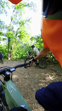
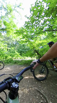
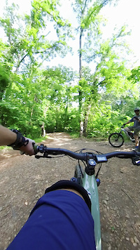
Trails
- By canadaka
 Trailforks & contributors
 - Admins: Map Team, IMBA, chuktA, msmcfate, WillieJacobsz, PlumbBobM, ReckitRolley, colinreuter, ARSP
- #3180 - 56,884 views
- arkansas activity log | embed map of Arkansas mountain bike trails | arkansas mountain biking points of interest polygons
Downloading of trail gps tracks in kml & gpx formats is enabled for Arkansas.
You must login to download files.